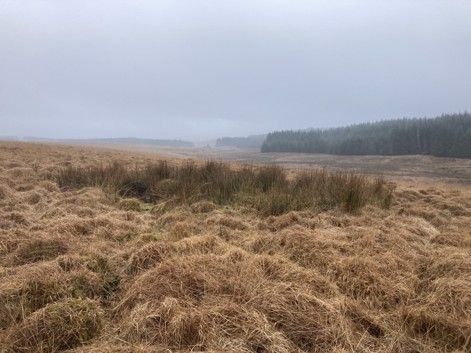
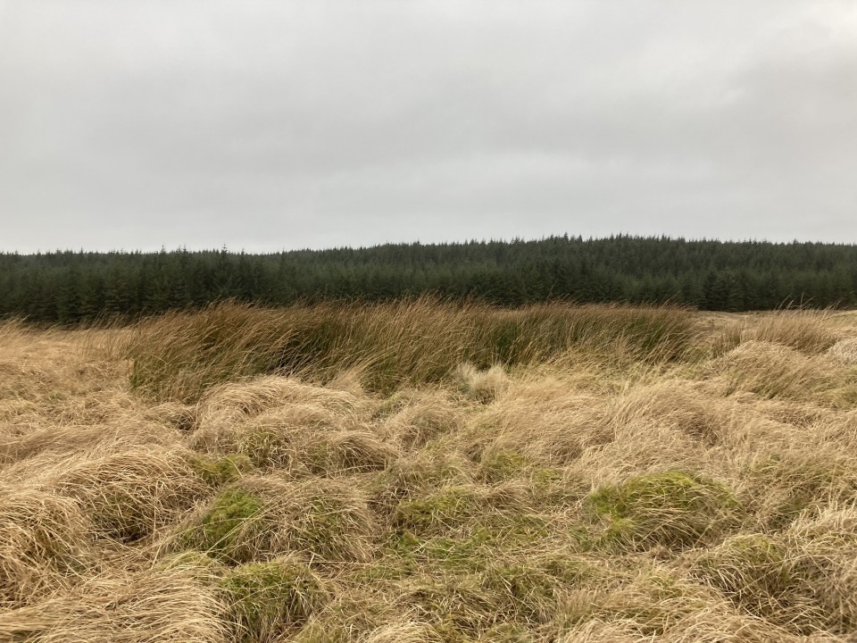
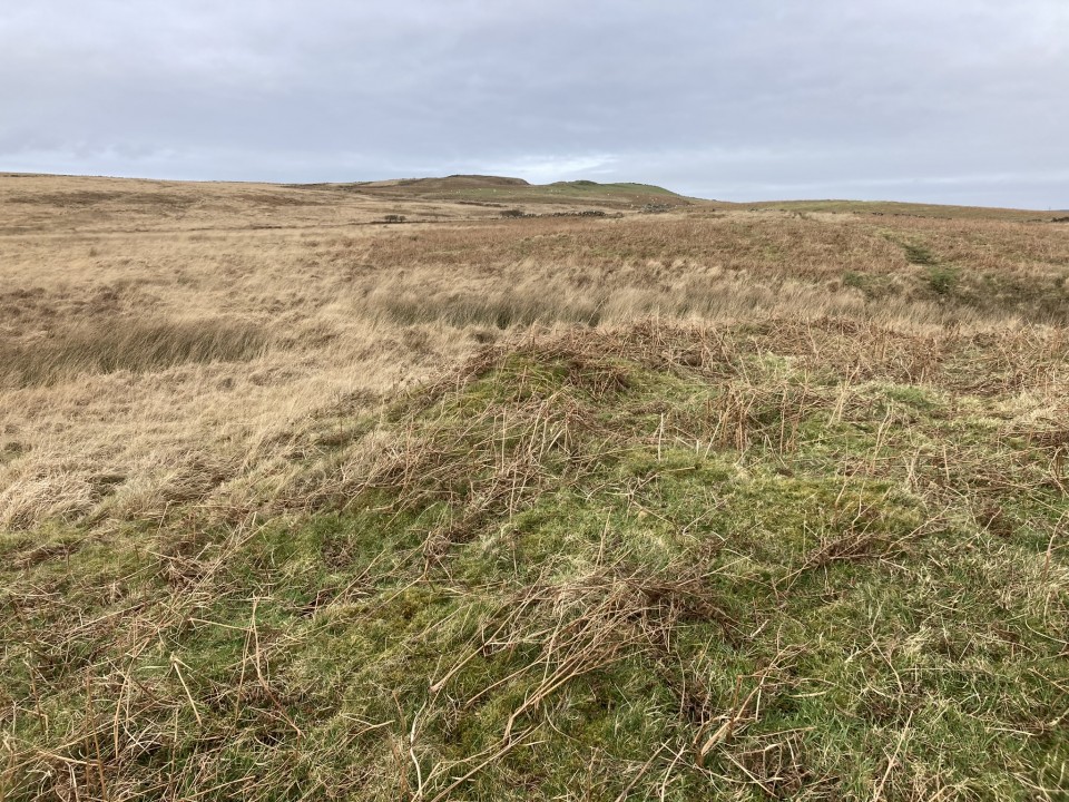
The Modern Antiquarian. Stone Circles, Ancient Sites, Neolithic Monuments, Ancient Monuments, Prehistoric Sites, Megalithic MysteriesThe Modern Antiquarian

Get the TMA Images feed
markj99's Latest Posts

Latest Posts
Previous 50 | Showing 51-100 of 3,411 posts. Most recent first | Next 50

Claywarnies (Cairn(s)) — Fieldnotes

Visited 10.02.24

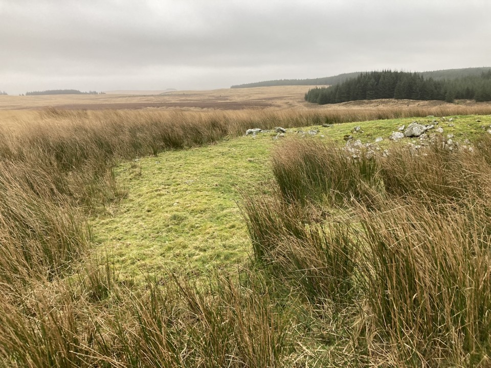
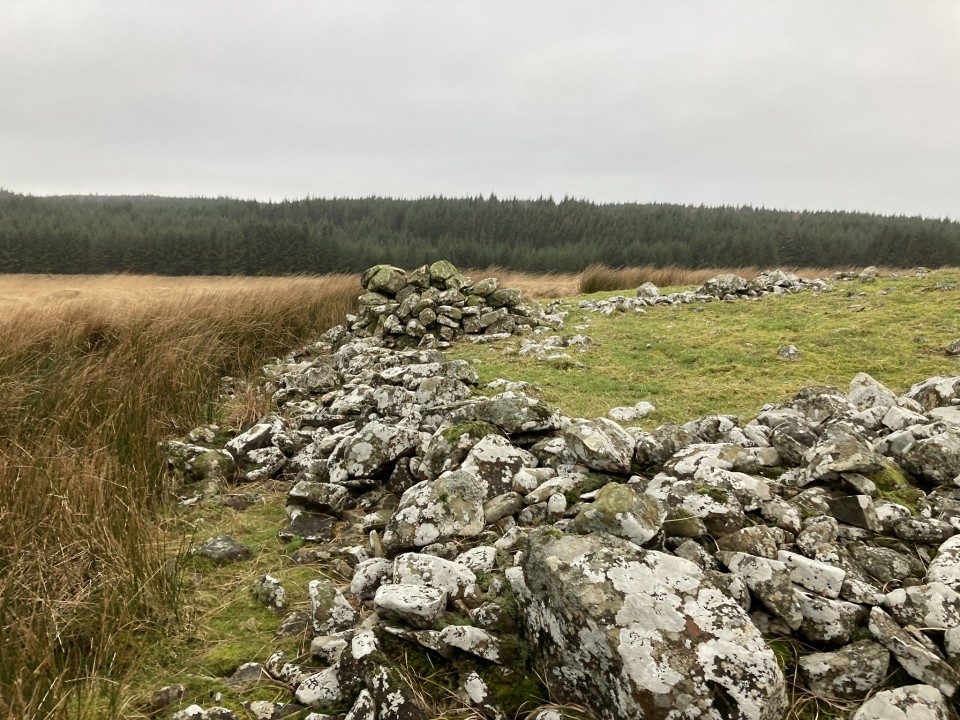
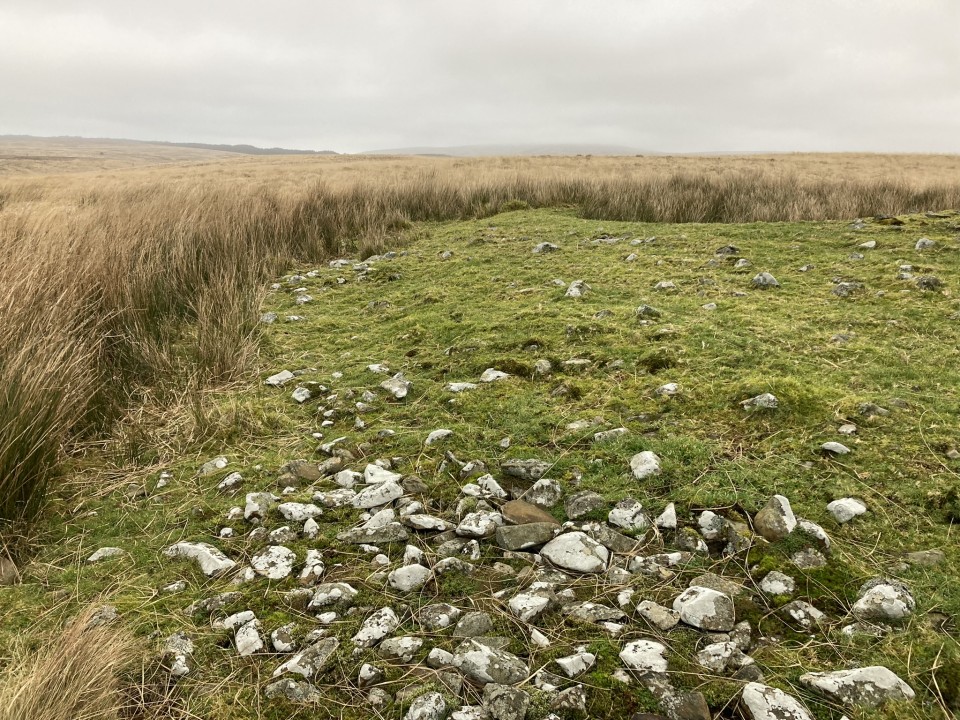
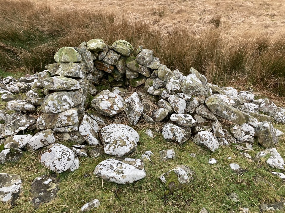
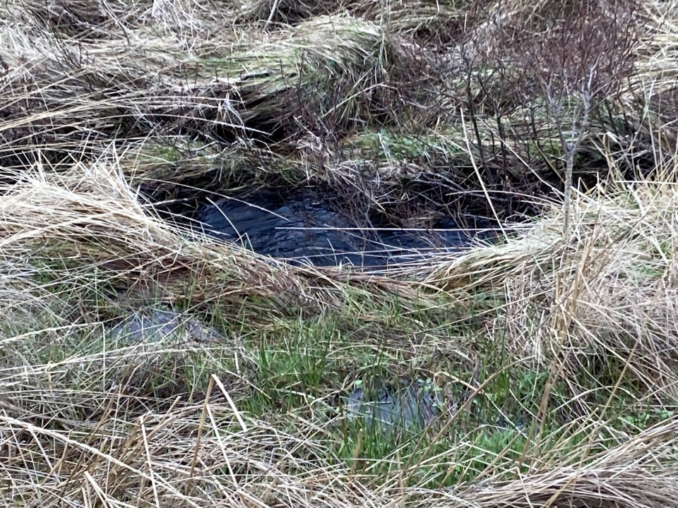
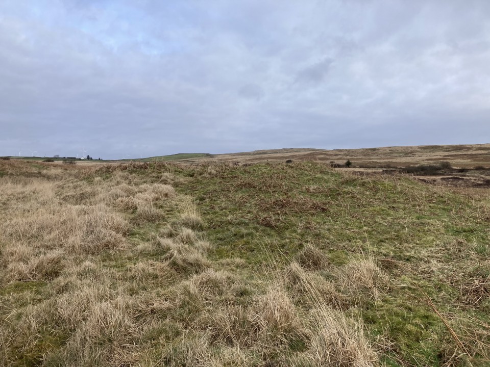
Claywarnies Cairn is located in a forest clearing c. 2 miles NW of Penwhirn Reservoir in Dumfries and Galloway. The large sub-circular mound has been extensively modified by man over time. Several enclosures have been constructed on and around the cairn, presumably using original cairn stones. There is a rectangular enclosure outside the N perimeter, a cluster of stones on the S arc and a ruined enclosure in the W half. The cairn, which measures c. 66 feet in diameter and 3 feet high, is covered in rushes obscuring any surface stones.

Canmore ID 61891 has details of Claywarnies Cairn, including a survey carried out in 1985.
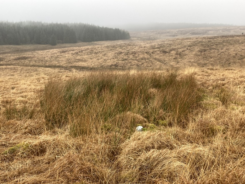
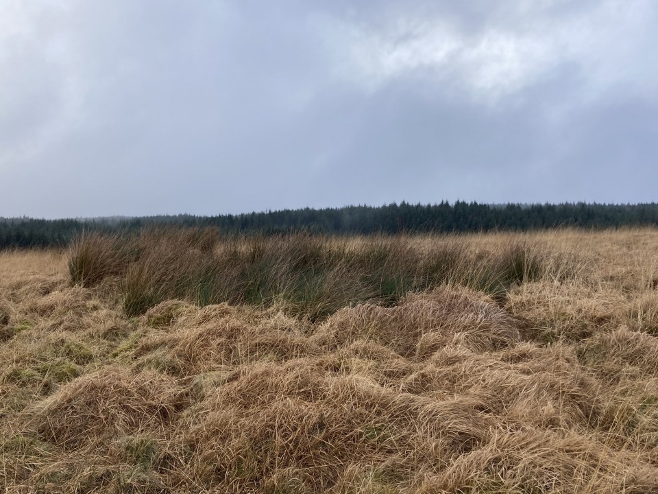
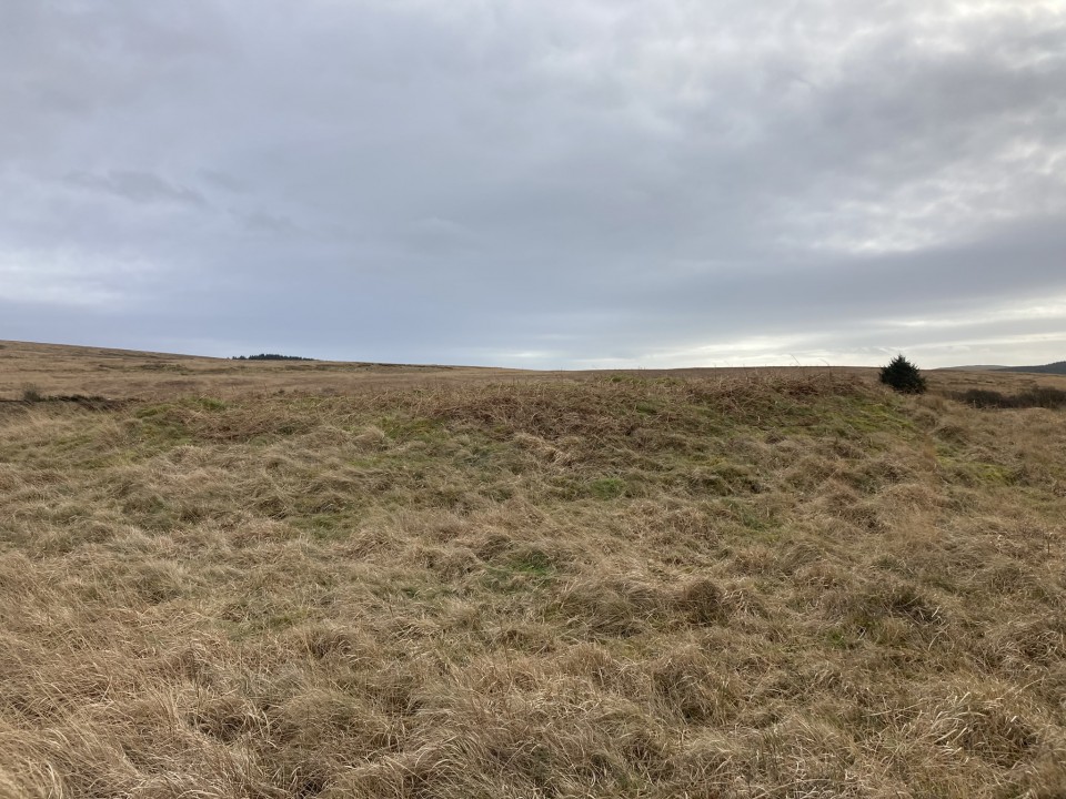
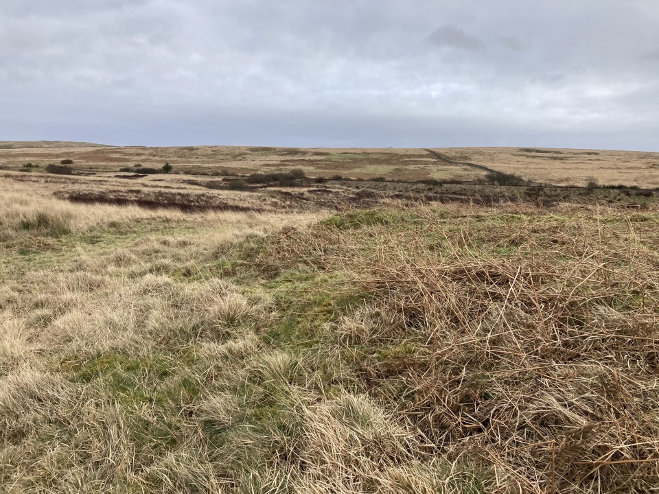
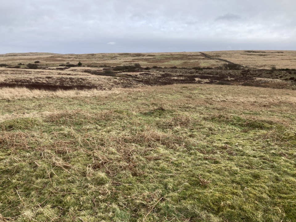
Drumanwherran N (Cairn(s)) — Images (click to view fullsize)

<b>Drumanwherran N</b>Posted by markj99<b>Drumanwherran N</b>Posted by markj99<b>Drumanwherran N</b>Posted by markj99<b>Drumanwherran N</b>Posted by markj99<b>Drumanwherran N</b>Posted by markj99<b>Drumanwherran N</b>Posted by markj99

Drumanwherran N (Cairn(s)) — Fieldnotes

Visited 11.02.24

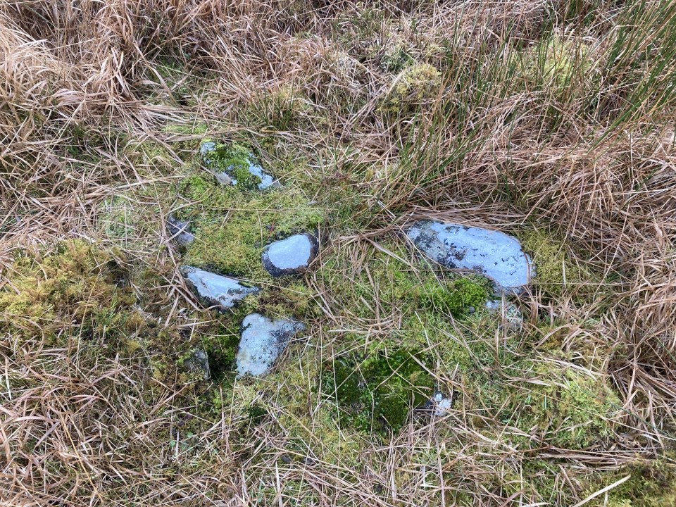
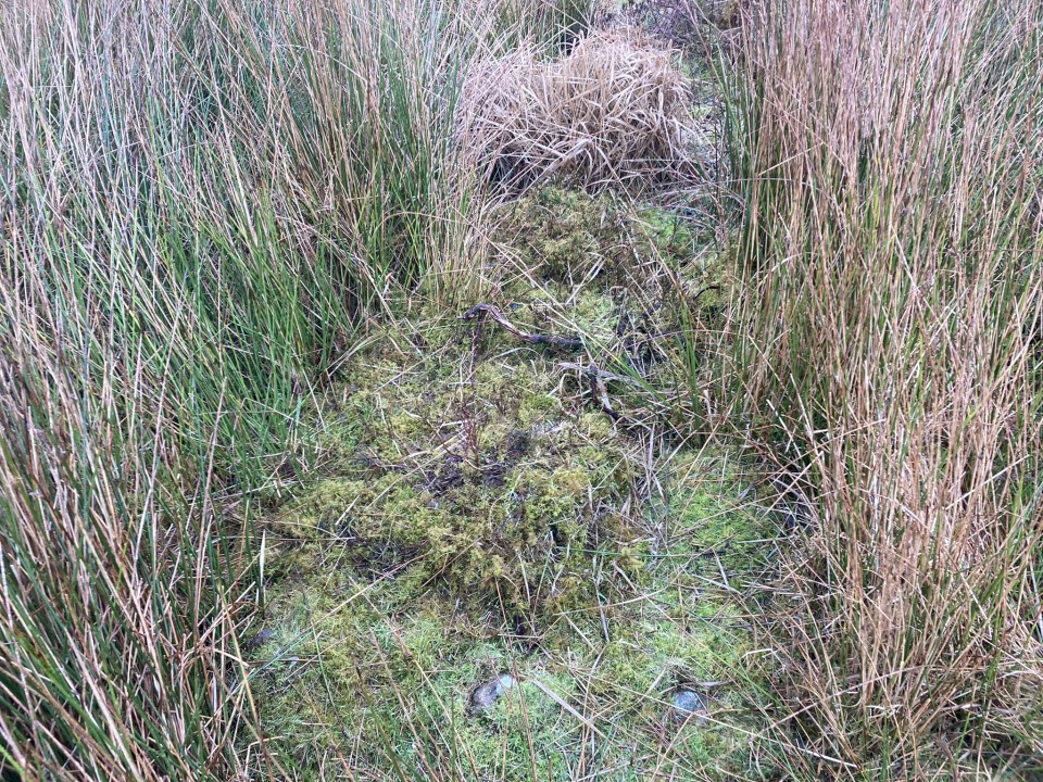
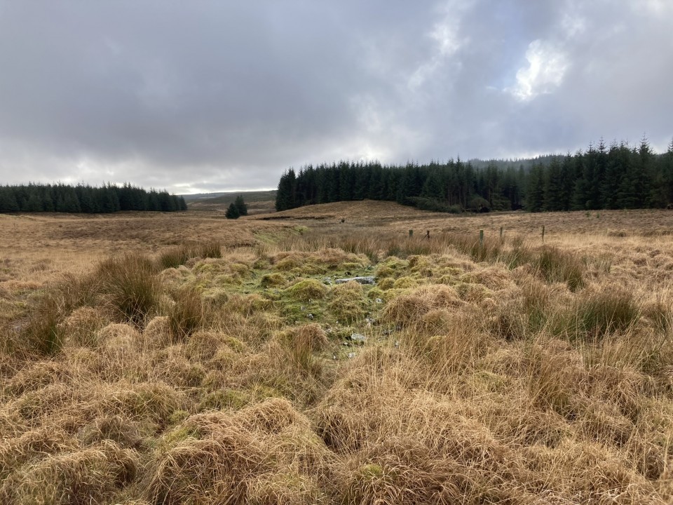
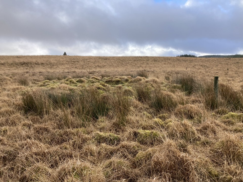
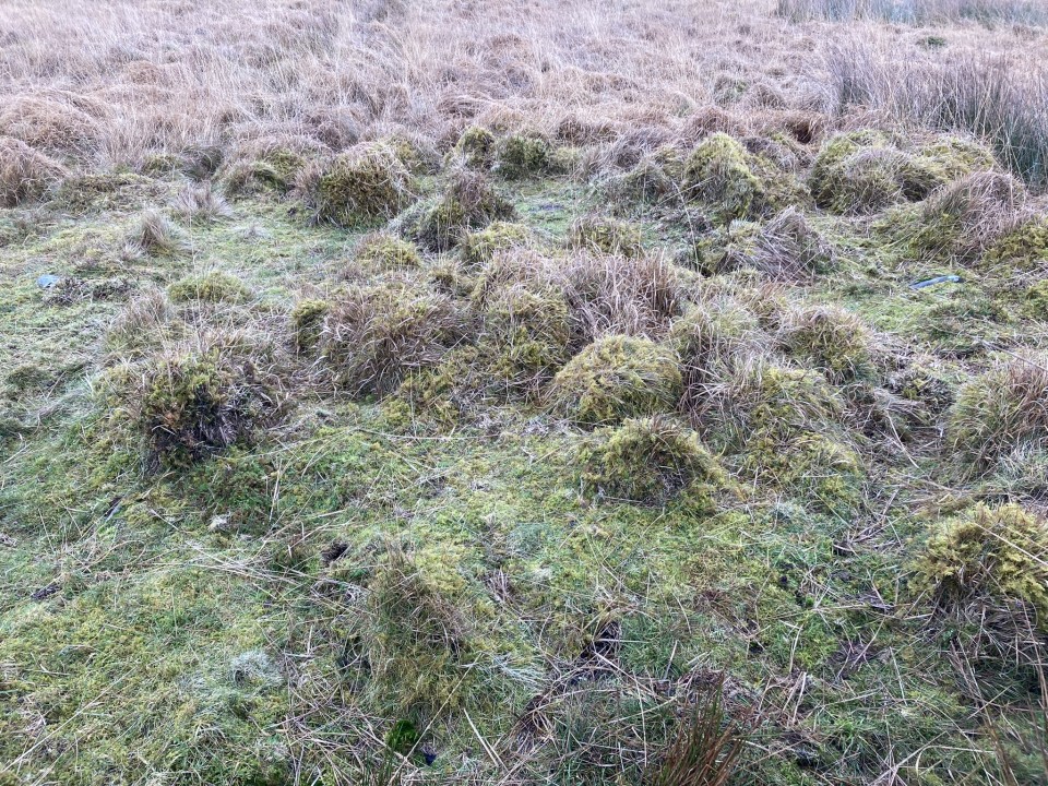
Drumanwherran N Cairn lies c. 700 yards NNW of Drumanwherran S Cairn Cemetery, c. 2 miles NNW of Penwhirn Reservoir in Dumfries and Galloway. It is located on the W slope of Drummanwherran.

The round cairn measures c. 18 feet in diameter and 1 foot high. The rough surface of the mound is covered in green rushes, making it stand out from the brown moorland. There are no stones visible on the cairn except for a cluster of small stones embedded on the E perimeter.

Further details are available in Canmore ID 61895.
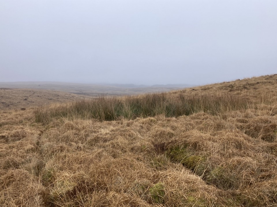
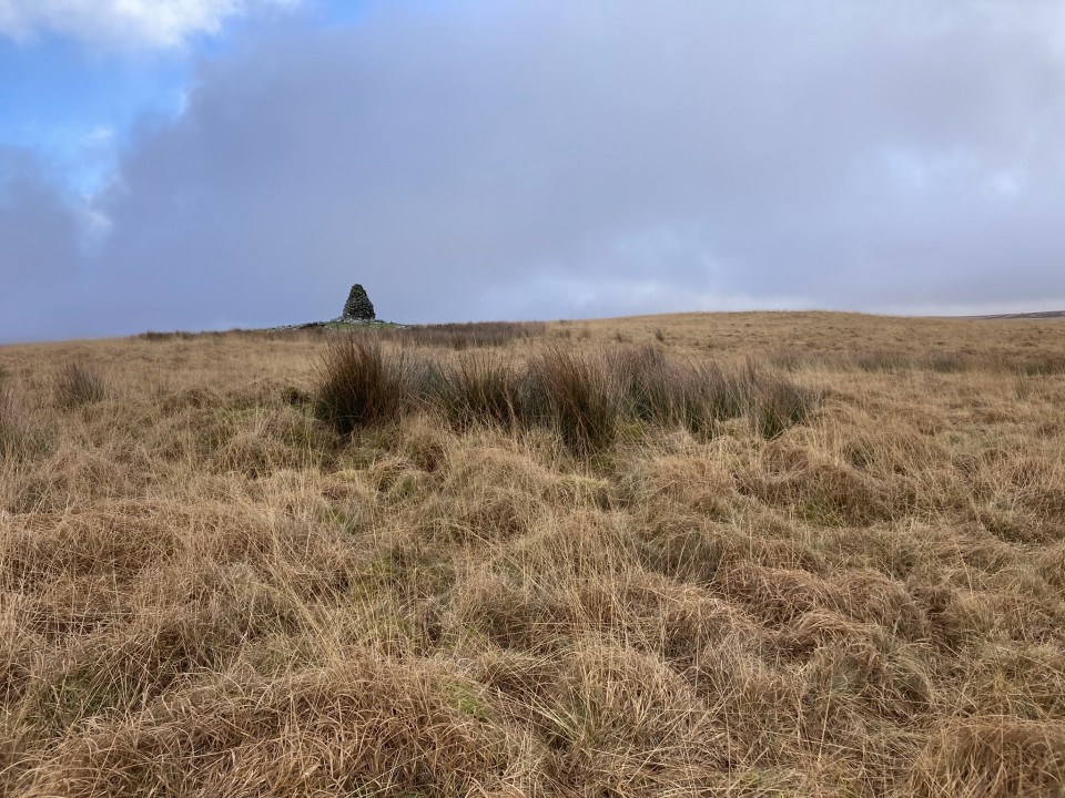
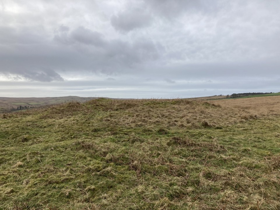
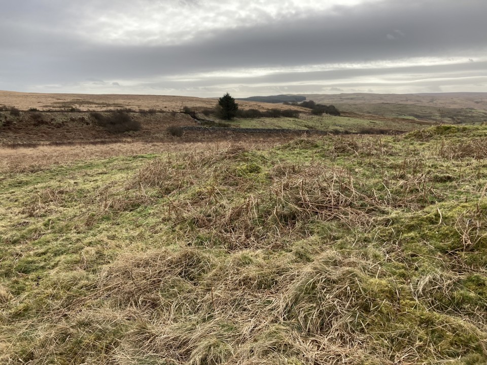
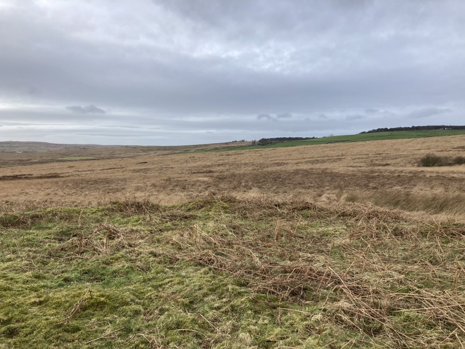
Drumanwherran S (Barrow / Cairn Cemetery) — Images

<b>Drumanwherran S</b>Posted by markj99<b>Drumanwherran S</b>Posted by markj99<b>Drumanwherran S</b>Posted by markj99<b>Drumanwherran S</b>Posted by markj99<b>Drumanwherran S</b>Posted by markj99<b>Drumanwherran S</b>Posted by markj99<b>Drumanwherran S</b>Posted by markj99<b>Drumanwherran S</b>Posted by markj99<b>Drumanwherran S</b>Posted by markj99<b>Drumanwherran S</b>Posted by markj99<b>Drumanwherran S</b>Posted by markj99<b>Drumanwherran S</b>Posted by markj99<b>Drumanwherran S</b>Posted by markj99<b>Drumanwherran S</b>Posted by markj99<b>Drumanwherran S</b>Posted by markj99<b>Drumanwherran S</b>Posted by markj99<b>Drumanwherran S</b>Posted by markj99<b>Drumanwherran S</b>Posted by markj99<b>Drumanwherran S</b>Posted by markj99<b>Drumanwherran S</b>Posted by markj99<b>Drumanwherran S</b>Posted by markj99<b>Drumanwherran S</b>Posted by markj99<b>Drumanwherran S</b>Posted by markj99<b>Drumanwherran S</b>Posted by markj99<b>Drumanwherran S</b>Posted by markj99

Drumanwherran S (Barrow / Cairn Cemetery) — Fieldnotes

Visited 10.02.24

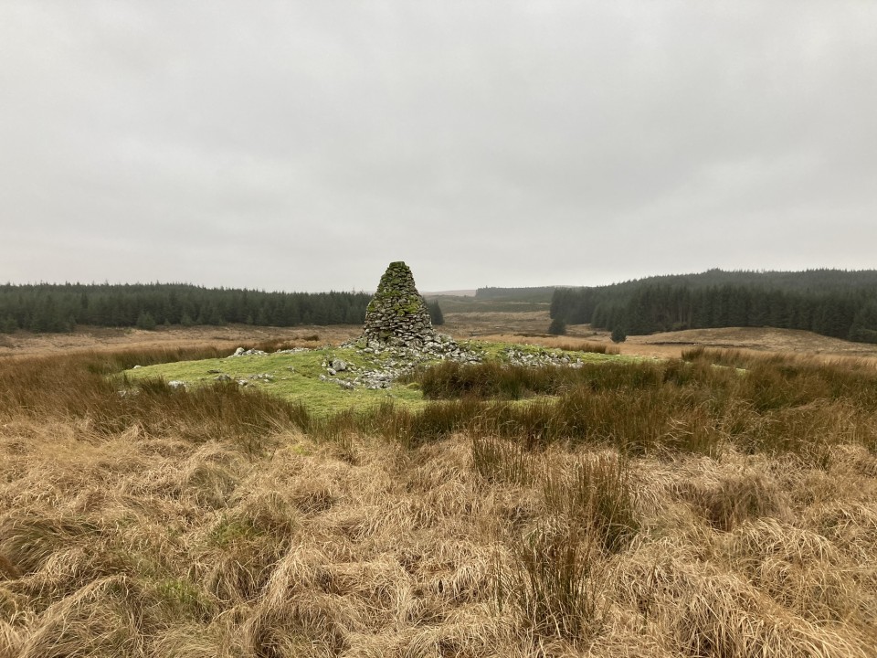
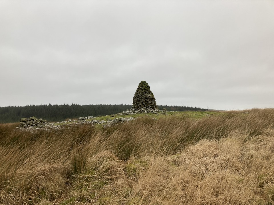
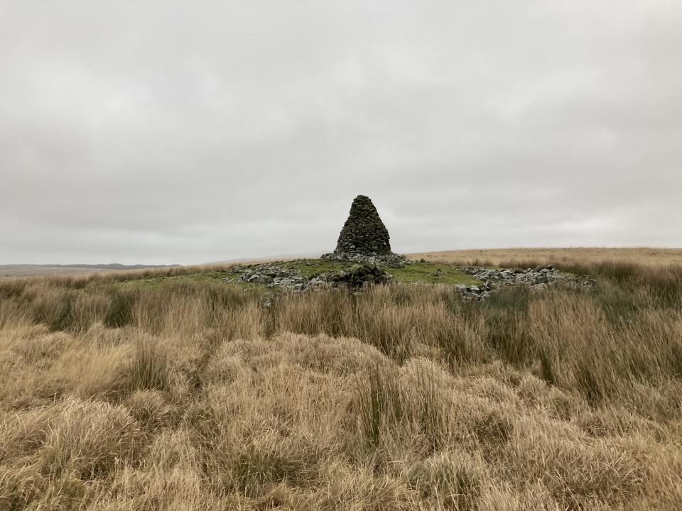
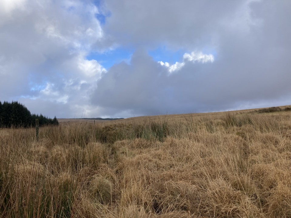
There is a group of 4 cairns located in a rectangular area, measuring c. 175 by 130 yards, on Drumanwherran moor c. 1.5 miles NNW of Penwhirn Reservoir. The largest cairn lies on the NE corner of the boggy moorland rectangle. It is the most prominent landmark due to a modern shepherds cairn erected in the centre of the grassy mound. The OS grid reference quoted above refers to this cairn.

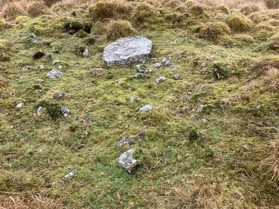
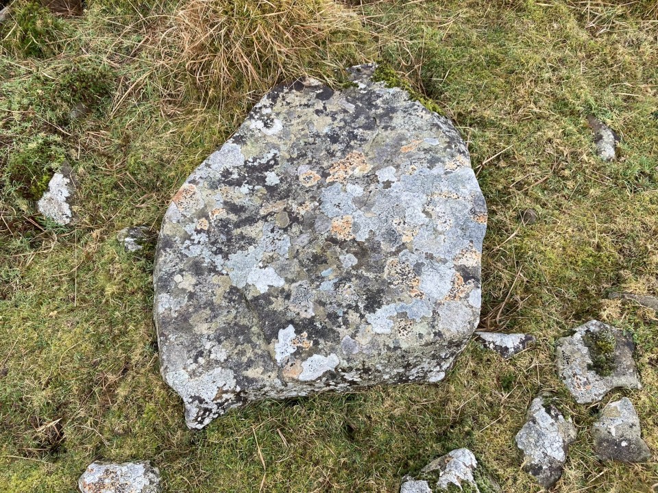
Canmore ID 61935 describes a large round cairn measuring c. 75 feet in diameter and 4 feet high. The grassy surface is studded with small stones. A modern shepherds cairn measuring c. 10 feet high has been erected in the centre of the mound. This may account for a hollow up to c. 1 foot deep in the N half. Additionally, there is a small stone structure built onto the S perimeter.

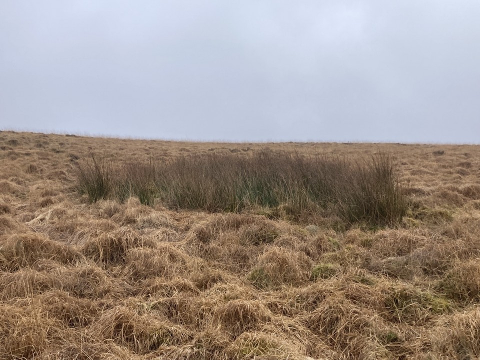
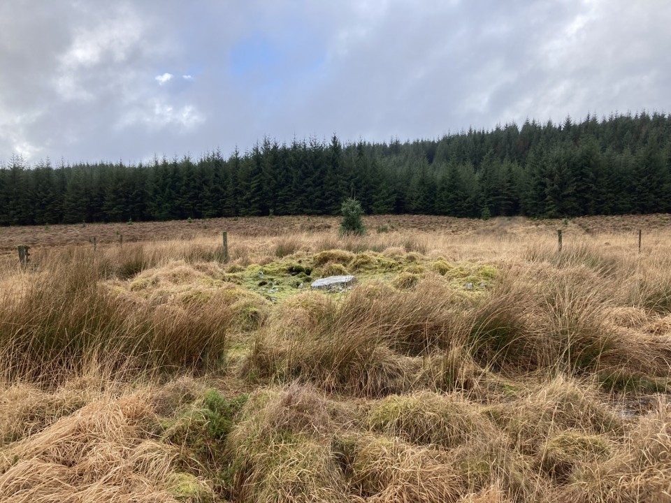
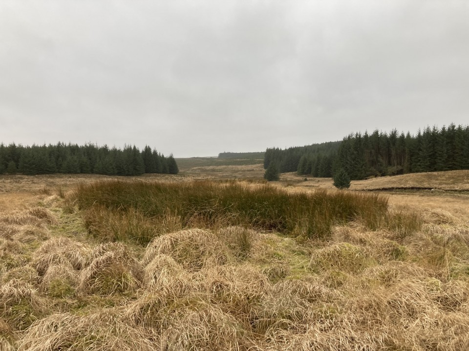
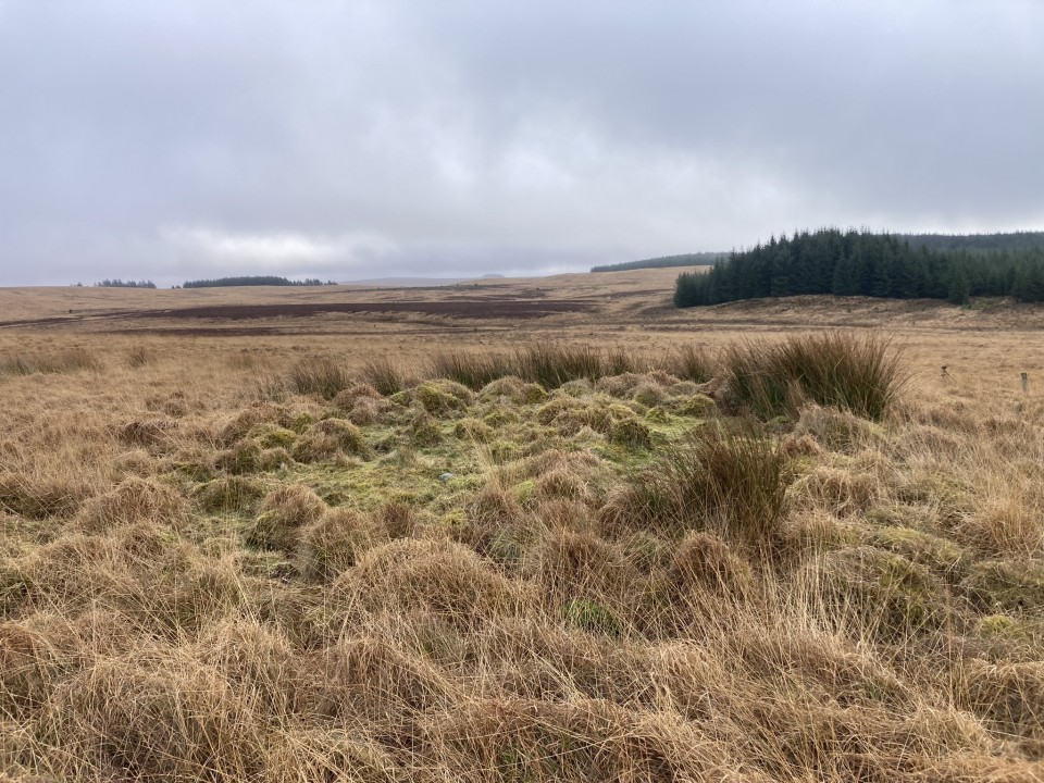
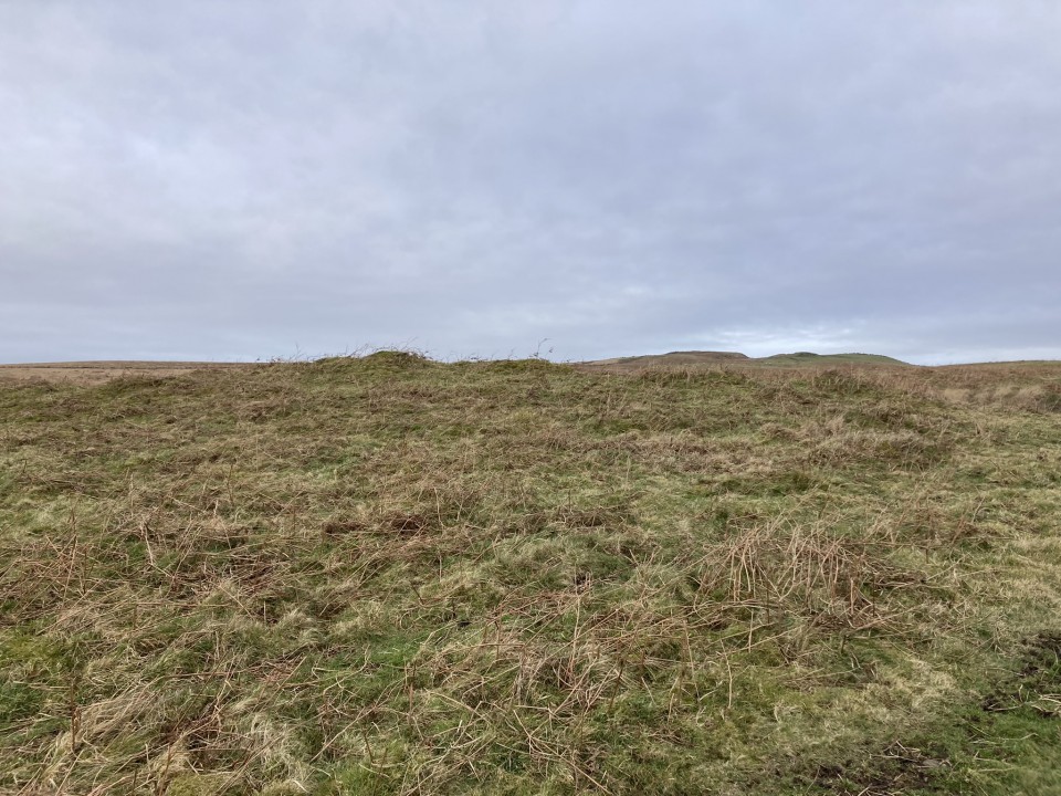
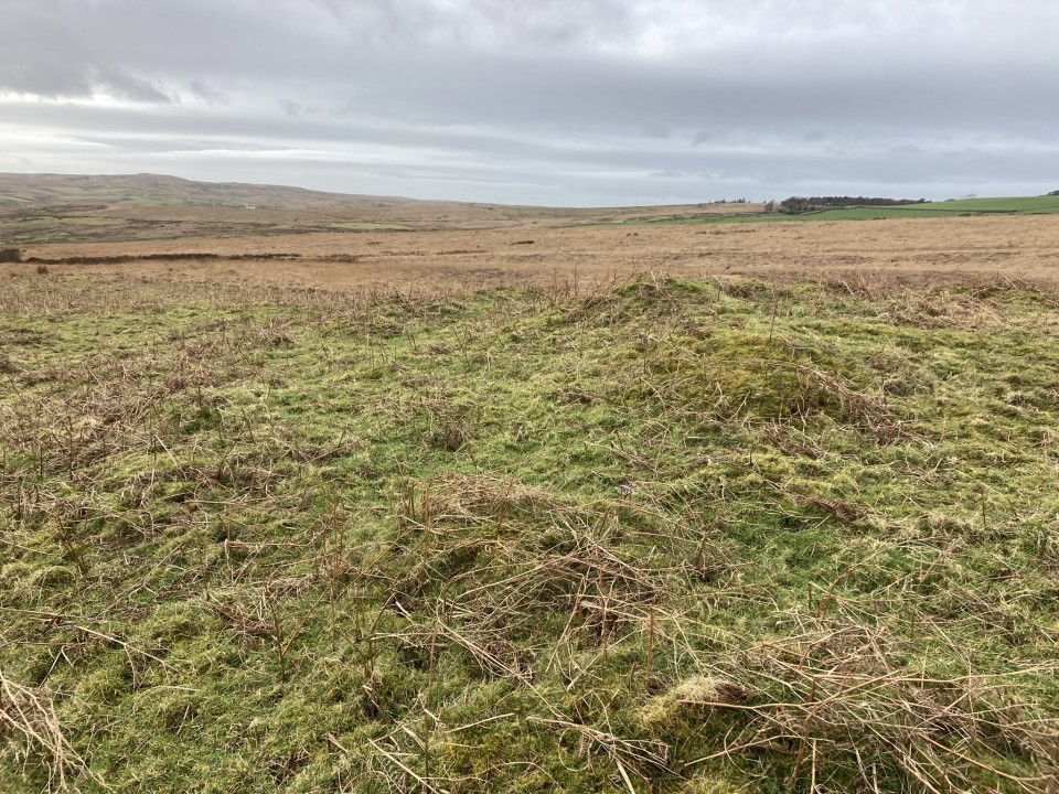
Canmore ID 61892 suggests that "a peat-covered mound measuring 7.5m in diameter and 0.5m in height", c. 50 yards S of Canmore ID 61935, "is probably a cairn". In situ, the rough tussocky green mound stands out in the brown moorland lending credence to its status.

Canmore ID 61893 lies c. 175 yards S of Canmore ID 61935. The cairn is a sub-circular hollow of rushes measuring c. 24 feet across and 1 foot deep.

Canmore ID 61894 has details of a robbed round cairn c. 130 yards WSW of Canmore ID 61935. The mound, which measures c. 27 feet in diameter and 1.5 feet high, has a grassy central plateau. A large slab measuring c. 3x2x0.5 feet lies on the W arc, possibly a remnant of a destroyed cist.

Altigoukie Burn Burnt Mound (Burnt Mound / Fulacht Fia) — Images

<b>Altigoukie Burn Burnt Mound</b>Posted by markj99<b>Altigoukie Burn Burnt Mound</b>Posted by markj99<b>Altigoukie Burn Burnt Mound</b>Posted by markj99<b>Altigoukie Burn Burnt Mound</b>Posted by markj99

Altigoukie Burn Cairn (Cairn(s)) — Images

<b>Altigoukie Burn Cairn</b>Posted by markj99<b>Altigoukie Burn Cairn</b>Posted by markj99<b>Altigoukie Burn Cairn</b>Posted by markj99<b>Altigoukie Burn Cairn</b>Posted by markj99<b>Altigoukie Burn Cairn</b>Posted by markj99<b>Altigoukie Burn Cairn</b>Posted by markj99<b>Altigoukie Burn Cairn</b>Posted by markj99<b>Altigoukie Burn Cairn</b>Posted by markj99<b>Altigoukie Burn Cairn</b>Posted by markj99<b>Altigoukie Burn Cairn</b>Posted by markj99

Altigoukie Burn Burnt Mound (Burnt Mound / Fulacht Fia) — Fieldnotes

Visited 01.02.24

Altigoukie Burn Burnt Mound is located c. 2.5 miles NNW of New Luce in Dumfries and Galloway. It lies c. 50 yards NW of the Stranraer railway line, on the S bank of Altigoukie Burn. According to Canmore ID 61415 the burnt mound "measures 7m from E to W by 4.5m transversely and is up to 0.6m in height". The visible burnt stones noted in Canmore were obscured by vegetation on my visit.

Altigoukie Burn Cairn lies c. 110 yards NW of Altigoukie Burn Burnt Mound.

Altigoukie Burn Cairn (Cairn(s)) — Fieldnotes

Visited 01/02/24

Altigoukie Burn Cairn is located in moorland c. 2.5 miles NNW of New Luce in Dumfries and Galloway. The grassy round cairn lies c. 150 yards NW of the Stranraer railway line. There are no visible stones on the mound which measures c. 54 feet in diameter by 3 feet high. The cairn has a central hollow up to 1 foot deep. Canmore ID 61425 has a full description of Altigoukie Burn Cairn.

Kilfeddar Farm Cairn is c. 0.5 mile NE of Altigoukie Burn Cairn.
Previous 50 | Showing 51-100 of 3,411 posts. Most recent first | Next 50
I love to travel, especially to antiquarian sites. I'm working through the extensive Cornwall site list with an annual week holiday. Avebury is my favourite spiritual destination. Las Vegas is my favourite sinful destination.

I also enjoy hill climbing however as time passes the hills grow steeper. I have climbed around 30 munros, however, I've also climbed The Cobbler, Stac Pollaidh and Suilven so height is not the only criteria.

I used to play golf (9 handicap) and support Queen of the South however I gave up both bad habits. Horse racing was a more recent obsession. Epsom and Newmarket are my favourite racecourses. At the moment my current obsession is music gigs: Arcade Fire, Dinosaur Jr, Sparks, Jesus and Mary Chain and Belle & Sebastian, my favourite band.

My TMA Content: