Showing 1-50 of 2,021 posts. Most recent first | Next 50  
|

|
    
|

|
       
|
  
|
Nenagh Guardian - 18.12.1954
13 - Timoney Carved Stone
This carved stone comes from Timoney and was once thought to be a Cross Shaft but expert opinion suggests that it is an ancient stone of secular origin and of the same type as the Tybroughny Stone.
|
Nenagh Guardian - 22-08-1936
About a mile to the east of Ardcroney in a district called Lough Fada (Loch Fada), which according to tradition, was visited by St. Patrick. The place was, as the name indicates, at one time covered with water, but it is now quite dry. The bed of the river, which drained the lake into the Shannon, can still be traced. Faint with hunger, the saint was one day, according to legend, passing the lake in which three men were engaged fishing. Though hard at work for hours they had caught no fish till a few minutes before St. Patrick's arrival. Explaining his plight to the fishermen, he asked them for some fish to relieve his hunger but they refused. He thereupon changed them into stones. Three large pillars of stone, each about six feet high and four feet wide, are still pointed out as confirming the truth of the legend.
Druid's Altar
As is the case in most legends, there is probably a stratum of truth in the story. According to Dr. Healy, the saint visited Rathurles, about three miles distant, on his journey northward from Cashel. From Rathurles he proceeded to Terryglass, and Ardcroney would be in a direct line between these two places; near Loch Fada are the remains of a large fort which is still called "The Doon" (An Dun), where a king or chieftain resided in olden times. It was St. Patrick's policy to convert the ruler of the district first, and having done so in Ardcroney, he would probably proceeded to Loch Fada to view the Druid's altar - for such undoubtedly were the three large stones. According to tradition, a number of smaller pillar stones formed a circular enclosure round the altar but these were removed by the planters for building purposes. It is also stated that the smaller stones were covered with rude inscriptions on the edges. These were probably the Ogham characters as used by the Irish till St. Patrick's time."
|
Nenagh Guardian - 30-04-1910
Another piece here titled - The history of Nenagh - Instructive Lecture By Eminent Nenagh Clergyman
The most interesting piece in it to me is "In the beginning of the 2nd century of the Christian Era the province of Munster extended to the parish of Laun Eala or Lynally, in the King's County, in the barony of Ballycowan, about a mile south-east of Tullamore, in the O'Molloy's country. It was then called Aenach Cholman. About that time the Ard Righ of Ireland, Turthal Teachtmar, took possession of that part of the King's County. The Munster Aenach was then transferred to Ormond. This event occurred in the year 130, A.D. This, therefore is the first date in the history of Nenagh. In the year 1930 you can celebrate the 18th centenary of your history as a town and place of note in Munster. Nenagh was a place of much interest in this country when London was a small village. The Aenach of this town had two names - Aenach Thete (pronounced Thebe), which means the Fair of the Flight, and, a'so, the name Aenach Urmumhain (The Fair of Ormond.) It is not recorded why the Aenach was called Thete, and I can only conjecture that this name may have arisen from the fact that the Munster Aenach was removed from its original situation in King's County, and brought to Ireland in North Tipperary."
Nenagh Guardian - 21-04-1917
This is titled "History of Nenagh" and contains the following "The circumstances which led up to this battle are the following: At this time two remarkable kings lived in Ireland: Malachy King of Meath and Ard Righ of Ireland and Brian Boru, King of Munster. Brian was at this time coming into prominence because of his ability and his success against the Danes. In the election of the Ard-Righ or High King of Ireland, the most powerful provincial King was sometimes chosen. A jealously existed between Malachy and Brian, who afterwards succeeded in dethroning Malachy and becoming Ard-Righ. The career of Brian was as follows: "He first became King of Thomond, North Munster; he next became provincial King of all Munster his third step upwards was to claim sovereignty over the Southern half of Ireland. Leath-Moghs, according to an ancient division of the country as described above. This claim of Brian excited the jealousy of Malachy; if Brian ruled Leinster and Munster, he might become too strong for Malachy. It would seem therefore, that it was a struggle between the West of Ireland under Malachy, against Munster, which eventuated in the Battle of Nenagh. In that age it was custom to inaugurate the Kings of Munster under a great oak-tree, at a place called Magh Adhair, now Moyre, near Tulla, in the County Clare. This tree Malachy cut down and had it taken up by the roots, using the timber of the oak to roof his palace. Brian determined to avenge the insult offered to his family in the cutting down of the coronation-tree. He led an army in the boats up the Shannon, entered Meath, and burned the royal rath of Dunna Sgiath. The timber of Brian's oak was in the roof of this rath, and Brian had the satisfaction of burning the timber which Malachy had the trouble of cutting down. This act of Brian was the immediate cause of the Battle of Nenagh. Malachy was absent in Connaught at the time, he re-crossed the Shannon, marched South, and burned Aenach Thete. After this victory Malachy attacked the Danes near Dublin, and carried away the collar of gold of Tomar, a Scandinavian Chief, celebrated by Moore in the Melodies. It is satisfactory to recall that three years after the Battle of Nenagh Brian and Malachy were united, to the great joy of the Irish. Their combined forces attacked the Danes of Dublin in the year 998 A.D and plundered a great part of their weath, previous to the battle of Clontarf. Brian was acknowledged by Malachy as King of Leath Mogha, Southern Ireland and Suzerain of Leinster. O'Halloran gives the Leinster tribute to Brian as 300 gold-handled swords, 300 cows and brass yokes, 300 steeds and 300 purple cloaks. In the Battle of Nenagh perished Domhnall, on of Sorcan, and uncle of Brian and six hundred men fell with him. Domhnall was Lord of Muskerry and Ui Forga or Ormond. The Second Burning of Nenagh. Sixty years after Nenagh had been burned by Malachy it was burned a second time by Diarmuid, King of Leinster, in the year 1056. This event is recorded in the Annals of the Four Masters, 1056AD. Diarmuid the son of Maolnambo, marched on a predatory excursion into Munster and burned Dun Mac na n-Inguir (Dungar) near Roscrea, Aenach Thetey and Dun Furicadrain. The same event is recorded in the Annals of Innisfallen in the year 1959. Diarmuid Mac Maolnambo, marched with a ravaging army into Munster and burnt Dun Iongar, Aenach Thete and Dun Fuaradrain. Turlough O'Brien was with him on that occasion. (Dungar, which Torlough burnt, is situate in the O'Carroll country and probably the other Dun, mentioned in the record, was the name of another royal residence of the O'Carroll's).
Nenagh Guardian - 31-12-1932
An unusual piece titled "The Fairies of Munster" -"Did you ever hear of a place called Nenagh?" he asked "Yes" said I "I have heard of it" Well "said he "I was born and reared within a few miles of that town" "It is a fine town, I suppose" said I "Well, it is and it isn't" he replied. "It is a great place for fairs, to be sure. In fact, the original name of the town was Aonach, which meant a fair. "At one time there used to be a great fair at a place called Tyone, a mile or so outside the town, every 1st August. In fact that date was known locally as the "1st of Tyone". It was not far from a rath, known as Rathurles, and the fairies from there gave so much trouble at the fairs that they had to change the fair to the town." "Not into the town surely" said I, "there must be a fair green in such an important town". "There is not; then" said he "The cattle are in the very streets and right up against shop windows" I suppose the idea is "said I "that the shopkeepers want to keep the trade at their doors". "By no means" said my friend "but they are afraid if they hold the fair outside the town the fairies might interfere with it, for they are averse to the smoke and dirt of a town. They love the fresh air, and that is the reason there is no fair green in Naenagh". "Well now" said he "it was in this district I was in the fairies and next time we meet I will tell you about my experiences during the seven happy years I spent amongst them" - it is signed off as "Old Boy".
Nenagh Guardian - 24-04-1943
Old Nenagh Place Names - it looks to be by D.F.G who I assume is Dr Dermot F. Gleeson - the most interesting bit relating to Rathurles is as follows "There remains the place name of the 1673 Deed "Lisnenagh". In 1703 it is "Lissnemogh" but I think this is clearly a mistranscription. It is of much interest in the form "Lisnenagh" because taking its area (30 acres only), and its place in the Deeds in immediate conjunction with Rapplagh, I think there can be no doubt that here we have an old and most valuable and suggestive alias for the great triple ring fort of Rathurles - forerunner of Nenagh and original home and "strong wattled rath" of the old "Kings of Ormond". I would regard it as a most valuable contribution to local history if anything can be added to this either from record or tradition. Does anyone remember Rathurles being called "Liss Nenagh"? Per contra is there a "Lissnemogh" near Rapplagh or any other fort to which the name could apply? One must remember that Rapplagh in 1700 stretched over and included South Hill and probably included Shean across the road. Here (at Shean) are two forts with two more near the road. Does anyone know the field names of any of them? This form "Lisnenagh" in an original script of 1673, is quite new to me and very strongly suggests Rathurles for a number of reasons. Ballygaggery of the 1703 Deed is not mentioned in 1673 but appears in a variety of records though missing from the 1849 O. Sheet. It is given as containing only 33 acres in 1703 but in the Civil Surveys appears in the Upper Ormond part of Kilruane Parish as a more extensive townland of 108 Irish acres and, since all the Civil Survey acreages are an underestimate by at least one fifth, it must have been once quite an extensive piece of ground. Its bound (per the Civil Survey) are "On the S.W. with a muddy lough in this parish called Lough Duff, on the north by the parish of Ballygibbon and Killownye (now Killowney") "on ye east and south by the lands of Rathurles in this parish". This puts it between Rapplah and Liscarode and perhaps the name is remembered there. The name appears to mean the "townland of the cracks or fissures". Where the "Commons of Nenagh" containing 400 acres in Lower Ormond barony may have been is none too clear. I suggest that they lay to the north west of the present "Commonage" down to and probably across the Limerick road. There is no field name for this area on the 1840 O. Sheet, and of course the Limerick road was not there in 1703. The 1673 Deed finally contains the curious name "Allmodein" which does not appear in 1703. Of this in the form given, I can make nothing but no doubt a little patience would solve the problem. It may be a mistranscription though it appears in this form in the original and it is hard to suggest an alternative spelling."
Nenagh Guardian - 14-02-1953
There some debate going on at this stage about making a coat of arms for Nenagh. Dr Dermot F Gleeson had this to say regarding Rathurles "Nenagh, of course, as a centre of population is not older than the castle - its predecessor is undoubtedly the huge triple rath at Rathurles (with a 15th century church built inside ring). The stone gate piers are still there and date to at least 2,000 BC. This is one of the most remarkable earth forts in all Ireland, though I fear few Nenagh people ever visit there. I have shown it to many of our leading archaeologist who are all of the opinion that its was the central rath and place of inauguration of the Muscraige of Muscraige Thire (now Ormond) long before the Dal Cais came and indeed back to B.C."
Nenagh Guardian - 11-04-1953
There is a piece about lecture given by Dr Dermot F Gleeson on "Who were the first inhabitants of the town".
Dr Gleeson is described as a native of the town and "as they all knew from the reading of newspapers and magazines, was an authority on the subject".
A few interesting quotes from it "At Rathurles they would find two things in addition to the earth-forts. They would find places marked with stones, and they were remarkable stones and must be a few tons in weight. There were in fact gate piers at the entrance into the fort, and they could see they were prepared to hang a gate. It was a huge triple-ringed earth-fort and it stood in the middle of the Knockalton, Sheane, Rathfalla and Rathmartin district. That was the centre of population before Nenagh was heard of. The fort at Rathurles was a magnificent one and was one of the finest earth-forts in the whole country. He (Dr. Gleeson had shown it to Dr. Leask, to Professor O'Riordan, and to Dr. John Ryan, and they all agreed there was nothing like it in the country except the one near Armagh." He goes on to say "The stones were Megalothic and went back to Middle Stone Age, 2,000 years before Christ. As late as the fourteenth century they were mentioned in the Ormond Deeds, and in the disputes between the O'Kennedy's and the Butlers. In the middle of the fort there was a big church, 15th century. What was the church doing there in the middle of the earth-fort? Rathurles was a place of such significance the O'Kennedy's put the church in the ring to mark what a place of distinction it was in olden times."
Nenagh Guardian - 30-06-1962
Historical Places of Interest - "Rathurles - 3 ring with "Remarkable Stones" which are the gate piers of the ancient entrance judged by Dr. H. G. Leask to be "almost megalithic".
Nenagh Guardian - 06-05-1967
Origins of Nenagh from the Ancient Aenach by Rev. John A Gleeson. The most interesting part in terms of Rathurles is as follows "O'Donovan says that this parish is called in Irish Aenach Urmhumhan (pronounced Uroon), which means the Fair of Ormond. He adds "We are not able to ascertain the period at which this name was first given, but we have reason to believe that it is of extreme antiquity this name is given in the Annals of the Four Masters at the year 994 A.D. In Gough the following reference is made to Nenagh: It is probable that this place called Aenach Thite (Thehe) by the Four Masters, and Aenach Teide in the Annals of Innisfallen, is Nenagh. There is no direct evidence of their identity, but it may be inferred from the manner in which Aenach Thete is mentioned in connection with Urmumhan, that, in all likelihood, it lay in the same territory; and we know of no other aenach in the same territory except Nenagh, which is still called by the people Aenach Urmhumhan" It seems strange that Gough did not know that Roscrea was situated in ancient Ormond, which formerly included the whole of North Tipperary, and the two baronies in King's County which lie between Roscrea and Birr. One of those names may have belonged to the Roscrea Aenach and the other to the Aenach at Nenagh. Aenach Thete means the Fair of the Flight and Aenach Teide means the Fair of the Rope. This name Thete belongs to the Aenach at Nenagh; an explanation of the name may be found, perhaps , in the early history of the fair. The first establishment of the Aenach at Nenagh is thus described in Miss Green's "The Making of Ireland and its Undoing": Previous to the year 130 AD the province of Munster extended to the parish of Lann Eala or Lynally in the barony of Ballycowan, King's County, about a mile south-east from Tullamore. It was in this parish that the Munster Aenagh was held before the year 130. It was called Aenach Cholmain. In the year 130 the Ard Righ, Tuathal Teachtmhar, took possession of that part of the King's County. The Munster Aenach was then transferred to Nenagh in the baronies of Upper and Lower Ormond. It was called Aenach Teite and in later times Aenach Urmhumhan. Nenagh as an Aenach, therefore, began its course in the year 130, close on eitghteen centuries from our time (1915). It was probably a place of note before 130. The original Aenach was situated in Fercal in the O'Molloy country. In after times it became a tribal Aenach under the presidency of the O'Molloy. The change of situation from Fercal to Ormond may probably have given this fair the name of Aenach Thite, the Fair of the Flight. The town of Nenagh, being situated on the border line of the two Ormonds, in a level plain, and convenient to the great highway of ancient times, the Shannon; situated also on one of the five great roads which led from Tara in ancient Meath to the south, was specially suited as a place for the Munster Aenach."
Nenagh Guardian - 16-04-1977
There was a reprint of "Nenagh and its Neighbourhood" by EH Sheehan and a review was done of it in the Nenagh Guardian by George Cunningham.
A bit of background on Dr Ned Sheehan "born in Summerhill in 1882; although he left Nenagh at an early age, for school in the first place and then for the Royal Army Medical Corps in the World War, he never lost his affection for his town and countryside and returned always during holiday time. Of the book Dermot Gleeson wrote in 1952 "It attracted a great deal of attention amongst the professional historians because nothing like it had ever been done before. He describes Nenagh street by street, traces its inhabitants house by house, goes into the country about and tell the story of each of the 'great houses' built in Georgian times, and sets down all the Nenaghmen of the past 200 years who gained fame either amongst their fellows or in the world at large" Mr Cunningham goes on to the review "The amount of research, most of it a primary nature, necessary to compile a publication of this type is almost a life's work. This must be added to intimate knowledge and a feel for the locality, not forgetting the footslogging to ruins, graveyards and other places of historic and scenic interest. That is was a labour of love is evident and Dr Sheehan is lucky that the same dedication is inherent in those who edited this edition." Skipping on he says "But to get back to the book under review. Dr Sheehan's work will never become an academic historical source for the area and this for two main reasons. Although the book teems with primary research not sources (other than general ones as Registry of Deeds etc) are given. This is really a pity; future historians will have to try to research the same ground once more; and secondly Dr Sheehan may have had access to estate and family papers, the whereabouts of which today are unknown."
Nenagh Guardian - 24-05-1980
A conference was held in Nenagh by the "Group for the Study of Irish Historic Settlement" it goes on to say they visited Rathurles and had this to say "The triple bank enclosure at Rathurles, although it is one of the most imposing in the country, is only one of five such forts in the Nenagh neighbourhood; others are situated south of the town, Without excavation it is not possible to date the monument, so it is purely conjectural to describe it as a prehistoric ritual centre, a habitation site of the Iron Age peoples, a prestigious inauguration place of the Celts or the assembly place for the great Fair of Ormond - the Aonach of Urmhumhan. The stone piers remain the enigma that they always were, although many reasons - both weird and practical - were put forward for their locations. The O'Kennedy private chapel in the ring-fort enclosure is unique. This dates to the late 15th century, has battered walls, some window decoration and little other dating evidence. Rathurles is one of Ireland's prime sites. We are lucky that it is owned by a family who appreciate its importance."
Nenagh Guardian - 07-09-1985
What's in a placename?
"Magheranenagh similarly at first sight suggests the plain of the fair, machaire (a derivative of magh) and aonaigh. But the ear queries this. The local pronunciation is Moher/mugher, and the Irish mother is defined as a ruined fort, or a cluster of trees or bushes - a typical growth on such a disused dwelling place. the ordnance sheet shows two such sites of settlement in the townland; one is visible from Ashley Park filling station, looking right or east with one's back to Nenagh. If the conclusion is the fort of the fair, it seems to lend credence to a hypothesis recently put forward that this may have been the location of Aenagh/Aonach Urmhumhan, the great fair of Ormond, given the intensive settlement pattern in the Ardcroney area revealed by archaeologists in co-operation with local people in 1977. Incidentally, the speculation by Rev. John Gleeson that Rathurles (rath durlas, the strong fort) was the original site of Anonach Urmhumhan is no more than a guess and not a provable fact as some writers appear to believe. Lisatunny, closer to An Aonach (Nenagh itself) and not much less impressive than the great triple rings of Rathurles, has as good a case to be considered. Just as the rath, a fort and durlas, a strong fort give a double emplasis to the size and strength of one site, so do lios, a fort and sonnach, a rampart, do likewise for the other. In Joyce's words, the names Lissatunna and Lissatunny in Clare, Galway, Tipperary and Westmeath 'indicate that at each of these places there was a lis or fort defended by a circumvallation of unusual magnitude (Vol. II p.220). One would require a line through a reputable national historian to the ancient Irish manuscripts of evidence that a fair - a hosting for trade and sport at least - was inevitably held near a king's residence, before being convinced of the possibilities of either Rathurles or Lissatunny. To the contrary, F.J. Byrne states the site was 'normally an ancient tribal cemetery' - perhaps swinging the argument back to Maheranenagh. Either line of thought ignores the most obvious possibility; that the great fair of Ormond was held at the spot which bears its name, the site of the present town. It is close and central to a circle of settlement sites including those mentioned to the south and south-west. It is beside the strongest source of water around, the Nenagh river. To support the theory one has to argue that signs of such a gathering would have been built over by the medieval town and religious houses."
Interestingly the official translation of Maheranenagh is the "plain of the fair" - http://www.logainm.ie/en/46161?s=magheranenagh
|
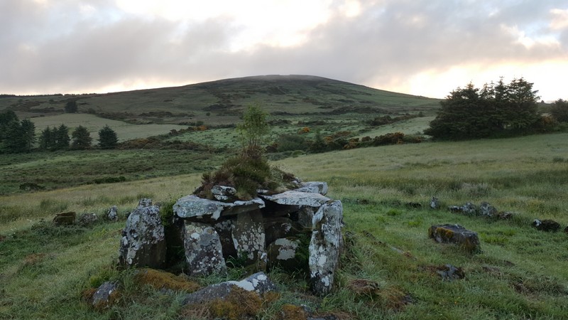
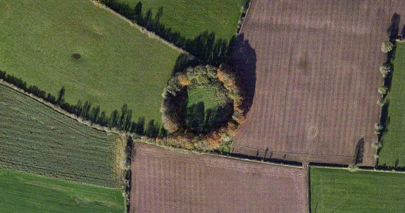
Rathurles and surrounds – A forgotten royal complex and a previously unrecognised henge?
|
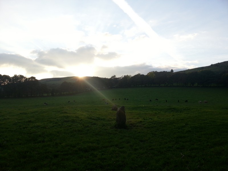
Rathfalla or (Rath Bhaile - rath of the town) is described as a ring-fort in The Archaeological Inventory of County Tipperary. Vol. 1 - North Tipperary'.
I recently visited it as part of research for an article I was writing and discovered that rather than an external ditch which is the norm for ring-forts in Ireland it actually has an internal ditch which is more indicative of ceremonial use or a henge.
The diameter of the monument is 90m and the entrance is in the south-west.
|
   
|

|
Cathair-Durlais, i. e. the city or stone-fort of Durlas. There are several places of the name in Ireland. There is a very remarkable fort called Rath-Durlais, in the parish of Cill-Ruadhain (Kilruane) barony of Lower Ormond and County of Tipperary, which may be the one here referred to.
From The genealogy of Corca Laidhe (Author: Unknown), p.47 column 2 (section 14.) Corpus of Electronic Texts Edition
http://www.ucc.ie/celt/published/T105009/note126.html
|

From the shortened NT Gazetter by Siobhan Geraghty (which was available on the local council website for a while)
One family have owned this land since the 18th century if not before. The land is now rented out and the big house sold.
The archaeological sites include a (round?) castle or tower-house and Rathurles ‘ring fort’ probably a ritual inauguration or assembly site either iron age or pseudo Iron age (12th century?).
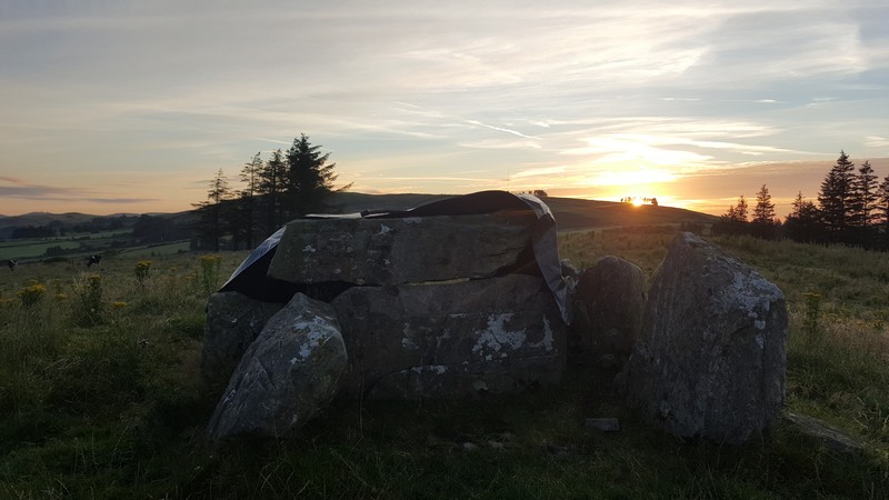
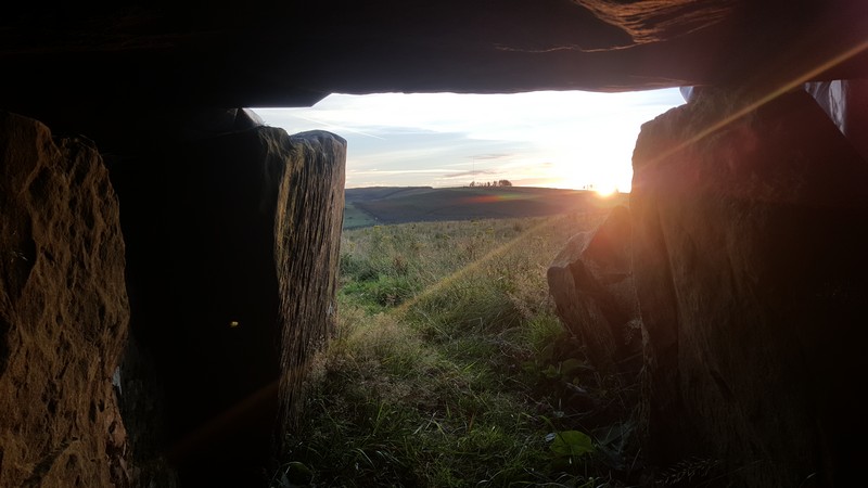
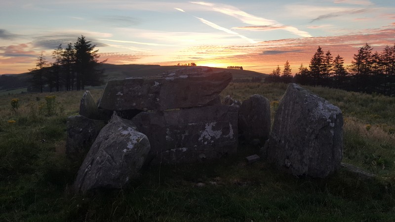
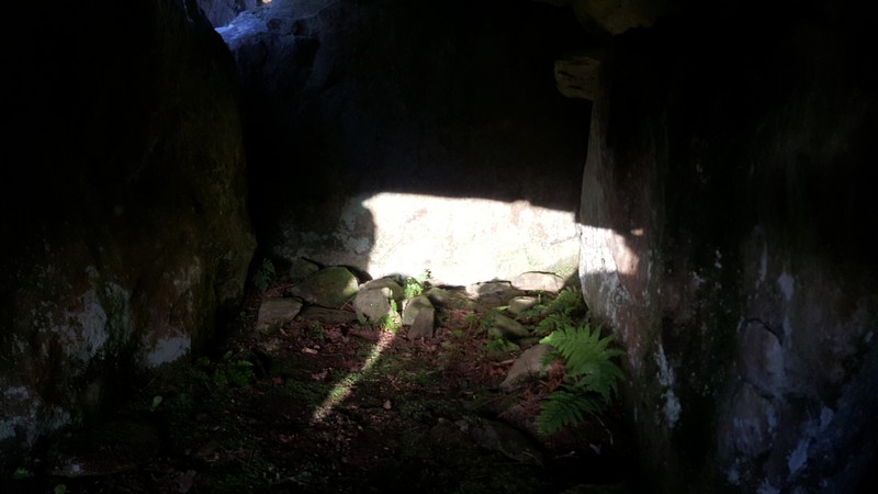
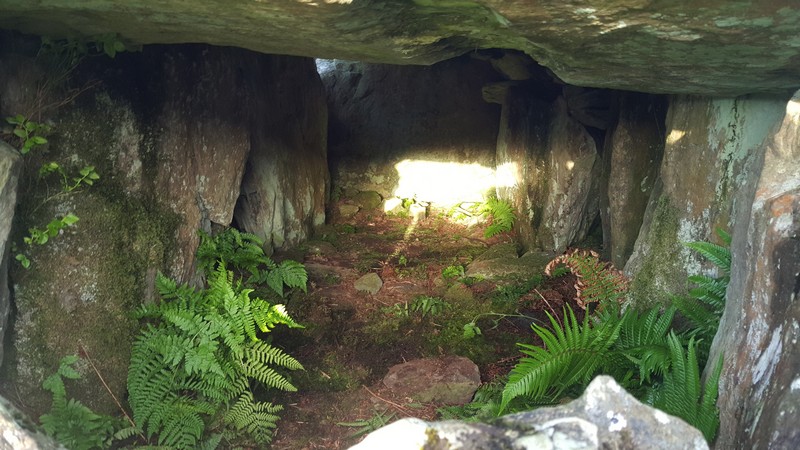
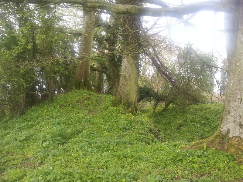
Rathurles fort and church. (Fort only, described as ‘Prehistoric Trivallate Rath’). The medieval stone church in the fort is in good condition although roofless and with 4 yew trees growing in it; these trees will eventually have to be removed. Several 19th and 20th century members of the landowning family (Breretons) are buried outside the church in the interior of the fort.
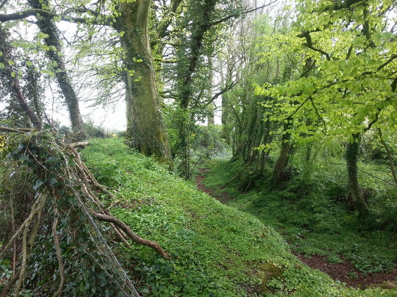
The fort is surrounded by very large (150yr+) beech trees, which are simultaneously a heritage feature in their own right and a potential threat to the archaeological heritage. The interior is overgrown with nettles, thistles and docks, and was displaying a good butterfly fauna at the time of my visit.
|

|
I checked through the Irish Folklore Commission micro-film from the schools around the area but found very little on the ring-fort.
In one there is a description of "lights" in the fort and in another a "white woman" haunts the fort. However for such a large and impressive monument there seems to be very little about it.
Another describes it as having being built by "the Danes".
In Donovans OS letters it is also referred to locally as having being built by the Danes and that a great battle took place at "Barnaderg" in the vicinity. Barnaderg is noted on the 1840s os map and translates as the "gap of red". This may be a reference to the blood-shed. It also mentions that a great number of bones were found within the fort and again makes reference to a battle.
Unfortunately I was unable to copy Donovans OS letters and so this is from memory. (Looked at 17th Oct 14).
What is unusual is that no mention is made to the "fair of munster" in any of the folklore above.
Please see my flickr account for a link to some further info on Rathurles from "Nenagh & It's Neighbourhood" by EH Sheehan (To download a copy click here) http://www.askaboutireland.ie/aai-files/assets/ebooks/ebooks-2011/nenagh-and-its-neighbourhood/SHEEHAN_NENAGH-AND-ITS-NEIGHBOURHOOD.pdf & History of Ely O'Carroll Territory here https://www.flickr.com/photos/13367662@N06/15534109166/in/photostream
|
    
|
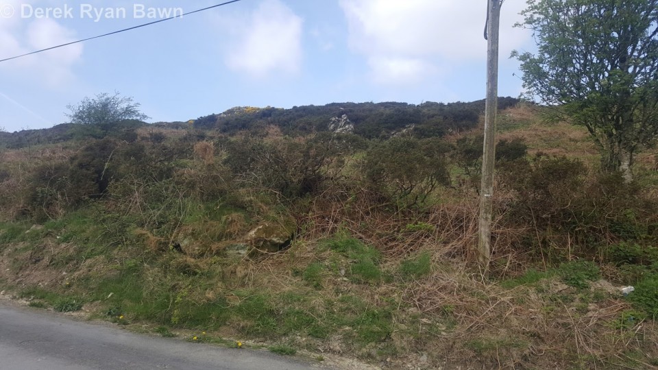
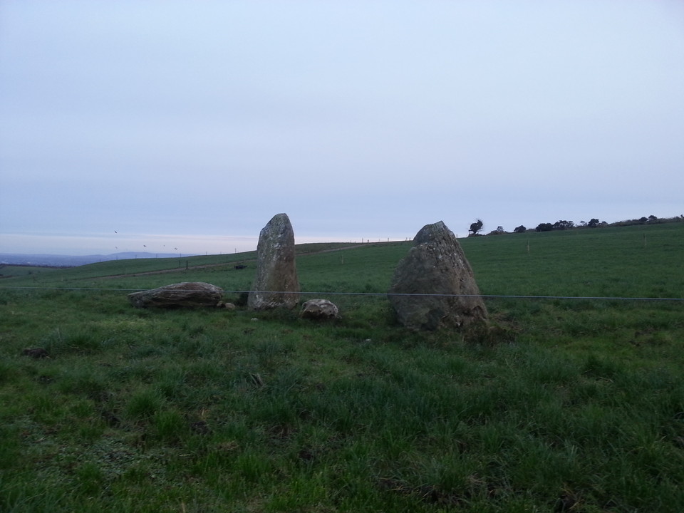
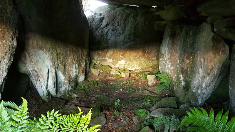
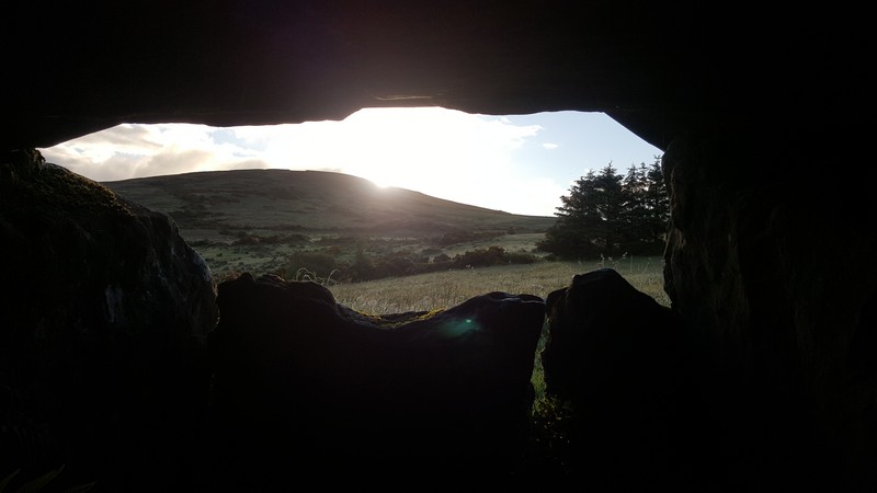
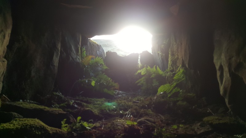
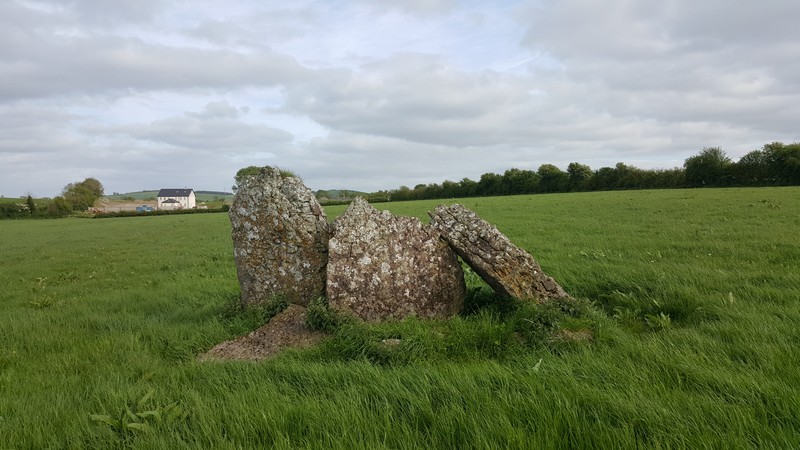
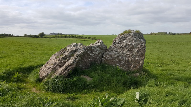
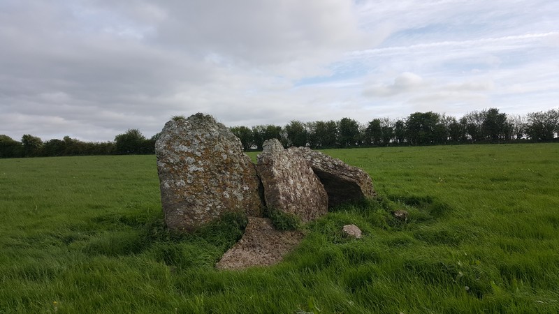
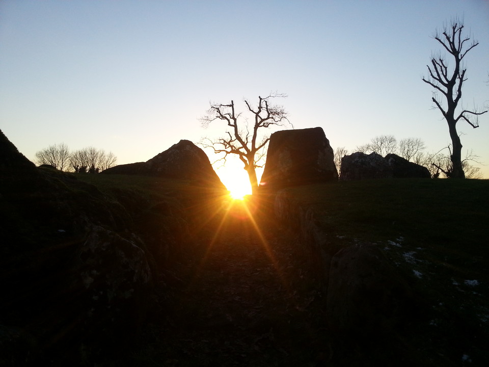
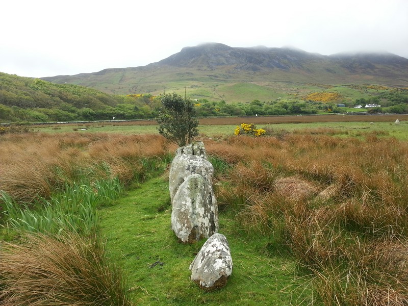
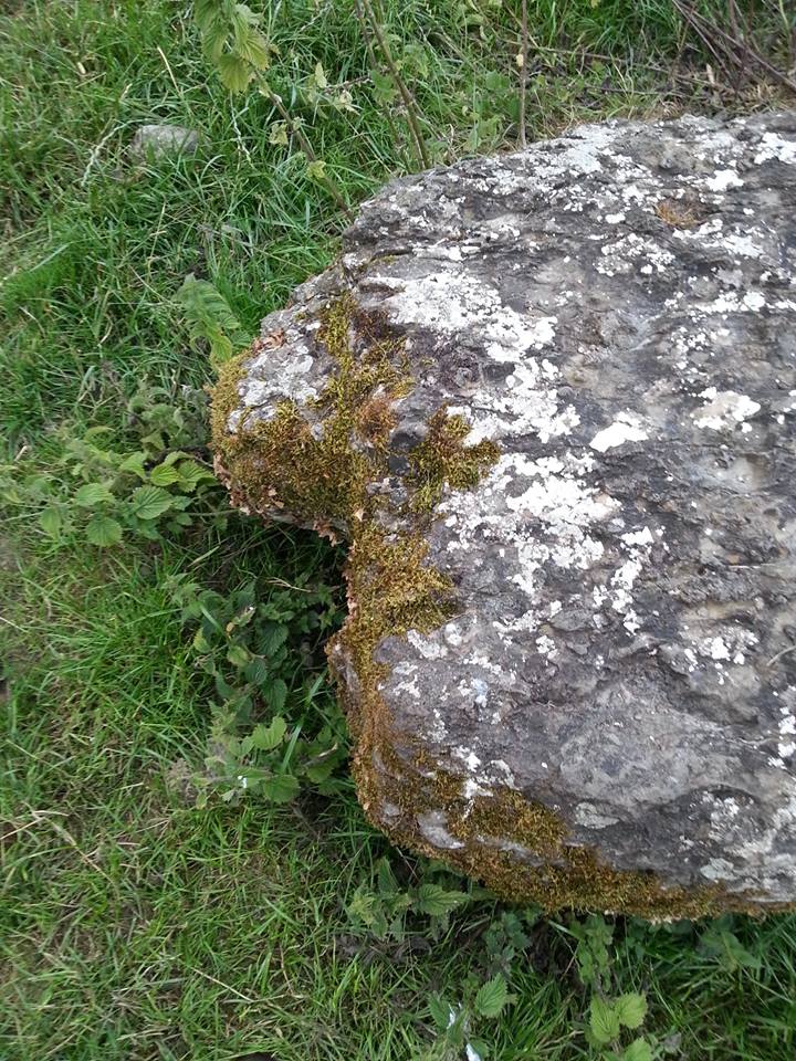
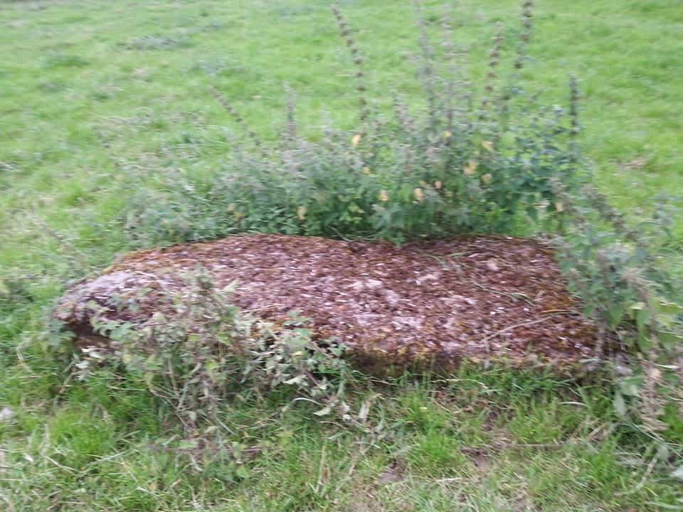
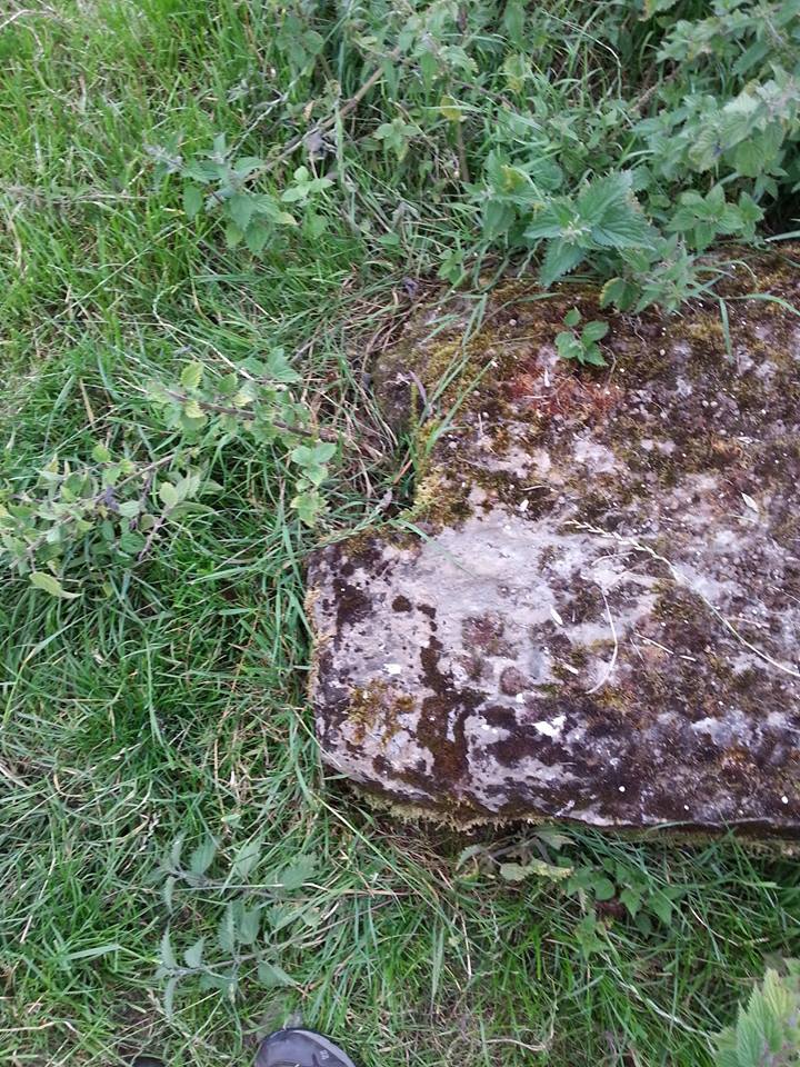
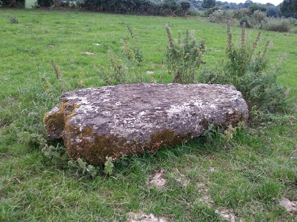
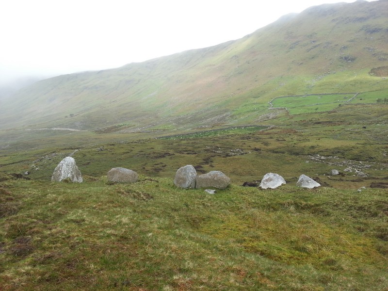
To the north of the tri-vallette ring-fort are two large recumbent blocks of stone.
In the older OS letters they are described as the remains of a druids altar however in the latest description they are described as "gateways" and "Listed in the SMR (1992) and RMP (1998) as piers. These gatepiers are located in the field NE of Rathurles ringfort (TN021-012001). They consist of two large recumbent limestone blocks fomerly used as gatepiers to mark the entrance to the ringfort and are likely to be of nineteenth-century date."
On the old 6" OS maps of the 1840s they are described as "remarkable stones".
To me I'm not sure how they could be described as gate-posts to a ring-fort and I've been trying to identify where this newer description came from. There those appear to have been some work done to the stones and at what date this was completed I don't know. However where these large stones are now located is not near any existing or old field entrance. Why someone would move them to this position I don't know. It seems to me more likely that they are in their original position?
The ring-fort itself is known as "the fair of munster or Ormond" (Ormond comes from the irish for north munster) or an old aonach site. Seemingly it is the reason why the town of Nenagh is located where it is. The thinking being that when the Norman settlers arrived they moved it to a new location.
|
|