The Modern Antiquarian. Stone Circles, Ancient Sites, Neolithic Monuments, Ancient Monuments, Prehistoric Sites, Megalithic MysteriesThe Modern Antiquarian

Showing 1-50 of 108 posts. Most recent first | Next 50

Bryn Celli Ddu Gorsedd (Natural Rock Feature) — Fieldnotes

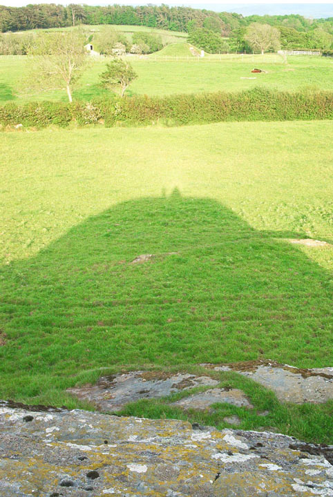
The shadow of the gorsedd is to me more important than the gorsedd itself. Visiting the site at the correct time is essential to see this phenomena.
Bryn celli ddu is an exact replica of the gorsedd shadow when the sun is behind you as you look towards the monument itself.
Similar to maes howe, new grange and stone henge the ancients have this way of perfecting light trickery..
Do not miss this when visiting it adds another dimension to an already facinating site..????

Lockington (Barrow / Cairn Cemetery) — Miscellaneous

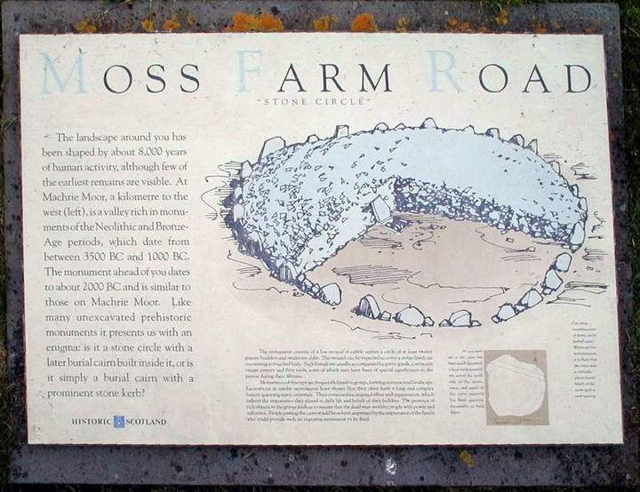
The barrow provided a rare opportunity for examining in detail Bronze Age funerary practices and associated ritual activity in a lowland context in the English Midlands. In addition, a rich group of metalwork finds was discovered - two gold armlets and a copper dagger

Misterton (Barrow / Cairn Cemetery) — Links

University of Leicester: Neolithic & Bronze Age Leicestershire and Rutland


An Archaeological Resource Assessment of the Neolithic and Bronze Age Leicestershire and Rutland by Dr Patrick Clay (PDF).

Misterton (Barrow / Cairn Cemetery) — Miscellaneous

Overall lithic densities from Misterton, for the Early Neolithic and later periods, are comparable with those from surveys of chalkland areas in the south including East Berks, Maddle Farm and the Vale of White Horse.
(Ford 1987; Gaffney and Tingle 1989; Tingle 1991)
Ploughzone areas have produced lithic scatters, occasionally with Early Neolithic material although separating Late Mesolithic from Early Neolithic has always been a problem. In Leicestershire 17 locations might be interpreted as core areas - Three areas where systematic survey has been undertaken, at Medbourne, Misterton and Oakham, surface scatters show possible early Neolithic ëcore areasí on Liassic clay and boulder clay valley sides.
An Archaeological Resource Assessment of the Neolithic and Bronze Age Leicestershire and Rutland.

Croft (Ancient Village / Settlement / Misc. Earthwork) — Links

University of Leicester: Neolithic & Bronze Age Leicestershire and Rutland


An Archaeological Resource Assessment of the Neolithic and Bronze Age Leicestershire and Rutland by Dr Patrick Clay (PDF).

Croft (Ancient Village / Settlement / Misc. Earthwork) — Miscellaneous

Although most evidence comes from the visible plough zone areas in the form of lithic scatters there is increasing evidence of Early Neolithic activity from low lying stream and river-side areas. At Croft at the confluence of the Soar and Thurlaston Brook possible palisade gullies for post-ring round-houses were located tentatively dated on lithic evidence to the Late Mesolithic or Early Neolithic (Hughes and Rosseff 1995)
An Archaeological Resource Assessment of the Neolithic and Bronze Age Leicestershire and Rutland.

Husbands Bosworth Causewayed Enclosure — Links

The Scheduled Ancient monuments of Leicestershire and Rutland


An on-line book by Leonard Cantor giving brief info of local sites (PDF).

Husbands Bosworth Causewayed Enclosure — Miscellaneous

A Passage from The Scheduled Ancient monuments of Leicestershire and Rutland, by Leonard Cantor:
In the parish of Husbands Bosworth, 175 metres
west of Wheler Lodge Farm (HARBOROUGH, O.S.140 SP640823),
the buried remains of a large causewayed enclosure have
been revealed by recent geophysical survey and
excavations. Two concentric interupted ditches survive
well as a buried feature, and are likely to preserve
artefacts such as pottery fragments and flint tools. Over
50 such enclosures have been recorded nationally,
constructed in the Neolithic period, between about 3000
and 2400BC and continued in use later. They were used for
various functions including settlement, defence and
ceremonial and funerary purposes. Amongst the earliest
field monuments to survive in the modern landscape, they
are considered to be of national importance.

Law Of Melrose (Cairn(s)) — Links

Macduff to Rosehearty Walk


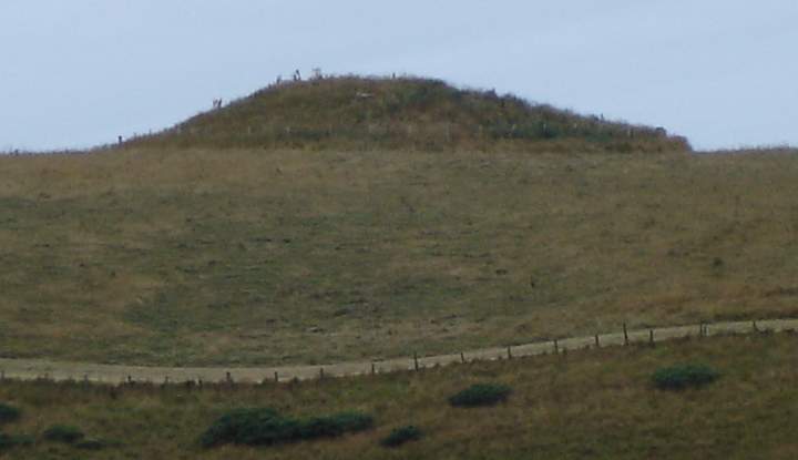
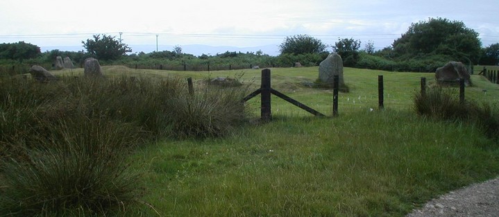
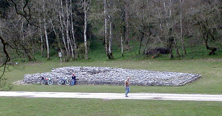
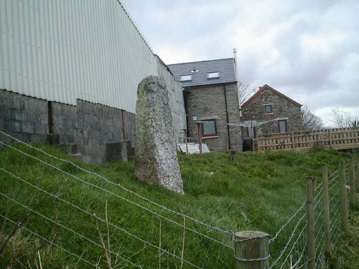
Photos showing the prominent position of the cairn

Law Of Melrose (Cairn(s)) — Images (click to view fullsize)

<b>Law Of Melrose</b>Posted by broen

Husbands Bosworth Causewayed Enclosure — Links

University of Leicester Archeological services ULAS


Living on the Edge - pdf format with images of archeology

Brinklow (Artificial Mound) — Links

Time Trails 1910ce


A Photo of Brinklow in 1910 with sheep grazing and Elm trees

TimeTrail


TimeTrail - Warwickshire Museum
Scroll down the page to find maps, stats and a pictures

The Gatehouse


Essentially a castle web site - but gives some interesting dimensions, dates and info

Brinklow History Group


Brinklow History Group is a small informal group of people dedicated to researching, collating and publishing the history of the village of Brinklow, in Warwickshire, England.

Brinklow (Artificial Mound) — Images

<b>Brinklow</b>Posted by broen

Din Dryfol (Chambered Tomb) — Images

<b>Din Dryfol</b>Posted by broen<b>Din Dryfol</b>Posted by broen

Nether Largie Cairn Cemetery (Cairn(s)) — Images

<b>Nether Largie Cairn Cemetery</b>Posted by broen

Nether Largie South (Cairn(s)) — Images

<b>Nether Largie South</b>Posted by broen<b>Nether Largie South</b>Posted by broen

Loanhead of Daviot (Stone Circle) — Images

<b>Loanhead of Daviot</b>Posted by broen<b>Loanhead of Daviot</b>Posted by broen

Callanish (Standing Stones) — Images

<b>Callanish</b>Posted by broen

Loanhead of Daviot (Stone Circle) — Images

<b>Loanhead of Daviot</b>Posted by broen<b>Loanhead of Daviot</b>Posted by broen<b>Loanhead of Daviot</b>Posted by broen

Moss Farm Road (Cairn(s)) — Images

<b>Moss Farm Road</b>Posted by broen<b>Moss Farm Road</b>Posted by broen<b>Moss Farm Road</b>Posted by broen<b>Moss Farm Road</b>Posted by broen<b>Moss Farm Road</b>Posted by broen

Machrie Moor (Stone Circle) — Images

<b>Machrie Moor</b>Posted by broen<b>Machrie Moor</b>Posted by broen<b>Machrie Moor</b>Posted by broen<b>Machrie Moor</b>Posted by broen

Loanhead of Daviot (Stone Circle) — Images

<b>Loanhead of Daviot</b>Posted by broen

Ardvreck (Chambered Cairn) — Images

<b>Ardvreck</b>Posted by broen

Machrie Moor (Stone Circle) — Images

<b>Machrie Moor</b>Posted by broen<b>Machrie Moor</b>Posted by broen

Parc Le Breos (Long Cairn) — Images

<b>Parc Le Breos</b>Posted by broen

The Bulwark (Hillfort) — Images

<b>The Bulwark</b>Posted by broen<b>The Bulwark</b>Posted by broen

The Bulwark (Hillfort) — Fieldnotes

11/4/04
You can park in Llanmadoc and walk up the hill to the fort which according to GPS is 350m but seems alot further walking up hill.
Once at the top the fort has astounding views to the North and North West of Broughton Bay and Whitford point and across the delta of Afon Llwchwrthe to the Pembrookshire coastline.
There is also (I assume) a cairn about 100 yards to the west of the fort very similar to the cairn adjacent to Maen Cetty (Arthurs Stone).
The ditches are substantial and the fort is roughly circular in shape.
*NB, one of the road workers at the bottom of the hill said it was an iron age structure.

Ty'r-coed (Standing Stone / Menhir) — Images

<b>Ty'r-coed</b>Posted by broen<b>Ty'r-coed</b>Posted by broen

Ty'r-coed (Standing Stone / Menhir) — Fieldnotes

I asked the farmer for access to the stone, he was very polite and showed us the way. The stone is tucked away behind his house as you can see in the images provided. The lambs in the field must have been hand reared as they are super human friendly even suckling on my finger - unlike the Alsatian which has evil in its protective bark - I never offered it my hand to check his friendlyness.

Bryn Celli Ddu (Chambered Cairn) — Images

<b>Bryn Celli Ddu</b>Posted by broen

Abbey Farm Barrow (Round Barrow(s)) — Fieldnotes

one of a number of barrows in a relatively short distance. situated halfway between croft hill - iron age hill fort - and brinklow mound. this barrow holds the most westerly position. Moving east there is copstone barrow and then wigston parva barrow. all within aprox 1 mile of each other. there is not a lot to see here. just a raised level in the middle of some vegetable crops. I Will get permission off the farmer next time to wander aimlessly around his field.

Abbey Farm Barrow (Round Barrow(s)) — Images

<b>Abbey Farm Barrow</b>Posted by broen
Showing 1-50 of 108 posts. Most recent first | Next 50

My TMA Content: