|
|

|
|
Din DryfolChambered Tomb
|
|
|
|
Images (click to view fullsize) |
|
Photographs: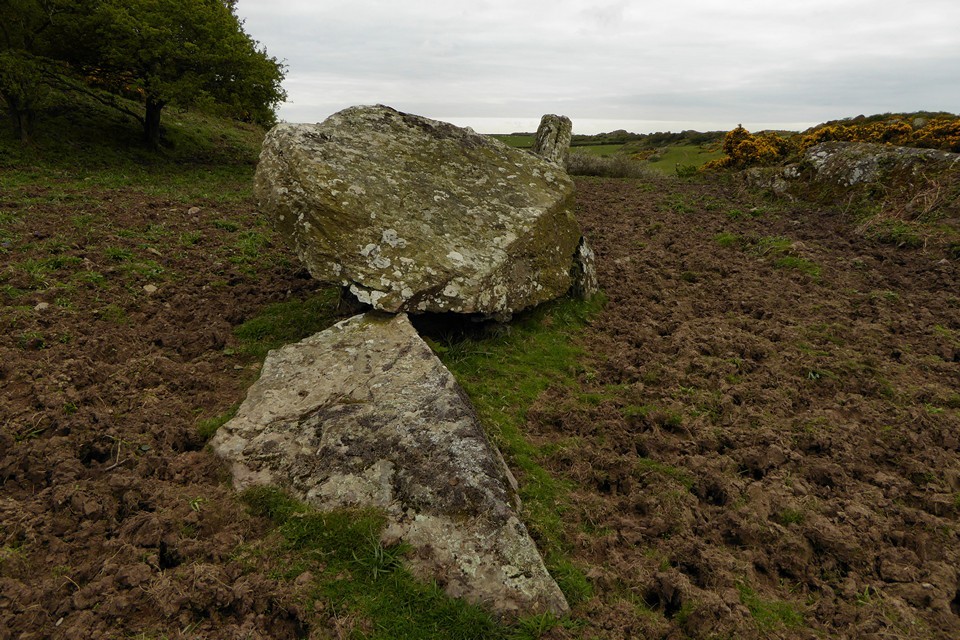
 Maps / Plans / Diagrams:
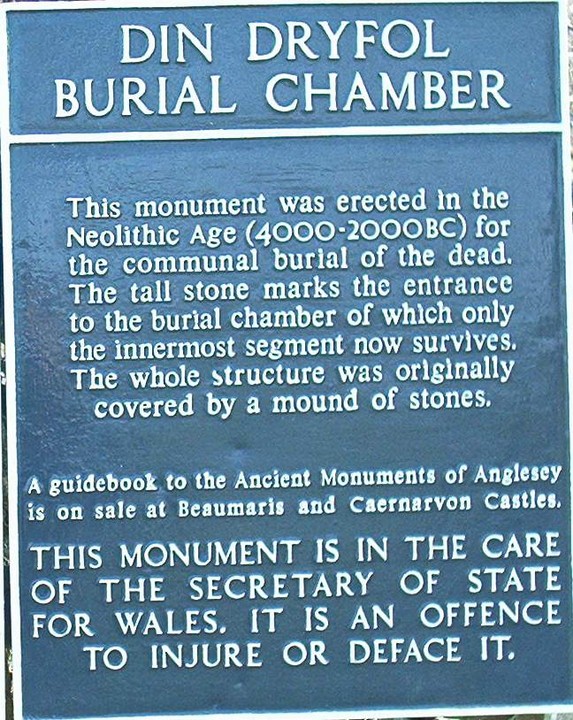
|
Fieldnotes |
|
|
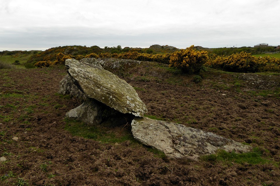
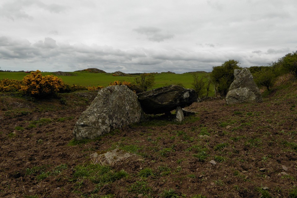
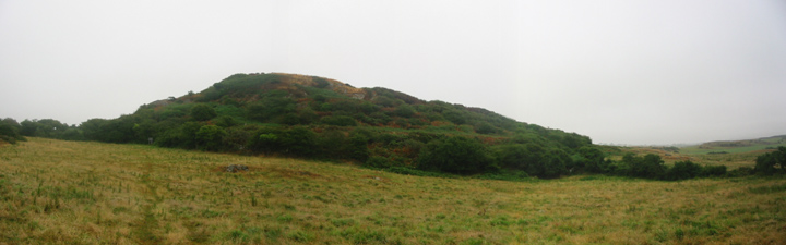
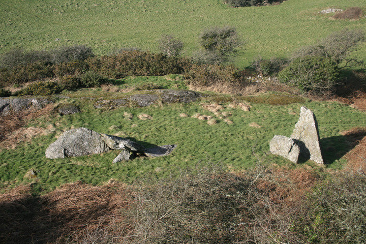
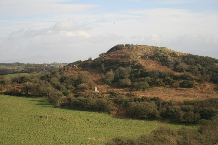
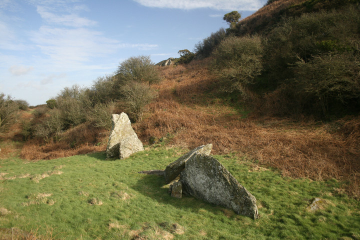
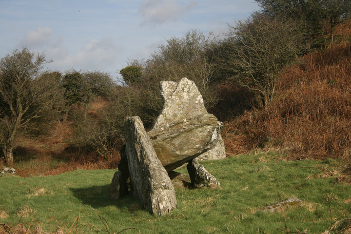
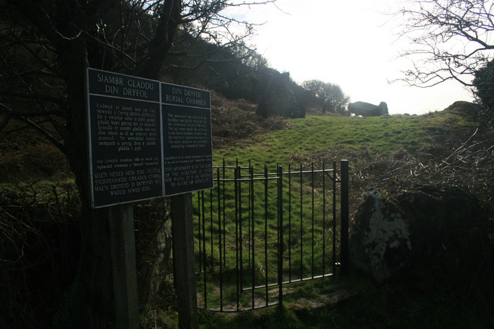
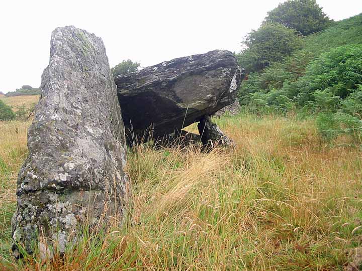
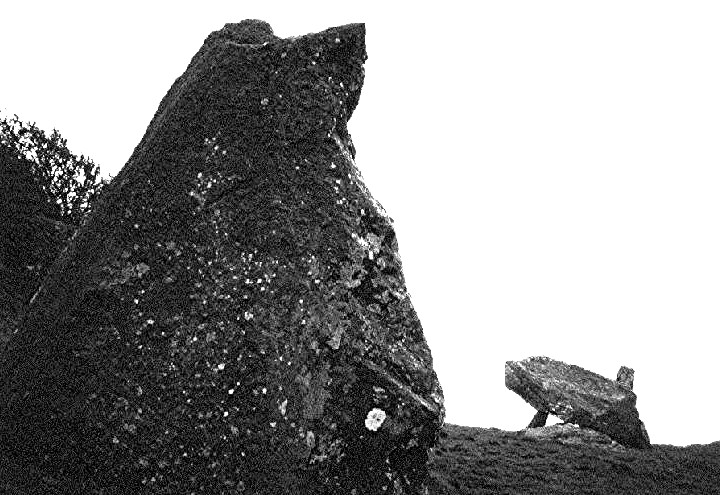
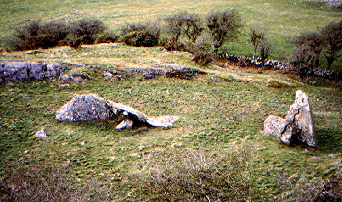
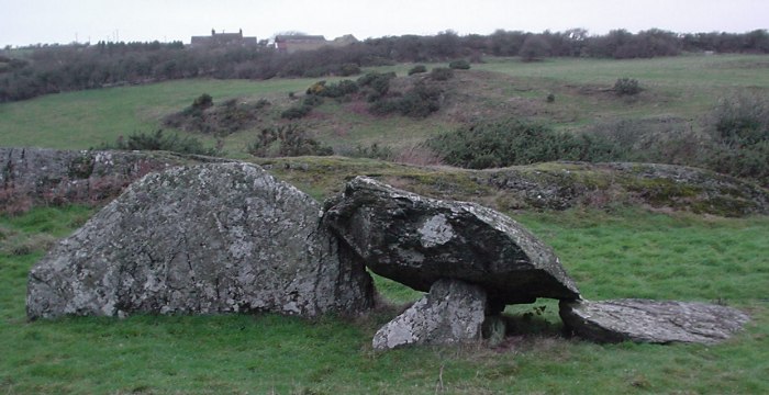
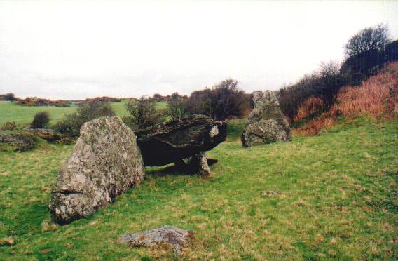
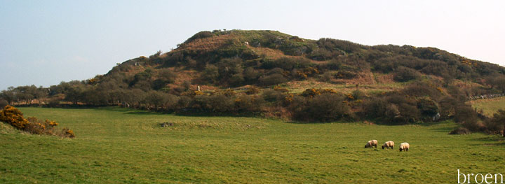
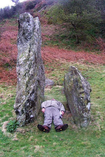
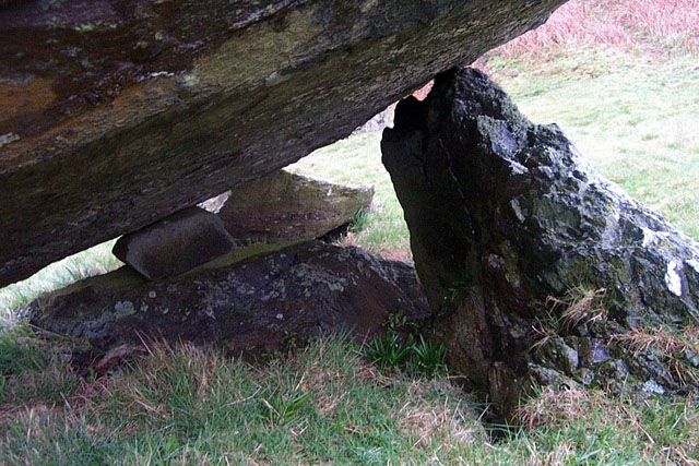
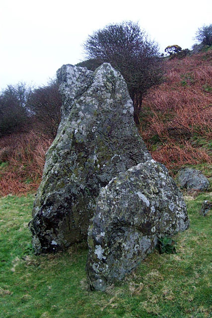
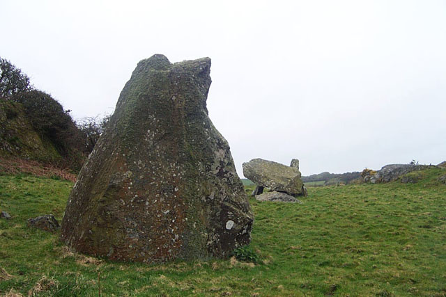
Visited 8.9.12 The first of my Anglesey CADW sites. This was a bit trickier to find than I was expecting. Karen stayed in the car and I carried Sophie as I thought this would be easy to walk to. Directions: There is room to park near the farm entrance. (The sign for the tomb was covered by an overgrown hedge – I cleared it before we left) Walk down the farm track (farm derelict?) and over the field gate. Across a small paddock and over another field gate. Across a field and over a padlocked, old, rusty gate. Across another field and through a kissing gate. Then across a field of thistles before squeezing through an overgrown kissing gate. You then come to the Chambered Tomb! (In total it is a 15 minute walk) The signage is poor and you can’t see the tomb until you are through the final kissing gate as the site is obscured by bushes / brambles etc. The info board is no longer there. In saying all this don’t be put off as persistence will prevail and the site is worth the effort. If you get lost – head for the ‘rocky hill’ – the site is in front of it. There are two large remaining stones. One is approx 6ft square and the other is about 4ft high x 7ft across. |
Posted by CARL 17th September 2012ce |
|
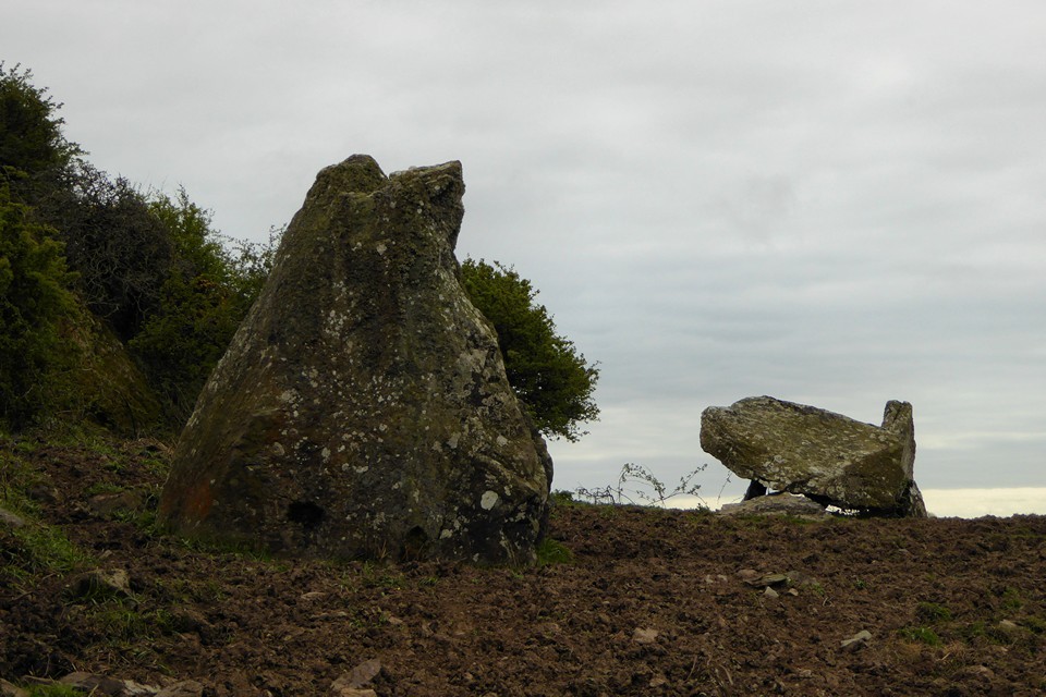
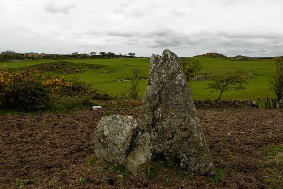
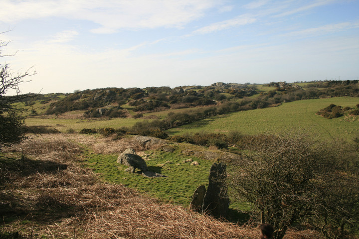
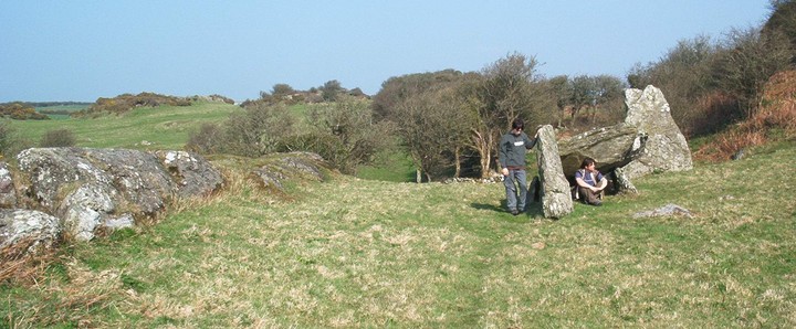
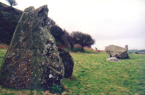
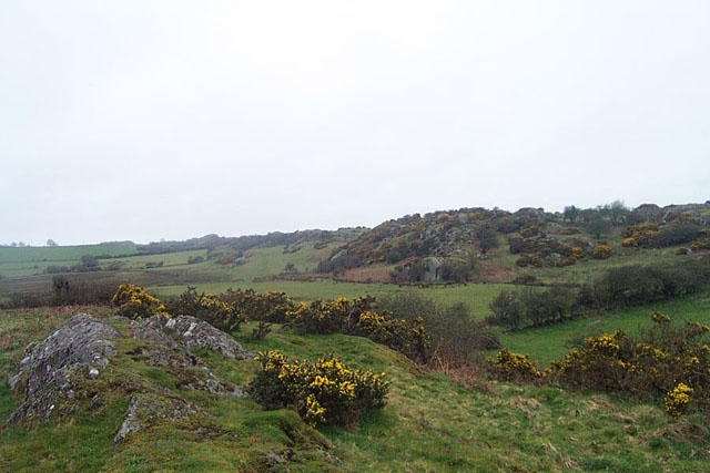
Din Dryfol is sign posted from the road, so presuming you successfully navigated the small warren of lanes, park somewhat precariously by the sign and walk down the driveway to the farm. Further signs take you through two gates and a stile, then across one field heading towards the tiny mountain and more specifically the information board, and your there. The majority of this burial chamber is gone but it's in such a lovely place and there remains just enough to stay for several hours. A small dolmen and two standing stones one of which is huge, a long rocky outcrop runs parrallel to the stones and was used as a curb for the cairn material (or so I read somewhere)The hill or tiny mountain as my kids called it is the highest ground for some distance and is surely the reason the burial chamber is here, if your coming why not climb it for a good all round view, also keep your eyes open for a Cokin ND Grad camera filter which inexplicably broke free from me and refused to be found, Darn it ! |
 Posted by postman
2nd March 2008ce |
| Perfectly located, nestled below a prominent outcrop. The outcrop can be clearly seen from the main road, and I knew instantly that this would be the location of this wonderful site. I cannot imagine many people visiting here, so this is a great spot to just chill out. |
 Posted by IronMan
2nd April 2002ce |