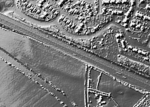
A bronze age univallate hillfort. Visited the site today and not a lot left apart from a raised bump in the field on the south west corner about a meter high. But still quite visible if you know what your looking for. Originally triangular in shape much has been destroyed by the A303 and housing
If you're ever speeding along the Andover Bypass you might spare a thought for poor Balksbury. Most of it has been destroyed by the road and a big housing development (no doubt full of corny road names relating to the fort). Only the very SW end survives (if you can call it that, squeezed as it is, and damaged by ploughing). It was a large hillfort first occupied in the Late Bronze Age, and probably had rather a nice view over the confluence of two rivers below, to the south east. This was also the direction of the single gated entrance. It was used until and during the Roman period. It's on the scheduled ancient monuments list (which is where this information derives, from Magic) - but this status clearly hasn't afforded it much protection.

 Posted by Rhiannon