Skip to content
Julian Cope
presents
The Modern
Antiquarian
Latest
Posts
Sites
Map
Blog
Forum
search
Search
⚠️
Sign in
more_horiz
United Kingdom
England
Southern England
Hampshire
Oram’s Arbour
Hillfort
expand_more
Nearest town:
Winchester (1km ESE)
Latitude:
51° 3' 53.47 N
Longitude:
1° 19' 21.14 W
Added to TMA by
goffik
Images (2)
Add
content
Images
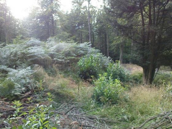
Image credit: Graham Orriss
goffik
Feb 24, 2017
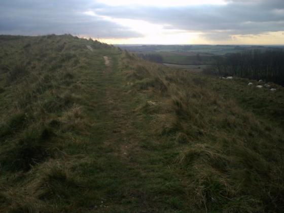
Image credit: Graham Orriss
goffik
Feb 24, 2017
Sites within 20km of
Oram’s Arbour
St Catherine’s Hill
Hillfort
•
2.41km SE
photo
15
description
7
Oliver’s Battery
Ancient Village / Settlement / Misc. Earthwork
•
2.52km SW
photo
4
description
3
Magdalen Hill Down Barrows
Barrow / Cairn Cemetery
•
2.55km E
photo
7
description
4
Flowerdown Barrows
Barrow / Cairn Cemetery
•
2.71km WNW
photo
10
description
5
Texas Barrows
Round Barrow(s)
•
3.37km SW
photo
3
description
2
St Mary’s Church, Twyford
Christianised Site
•
4.72km SSE
photo
3
description
1
link
1
Telegraph Hill Barrow
Round Barrow(s)
•
4.98km E
photo
6
description
1
Twyford Pumping Station Barrows
Round Barrow(s)
•
5.22km SE
photo
2
description
1
Littleton House Bowl Barrow
Round Barrow(s)
•
5.25km NW
photo
1
description
1
Cheesefoot Head Barrows
Round Barrow(s)
•
5.39km E
photo
3
description
1
Love Lane
Round Barrow(s)
•
5.4km SE
photo
2
description
1
Wallers Ash Barrow
Round Barrow(s)
•
5.8km N
photo
1
description
1
South Wonston South-west Long Barrow
Long Barrow
•
5.8km NW
photo
3
description
2
West Wood
Round Barrow(s)
•
6.16km WSW
photo
6
description
1
Merdon Castle
Hillfort
•
6.27km WSW
photo
1
description
1
South Wonston East Long Barrow
Long Barrow
•
6.31km N
photo
1
description
1
South Wonston Long Barrow
Long Barrow
•
6.31km NNW
photo
4
description
2
South Wonston North Long Barrow
Long Barrow
•
6.93km NNW
photo
1
description
2
Crawley Clump East Barrows
Round Barrow(s)
•
7.19km NW
description
2
link
1
Crawley Clump West Barrows
Round Barrow(s)
•
7.35km NW
photo
1
description
3
Farley Mount Enclosure
Enclosure
•
7.37km WSW
photo
7
description
2
Withering Corner Barrows.
Barrow / Cairn Cemetery
•
7.97km WSW
photo
4
description
2
Longwood House Long Barrow
Long Barrow
•
8km ESE
photo
5
description
1
Owslebury
Long Barrow
•
8km ESE
photo
4
description
2
Micheldever Woods
Ancient Village / Settlement / Misc. Earthwork
•
8.69km NE
photo
10
description
2
link
1
Gander Down
Round Barrow(s)
•
8.71km E
photo
1
description
1
Barton Stacey Barrows
Round Barrow(s)
•
9.22km NW
description
1
Itchen Stoke Down Barrows
Barrow / Cairn Cemetery
•
9.24km ENE
photo
1
description
1
Moody’s Down
Long Barrow
•
9.74km NW
description
2
Dirty Mount
Round Barrow(s)
•
9.89km WSW
photo
3
description
1
Chilbolton Round Barrows
Round Barrow(s)
•
9.96km WNW
description
1
Chilbolton Down Long Barrow
Long Barrow
•
10.21km WNW
description
1
Moody’s Down Farm
Long Barrow
•
10.22km NW
description
2
New Farm
Round Barrow(s)
•
10.22km WNW
description
1
Heardulfes Hlaewe
Round Barrow(s)
•
10.3km WNW
description
1
Kitson’s Clumps
Round Barrow(s)
•
10.31km N
description
1
Little Somborne Hillfort
Hillfort
•
10.33km WNW
description
1
Leckford Barrows
Round Barrow(s)
•
10.36km WNW
description
1
Norsebury Ring
Hillfort
•
10.44km N
photo
2
description
3
Cheriton Church Mound
Christianised Site
•
10.69km E
photo
3
description
1
Newton Down Farm
Round Barrow(s)
•
10.69km NW
description
2
Woolbury
Hillfort
•
10.84km W
photo
9
description
2
The Millbarrows
Barrow / Cairn Cemetery
•
11.06km E
photo
3
description
2
Stockbridge Down
Round Barrow(s)
•
11.56km W
photo
1
description
1
Cheriton Long Barrow
Long Barrow
•
11.78km E
photo
5
description
2
Lamborough
Long Barrow
•
11.79km E
description
2
Hinton Ampner Park
Round Barrow(s)
•
12.37km E
description
1
Oliver’s Battery
Hillfort
•
12.64km ENE
photo
1
description
2
Kilmeston
Round Barrow(s)
•
12.75km E
photo
1
description
2
Cranbourne Wood Long Barrow
Long Barrow
•
12.77km N
description
1
Tidbury Ring
Hillfort
•
13.16km NNW
photo
4
description
1
Andyke
Ancient Village / Settlement / Misc. Earthwork
•
13.69km NW
photo
3
description
1
Chilworth Ring
Hillfort
•
14.18km SSW
photo
1
description
1
Toothill Fort
Hillfort
•
14.56km SW
photo
2
description
2
Popham Beacons
Barrow / Cairn Cemetery
•
14.97km NNE
photo
7
description
3
Moorgreen House
Round Barrow(s)
•
14.97km S
description
1
Monarch Way
Round Barrow(s)
•
14.97km S
description
1
Three Barrows (Laverstoke)
Round Barrow(s)
•
14.99km N
description
1
Freefolk Wood Barrows
Round Barrow(s)
•
15.18km N
description
1
Brockwood Park
Round Barrow(s)
•
15.36km E
description
1
Waters Down Farm
Round Barrow(s)
•
15.94km W
description
1
Danebury Round Barrows
Round Barrow(s)
•
16.08km W
description
1
Danebury Long Barrows
Long Barrow
•
16.97km W
photo
5
description
2
Danebury
Hillfort
•
16.97km W
photo
28
description
11
link
4
Lockerley Camp
Plateau Fort
•
17.45km WSW
description
1
Dunwood Camp
Hillfort
•
17.48km WSW
photo
1
description
1
Danebury North-East long barrow
Long Barrow
•
17.5km W
description
1
West Meon
Round Barrow(s)
•
17.68km E
description
1
Abra Barrow
Barrow / Cairn Cemetery
•
17.73km N
photo
2
description
2
Netley Hill
Round Barrow(s)
•
17.77km S
description
1
The Turret
Round Barrow(s)
•
18.54km W
photo
1
description
1
Whiteshoot Hill
Round Barrow(s)
•
18.57km W
photo
1
description
1
Bury Hill
Hillfort
•
18.84km WNW
photo
18
description
2
Testwood Lakes
Ancient Village / Settlement / Misc. Earthwork
•
19km SW
photo
4
link
1
Old Winchester Hill
Hillfort
•
19km E
photo
18
description
3
link
2
The Jumps
Round Barrow(s)
•
19.14km E
description
1
Balksbury
Hillfort
•
19.18km WNW
photo
2
description
2
Stock’s Farm Long Barrow
Long Barrow
•
19.25km E
photo
2
description
1
search
I’m looking for…
location_on
photo
ondemand_video
forum
description
link