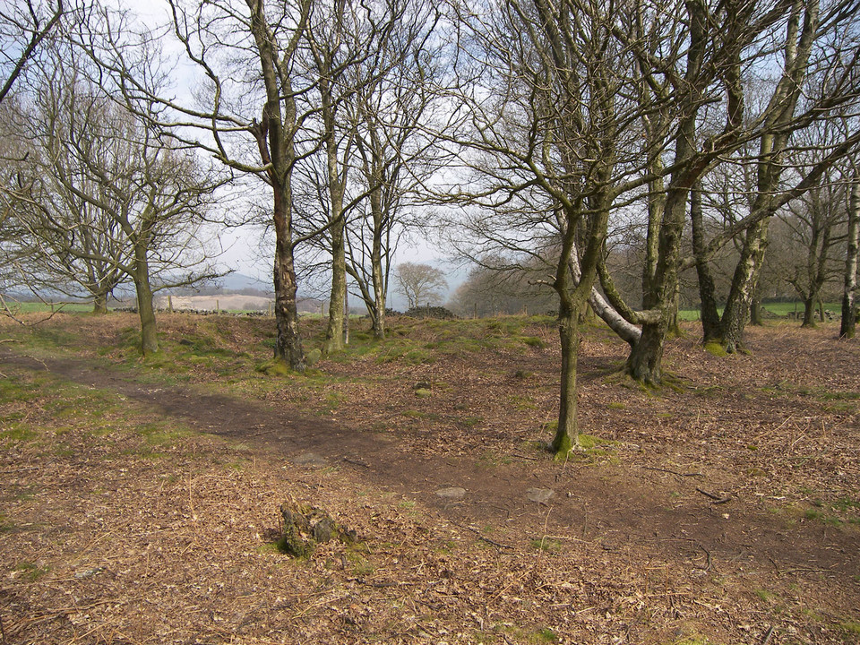
After a trip to Pembroke, I thought I’d take another look at Beddarthur on the way home. It was mid-afternoon and I decided I’d see if it’s possible to take the direct route north from the parking area opposite the gate to Pentrithel. You’ll note from the OS map that the obvious trail to the stones is a dog-leg that skirts the huge hill (Talfynydd) in front of you.
At the parking area, instead of going northwest along the Pony Trail, I hugged the fence at the east for a short distance and took a well-defined northward-bearing track that leads to a rock outcrop (presumably at 130314). To avoid some horses, I’d actually taken a path on the slope above the track that led to the top (but it’s not at all high).
Here, there’s a distinct hollow (where I imagine the water runs off the hill) and a line of rocks in view to the north on the very top of the slope, where the main trail runs a good few hundred metres away (I could see people walking along it).
I cut off northwards along the top of the hollow, following the contour but tending towards the crest of the hill (safe in the knowledge that the main trail was above me) and eventually met the track at the stones below Carnbica.
Two-thirds of the walk is on rough moorland, but it was a doddle walking back. I just wouldn’t try it in the mist or in the dark. As it was, I reached the track below the rock outcrop just before dusk.
|

|

|

|

|

|
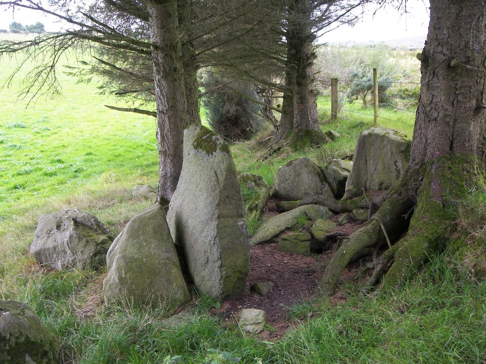
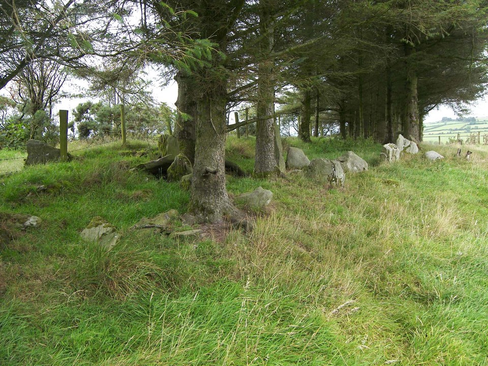
This four poster, sadly threatened by trees, lies on an island marked Knockacappul on the OS map, in Kilmakillog harbour on the south shore of the Kenmare River. We were informed that it is owned by Lauragh Gardens, but didn’t check.
You can get across to the island at low tide wearing wellington boots, or paddling, but be warned that the channel is over a metre deep at high tide, and the water moves quickly with the tide running. We used the tide tables for Bantry Bay, and crossed 40 minutes before low tide there (ankle-deep at worst), which gave us more than enough time on the island to get back safely with the water apparently no deeper.
To get there, drive past the post office at Lauragh (at the northern end of the Healy Pass) in the direction of Ardgroom, over the stone bridge, and turn left on the road signposted to Shronebirrane circle. After a few hundred metres there’s a driveway on the right, with a gate a short way up, leading to a large house. This lies about 100 metres from the best crossing point, though it’s not easy to get over the fence on the opposite side of the road (the access gate being completely out of the question) and then through the trees.
We stepped over the fence about 50 metres further along the road, where the bank drops, walked back to a point level with the driveway, and struck out for the island, eventually coming upon a ditch that leads to the channel and crossing point.
It’s an easy drop off the bank - but be careful of slipping on the seaweed that covers the rocks. The circle is in the trees, slightly to the south of the centre of the island, just short of where the trees thin out. It has one very tall stone and a very low stone at north, and two others of medium height at the south.
There’s an outlier some 13 metres to the north, hidden from the circle by closely packed trees. We also noted a large stone (probably not an outcrop, perhaps a fallen outlier?) about 35 metres to the east.
To celebrate a safe crossing, and actually finding the stones, we treated ourselves to a delicious coffee and freshly baked pastries at the post office/café at Lauragh.
|
  
|

|

|

|
|
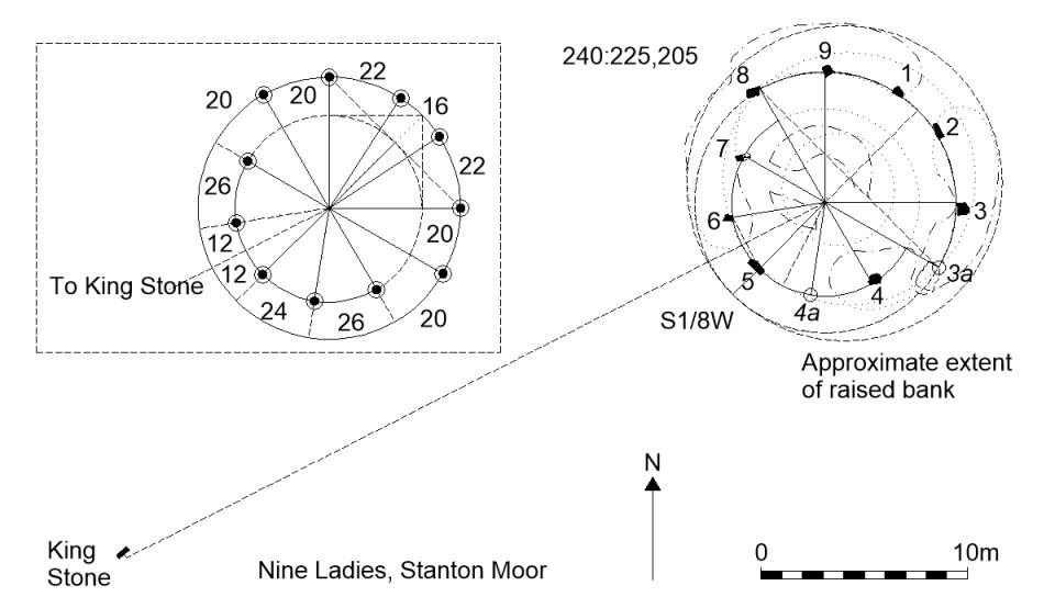
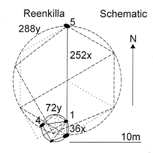
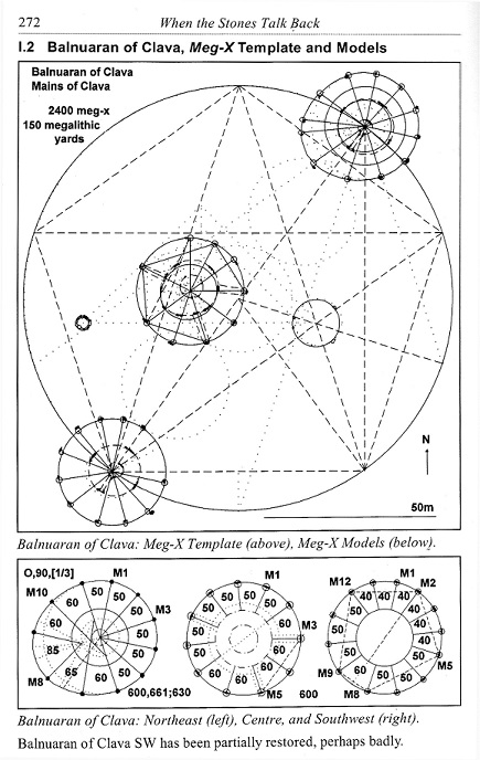
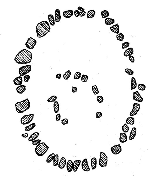
While at the site, check out the apparent symmetry of the markers forming the outer (stone) circle. This appears to have a north-south axis, and I suggest that the gaps were measured. This can be appreciated from a suggested model (overall schema) in the Plans section.
|

|

|
To be more explicit as to directions: As can be seen from the OS map, fom the car park at the Cow and Calf Rocks, follow the road uphill and strike off right at a signpost just before the Cow and Calf, which directs you onto the steeper slope. This will take you to the first level, to the right of the Pancake Stone, which you may wish to visit. The moor proper is at the second level, which can be seen straight ahead. The path is marked by a thick post visible on the skyline, more or less behind the Pancake Stone. Once there, just follow the well-defined track, which bears slightly to the left, and you’ll soon see ‘The Shed’ off to your left, after a small lake. You may wish to visit the Grubstones, and then carry on as in the instructions in the entry below this.
To try to pin down the location: You’ll see the ‘Thos. Pulleyn’ stone from the path, but carry on until you reach the stile a short way further on, which you have to climb over. From the top of the stile, if you look southeast (halfway to your right) the circle is about 50m distant, just where the land drops away. You can't actually see it because of the dip. Alternatively, walk about 40 paces southwards along the fence line, and go about 40 paces at a right angle from there. So, I figure the circle has to be about 100m SSE of the 'Thos. Pulleyn' stone.
The circle may best be appreciated with Arthur Raistrick’s survey at hand. I don’t know if there’s been interference, but the central setting is not now as he depicts. It’s a complete near-true circle of 20 stones with a loose stone inside. What’s more, it’s not offset as far southwards as he shows it - it’s almost central. The stones of the outer ellipse are still recognisable from his survey, though some of the smaller stones, particularly at north and south, appear to have been moved. A few are larger than he shows. It may look ragged, but this is a fascinating circle, or enclosure, or whatever it is.
As an aside, if you approach the ring from the Cow and Calf via the Grubstones then instead of walking back the same way you can go on to the Twelve Apostles. Just continue south on the path a few hundred metres to the Horncliffe Well (following the fence, and over a stream) where there’s a stone wall with a stile, and a path on the other side. Turn right (NNW) and you’ll eventually re-negotiate the wall, and almost bump into the circle at the top of the long, long, rise - soon after a modern milestone at a track joining from the left. Be aware that the track can get boggy after rain. As a closing note, from the Apostles continue northwards and take the stone-flagged path on the right, downhill at the fork / junction, then go right at Gill Head (where the path drops sharply) to follow the stream back to the rear of the Cow and Calf Rocks, where you cross it. The entire trip should pass away a good few hours!
The circle can also be approached from the south (shorter), via the Horncliffe Well.
|
|
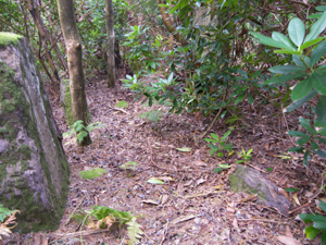
I've added a photo of a fairly distinctive stone in the path that might aid in spotting the circle.
|
|
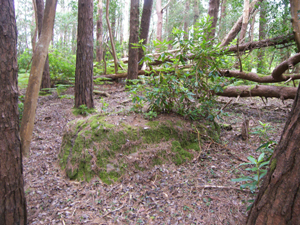
I've added a photo that should help identify the track to the circle.
|

|

|
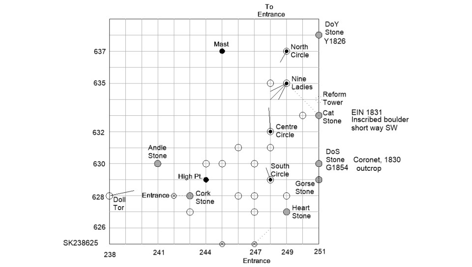
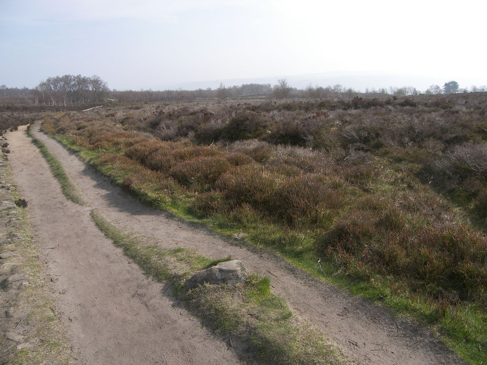
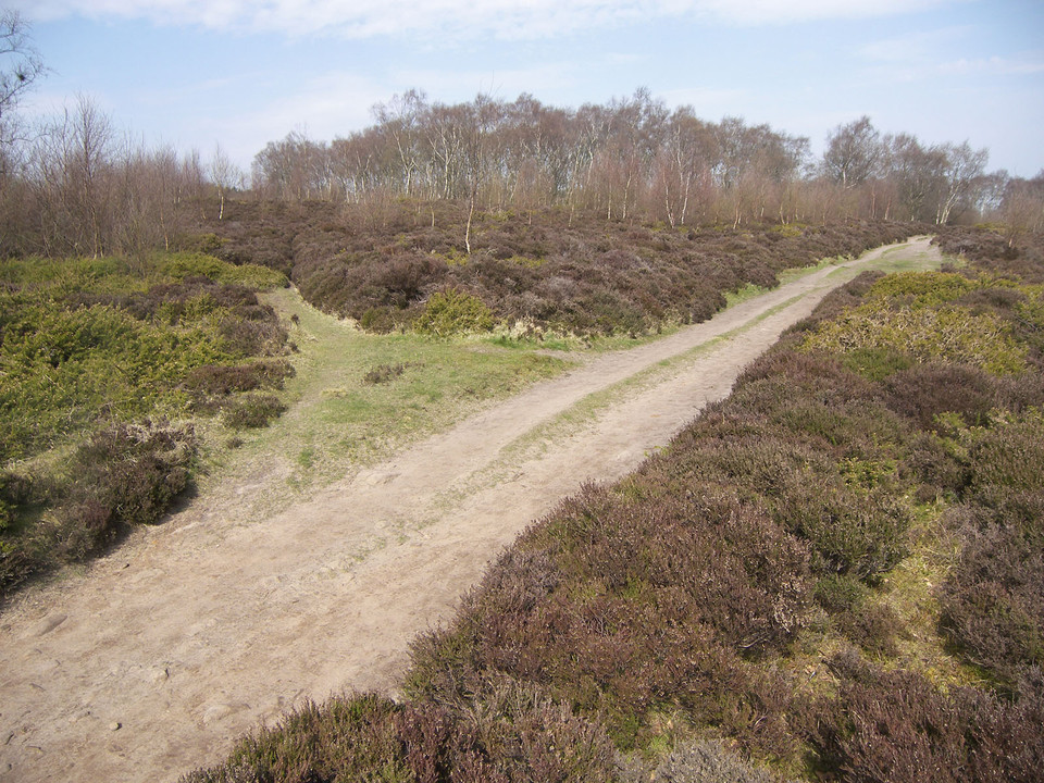
The circle is far more obvious on the ground than in the photos. Follow the main path north from the Nine Ladies, and just after you lose sight of the info board there’s a track forking off slightly to the right (NNE). This leads to a small gate at the boundary fence where the track then takes a 90 degree turn back to the main path. Continue on the track for 65 metres (measured) from the gate (about 80 paces) and the circle will be just to your right. Before it, there’s a distinctive tree on the right with two boughs close to the ground (see image).
I’ve surveyed the ring, and it’s circular with two entrances opposite each other: one at SSW from the centre, just off the track, while the other lies about ten metres from the boundary fence/wall behind.
|
 
|
  
|
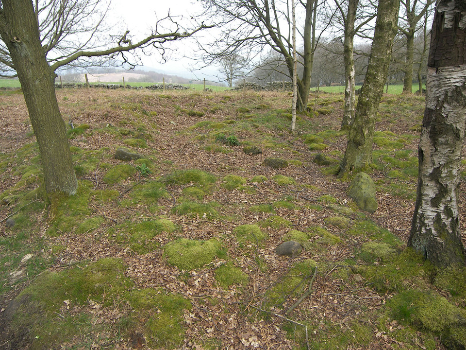
This much-disturbed elliptical ring is divided in two by a barbed wire field boundary fence, and has been damaged by a line of trees planted across it. There's a small setting of stones on the perimeter at the southwest, outside but attached to the ring, though the stones now seem not to be as on a published plan. The ring is about 16.5m x 12.5m, and there are 18 or so stones discernable, plus others apparently firmly set but not obviously on the perimeter.
To get to the circle, driving east from Strabane, at Glenmornan turn immediately right at the village sign, go over a stone bridge and take the next left turn, with ranch fencing and a five-barred gate at left. (If you come to a sharp bend to the right, with a double gate ahead of you, then you’ve gone too far.) Go down the road, over a concrete surface, to the end, where there’s a house at a sharp right bend (with a cattle grid at the driveway entrance) and some farm buildings, where the road turns into a track. We tucked the car in here, on the right hand side.
You should be able to see the roof of a large barn-type structure on the top of the hill to the south, and this is close to the circle. Follow the track through the two gates in view ahead, after which the path turns sharply left, then sharply right, up to the top. Go past the building previously described, then through a gate to the right of it, and the circle can be seen at about 30m to the right, upon a low bank just short of the field boundary.
|
|
2014 update: there's now a house at the very end of the track, beyond the farm, and it looks as if there may be plans to build in the field containing the circle (it has a well defined track and a small levelled area.)
|
If you use the map coordinates given above, and as provided by Burl, you may end up confused. On iOS map 85, there are three red dots representing stones in the lower portion of square W 090 600. The most easterly is at W 097 604, the central location is at W 0955 6030, and the westerly at W 094 602. On TMA, there are three sites with reference W 097 604 in the same group: Ring Cairn, Circle, and Standing Stones, though the latitudes differ. Burl gives the OS map reference W 097 604 as the location of Cappaboy Beg SE (stone circle). I believe this may be incorrect.
Travelling northeast on the R584, 6km out of Kealkil, there's a school on the right at W0970 5985 (on a side road). Continue on the main road for about 700 metres and you'll see a pair of field gates on the left. We parked here as best we could without causing an obstruction. Take the gate on the right, and follow the track straight up the hill, which eventually leads onto open moorland. If you keep the fence on your right (following the rougher track uphill) you'll find the ring cairn after a few hundred metres. The circle is then a few hundred metres further on up the hill, out of sight, just over the ridge (the 200m contour on the OS map.)
|
|
We tried to follow Jack Roberts' instructions, but didn't feel at all comfortable trying to get to the circle as he directs. So, given the difficulty of parking, the livestock in the fields, and the reported problems of reaching the site, we drove around and found the owner, who lives at the top of the next road to the left off the N71. We were given permission to drive up to their milking parlour along a track going uphill between the two minor roads (if driving east on the N71, this is a sharp turn back on yourself.) We parked easily at the top, and the circle is in the field to the northwest, behind the milking shed at about 200 metres, through a wide gate having a pedestrian access at the right. Once on the other side, the boulder burial is visible up the slope to the left. We then just had to step over a few wires.
|
meg-y hasn't added a profile
|
|