|
|

|
|
The Hoar Stone (Duntisbourne Abbots)Long Barrow
|
||||||||||||||||||||||||
|
|
|
Images (click to view fullsize) |
|


|
Fieldnotes |
|
|
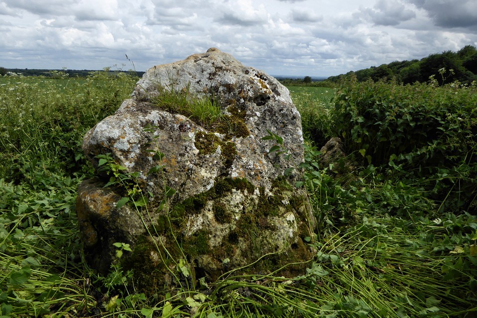
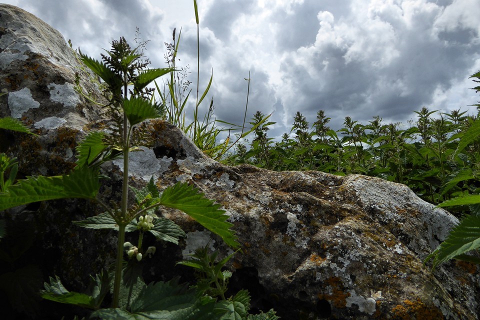
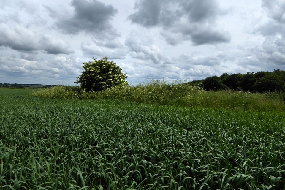
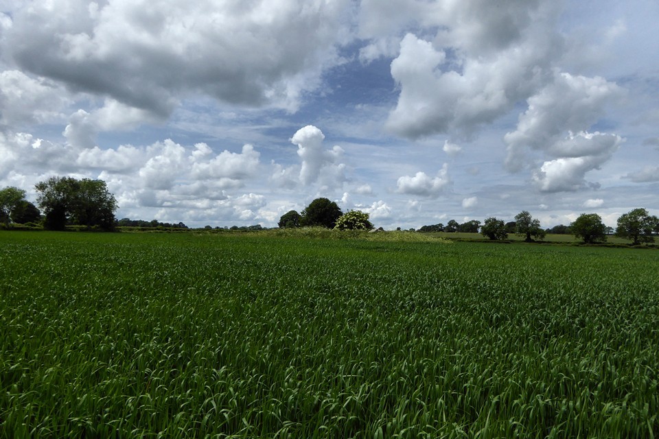
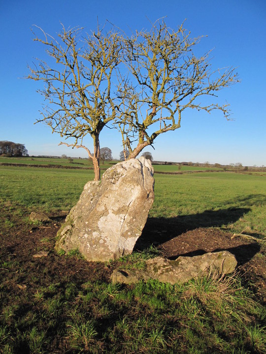
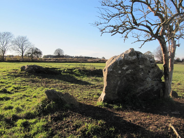
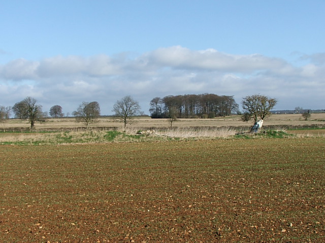
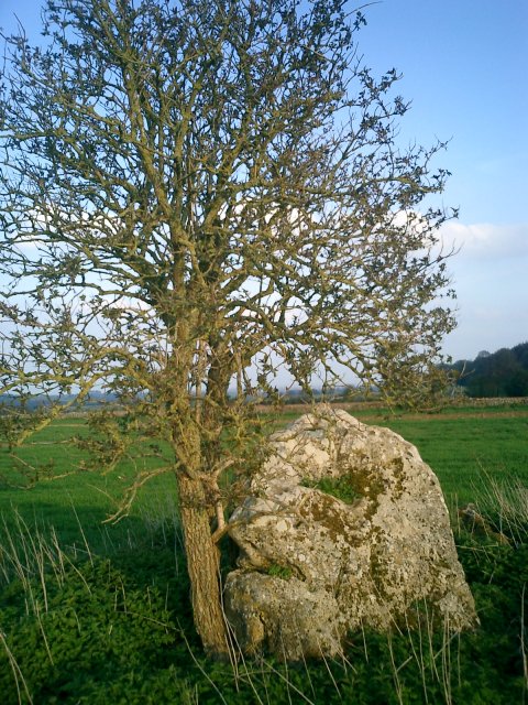
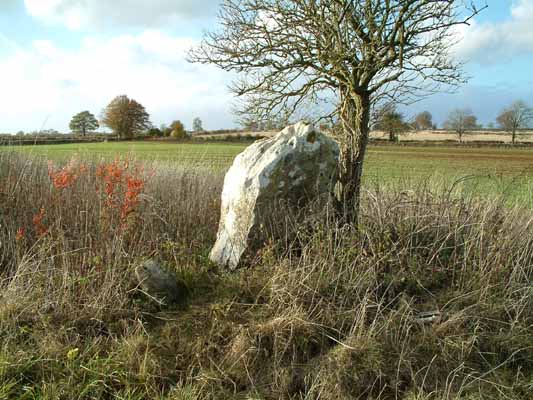
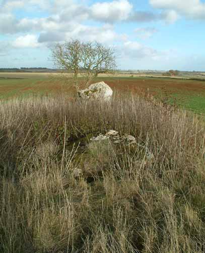
In a cultivated farm field, a venerable old standing stone along with some fallen stones on the remains of a long barrow, now just a small mound. A small leafless tree growing next to it - an elder I think. Visited today on a bright, chilly afternoon; near the Cotswold village of Daglingworth in the Duntisbourne Valley is the Hoar Stone long barrow. The field next to it has a locked gate (easily climbed) and a gap in the field hedge for access. I did it the hard way as usual; climbed over a barbed wire fence into the actual field getting caught on both fence and blackthorns in the process. Glad to report no serious injury and jeans still intact. In Old English 'se harne stan' - hoar stone indicates the boundary between the known, familiar world of human activity and the frightening realm of monsters and the supernatural. Also means 'grey-haired with age, venerable' which seems about right. Just up the lane to the left, is Duntisbourne Barrow - two mounds in Cherry Wood (notice on gate saying walkers welcome). I understand these are the remains of one very large long barrow - much evidence of past excavation and damage. |
 Posted by tjj
15th November 2010ce Edited 16th November 2010ce |
Folklore |
|
Celia Hadon suggests that the stones at this barrow may be 'running stones':This is no 14 in Old Stones of the Cotswolds by D.P. Sullivan (Reardon). These may be the hoar stones of which it is said that they run round the field when they hear the nearby church clock strike the hour. |
 Posted by Kammer
18th August 2004ce Edited 18th August 2004ce |
|
The field in which the stone lies is called the 'Devils Flights', and it is said that the stones sometimes turn over at midnight - presumably if they haven't got the energy for the activity Kammer mentions above. (folklore info from J + C Bord's 'Atlas of Magical Britain') |
 Posted by Rhiannon
31st October 2003ce Edited 18th August 2004ce |
Miscellaneous |
|
|
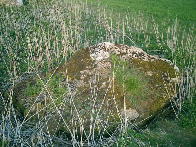
Details of Long Barrow on Pastscape A Neolithic long barrow is visible as earthworks and a pair of upstanding stones on aerial photographs. The site comprises an oval mound which measures 48.0m long, and 28.0m wide across the centre, at which point it has been almost flattened; it attains a height of about 0.5m at the east. The longer axis of the mound is oriented ENE-WSW, and it is surrounded by a circa 2 metre wide raised strip, likely to be the result of plough damage. This site has been mapped from aerial photographs as part of the Cotswolds Hills National Mapping Programme. SO 96490659 Hoar Stone (NAT) Long Barrow (NR) (1) A long barrow 120 ft long by 90 ft wide and 3 ft high, orientated east to west with a large stone, the Hoar Stone, placed at the east end, probably as some kind of fake portal. To the south of the centre of the barrow is a large prostrate slab; the capstone of the chamber excavated by Anthony Preston in 1806, in which he found the remains of 8 or 9 skeletons. The chamber was divided into two segments. (2-4) Hoar Stone (NAT) Long Barrow and Burial Chambers (NR) (Remains of) (NAT) (5) An extremely mutilated long barrow, oriented east-west situated in arable, below the crest of a wide spur at about 700 ft (213.0 m) above sea level. The mound, now extensively spread by ploughing, is 48.0 m long, and 28.0 m wide across the centre, at which point it has been almost flattened; it attains a height of about 0.5 m at the east and 0.9 m at the west end. There are no traces of side ditches. The 'Hoar Stone' (name verified, and in local use) or 'Flight Stone' (a) is a large lozenge shaped, weathered sarsen, 1.9 m high to its point, 2.0 m wide at base and 1.0 m thick, it leans at about 30o out of vertical. The kite shaped capstone, 2.7 m long, 2.0 m wide and 0.3 m thick appears to be in situ. A chamber (with? dividing wall), now full of limestone fragments, is partly visible beneath the slab. Several earth-fast stones, set on edge, are visible on the unploughed portion of the mound (24.0 m east/west by 9.5 m north/south in extent) which is now under a cover of uncultivated vegetation. Long barrow resurveyed at 1:2500 on AM. (6) A Neolithic long barrow is visible as earthworks and a pair of upstanding stones on aerial photographs. The site is centred on SO 9649 0659 and comprises an oval mound which measures 48.0m long, and 28.0m wide across the centre, at which point it has been almost flattened; it attains a height of about 0.5m at the east. The longer axis of the mound is oriented ENE-WSW, and it is surrounded by a circa 2 metre wide raised strip, likely to be the result of plough damage. The pair of capstones are clearly visible on aerial photographs, and their dimensions compare with those given by authority 6 above (7). -------------------------------------------------------------------------------- SOURCE TEXT -------------------------------------------------------------------------------- ( 1) Ordnance Survey Map (Scale / Date) OS 6" 1960 ( 2) by Glyn E Daniel 1950 The prehistoric chamber tombs of England and Wales Page(s)221 ( 3) Transactions of the Bristol and Gloucestershire Archaeological Society 1960 (O'Neill and Grinsell) 79 Page(s)77 ( 4) Aerial photograph RAF 541/17 4091-2, 14-MAY-1948 ( 5) Ordnance Survey Map (Scale / Date) OS 25" 1919 ( 6a) Oral information, correspondence (not archived) or staff comments ( 6) Field Investigators Comments F1 JWS 08-OCT-77 ( 7) Scheduled Monument Notificationn 20-Aug-1998 ( 8) Oblique aerial photograph reference number NMR SO 9606/6 NMR 23685/07 18-OCT-2004 |
 Posted by Chance
10th July 2012ce |
|
If you're in the area, you might be interested in following this up, which I saw mentioned in an article on 'Gloucestershire Barrows' in the 1989 volume of the Trans Brist Glouc Arch Soc... Just 'round the corner' from the Hoar Stone was the Jack Barrow - at SO957071, judging by its position on the map at old-maps.co.uk - on the land of Jackbarrow farm, in fact. The barrow was destroyed/excavated in Victorian times - but the excavators "considerately" took the bones and reinterred them at the church in nearby Duntisbourne Abbots (at SO971078), popping a nice stone cross on top. I suppose their hearts were in the right place. Cynthia Haddon has a picture on her standing stones page at http://www.celiahaddon.co.uk/standing%20stones/gloucestershire.html The engraving reads: "These Rough stones taken from the barrow, Jack Barrow farm, Cover the human remains found therein when it was opened 1875". I have not looked it up but more info should be available in an article in TBGAS vol 59 (1937) 334-337. |
Posted by Rhiannon 4th January 2005ce Edited 4th April 2005ce |
The NMR (available via the MAGIC web site) describes the site:The monument includes a long barrow situated on a south east facing slope below the crest of a wide spur. The long barrow is orientated east-west but has been rounded by cultivation. The mound is 48m long and has a maximum width, at the centre, of 28m. It reaches a maximum height of 0.8m in the part that is no longer under cultivation but elsewhere survives as a slight rise approximately 0.3m high. Set into the east end of the mound is a large, lozenge shaped stone, known locally as the Hoar Stone. To the south of the centre of the mound is a large, kite shaped, capstone which covers a chamber. This was excavated in 1806 by Anthony Preston and is reported to have been divided into two segments and to have contained the remains of eight or nine skeletons. Although no longer visible on the surface, quarry ditches will flank either side of the mound and will survive as buried features 3m wide.On her web site Celia Hadon recommends a visit during the Autumn or Winter when the field is not full of crops. |
Posted by Kammer 18th August 2004ce Edited 18th August 2004ce |
Links |
|
Society of Antiquaries of London Catalogue"Sept 1806. A large oblong Barrow was open'd in the Parish of Duntesbourne Abbots Gloucestershire; in which was found a Kistvaen containing about eight or nine Bodies of different Ages..." Pencil / pen and ink drawings from 1806 of 'before and after' the excavations. |
Posted by Rhiannon 8th August 2006ce Edited 8th August 2006ce |