|
|

|
|
Nant TarwStone Circle
|
|
|
|
Images (click to view fullsize) |
|
Photographs: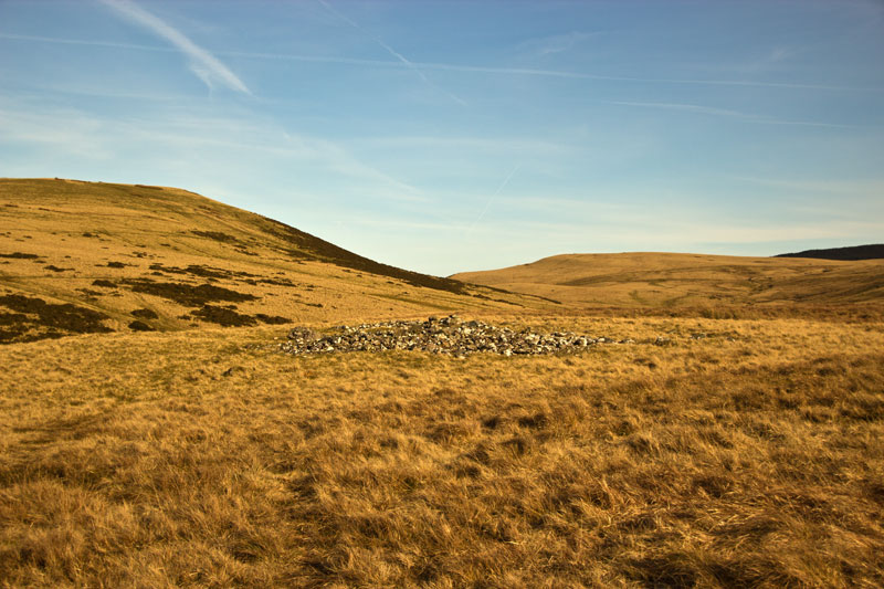


 Maps / Plans / Diagrams:
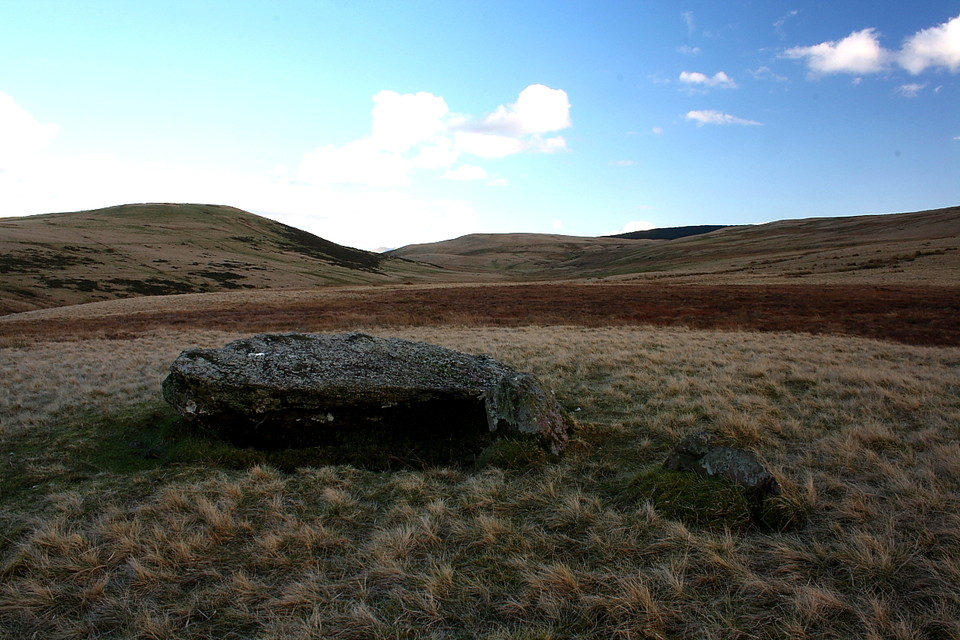
|
Fieldnotes |
|
|
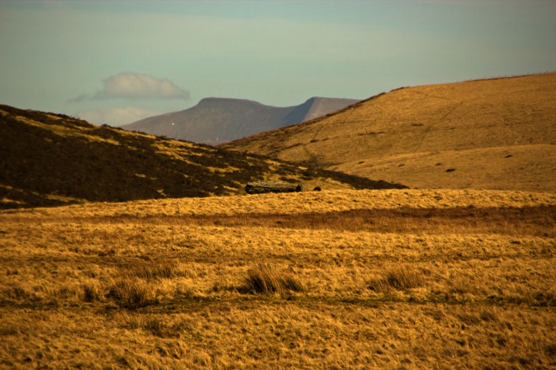
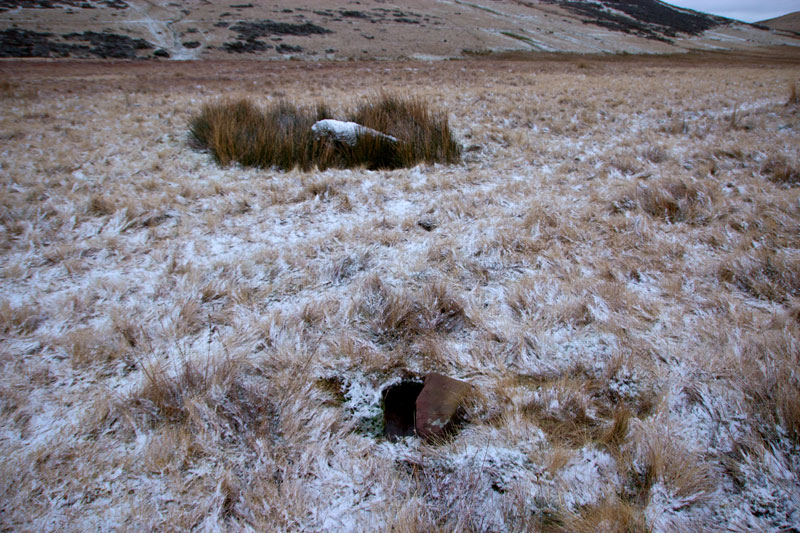
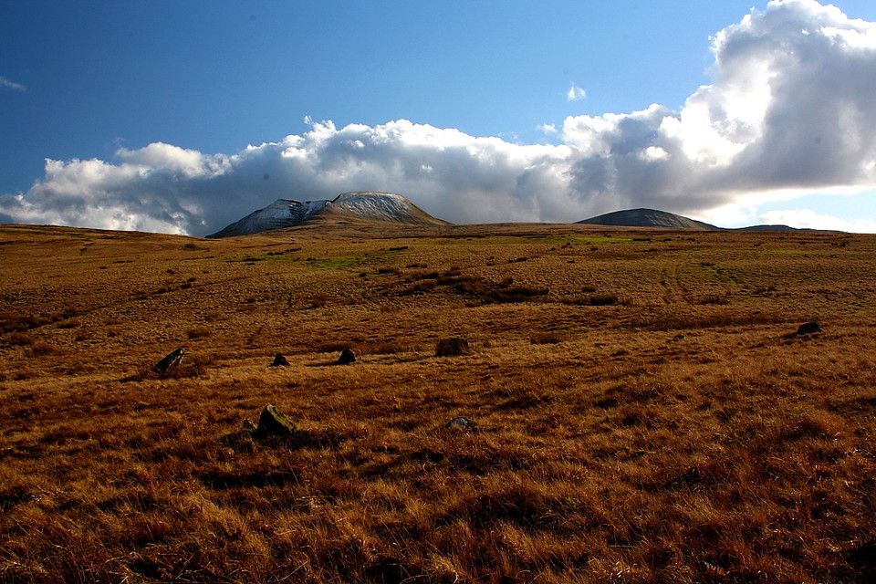
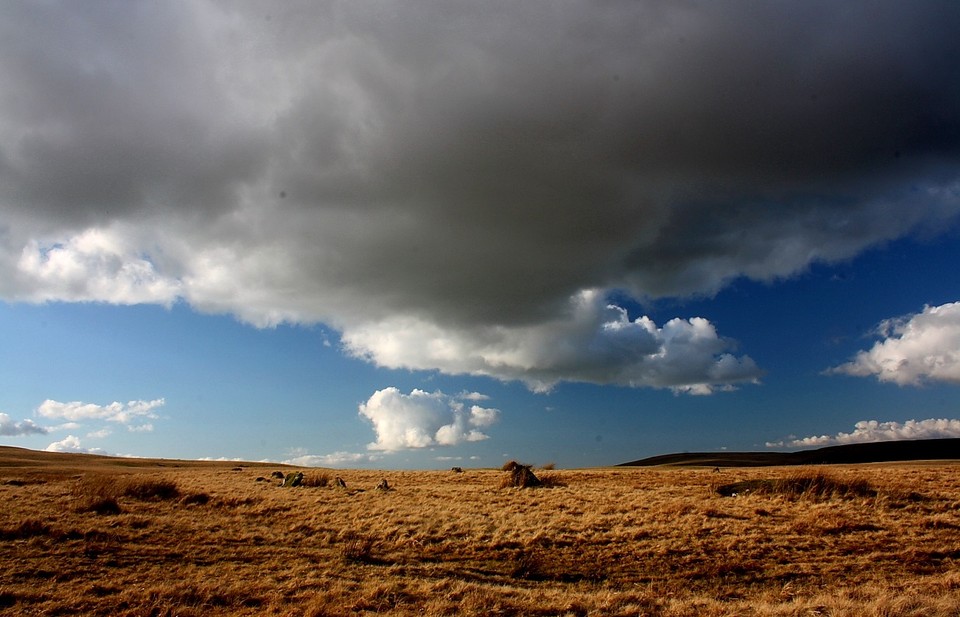
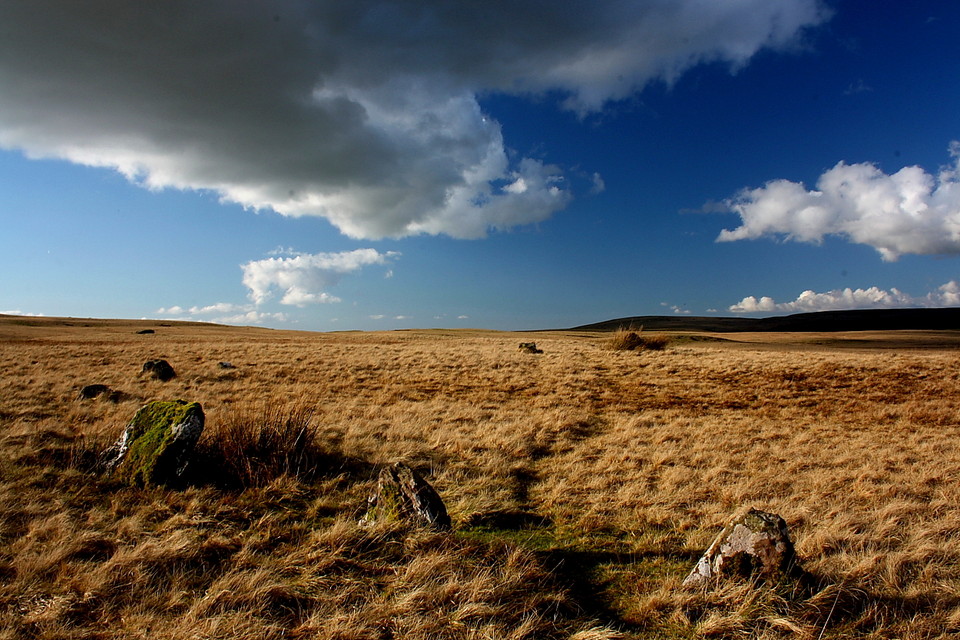
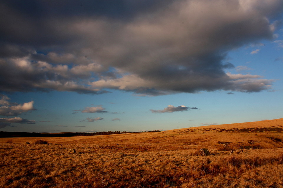
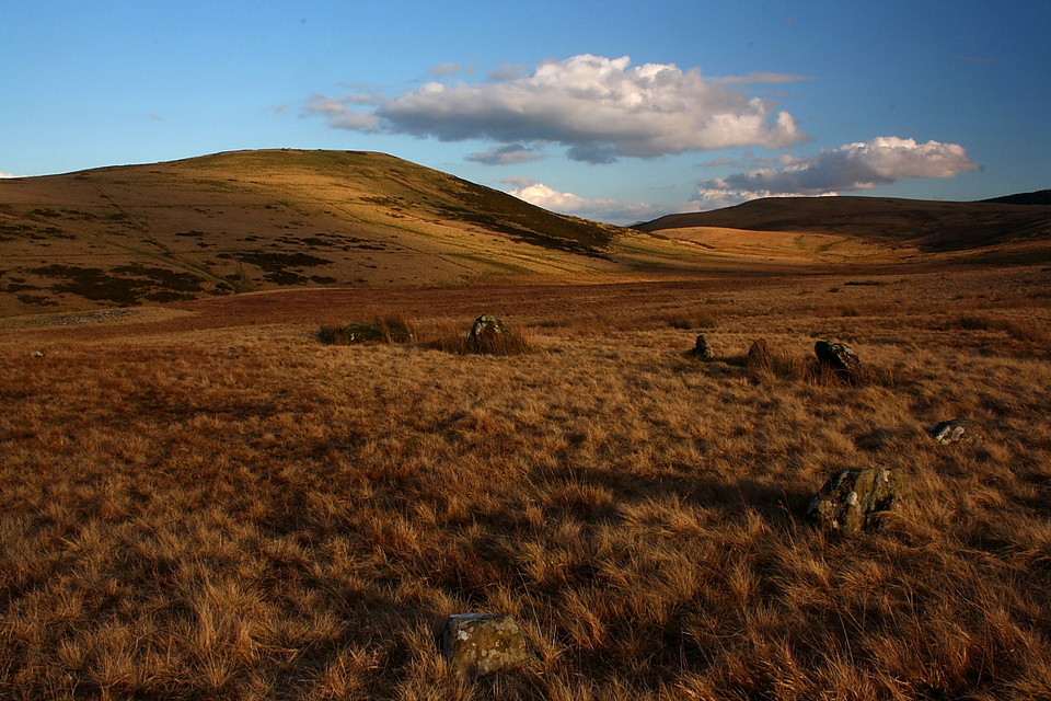
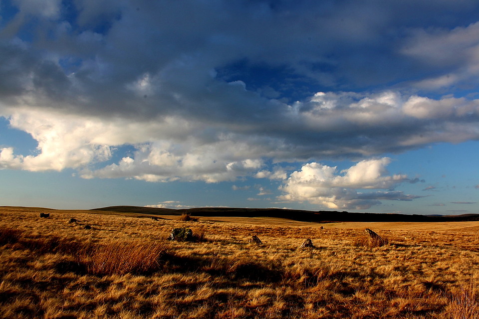
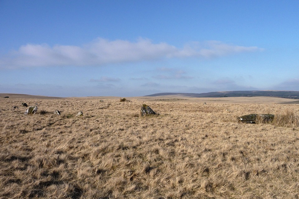
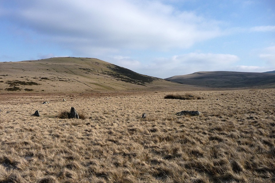
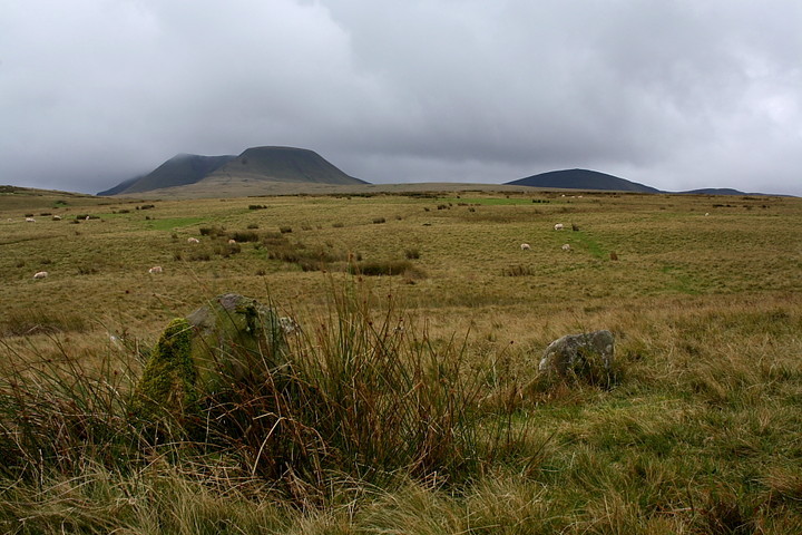
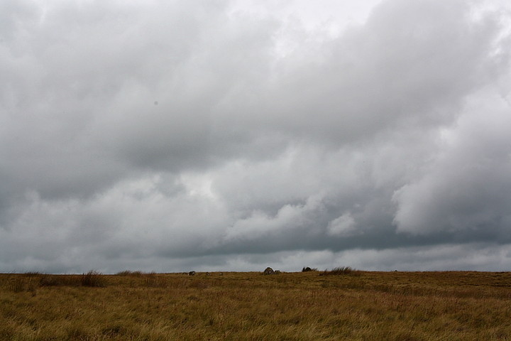
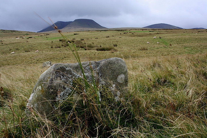
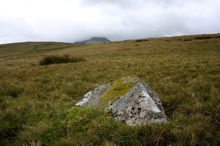
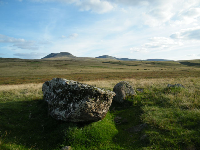
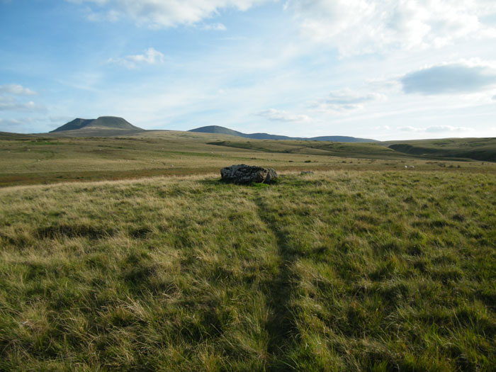
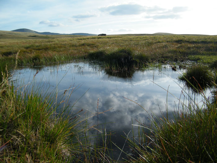
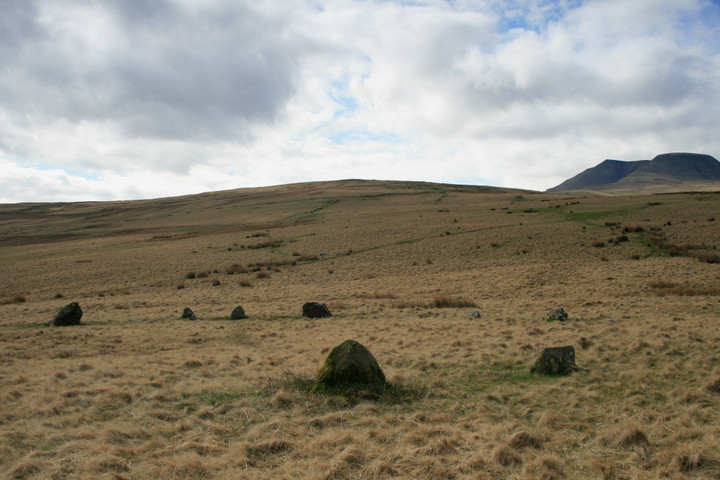
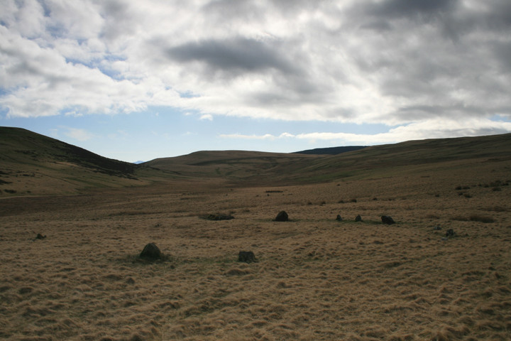
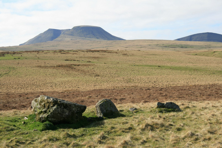
29.1.2011. After the walk from Blaenau Uchaf along the "processional route" of the valley, passing wild ponies and frozen streams aplenty, I reach the easternmost of two circles at Nant Tarw. Wow! My heart sings with an overwhelming feeling of elation as I arrive. The walk from Crai Reservoir had sapped me, taking far longer than I expected - although partly restored by the lovely Blaenau Uchaf stone, it is only as I reach the first circle that I truly feel at one with the world again. I must have just about the most perfect conditions for this visit. The sky is blue and the ground is frozen hard, meaning that what would normally be a wet and boggy crossing of open hillsides is actually very easy. The grass is also very low, making the diminuitive stones of the circles much easier to see. Even though the stones are tiny, and many are missing, this place is a joy. I rush around taking pictures, which almost freezes my ungloved fingers off. But a cup of tea later and I'm raring to go. Both circles are beautiful, evocative rings, in a wild and remote spot that even most of the ardent Burl-enthusiasts may be unfamiliar with. Then I pop across thankfully frozen bog to the three stone setting. Suddenly, from out of the sun and an big bank of cloud, the enormous bulk of Y Mynydd Du appears. Good grief. The breath is almost knocked from me at the sight - I knew the mountains were visible from here, but because they had been hidden, the sudden appearance is a real shock. I love it here. To quote Mr Tennant, I feel like taking all my clothes off and dancing to The Rite of Spring. But it's too cold and I might upset the ponies, so I content myself with sitting here in awe, literally chilling out. I have to come back here with more time, that's for certain. It seems criminal to have come to this spot, only to rush off again. But a sobering look at the map tells me that I have 5 miles of trackless, open hillsides and plentiful streams and springs to cross if I'm going to get back to the road in time for a bus, let alone if I want to stop off at Maen Mawr and Cerrig Duon on the way. So I head south, at speed. |
 Posted by thesweetcheat
30th January 2011ce Edited 21st September 2012ce |
|
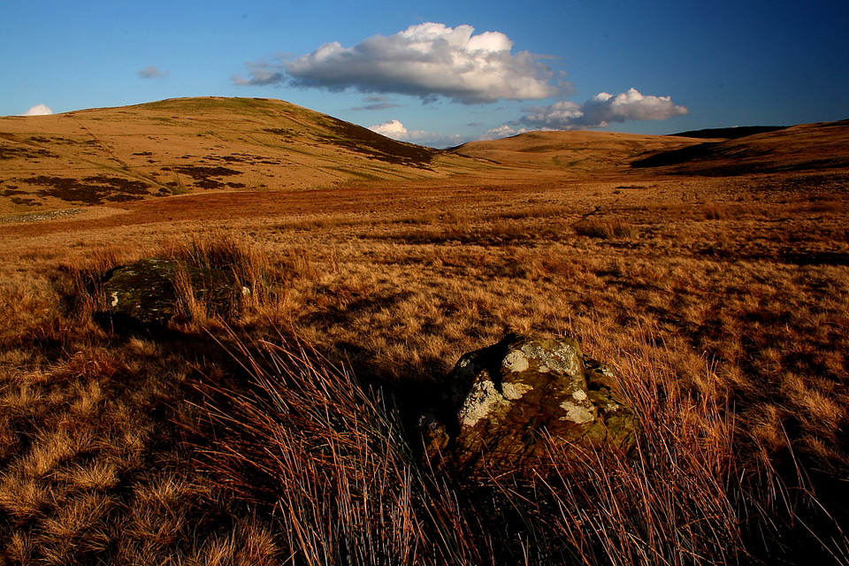
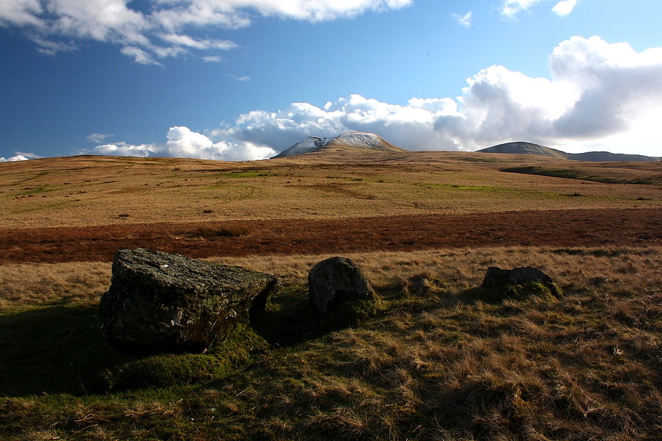
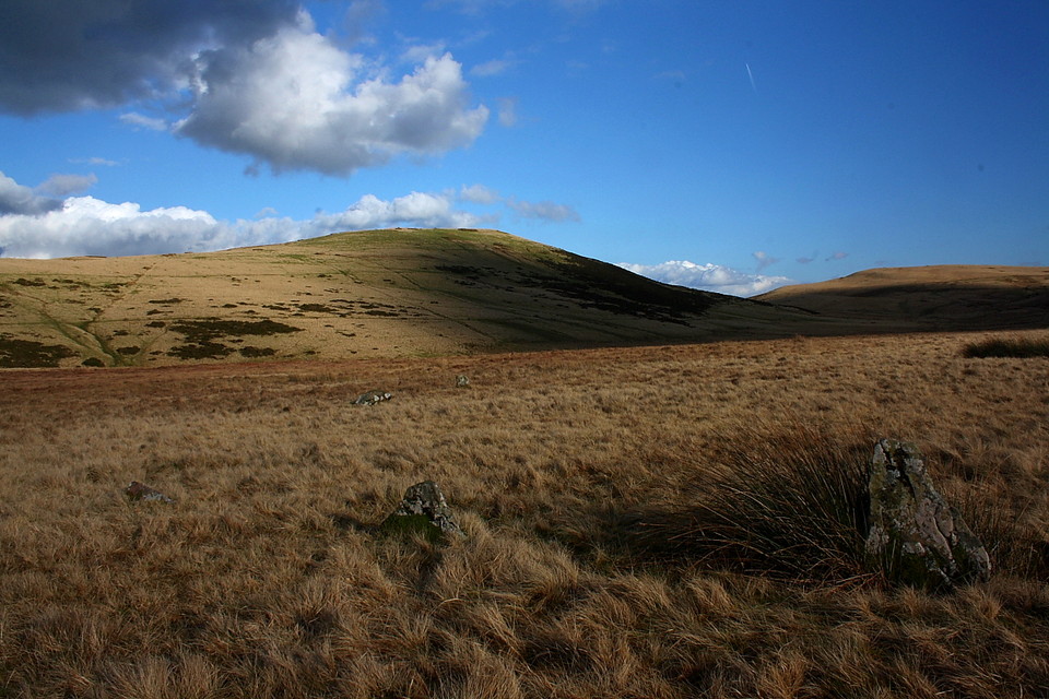
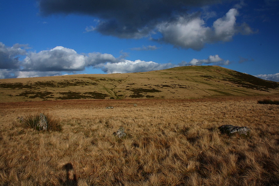
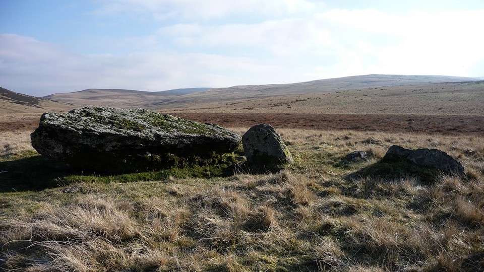
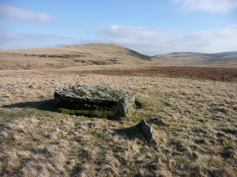
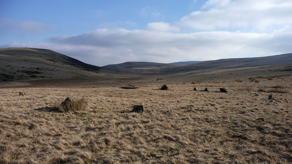
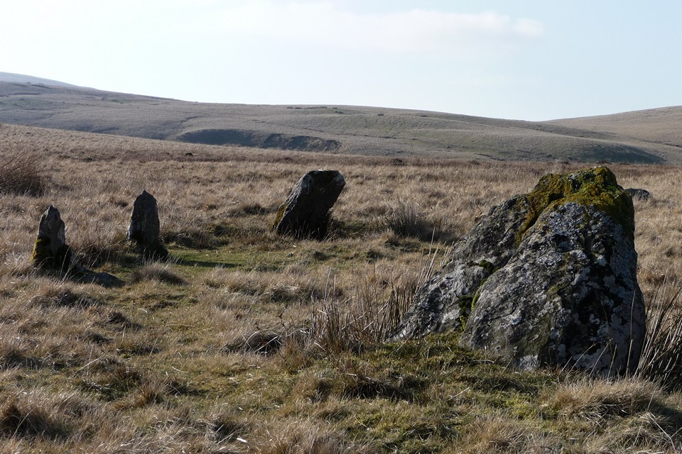
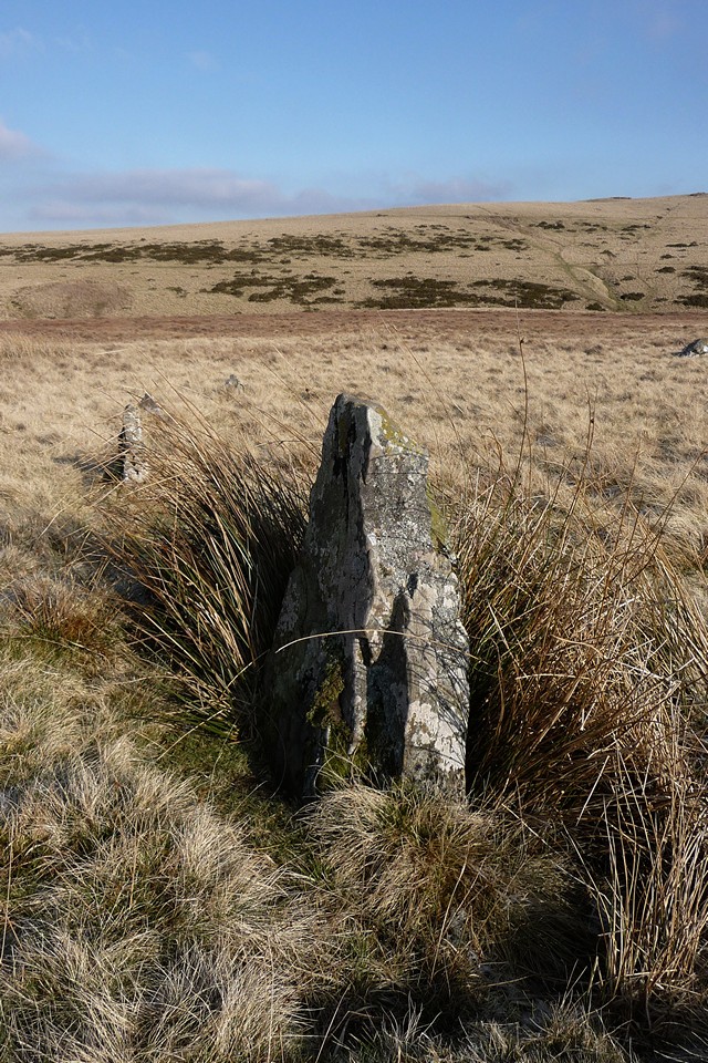
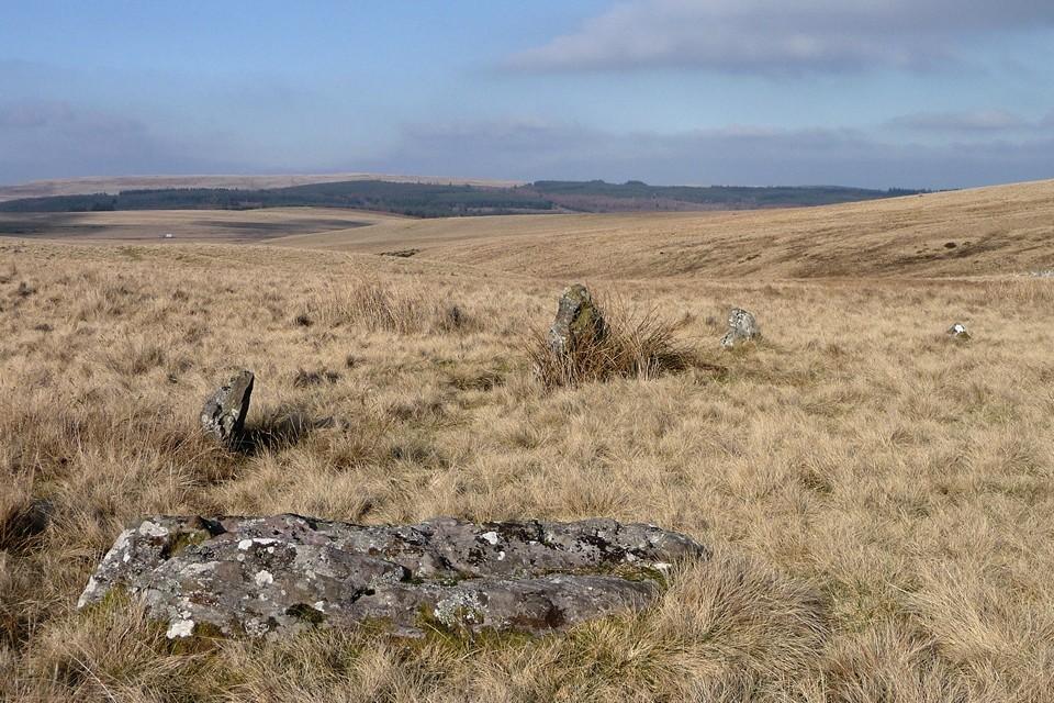
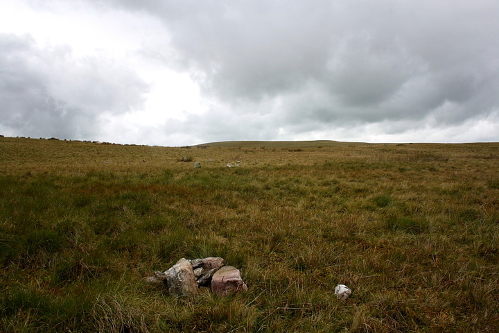
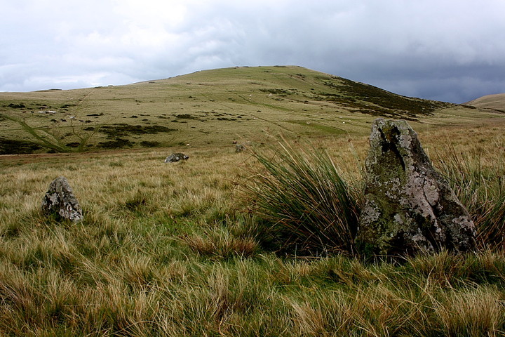
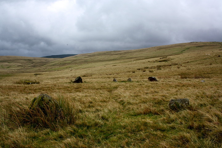
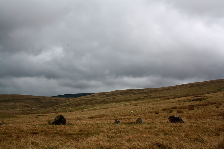
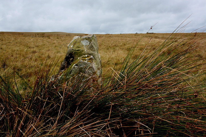
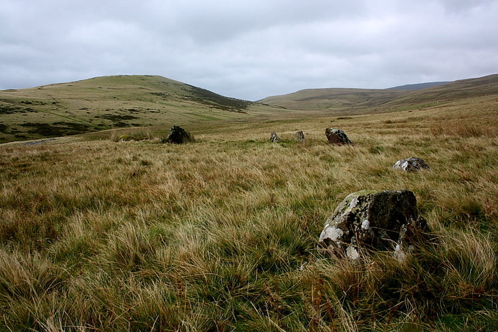
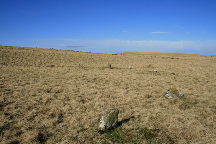
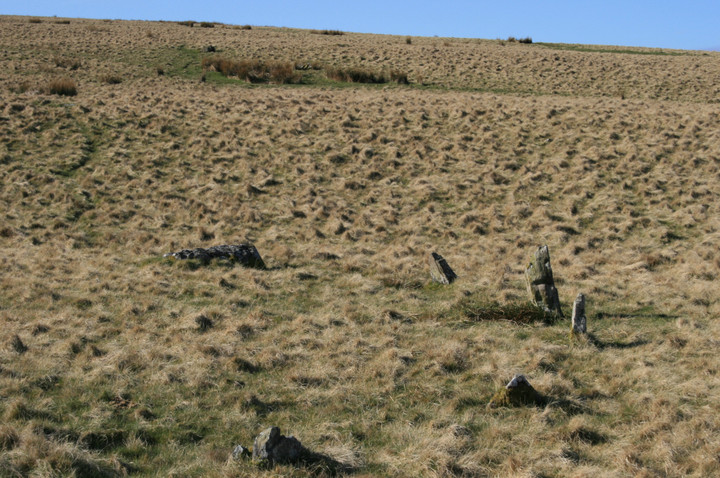
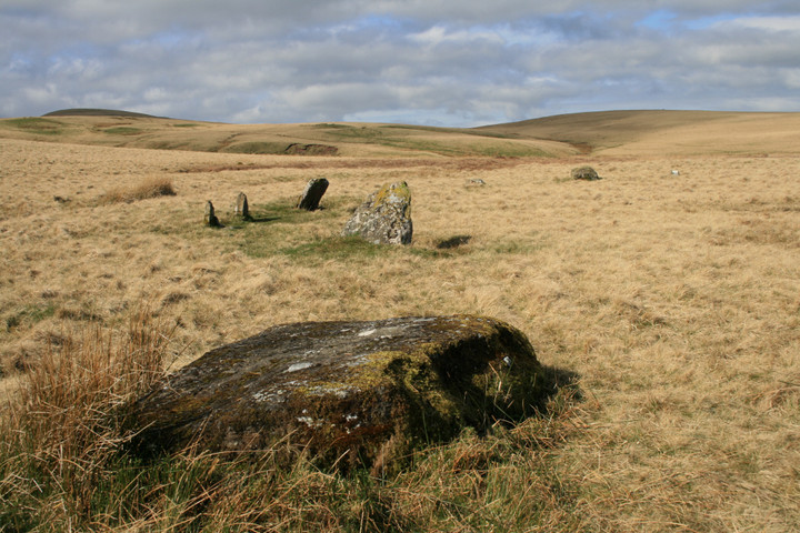
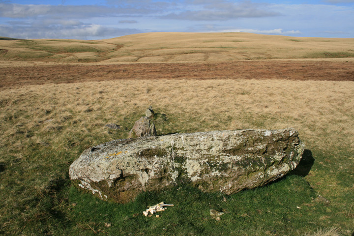
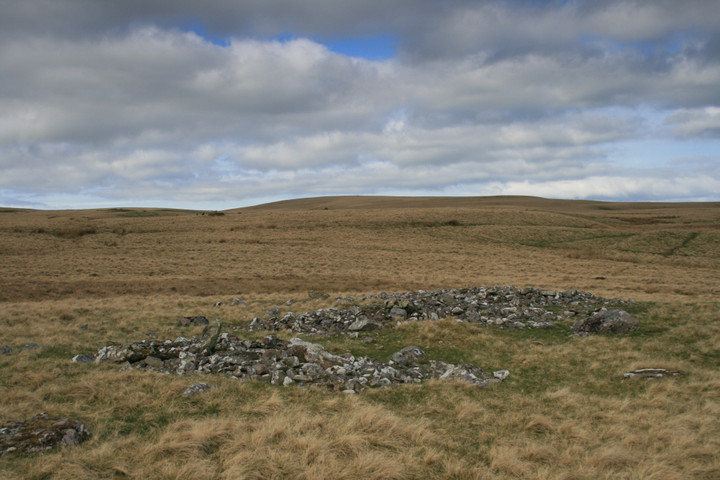
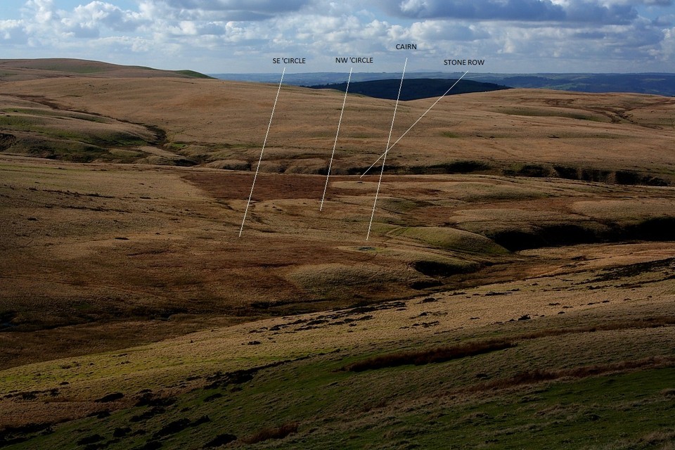
According to my map of the area, my only previous visit to these two obscure moorland stone circles was way back on 20/4/03... and it would appear I wasn't overly impressed. However a lot of water has gone under the bridge since then - an awful lot, if the proverbial bridge in question happens to be the Pont 'ar Wysg which stands some way north of the site. Time for a reappraisal, then. Perhaps my 'tastes', such as they are, have matured a little? The aforementioned Pont 'ar Wysg is a good starting point, if only for the fine skyline profile Y Mynydd Du presents.... or would present if the cloud base wasn't so low today. There are two car parks to choose from... take your pick, then the path diagonally opposite the one currently not within forestry, that is north of the road, to the right if coming from Trecastle. Incidentally, one can only hope the Roman legionnaries who marched up and down this road [there are the remnants of a camp to the approx west] got continually soaked and hated every minute of their posting! Ha! I suggest you follow the path as best you can and head for the general area to the right of Foel Darw, the most prominent hill in the locality. The circles are fairly obvious once you orientate yourself correctly, the larger being the nearer to Foel Darw to the east. According to Coflein [see misc post] both 'circles possess 15 stones, but since several barely break the turf, I could neither confirm nor deny this. Hey, I'd make a good politician, me. Not a good mathematician, though. Other orthostats are pretty substantial for your typical Welsh moorland 'circle and a lot larger than I recalled. A large recumbent lies between the two monuments, although whether this is an erratic or fallen monolith is a moot point. The latter would be nice, since there is another large recumbent to the north-west beside two much smaller orthostats... and thus - if it indeed once stood - begging comparison with a similar arrangement at the nearby Maen Mawr and Y Cerrig Duon. Add a pretty large cairn sited upon the banks of the Nant Tarw itself - not to mention several other 'are they or aren't they?' stones - and I do believe we have a Dartmoor-esque ritual complex upon these brutal northern slopes of Y Mynydd Du, the whole overlooked by the summit funerary cairns themselves. As I sit and take in the vibe - and occasional shower - the cloud swirls around the high mountain summits to eventually reveal them in all their glory, Fan Foel particularly striking in unfamiliar, stark section. Family units of wild ponies wander to and fro across this landscape, seeming to give their unfortunate brethren with humans upon their backs a very wide berth. Just beyond the eastern circle I find a pile of stones, not to mention several shallow holes upon the circumferance itself. No need to worry, however, since it transpires that our very own Cerrig has been doing a bit of local restoration work. Which is good to know - if only in retrospect - since I leave Nant Tarw wondering how anyone could fail to be impressed by this place. Dylan was right. The time's they indeed are 'a changing. |
 Posted by GLADMAN
3rd October 2010ce Edited 3rd October 2010ce |
|
There is a parking place to the north of the circles and I presume this is where Elderford parked, but his route seemed a tad torturous so I drove through the forest to the east (Mynydd Wysg on the map) and parked by the two small rectangles on the map on the ground they are animal pens. A short but uphill walk round the north side of the hill Foel Darw following the obvious path takes you up and over and down to "the bull brook" (Nant Tarw) Before going down to the river look across and you can see all the stones but most obvious is the big grey cairn head for that. When we reached the river I was a bit stunned to find a standing stone that isnt on any record,I don't know if its really genuine but after seeing everything else on the moor it's just got to be. Above the stone is the cairn, it's a spread of stones like any other cairn move on to the ESE circle. 300ft west of this circle is a fallen menhir ten feet long but I didnt bring Burl with me so couldnt find it. Some of the stones are gone and some are just sticking their noses above the surface of this grassy sea, but some are more than a metre tall. From here theres only one place to go...yep,uphill to the western circle. Before reaching the circle is a fallen menhir about 8ft long and would have dwarfed the circle stones just a few feet away, the stones are on average larger than the other circles stones but still small enough to keep the other anoraks away. Most intriguing of the whole place is the three stone row just 28feet away from the west circle, the tallest stone is sadly fallen though thankfully not on the two smaller stones, it would be an almost carbon copy of the Maen Mawr at Cerrig Duon four miles south east and very similar to Pant Meddygon three miles north, it must mean something. Perhaps the big stone is the Astronomer priest and the other two his acolites or maybe the circles builder and his mates,or is that just stupid. On the way back we were sitting across the river appreciating the whole moor when Eric cried "Crow" it was actually a Red Kite just a few metres above us, Iv'e never been that close to a free bird of prey, it was so close I thought it was going to attack us....... Amazing Place marvelous mega minilithic paradise |
 Posted by postman
14th April 2009ce Edited 14th April 2009ce |
|
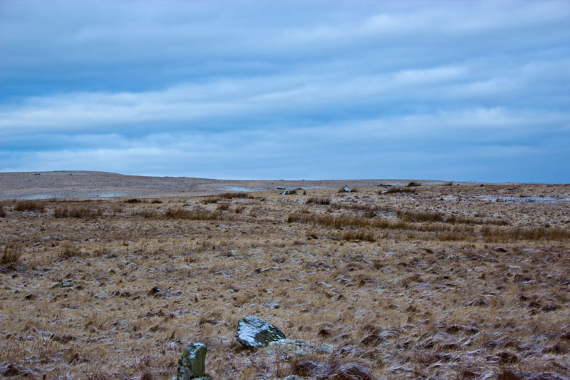
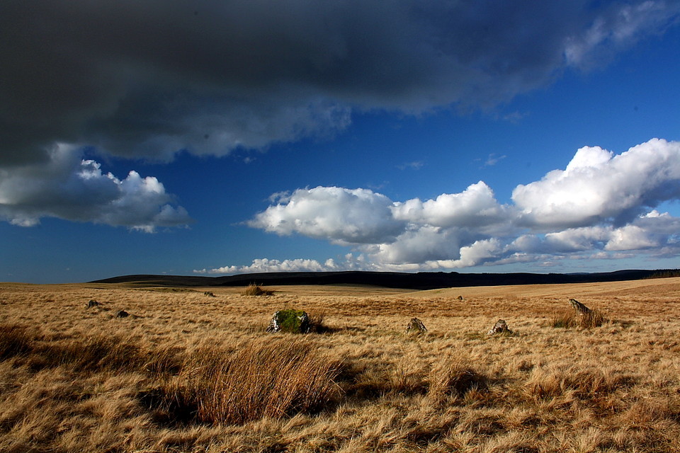
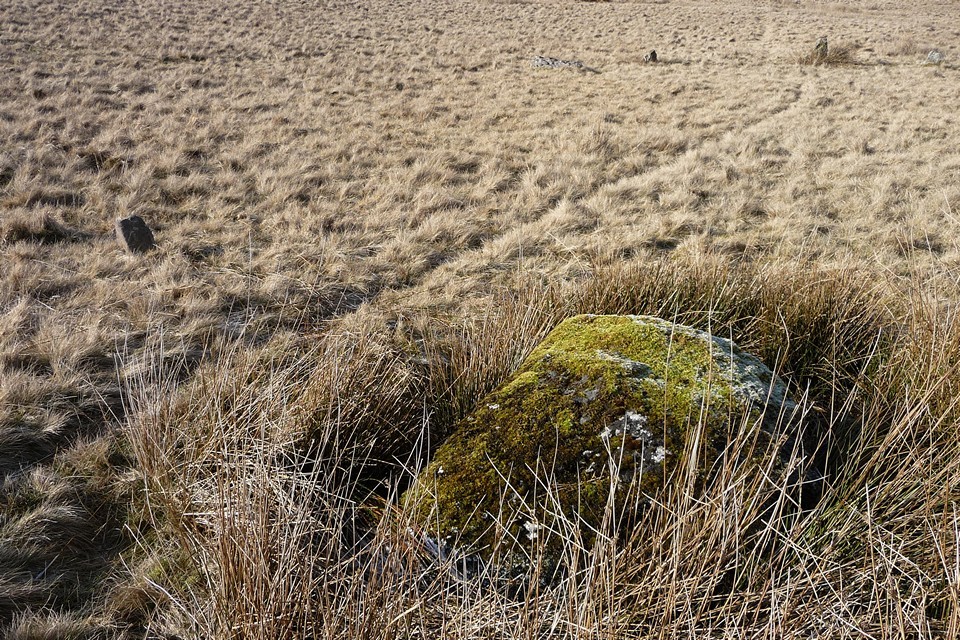
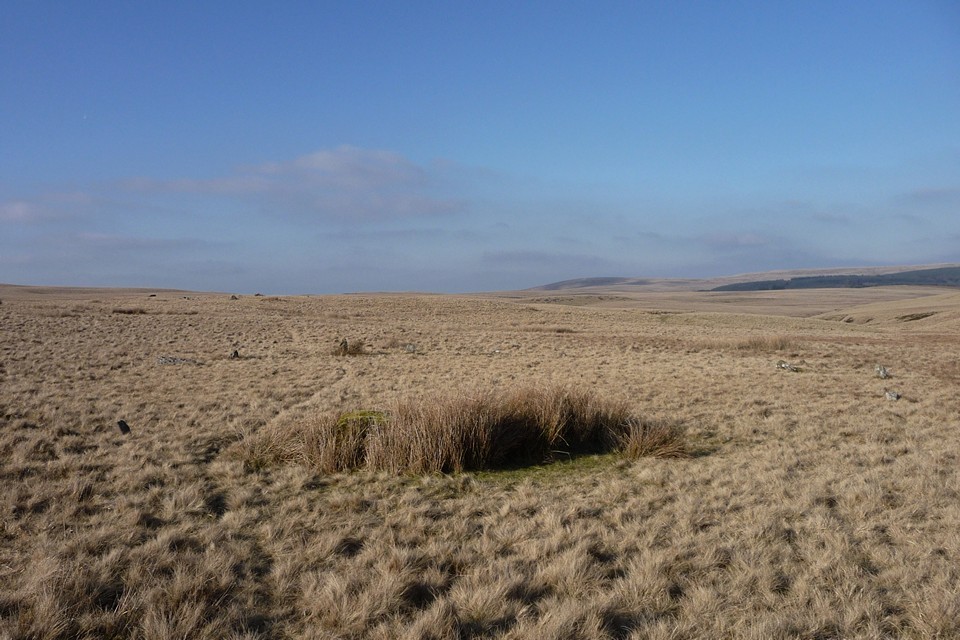
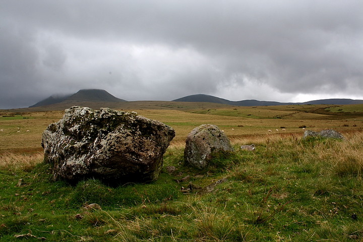
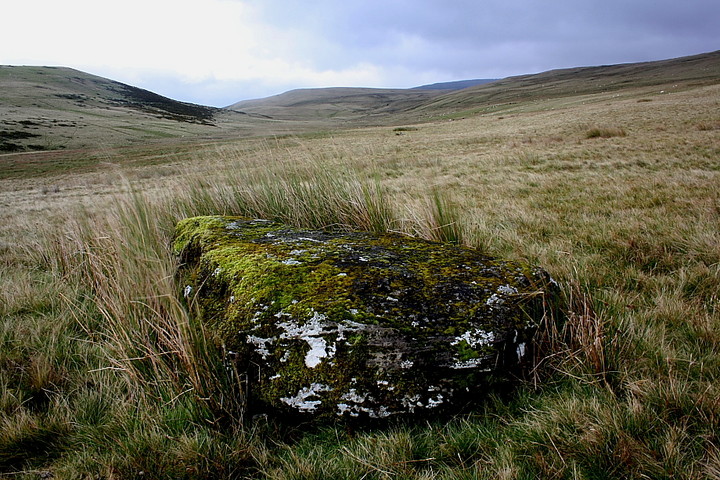
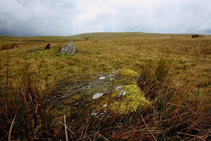
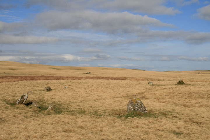
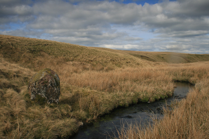
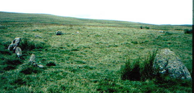
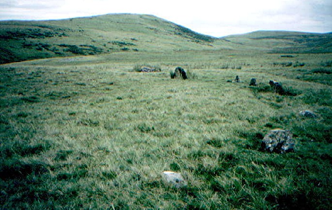
OS map required This really is in the middle of nowhere on open moorland. Crossing several streams and it’s boggy. Head out to the Usk Reservoir and use the car park just before the bridge Pont’ar Wsyg. Follow the track beside river Usk in a southerly direction away from the reservoir. After 200m or so of this the river forks. Cross the river and follow the right fork. After 400m or so the river forks again. To your right is the Usk, on your left is the Nant Tarw. Cross the Nant Tarw. Hopefully you are now between both rivers and ahead of you is rising land. Walk in a southerly direction keeping closer to the stream on your left (Nant Tarw) rather than the Usk on your right. 400m ahead you will hopefully reach a ruined (robbed) circular stone cairn. It is a good landmark and the stone is bare of grass and some 16m by 11m (0.3m in height). The stone circles are over to the east of the cairn on a plateau. Behind the hill you are walking along are two mountains (with dramatic scarps: Picws Du and Fan Brycheiniog). If you reach a point where the hill you are on is obscuring these two peaks: you have gone too far and missed the stone circles. If you reach a point where you are having to cross several streams running down from the hill to the river Nant Tarw: you have gone too far and missed the stone circles. At the top of the hill is a fence, so it is unlikely you will wander off and die of exposure on the Black Mountain (although there is supposedly a stone circle up there SN 823232 around 600m up Fan Brycheiniog). It is worth considering when at the circles that if you stand facing north: in the wooded hill north of the Usk Reservoir are two standing stones; another two at the eastern end; another two stone circles (Mynydd Bach) on the hill beyond that just below Y Pigwn. To your right less than 2km away is the standing stone Blaenau Uchaf. Behind you 3km or so away is another stone circle (as previously mentioned, but I cannot find any information on it). Infront of you is a ruined stone cairn (antiquarian accounts indicate 5 or 6 erect stones once defined its circumference). Nant Tarw consists of a pair of small Bronze Age stone circles 110m apart and intervisible with each other. The western circle is the higher of the two, slight ellipse of 15 stones with a diameter of 19m. Stones vary in height from nothing to 1m. A guide states that there are entrance gaps at west and east, but because the stones are small and some missing it’s not that obvious. It is comprised of glacial boulders and Old Red Sandstone slabs. Between the two circles is a large fallen stone 2.6m long by 1.5m wide. The eastern circle is similar in size (slightly larger at 21m and also an ellipse) and has 18 visible stones. The stones vary in height from nothing to 1.25m, one of the fallen stones would have been higher than that. Again the guide I consulted suggests two entrance gaps, this time in the southeast and southwest sections. Similar stones used to the western circle Many of the stones are very low. To give you a better idea, many of the guides state that the visiblity of stones is dependent on weather conditions on the ground and plant growth: we are not talking Avebury here by any means. It is a fair slog across open moorland and streams to reach the site. That said on the day I visited the weather was fair, the scenery majestic and I had the mountains to myself all day. I did run out of water though, so be prepared to be self-sufficient when you're out there. |
Posted by elderford 6th August 2003ce Edited 7th August 2003ce |
Miscellaneous |
|
|
Coflein has the following to say regarding the complex at Nant Tarw: 'There are two stone circles with associated monoliths at Nant Tarw. Both circles are composed of 15 stones: the larger, to the east, is 21m in diameter and centred at SN81972578. It has stones reaching from the level of the turf to 0.8m high. The lesser, western circle, is 19.5m in diameter and centred at SN81872583. It has stones barely breaking the turf, with others up to 0.7m high. Between the two circles is what is thought to be a large in-situ glacial erratic with another 116m west-north-west of the western circle associated with two small standing stones... Two cairns are set close to these monuments and a further stone, on the banks of the stream to the north-east has been viewed as a possible monolith.' And specific to the probable stone row at SN81762587: 'Located to the north-west of two stone circles at Nant Tarw, 115m from the western circle, lies an alignment of three stones. The largest is what appears to be a fallen, or broken, monolith. It measures some 3m long and 0.75m thick and its base is stone packed. Two further stones stand behind it, 0.43m and 0.28m high respectively. This kind of arrangement, an alignment of one large and two smaller stones, is similar to that found at Maen Mawr, Cerrig Duon' |
Posted by GLADMAN 3rd October 2010ce Edited 3rd October 2010ce |