|
|

|
|
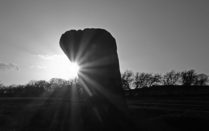
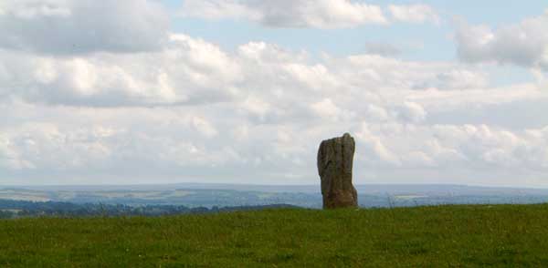
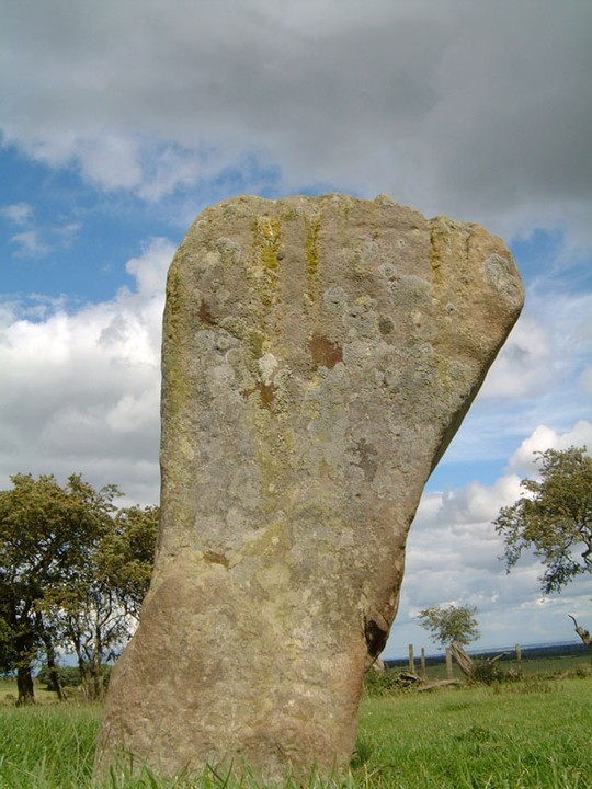
The Warrior StoneStanding Stone / Menhir
|
|
|
|
Images (click to view fullsize) |
|
Photographs: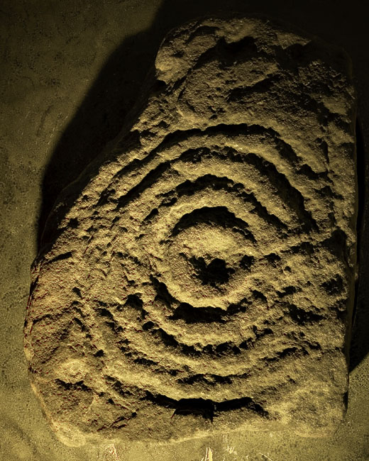
 Artistic / Interpretive:
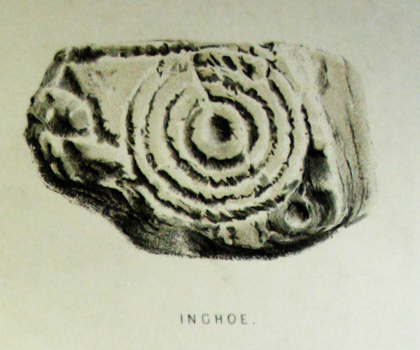
|
Fieldnotes |
|
|
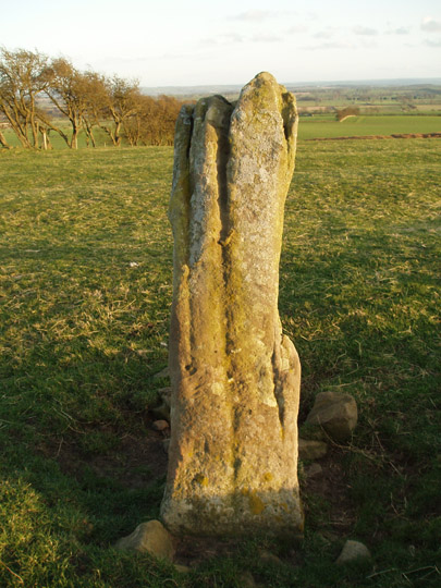
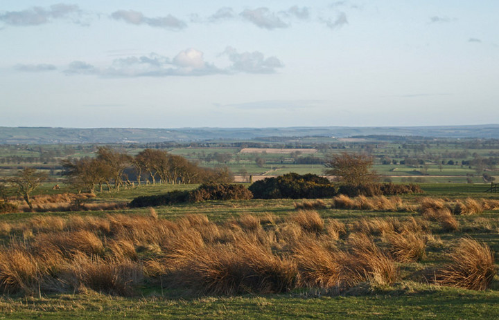
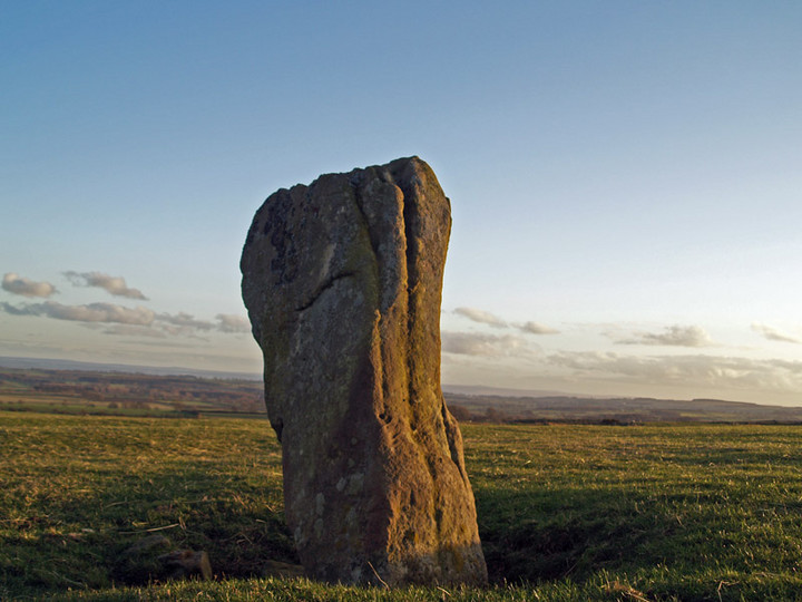
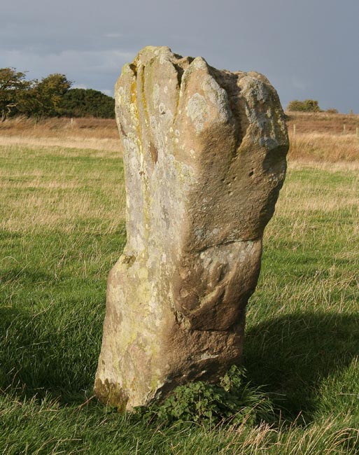
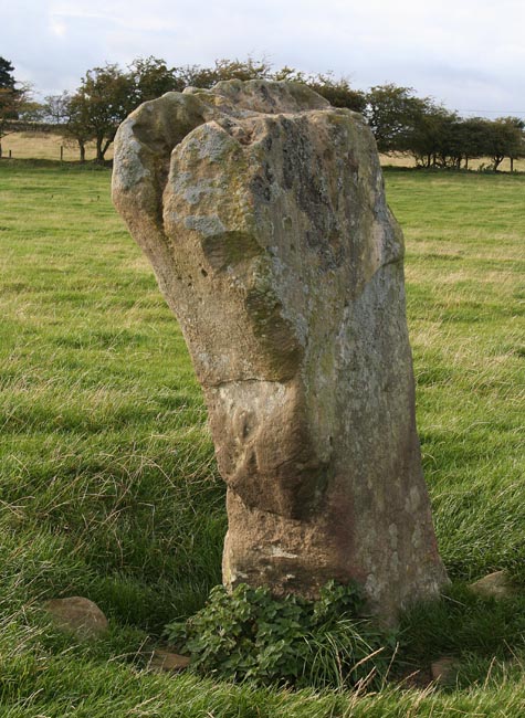
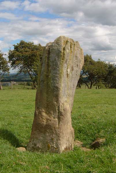
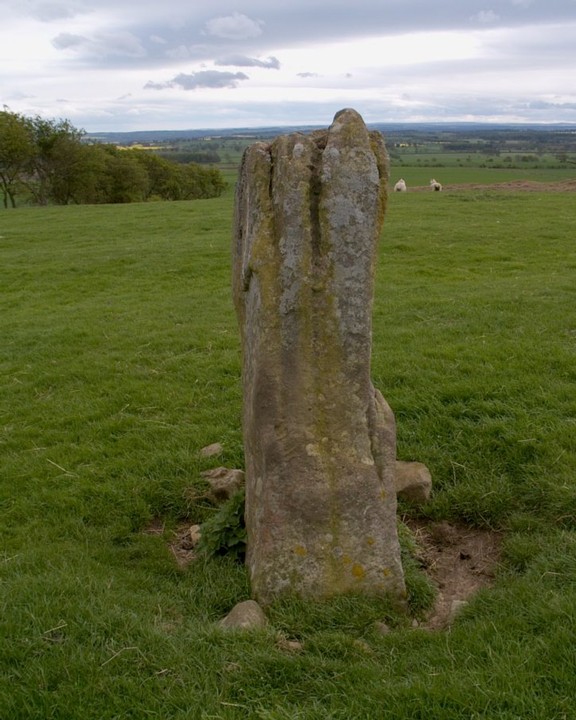
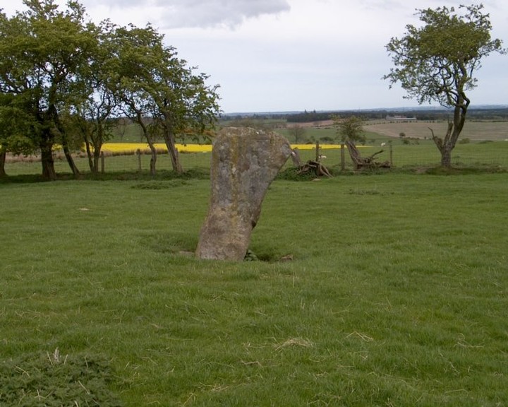
The Warrior Stone Visited 22.9.10 Directions: drive through Ingoe hamlet and when you get to the fork in the road go right. Over the cattle grid and park on the grass (plenty of room). The top of the stone is visible on the brow of the hill to your left but is difficult to spot due to the trees in the background. Walk across the field, over the field gate and a short walk takes you to the stone. The stone itself is weathered similar to the nearby Matfen Stone. What remains of the Barrow can be identified as a low mound in the field near the stone. The Warrior Stone is easy to access and worth a visit when in the area. |
Posted by CARL 5th October 2010ce |
|
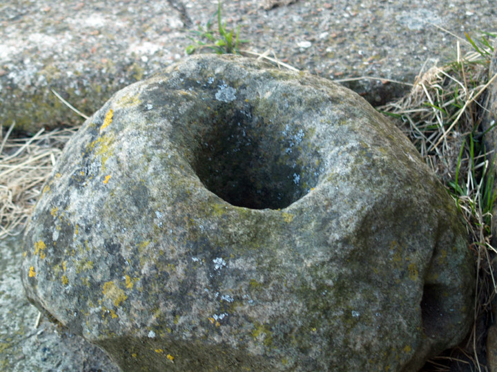
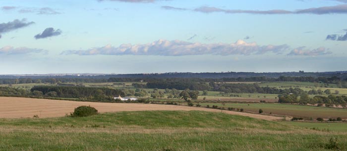
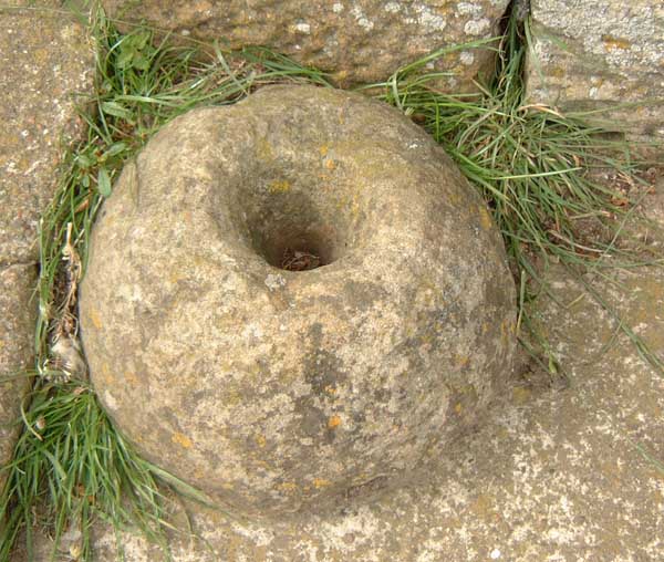
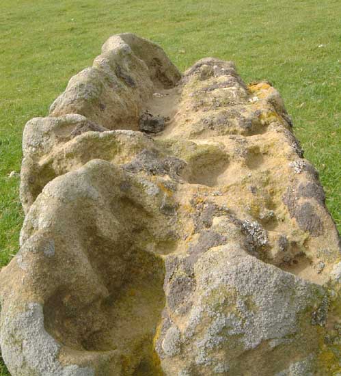
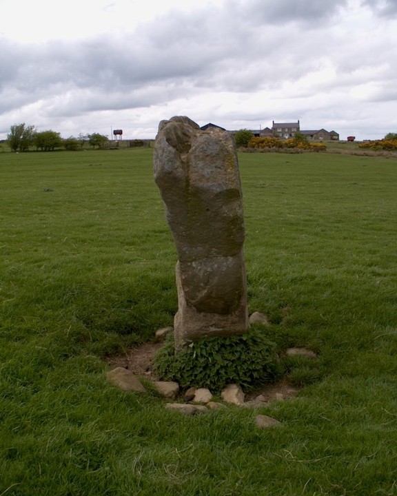
Keep going through Ingoe hamlet, don't take the left fork in the village, it gets tangly. Rather, head along to the right. down the dip, and up to Sandyway Heads farm. The short hardcore track not marked on the map leads to the field with the stone. The associated tumulus is on the other side of the fence, and looks badly ploughed out, can't be more than 70cm above field level. Excellent views over the Tyne valley, and further south across to Hexhamshire Common, and to the Simonside hills to the north, though the farmhouse obscures this. On the way into the hamlet of Ingoe, check out the possible quernstone on the tiny village green by the fork in the road. The stone itself is deeply grooved stone, like a few of the others in Northumberland. |
 Posted by Hob
3rd July 2004ce |
|
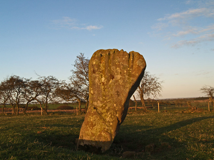
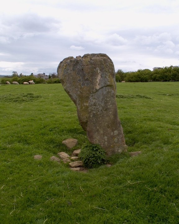
Standing Stone near Ingoe, Northumberland approximately six feet tall. |
Posted by spoors599 4th May 2003ce Edited 4th May 2003ce |
Miscellaneous |
|
|
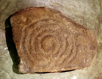
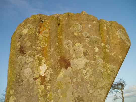
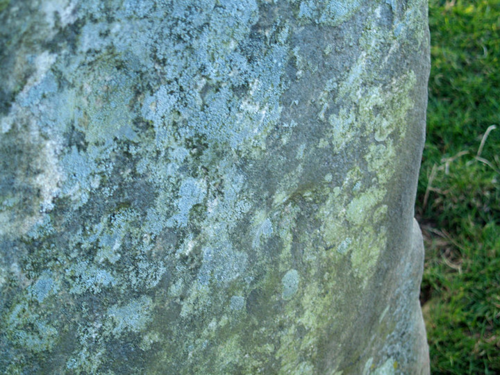
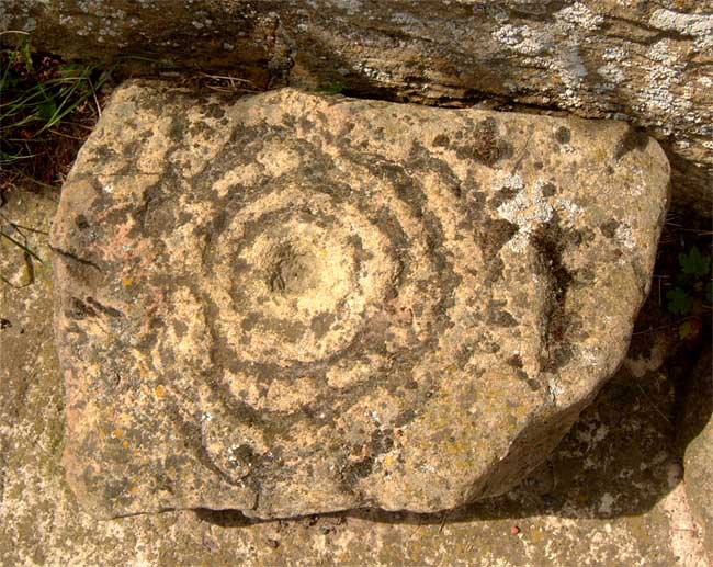
Details of Stone on Pastscape Bronze Age cup marked standing stone (in situ). One face of the stone is marked with seven clear cup marks and three small pecked marks. The stone is visible on air photographs. (NZ 04347465) The Warrior Stone (TI). Standing Stone (LB). (1) In a field south of Sandywayhead farmhouse, Ingoe, is a standing stone about 6 ft high, known locally as 'The Warrior Stone'. Marked as "Stone" on OS 6" (sited NZ 0434 7465). (2) A much weathered standing stone 2.0m high and 0.5m square at the base, with four distinct cup marks on its east face. See photograph. (3) NZ 043 746. Sandyway Heads standing stone. Scheduled No ND/133. (4) The Warrior Stone H00756 NZ 044 747 Close to Sandyway Heads in a field sloping to the south, this standing stone has seven clear cup marks on one face and three small pecked cups. (5) A Bronze Age standing stone is visible as a structure on air photographs at NZ 0434 7465. (6) |
 Posted by Chance
18th December 2012ce |