|
|

|
|
Abbotsbury CastleHillfort
|
||||||||||||||||||||||||
|
|
|
Images (click to view fullsize) |
|
Photographs: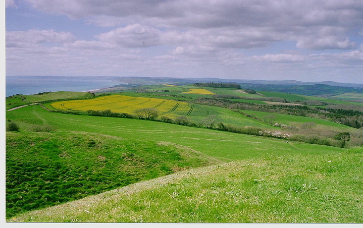
 Maps / Plans / Diagrams:
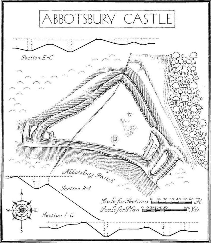
|
Fieldnotes |
|
|
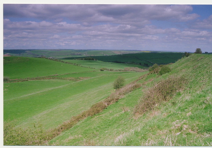
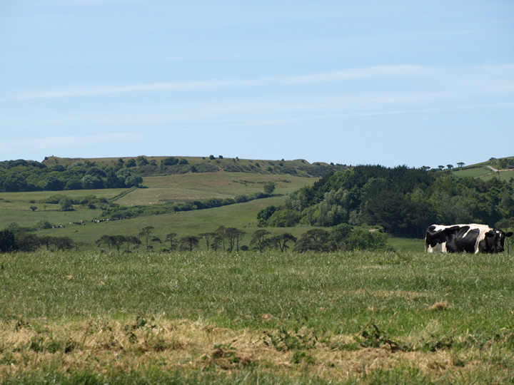
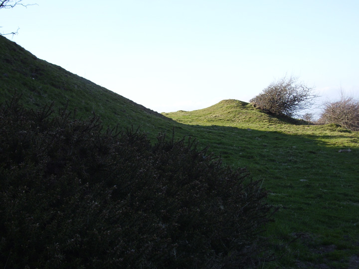
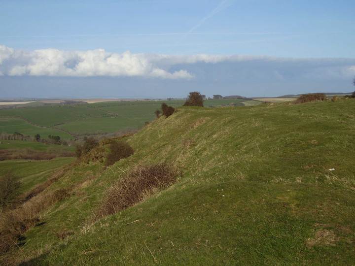
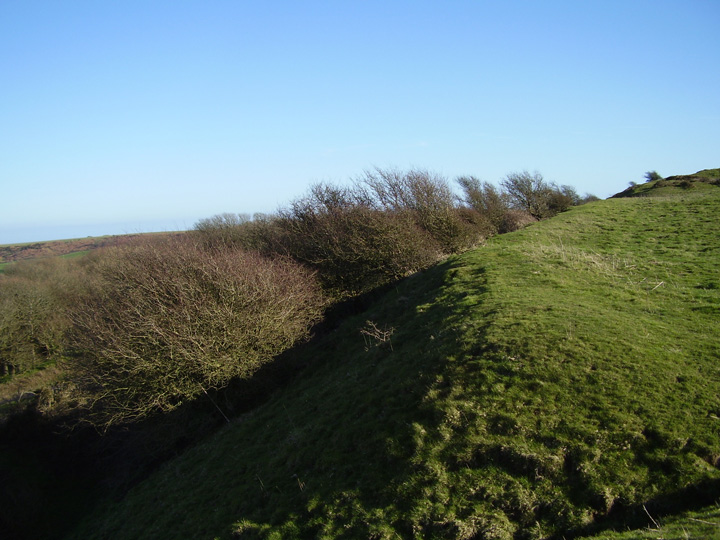
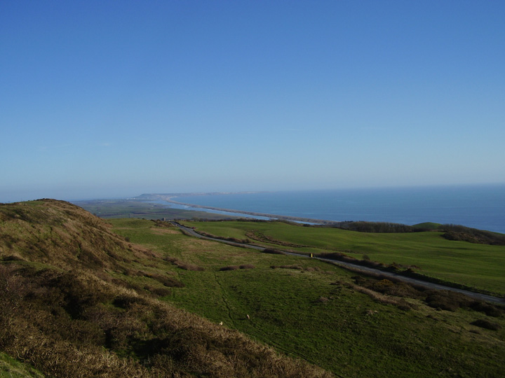
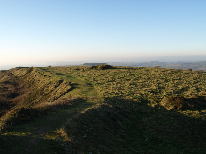
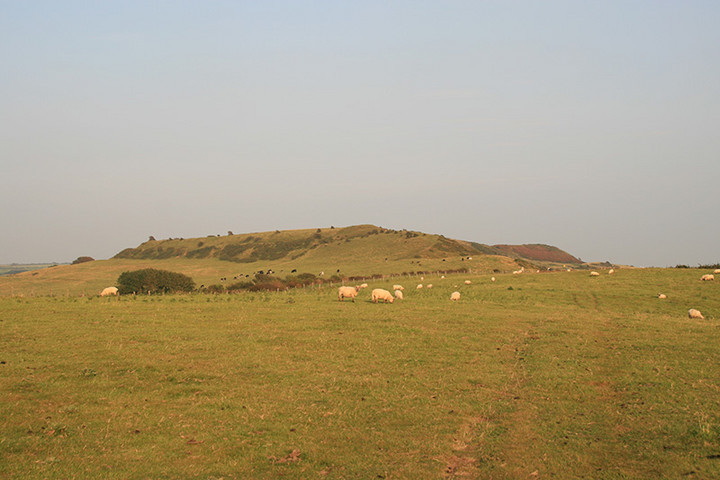
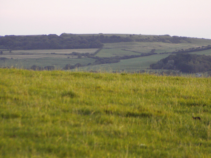
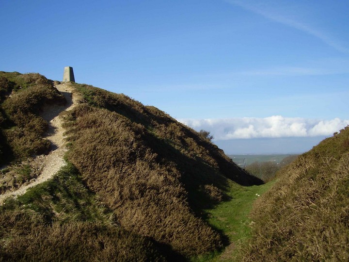
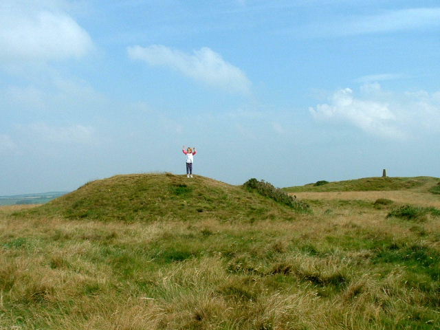
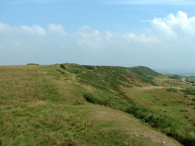
Visited 14.10.12 Surprised to find I am the first person to provide fieldnotes for this site! Abbotsbury Castle Hillfort is very easy to access being alongside the B3157. There is a small parking area along the minor road to the east of the site. Access to the Hillfort from the car park is via steps and a permissive ‘path’. Approached from the east, the two ramparts/ditches are quite substantial. The outer rampart is about 3m high from the bottom of the ditch. The inner rampart about 5m high. On such a nice day there were lots of people about. The Hillfort occupies a commanding position and affords great views out to Chesil Beach. Due to time constraints I didn’t have time to explore the whole Hillfort so had to settle for the eastern end. There is a ‘mound’ in the centre of the Hillfort approx 1m high x 5m across. A trig point sits on top of it. This is an easy to access Hillfort, in good condition and with great views. Well worth a visit when in this pretty part of the world. |
Posted by CARL 22nd October 2012ce |
Miscellaneous |
|
|
Details of Hill Fort on Pastscape Abbotsbury Castle on Wears Hill, 700' above OD. Internal area 4.5 acres, total area covered about 10 acres. The enclosure occupies part of the top of a ridge and is of roughly triangular form. The N, S and E sides are defended by two ramparts with a medieval ditch following the natural contours. At the SE end the defences consist of four ramparts of which the innermost, now of slight elevation appears to mark the original end of a single-ditched camp of the type associated with Iron Age 'A'. This early rampart was superceded by a new bank, raised outside and largely obliterating the early ditch, and supplemented by two new ditches, forming a complex characteristic of the Iron Age 'B'. At the W end there appears to have been an enlargement of the defences, but here the most notable addition is a small enclosure of squarish plan, with a ditch cutting through the main ramparts of the camp. It has been conjectured to be a Roman signal post, but there is no evidence [RCHM survey plan and sections]. (1) SY544866 Excavations at the south west corner of Abbotsbury Castle Hill-fort proved that a Roman Signal Station was not present (2-4) |
 Posted by Chance
29th March 2016ce |
| A Roman signal station would make a lot of sense here as there is known to be one at nearby blackdown (roughly the Hardy monument) which can be plainly seen from here. The blackdown site is also known to be part of a chain of "beacons". Also the coastal placing of the hillfort would make a very good place to put an emergency signal station. There's no evidence for the hillforts themselves having been used in the Iron / bronze ages for sending signals to one another, but I can't see any reason why not. |
 Posted by formicaant
24th March 2007ce |
|
A hillfort and a Roman signal tower?. Triangular in plan, its defences encloses 4 and half acres. On the N.S. and E. the earthworks comprise 2 banks with a ditch between them. At the S.E. level ground has caused the building of four ramparts with ditches outside them. Maybe Roman bit; At the S.W. earthworks have been altered at some later stage so that an almost square earthwork has been constructed in the angle of the inner bank. Within the hill-fort to S.E. are a group of about 9 circular depressions could represent site of huts B/A? south west of them is the mound of a bronze age bowl barrow.. Presumed Date; 250-50 bc. Taken from A Guide to Prehistoric England - Nicholas Thomas 1960. |
 Posted by moss
24th March 2007ce |