|
|

|
|
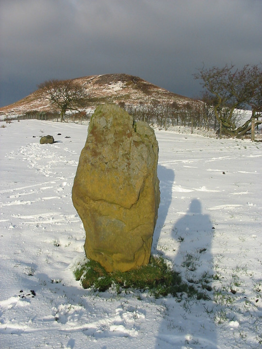
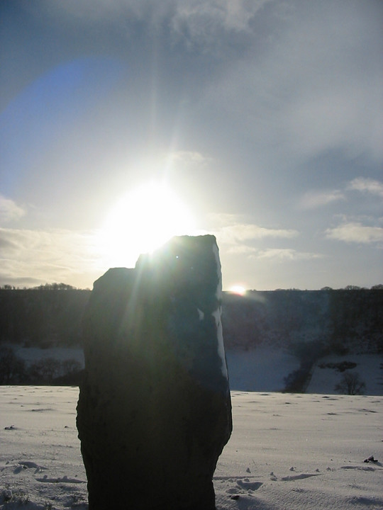
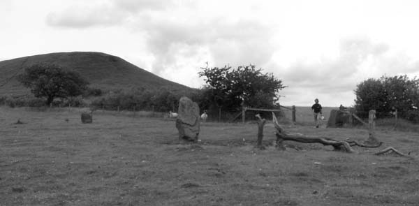
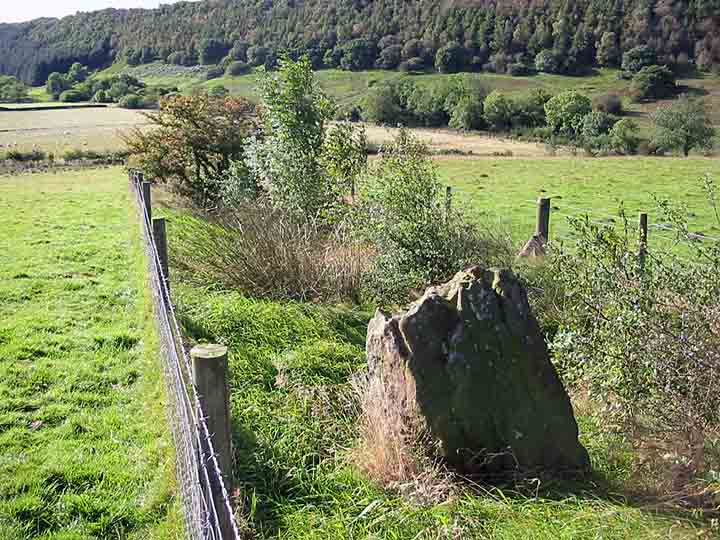
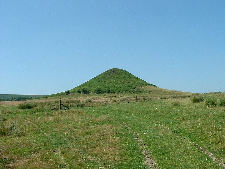
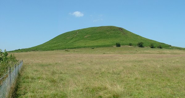
Blakey ToppingStone Circle
|
|
|
|
Images (click to view fullsize) |
|

|
Fieldnotes |
|
|
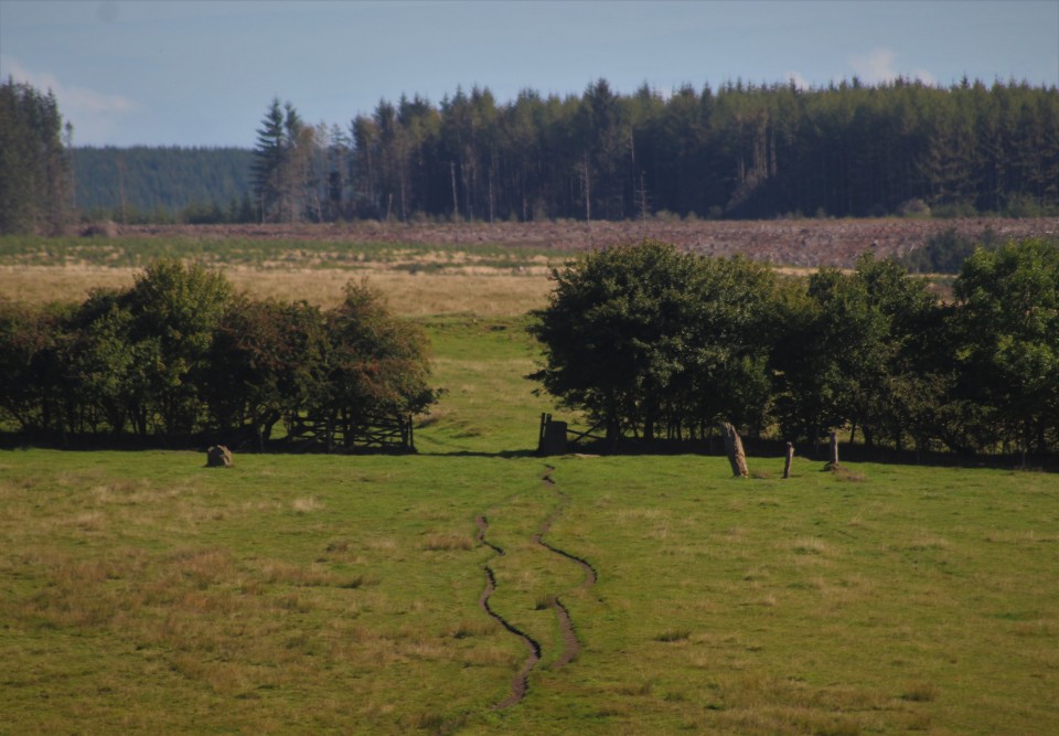
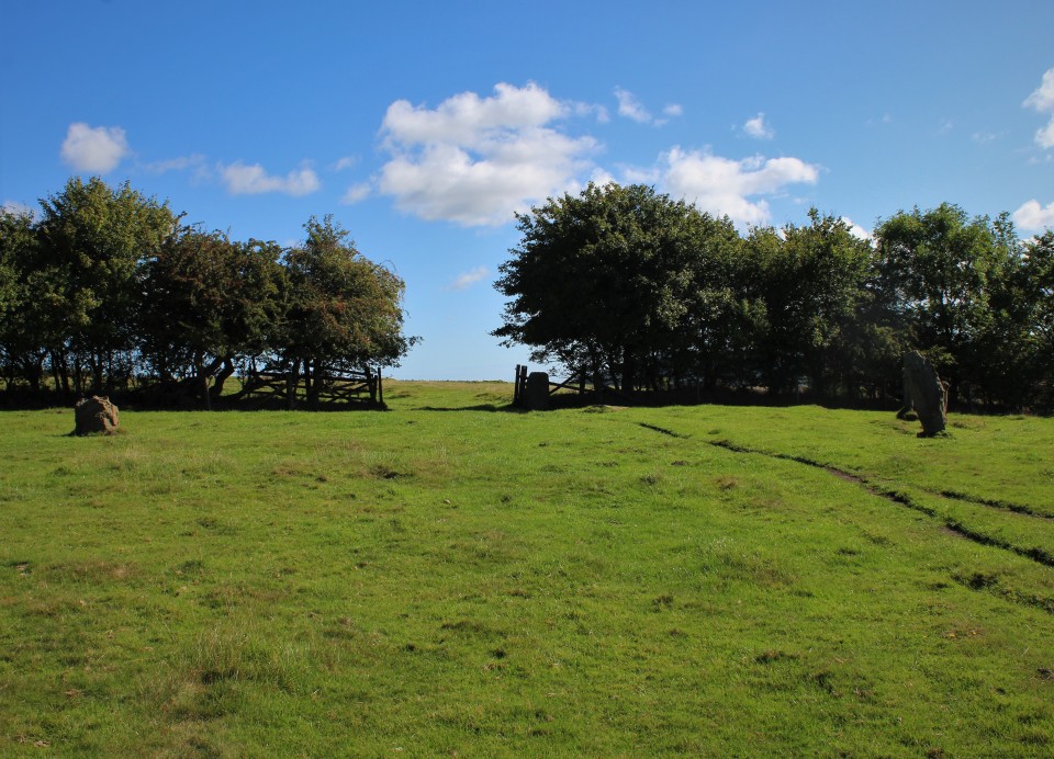
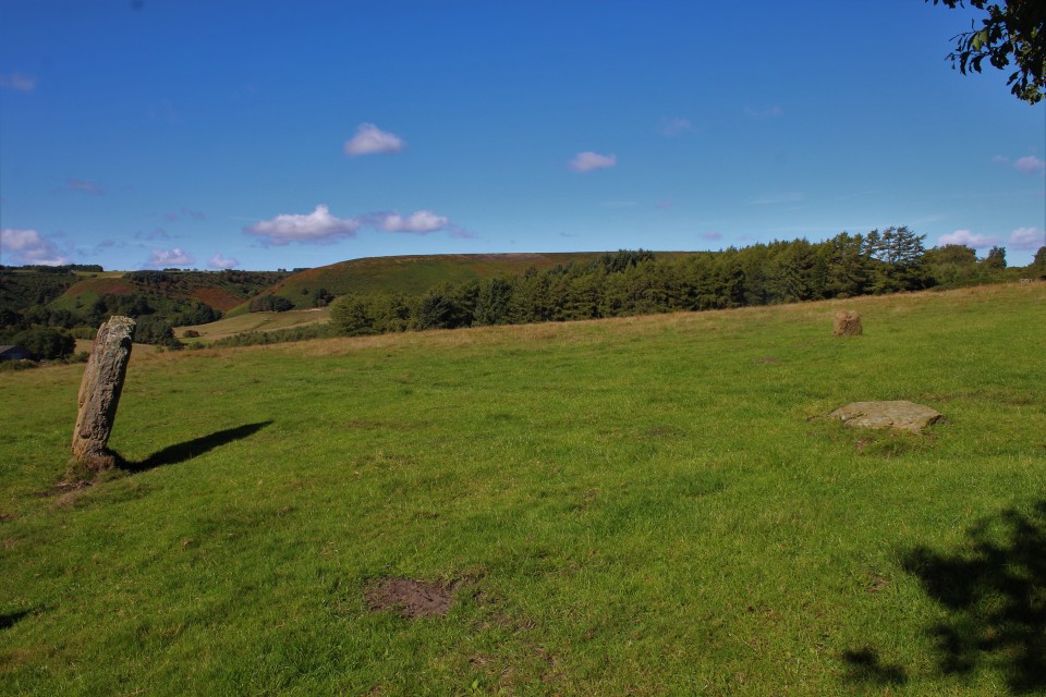
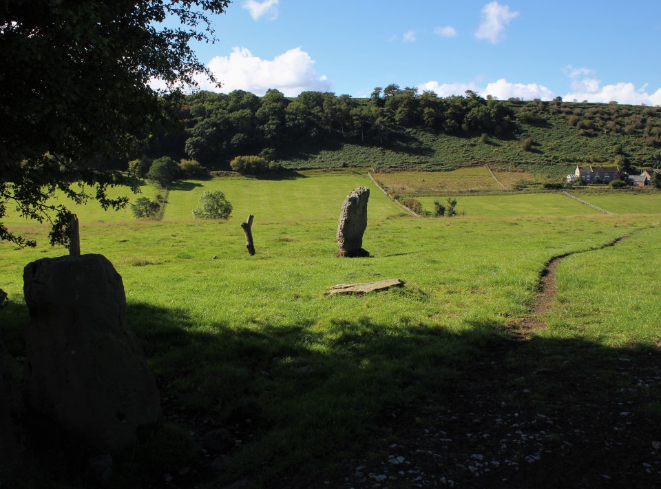
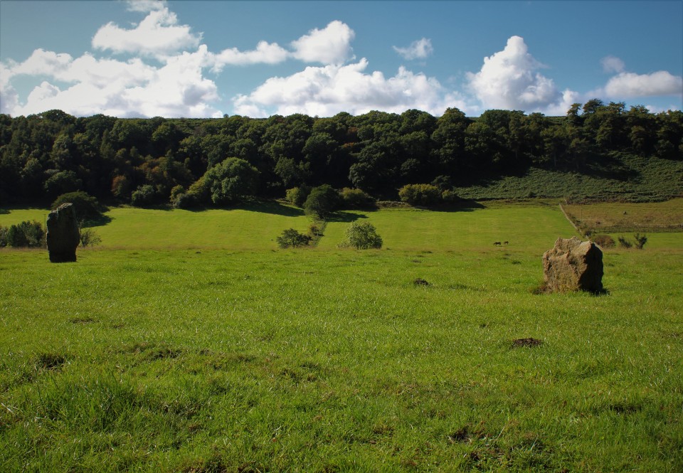
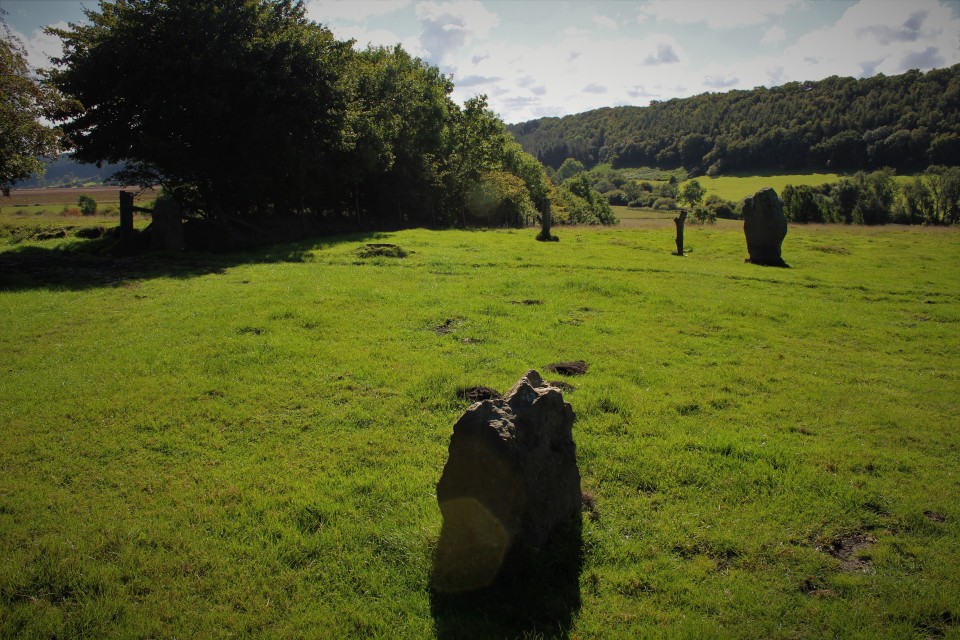
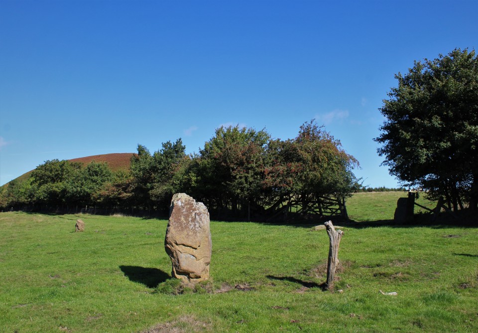
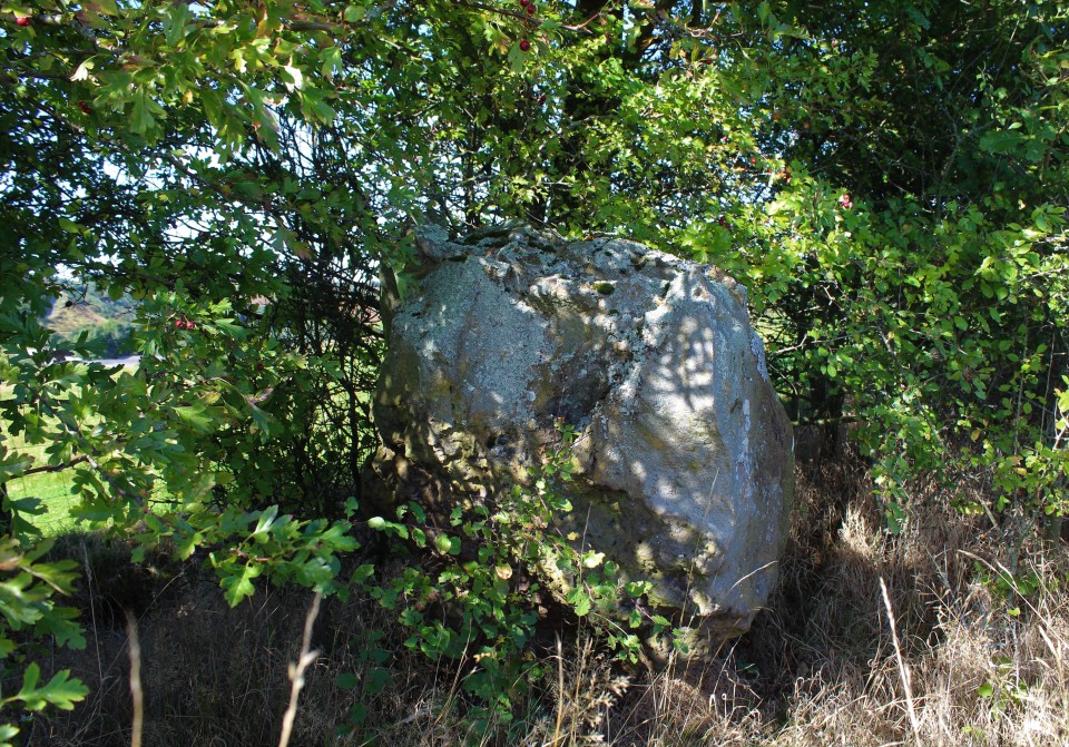
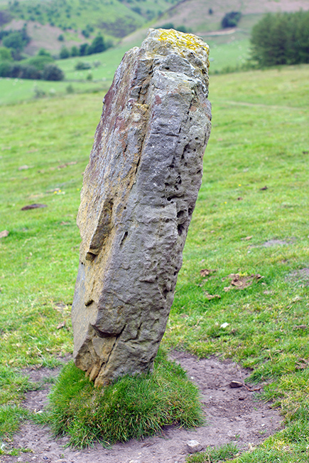
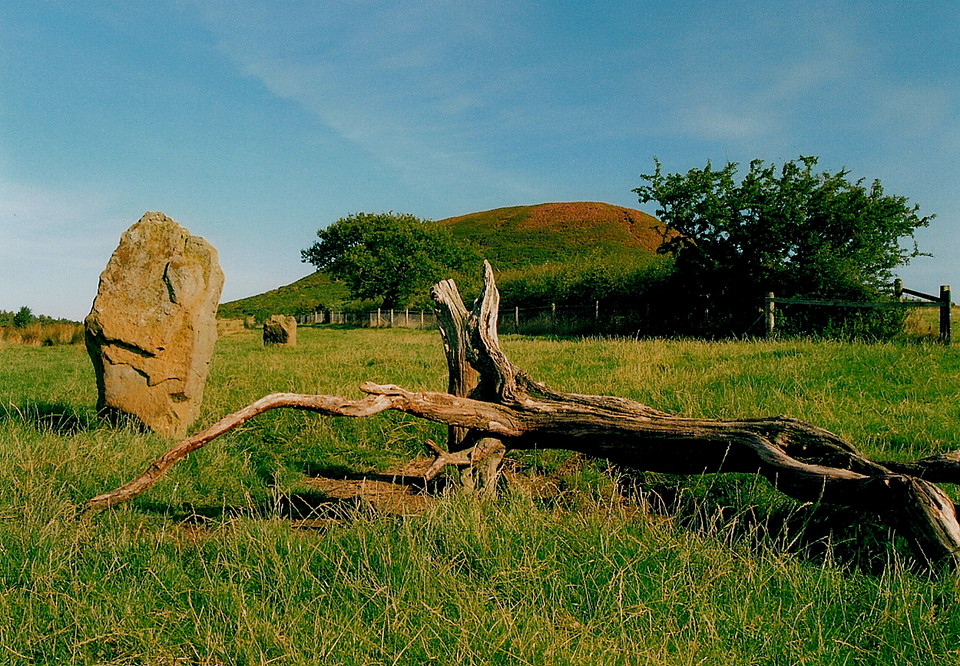
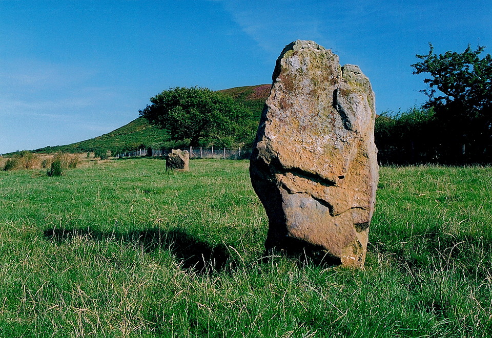
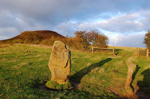
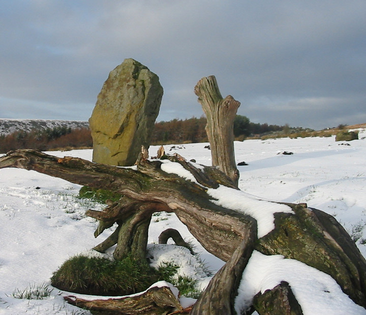
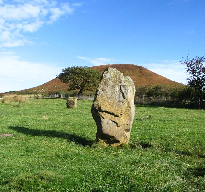
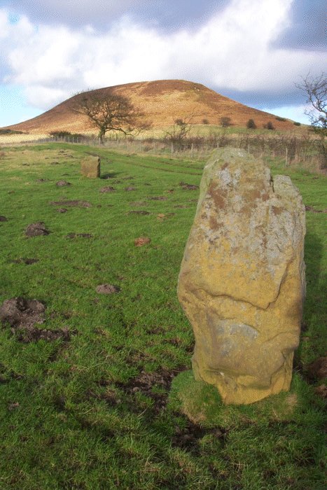
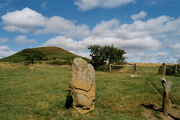
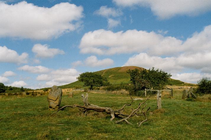
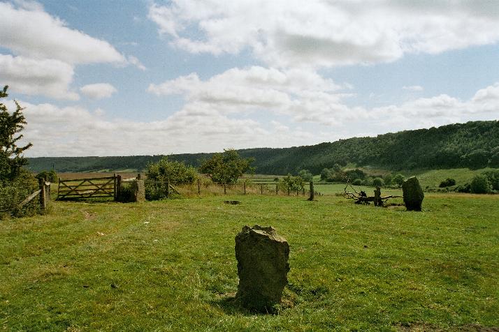
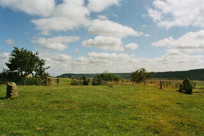
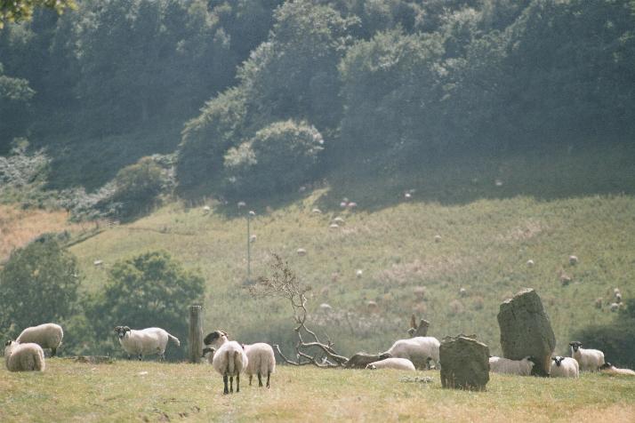
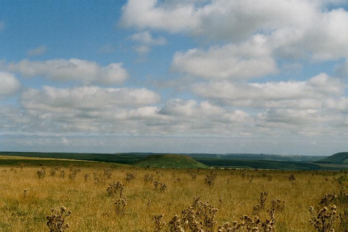
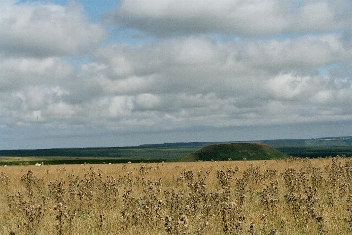
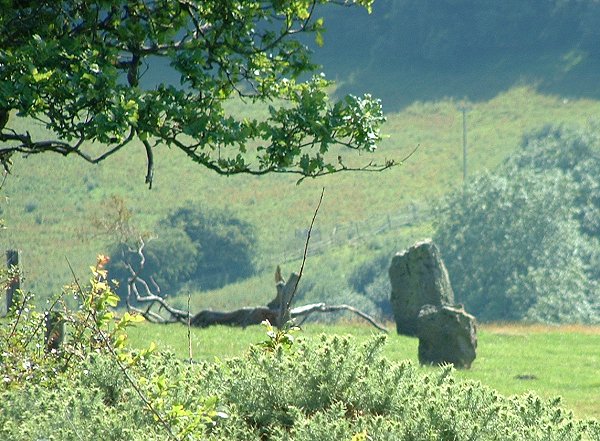
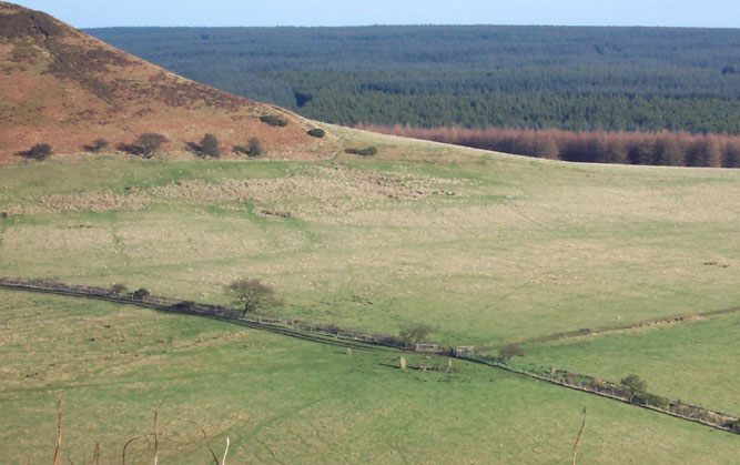
My first attempt was cut short by the distance from the car, wife and small children are only prepared to wait so long. Second attempt was thwarted by the local farmer and a policeman, bangin' on about lock downs and pandemics or something. Third time was the charm. I was on my own with no legal problems, the only problem being the long walk, i'm philosophically opposed to them. The big hill that is Blakey Topping comes into view early on, I keep making for that, I've no firm idea where the stones are but assume I'll be able to see them from on top of the Topping. Fighting my way to the top through the bracken was arduous, stopping every ten yards to scour the hedgerows for the stones, still no idea where they are. The view from the top of the Topping was most agreeable, I sat at the south east end and zoomed the camera here and there looking for the stones. I did see some, I assumed they to be them, so I skipped and stumbled back down to level ground, keeping my distance from the cows in the field, they obliged me by keeping their distance also. Upon reaching what I thought was the ruined stone circle it turned out to be an old settlement building or something, a weird structure was in it, a circular dip, concrete lined with a boulder in it, this wasn't it so I kept on searching. Memories of other peoples pictures has it by a hedge, so I made for the hopefully right one and followed it round, there was a large stone in the hedge, trapped by two wire fences, I'm getting near, is this an outlier maybe. Reaching the gap in the hedge the circle was finally revealed to me, elation, or something close to it. So this is a stone circle is it ? Map only goes as far as standing stones, I shall be more charitable. There are five stones, one is the gate posted stone, there is a fallen stone between the gatepost and the tall stone, there is the low recently (2012?) re-erected stone, and the stone in the hedge. I presume this to be four stones remaining of a stone circle with an outlier twenty or so yards south. I sat for a while with my back to the fence taking in the still leafy scenery, it'll be bare and drab all to soon, bah! I hate winter. I'd only payed for two hours in the car park by the Hole of Horcum so I had to bid a fond farewell to the stones and take my leave, on route back to the car I kept turning back to look at the stones and the hill, why couldn't I see them on my way down, oh well, sometimes you cant see the stones for the rocks. |
 Posted by postman
25th September 2022ce Edited 25th September 2022ce |
|
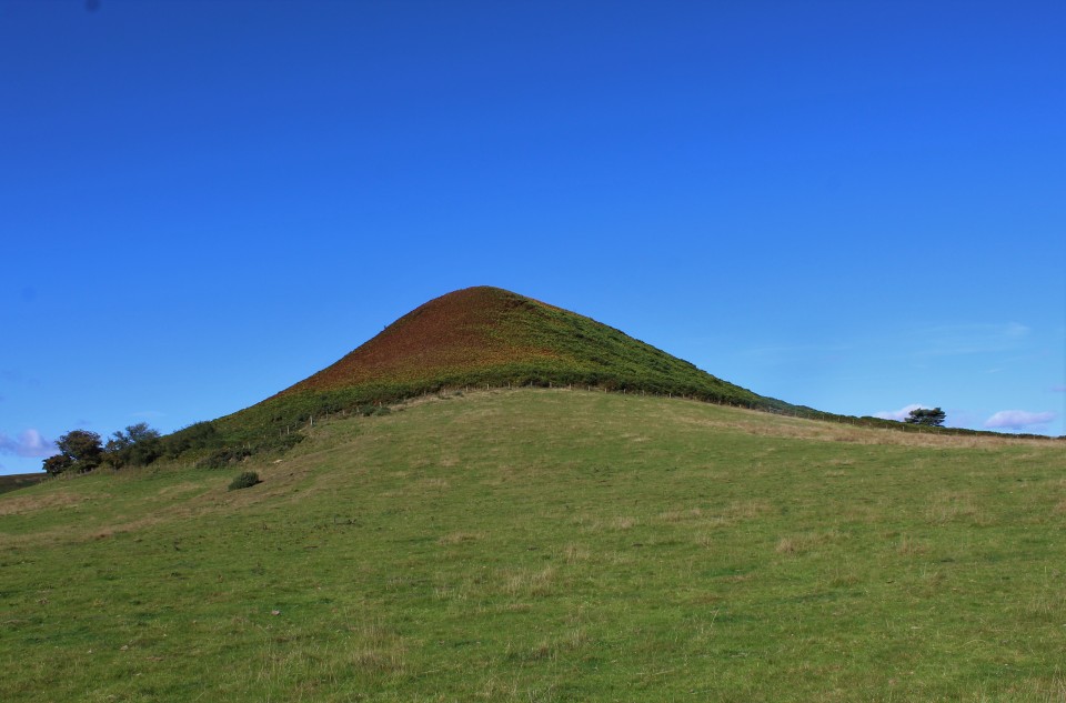
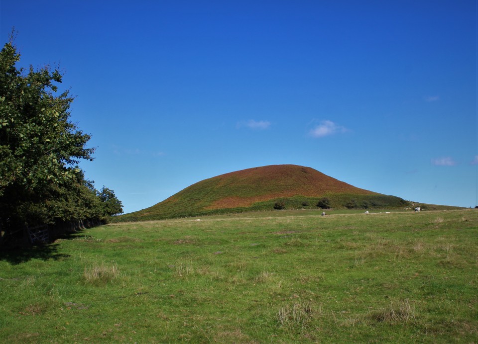
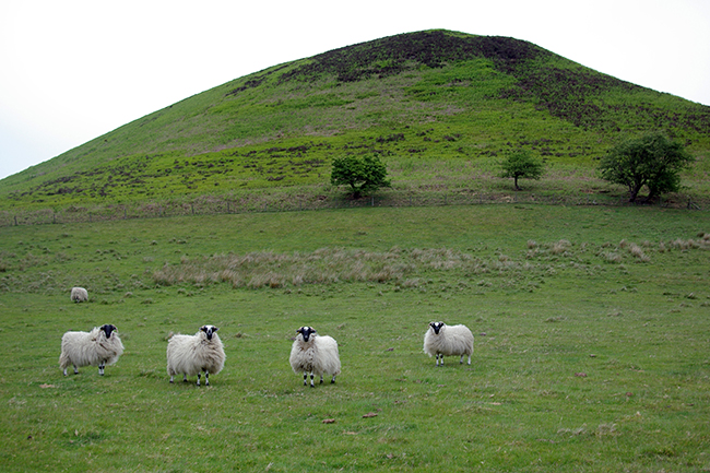
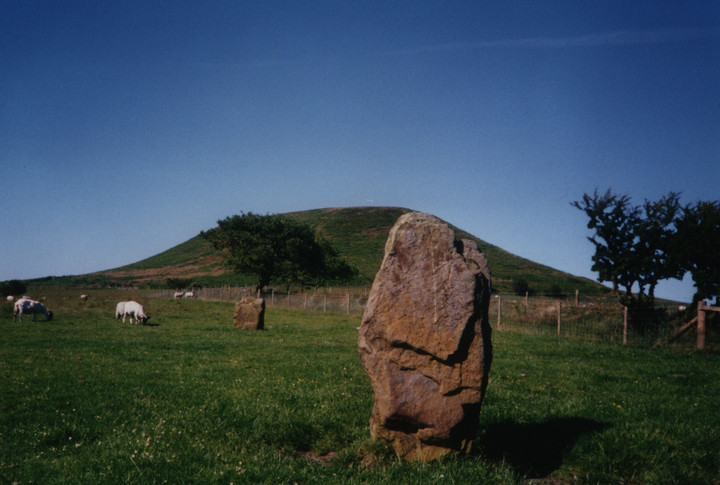
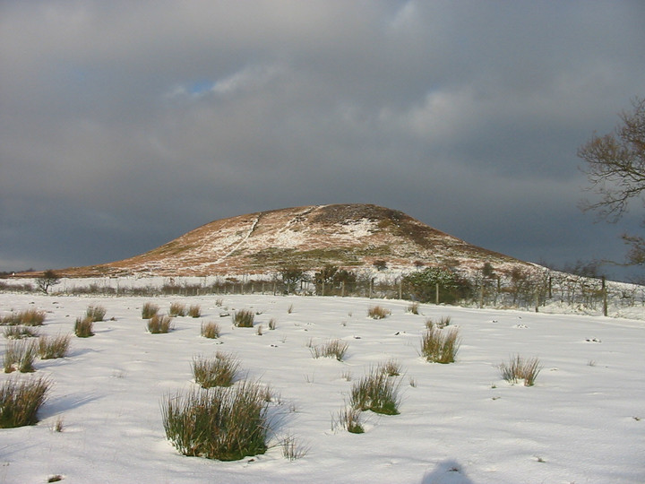
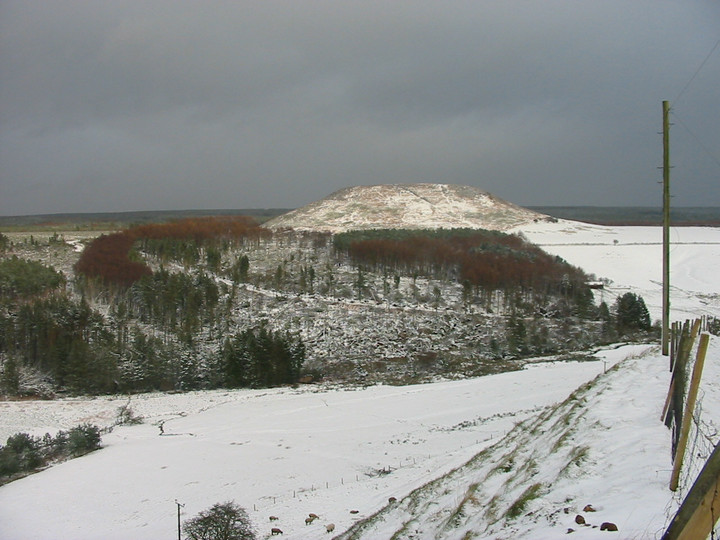
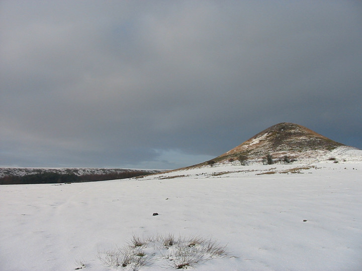
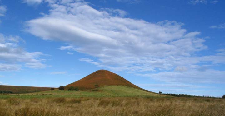
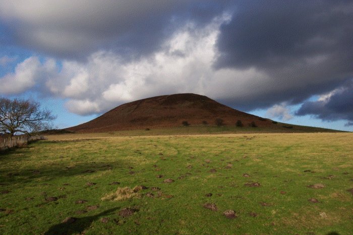
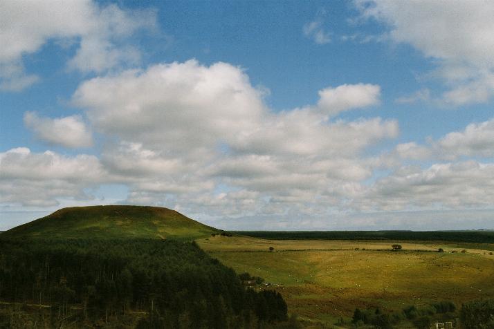
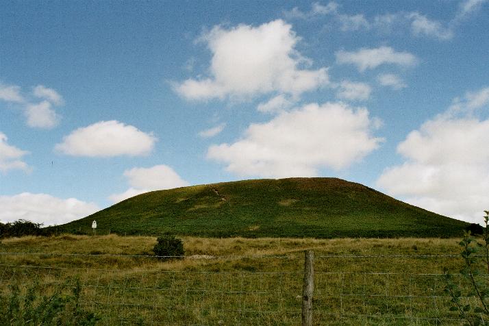
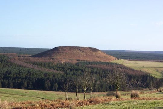
It's a truly smart place Blakey Topping...its conical shape when viewed from the SE similar to High Wheeldon in the Peak District. The stone circle/alignment, although a bit worse for wear, is worth the short walk (unless Fitz's navigating) from the Hole of Horcum. Blakey Topping makes it a must |
28th September 2004ce Edited 28th September 2004ce |
|
Do yourself a favour, if you ever come out with me, bring a map, bring a compass, bring a gps, bring directions. I am THE BAD (bad meaning bad) Navigator! I met up with the Mighty Stubob today to walk the Old Wife's Way and check out the stones at the foot of Blakey Topping. Hey, it's my country so I took the lead. I led him through fields, over fences, through bracken and guess what? all we had to do was, find the big hill & cross a field, simple eh? I was ashamed. That said. This is a messed up, beautiful site. How it came to be interpreted as a circle beats me, but the stones are lovely and the setting is magnificent. Groove on the ginger topping. |
 Posted by fitzcoraldo
28th September 2004ce Edited 28th September 2004ce |
|
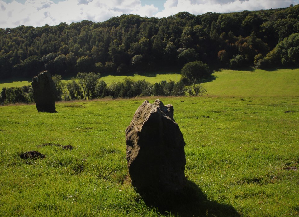
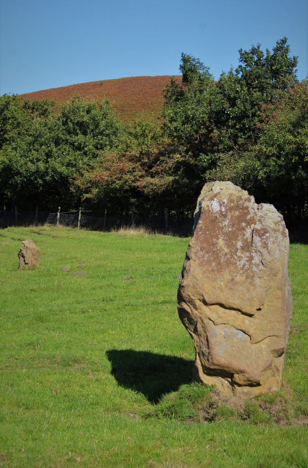
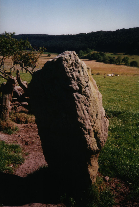
I had little idea what I was about to see. 'Blakey Topping' sounds like a cheapo, bubblegum-flavoured, powdered dessert mix and not a smooth, graceful sacred hill standing alone, like Kilimanjaro. With the icy wind cutting through my clothes as we got out of the car at the Hole of Horcum car park, and with the threat of a bit of a walk to reach it, I thought: 'this better be good, Moth.' I wasn't disappointed. As you approach it the way we did, it doesn't play visual tricks on you like Silbury does, it's just there and absolutely compelling. It's hard to take one's eyes off it. You can feel why the ancients regarded it as sacred in some way, but I couldn't begin to describe why. The big surprise for me was the wrecked stone circle in a field nearby. The tallest stone stands about 6 feet high. Others remain standing and some are down but still its hard to know what's been moved and what hasn't and so quite diffcult to work out how big it once might have been, or even where its centre was. It's quite a sheltered spot by the stones and completely dominated by the shape of the hill beyond. |
 Posted by Jane
11th February 2004ce Edited 11th February 2004ce |
|
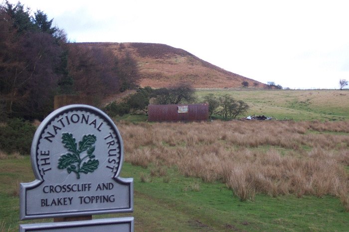
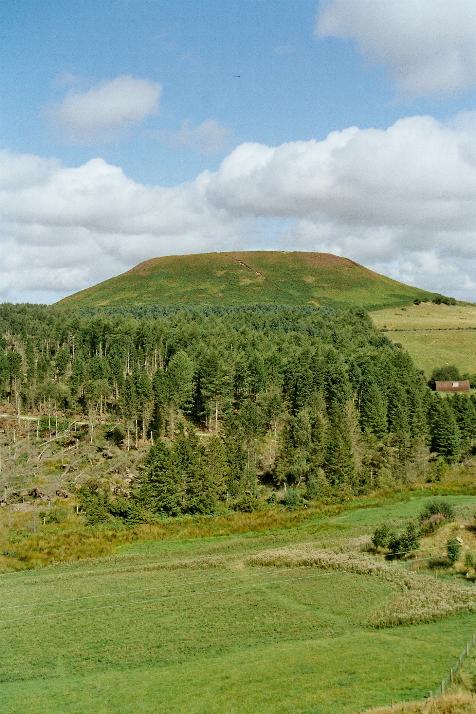
Access slightly uncomfortable walk for a few yards north along the verge of the busy A169 before a right turn onto a metalled farm lane. A very short distance along this lane, the hill of Blakey Topping comes into view. Continuing towards the hill and stone circle, the walk remains on metalled surface for the majority of the distance, with a couple of full width gates which I'm pretty sure were unlocked. Unfortunately, approaching the farm at the bottom of the hill the path leaves the metalled lane and makes a quick descent into pasture. This descent would be very awkward for anyone with any walking difficulties, but it may well be worth asking at the farm. Either way, the other side of the farm the walk continues on a small and reasonably steep grassy path up the side of a field next to forestry, to the 'foot' of the mound that is Blakey Topping itself. From here you will probably be able to make out the stones of the circle, a short walk to the right along the top edge of this field. Sunday 24 August 2003 The hill Well, as I thought the first time I visited, I defy anyone who's seen Silbury Hill not to immediately think of it when they first glimpse Blakey Topping from this direction. Big difference, of course is that it's not man-made. But it's nearly as weird and pretty much as striking and impressive! It's all the more impressive as you draw closer and descend into the valley at its foot, where a farm lies. The sun was blazing and (it's off-topic, but I just have to mention it) there were some absolutely beautiful horses grazing in the field that the path crosses by the farm. (Including a reasonably young foal.) I'm not usually all that much of a horse-fan, but the proportions of these beasts and the level of grooming were just spectacular. The stone circle The little stone circle on the slight ridge just below Blakey Topping and above the farm has a lovely feel to it. Incredibly peaceful – being so far from any roads. With the sheep happily munching their lunch, we decided to do likewise, and I can't remember ever having a picnic in as pleasant a place. We thought the circle might once have been bigger, but a couple of the remaining few stones didn't seem as if they were in their original positions, judging from angles of the stones and their positions in relation to each other. Just speculation and guesswork, but it looked to me like there might have once been as many as 8 or 10 stones forming a circle about the size of the Twelve Apostles of Ilkley Moor. But I could be way off! Bloody hell! I just checked and Burl says 51ft. The 12 Apostles is 52ft…. This post appears as part of the weblog entry Pottering around Pickering
|
14th September 2003ce Edited 15th September 2003ce |
|
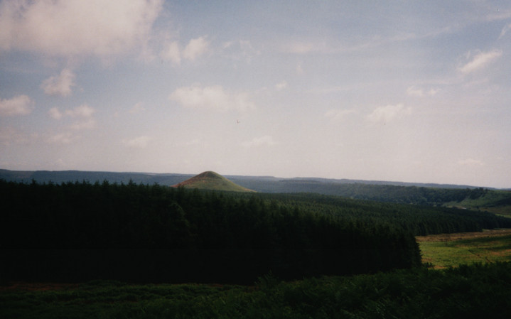
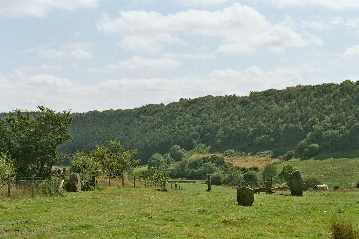
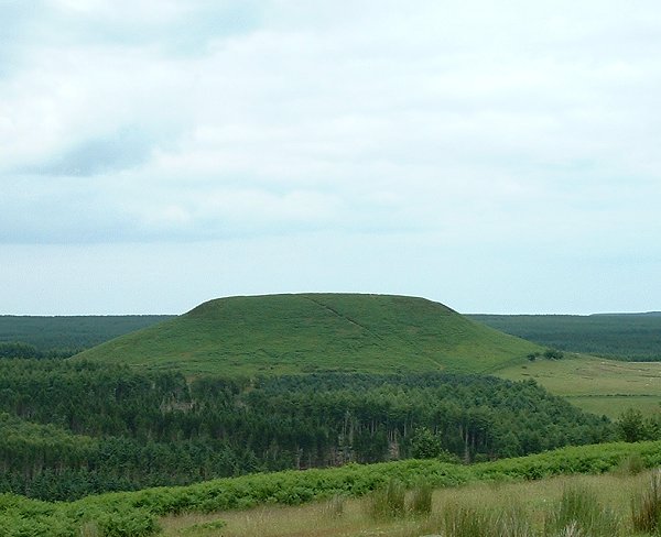
A two for the price of one fieldnote. My first attempt at Blakey Topping was on the 6th July when I parked at the carpark that overlooks the Hole of Horcum, and walked east along the Old Wife’s Way. A little way down the track the hill starts to become visible and as you continue its strange shape becomes clearer, my first though was that it resembled the hill in Close Encounters and I was tickled when I got home and read that Julian had the same impression. From this western angle Blakey Topping is less a ‘tit’ hill and more a giant nipple. I decided not to continue on to the stones at the base this time as it seemed just too much of a walk and decided to approach the hill from the opposite side on another occasion, which turned out to be a week later. This time I drove along the same forest track that leads past Howden Hill and parked next to Dargate Dyke – there is a charge for driving through this part of Dalby Forest, an unreasonable 4 quid. From here Blakey is about 2 miles to the northwest but I had thrown my old bike into the back of the car and was prepared for a leisurely peddle to the hill and stones – not so. First of all I took the wrong track due to having to rely on my map reading skills as the tree cover was playing havoc with my GPS. Twenty minutes and one detached chain later I managed to find my way back to where I had parked the car... Setting off again on the right track this time the land immediately drops down nearly 100 metres in a distance of only 500 metres which was pretty hairy on an old bike with iffy brakes, but safely at the bottom I turned left and continued west to Grain Beck where I was greeted by a couple of barking dogs from the house at the southeast end of Thompson’s Rigg. The dogs were quickly pacified and I continued onto the flattish plain of Thompson’s Rigg. From here the still distant Blakey appears a completely different shape to the western approach. The flat top and steep sides are replaced with a conical form that seems to almost exactly mirror Howden Hill when seen from the same direction – the southeast, which I found rather peculiar. Compare these pictures of Blakey- http://www.themodernantiquarian.com/image.php?image_id=16192 and Howden - http://www.themodernantiquarian.com/image.php?image_id=16158 Again like Howden the effect diminishes as you move round to the southwest where the stones are and it become just another hill (a very pretty one nevertheless). All the way along the track I had been careful to re-close all the gates I had been through but as I reached the fence and gate that the stone setting stood behind I found the gate wide open, and just beyond it close to the stones were some young cows. Wanting to avoid the beasties I took a right turn and went along the edge of the fence and had to content myself by viewing the stones from over it so I can’t really say if they form part of a circle or an alignment as the scheduling report suggests. If I had had the presence of mind I would have stormed the gate and closed it before the cows could come through it, which only occurred to me as I made my way back. Turning round I started back to the gate only to find the cows had already come through to meet a walker who was heading north along the fence, he didn’t seem at all bothered by them but there was no way I was going past them - maybe next time... |
 Posted by Chris Collyer
15th July 2003ce |
| has to be the most beautiful hill in the north. ignore the tree farms and fylingdales big lump of star wars junk on the horizon, and look at the shadow the hill casts all around. walking to the top makes your knees go wobbly. the circle at the foot of the hill is wrecked but still has some lovely big stones, and you can't help but lean into them like the sheep do. check out the bridestones and hole of horcum too - glaciation was the best thing that ever happened to yorkshire. |
Posted by linz23 19th May 2002ce |
Folklore |
|
|
"A witch story related by a native 25yrs ago attempts to explain two conspicuous natural features two miles apart on Pickering Moor; Blakey Topping, an isolated hill, and the Hole of Horcum, a deep basin-shaped valley. The local witch had sold her soul to the devil on the usual terms, but when he claimed it, she refused to give it up, and flew over the moors, with the devil in hot pursuit. Overtake her he could not, so he grabbed up a handful of earth and flung it at her. he missed his aim and she escaped. The Hole of Horcum remains to prove where he tore up the earth and Blakey Topping where it fell to the ground. From our point of view the significance of this story lies in the fact that between the Hole and the Topping there is a Bronze Age settlement site at Blakey Farm, with its stone circle. The rough trackway leading from the Hole to the circle is known as the Old Wife's Way, presumably also marking the witch's flight. This, together with other Old Wife's Ways, preserves as it were Bronze Age church tracks". The Archaeology of Yorkshire F & HW Elgee 1933 Republished 1971 by SR Publishers Ltd. |
Posted by fitzcoraldo 22nd February 2005ce |
| Adding to what Fitzcoraldo said, another legend has it that the Hole of Horcum was made by the local giant, Wade. He was having a row with his wife, Bell, and got so angry that he scooped out a lump of earth and chucked it at her. The Hole of Horcum is the dip left where he scooped out the earth, and Blakey topping, the clod itself, resting in situ where it landed. |
Posted by moleshag 30th September 2002ce |
|
The devil is supposed to be responsible for the near by Hole of Horcum or the Devils Punchbowl as it's known locally. Blakey Topping, Freeborough Hill and Roseberry Topping are supposed to be the result of the handfuls of earth thrown across the moors. If you look at the sides of the hole you can still see his fingermarks. Another folk tales attributes the Hole to the local giant Wade. He scooped the earth out of the ground to create Wades Causeway. |
Posted by fitzcoraldo 6th May 2002ce |
Miscellaneous |
|
|
Frank Elgee's assessment of the Blakey Circle from his Book "Early Man in North East Yorkshire" published in 1930. "Three large standing-stones about 6 feet high on the south-west side of Blakey Topping, that singular hill seven miles north of Pickering, are the remains of a circle about 18 yards in diameter. Two or three hollows in the ground indicate the position of other stones, some of which are serving as gate-posts near by. Others have been broken up to help build a wall. These stones are associated with a large settlement site similar to that on Danby Rigg, not very far from the imposing Bridestones and approached by an ancient trackway known as the Old Wife's Trod". |
Posted by fitzcoraldo 16th September 2003ce Edited 19th September 2003ce |
|
There’s bit of confusion about the stone setting at the base of Blakey Topping hill. Burl says it is so damaged that it cannot be said for certain that it was ever a circle, Dyer on the other hand thinks it was, as does JC while the scheduling report calls it an alignment. As the first three cover the stones in their own books I’ll give a brief summary of the scheduling instead. It mentions the 4 stones calling them ‘roughly hewn sandstone boulders’ with 2 of the stones on the west side in a SSW to NNE alignment. The stone to the north is 80cm high but was once higher, the top having been broken off. The southern stone is 15 metres to the SSW and is 1.7 metres tall. On the eastern side of the alignment the southernmost stone is now part of the field boundary and is 20 metres to the southeast of the southern stone on the west side. It stands 1.3 metres above the modern ground level with a slight lean to the south. The north stone of this pair has been moved at some point in time and is now 85 metres north of its partner and is 1.1 metres high. The report then mentions that there would originally have been more stones in the alignment, the others having been removed in land clearance or for reuse elsewhere and it goes on to speculate that the line of these stones would have continued the curve formed by the 3 stones still in their original positions or formed 2 parallel rows, part of which survives as the 2 western stones. The report makes almost no mention of the hill. |
Posted by Chris Collyer 15th July 2003ce |
Links |
|
Smell of Water - Wandering in the shadow of the sacred hill |
Posted by fitzcoraldo 11th February 2022ce |
National Trustuseful info regarding buses etc. |
Posted by fitzcoraldo 12th April 2002ce Edited 12th January 2003ce |