|
|

|
|
Danby RiggCairn(s)
|
||||||||||||||||||||||||
|
|
|
Images (click to view fullsize) |
|
Photographs: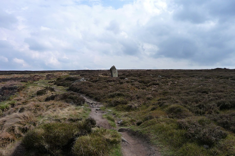
 Maps / Plans / Diagrams:
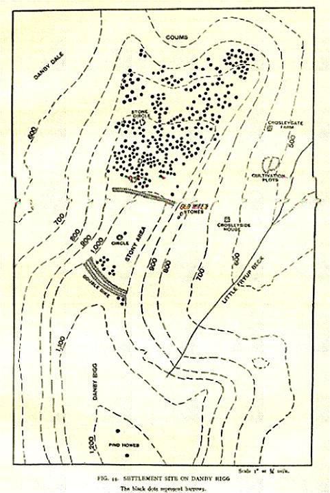
|
Fieldnotes |
|
|
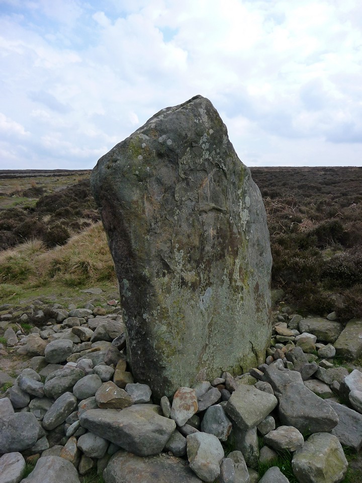
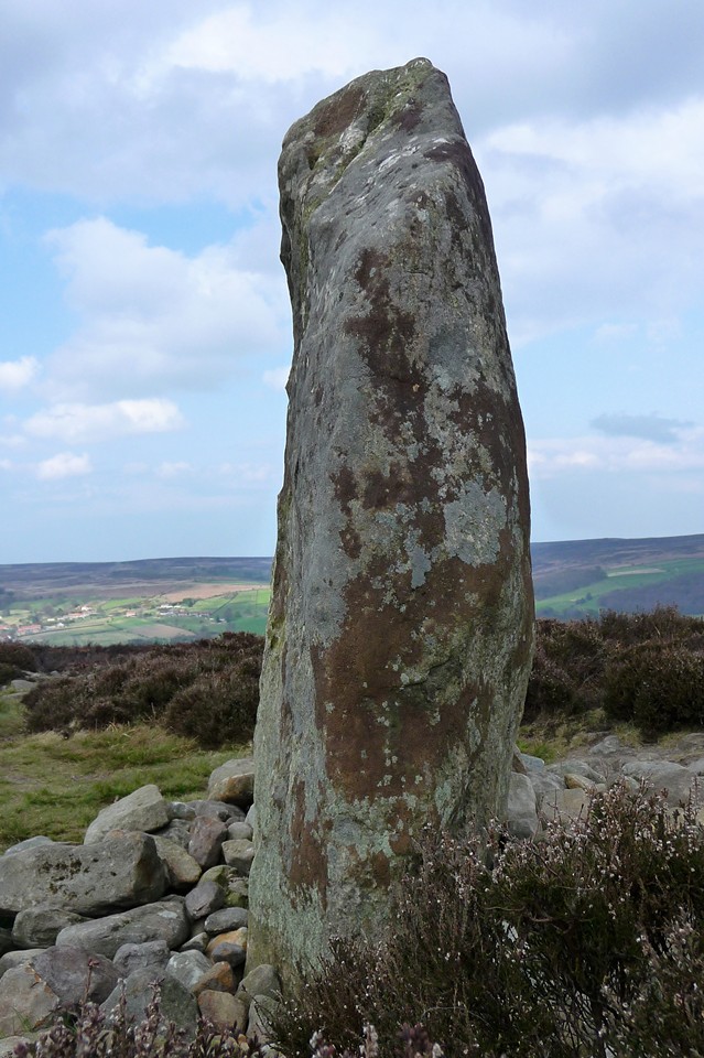
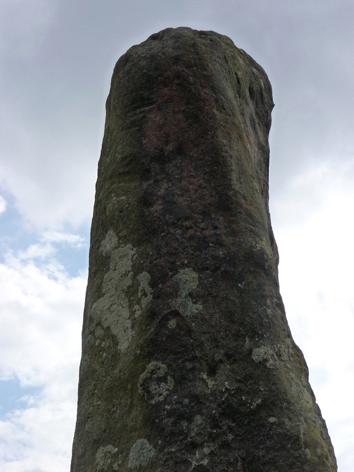
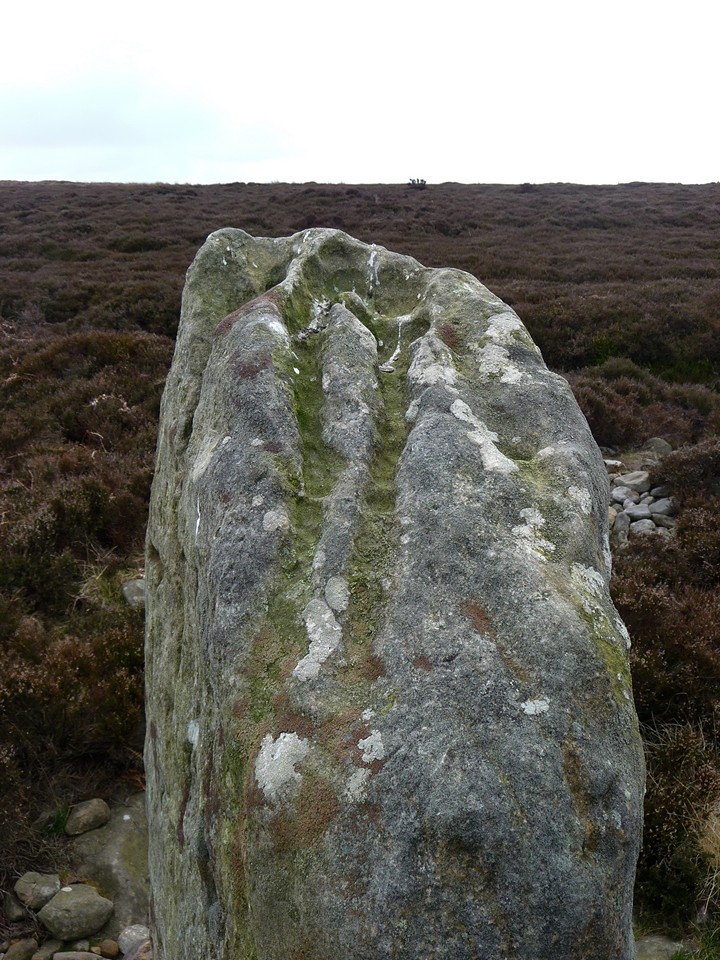
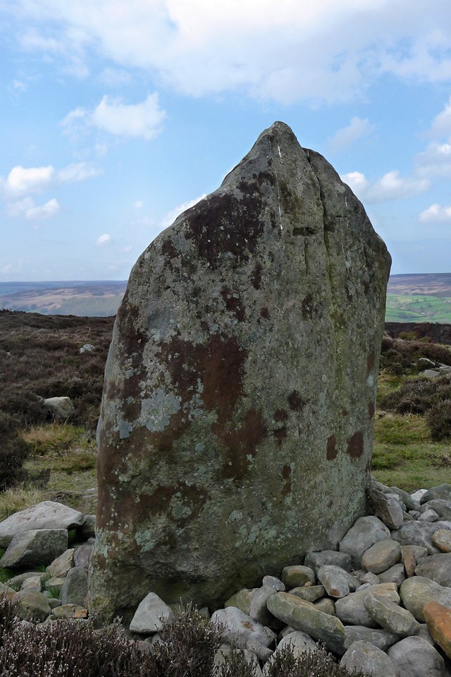
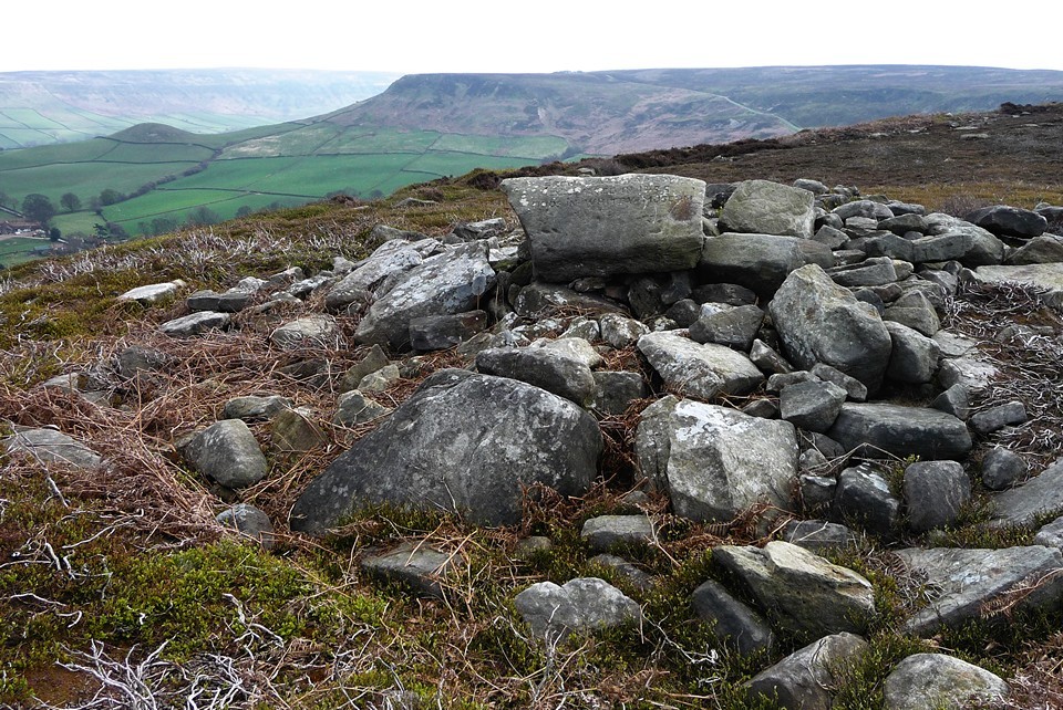
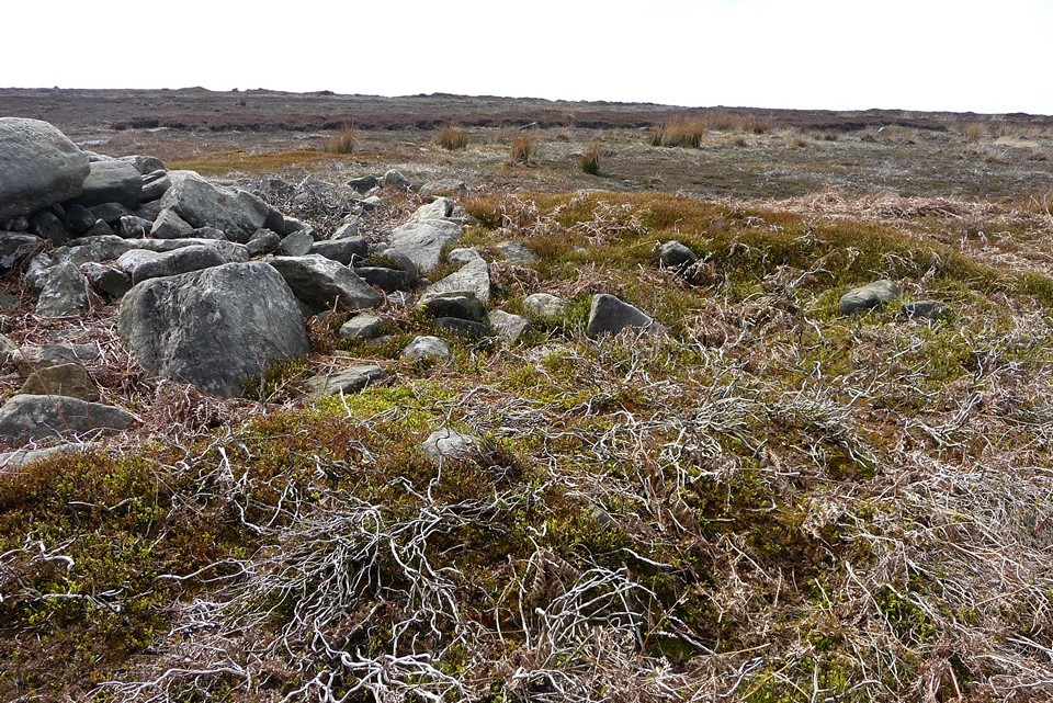
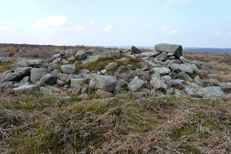
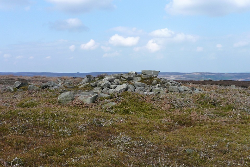
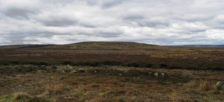
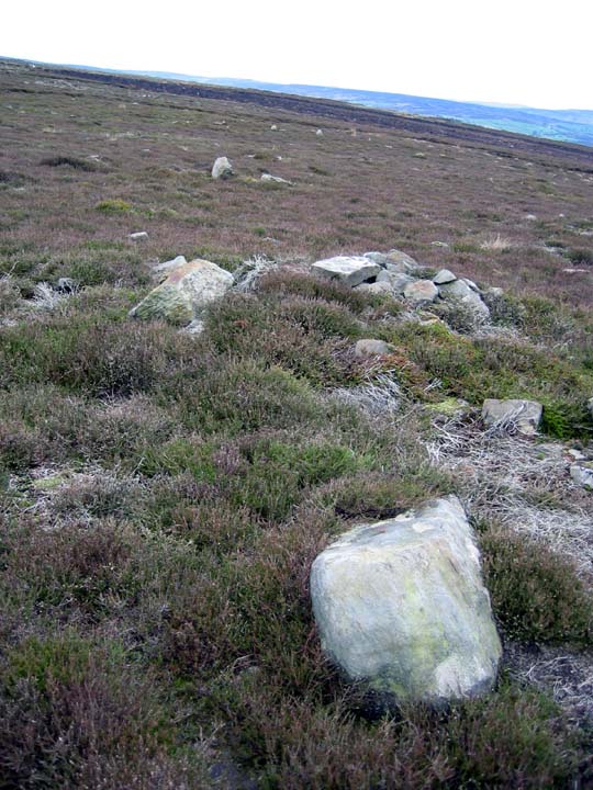
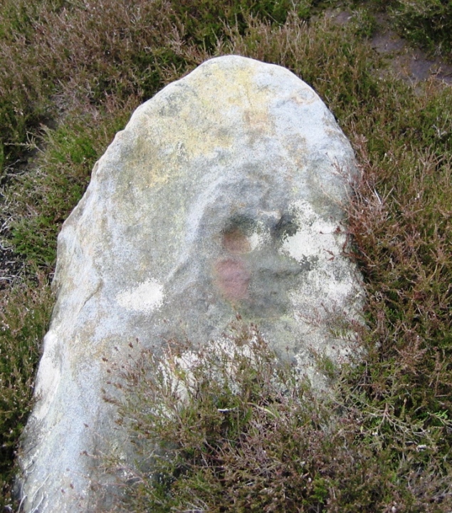
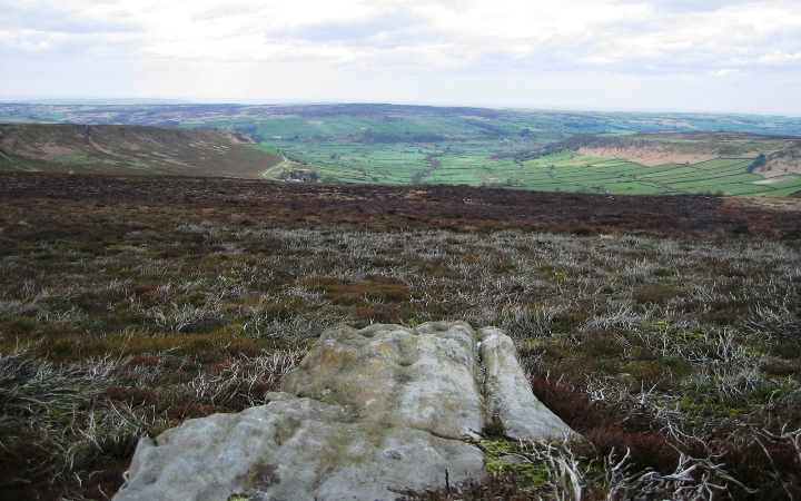
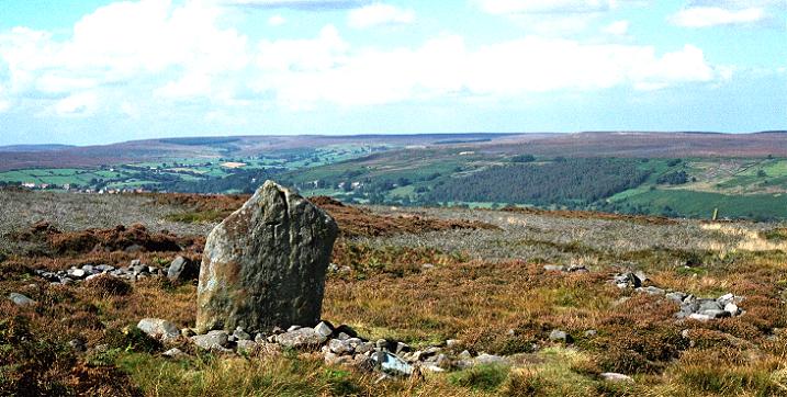
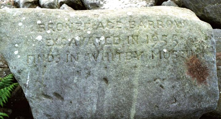
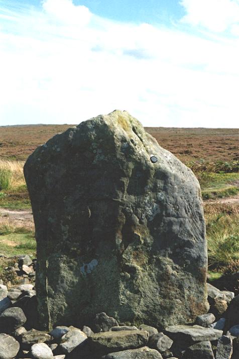
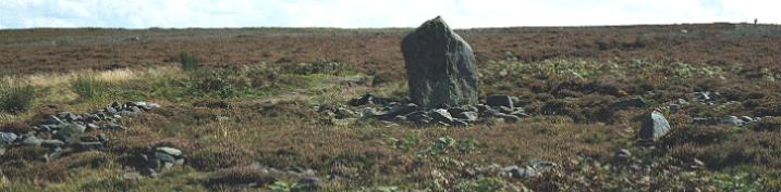
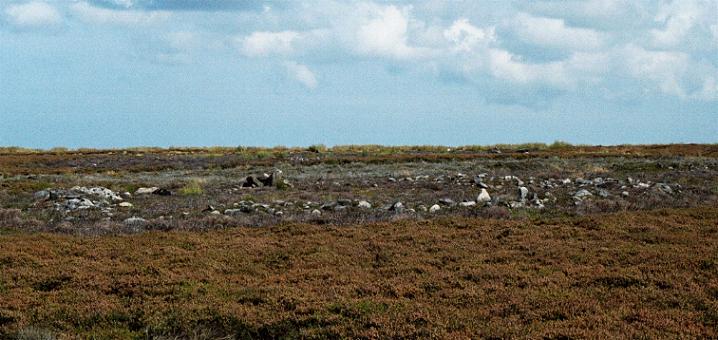
Approaching from Pind Howes to the south (25.4.2010), the first feature seen is the triple dyke, surrounded by neat drystone grouse butts. From there you're walking across an area of open moorland without a huge number of prehistoric monuments, before reaching another, single, dyke to the north. In between the two dykes the OS map shows a "settlement" which I couldn't really see amongst the heather and a cairn, which we did find. The cairn is a low mound, with a visible kerb of large stones. The heather over the cairn has been cleared, but I imagine this would be difficult to find at other times. Heading NE, there is a tall stone next to the trig point (presumably a medieval way-marker rather than anything older) and then the single dyke. After this, the path carries on NE along the edge of the Rigg, where it passes a very large cairn made up of sizeable stones, including one which has been inscribed to record the 1955 excavation. A little way north, a bridleway crosses the path heading NW, taking this leads us across the Rigg to the lovely cairn circle with its impressive standing stone. The stone itself carries some interesting erosion marks from millenia of standing in this exposed spot. There are good views across the Esk Valley to Danby Low Moor. It's an easy stroll from here down off the Rigg to Danby village, which has a pub, the Moors Centre, a train station and is visited by the Moors Bus on Spring Sundays and daily during the summer. Well worth the trip! |
 Posted by thesweetcheat
7th May 2010ce Edited 7th May 2010ce |
| This site is slap bang in the middle of a well-trodden path from Danby village. Drawing from memory, there is one chunky standing stone and what appears to be the remains of an embanked stone circle or ring cairn. The site has obviously suffered much damage and tampering over the years. On a clear day the view is lovely. I will return to photograph the site. |
Posted by Solarboy 15th July 2004ce Edited 16th September 2006ce |
|
For those who don't want to use cars, there is a railway station a short walk away (maybe a mile)at Danby. There is also the Moors Bus, phone 0870 6082608. Public toilets in Danby. You can park your car opposite The Fox and Hounds pub which is a little way down the hill from the start of the bridle path. The bridlepath up from Ainthorpe was in terible condition, a mess of deep ruts and loose stones and the sandstone underneath falling away, this path is in dire need of some conservation work on it, and the motorbikes who passed us on the way up to Danby Rigg are not helping. When we got home our eyes were full off gritty dust. Probably a combination of dry weather, periodic heavy rain, walkers, motorbikes, possibly horses too, and the sandy consistency of the soil. It is a place full of atmosphere and you can hear the sheep and curlews. Many little piles of white grit are here and there beside the path, what are they? There is a stone chair to rest on and some natural springs past the trig point. Watch out for the bogs and adder snakes on Ainthorpe Rigg. Lots for the naturalist to enjoy too. |
Posted by herbwormwood 14th April 2003ce Edited 15th May 2004ce |
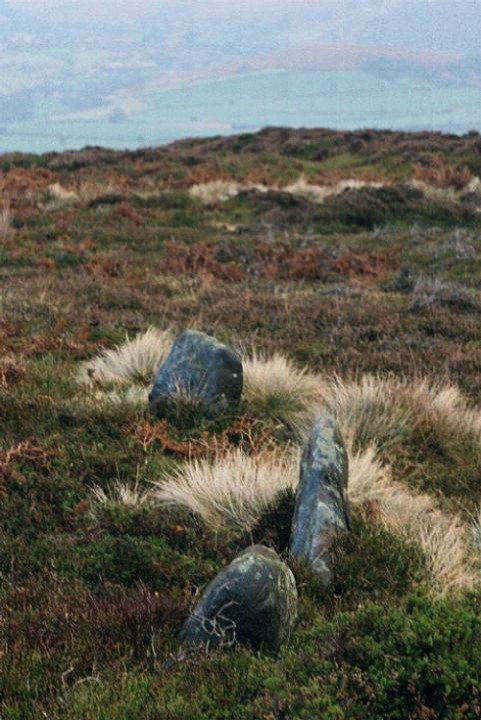
| Yes it was a great day out on Danby Rigg, there is just so much to see. As well as the cemetery, the nut circles and the dykes, there are also old embanked trackways and miriads of standing stones dotted all over the place. A great place to see an entire settlement in one place. |
Posted by moggymiaow 29th November 2002ce |
|
On a recent visit, the eagle-eyed Moggymiaow spotted what could possibly be another circle, (she has a talent for this sort of thing) there are a couple of large-ish stones and a hint of a possible embankment. The circle is amongst the cairn graveyard to the east of the cairn circle/standing stone and is best seen in winter with the heather burned back. It's subtle, so keep your mind opened pilgrim. |
 Posted by fitzcoraldo
28th November 2002ce |
|
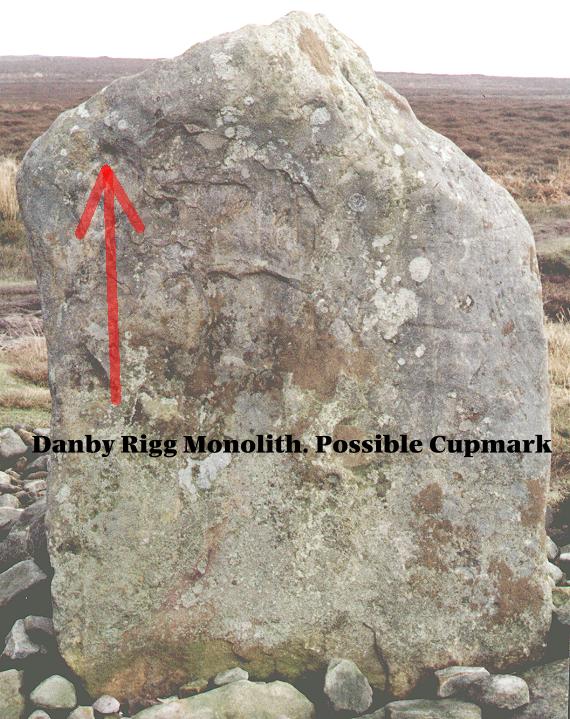
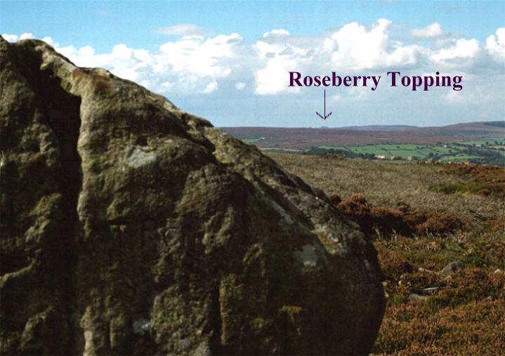
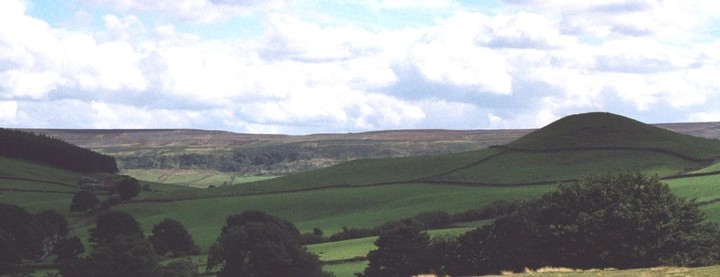
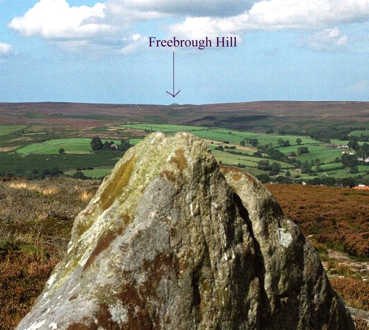
Revisited. A little more meat to add to the bones. The settlement marked on the OS map is a large stone banked circle with a raised bank and ditch. It would have been the foundation for a very large 'hut'*. It is stone walled with a definite entrance marked by large stones. Nearby are other smaller earthworks that could be the remains of hut circles. And the site is defended by large double ditches to the south. The cairn circle is the prize site It is 12m in diameter and contains one large standing stone. One thing I have never noticed about the Rigg before is that the peaks of both Freebrough hill (to the north) and Roseberry Topping ( to the west) are visible poking up over the surrounding moors. The site is overlooked by the areas main mother and father hills. I'm sure this wasn't lost on our ancestors. *19th September 2004 According to Harding & Ostoja-Zagorski's 1994 report, this is a Ring Cairn |
Posted by fitzcoraldo 8th September 2002ce Edited 19th September 2004ce |
|
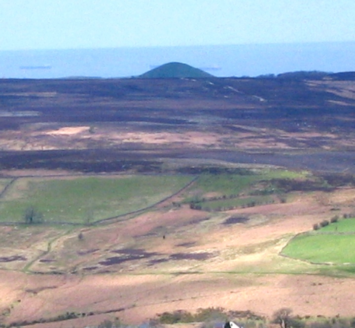
Me and Tess driving over to Danby pass the wonderful Mother Mound, Freebrough Hill (Freyas Hill) once called the Silbury of the North. Down into Danby then up to Ainthorpe, park-up and hike up to the Rigg. Elgee described the northern end of the Rigg as a Beaker burial ground, he wasn't wrong, your tripping over cairns. As we moved through, the mists came down which was exactly what the scene called for. From the cairn field we moved onto a well defined cairn circle with a lovely big standing stone on the edge. Then onto the cross dykes and a large round barrow with a lovely inscribed boulder perched on top stating the date of excavation and where the artifacts may be viewed (Whitby museum). Then we got a bit lost and decided to test our compass skills in the mist, to our suprise everything worked and we found a large hut circle exactly where we thought it would be. Bit more mooching then we dropped down into the wonderfully named Little Fryup Dale and the clement weather. Down to Danby castle which has morphed from a ruined castle to a farmhouse and back to a castle (top abode). Further down the road is the Duck Bridge an 500 year old packhorse bridge. We sat under the bridge like a couple of trolls and ate our lunch listening to the voices eminating from the fast flowing water of the Esk. All in all a top day, top company, top sites. love Fitz |
Posted by fitzcoraldo 16th October 2000ce Edited 3rd November 2009ce |
Folklore |
|
|
"The twin dales of Fryup (Fri-hop = Frigas valley) meet to th south of the elevated oval-shaped barrier which seperates them. The southerly tip of that rising piece of moorland is called Fairy Cross Plain, a name which dates to more than two centuries, and accordingly to local folklore, this used to be the haunt of fairies" Folktales from the North York Moors Peter N. Walker Pub. Hale 1990 |
Posted by fitzcoraldo 8th September 2002ce |
|
A Local saying Cleveland in the clay, Bring two shoes, carry one away. |
Posted by fitzcoraldo 23rd April 2002ce |