|
|

|
|
Acairseid an RubhaPromontory Fort
|
||||||||||||||||||||||||
|
|
|
Images (click to view fullsize) |
|
|
Fieldnotes |
|
|
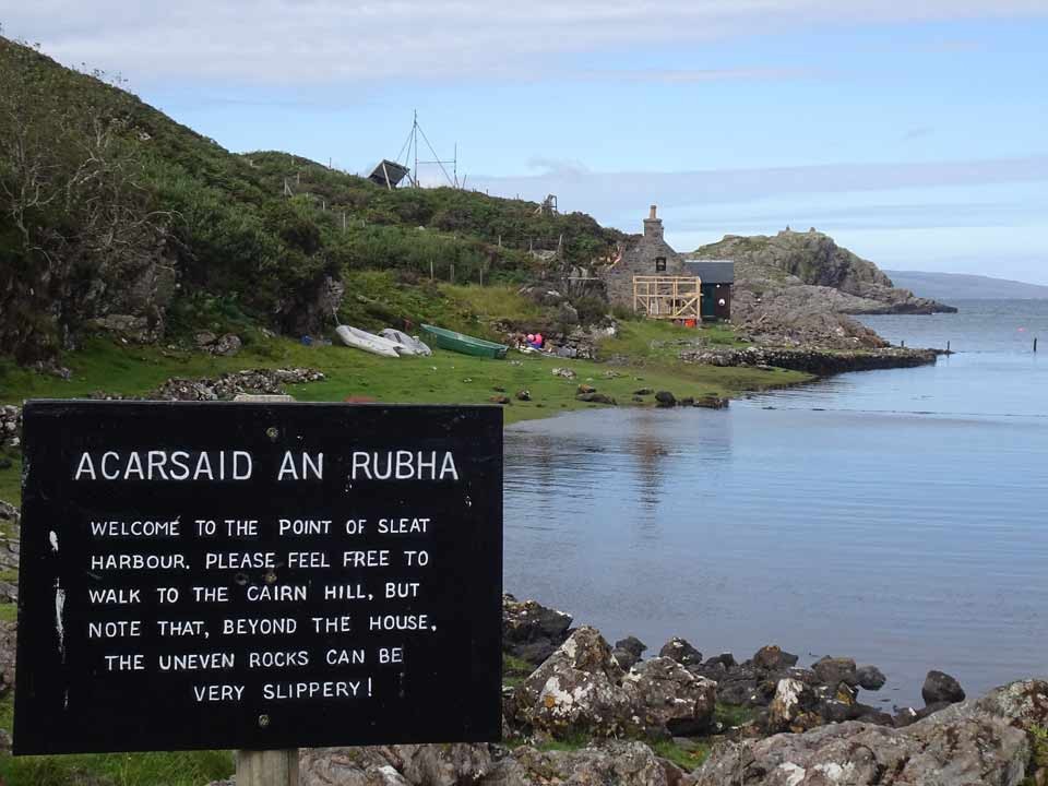
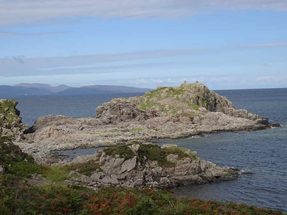
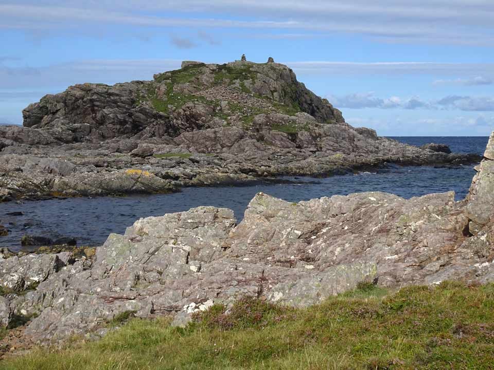
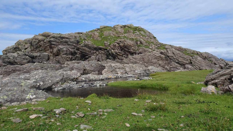
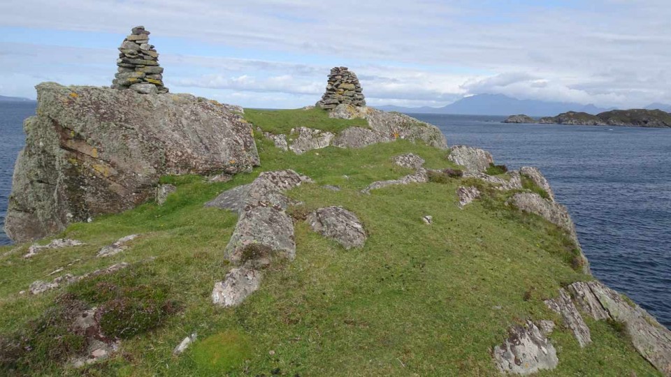
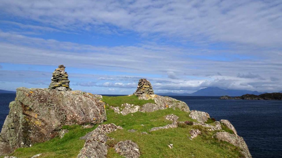
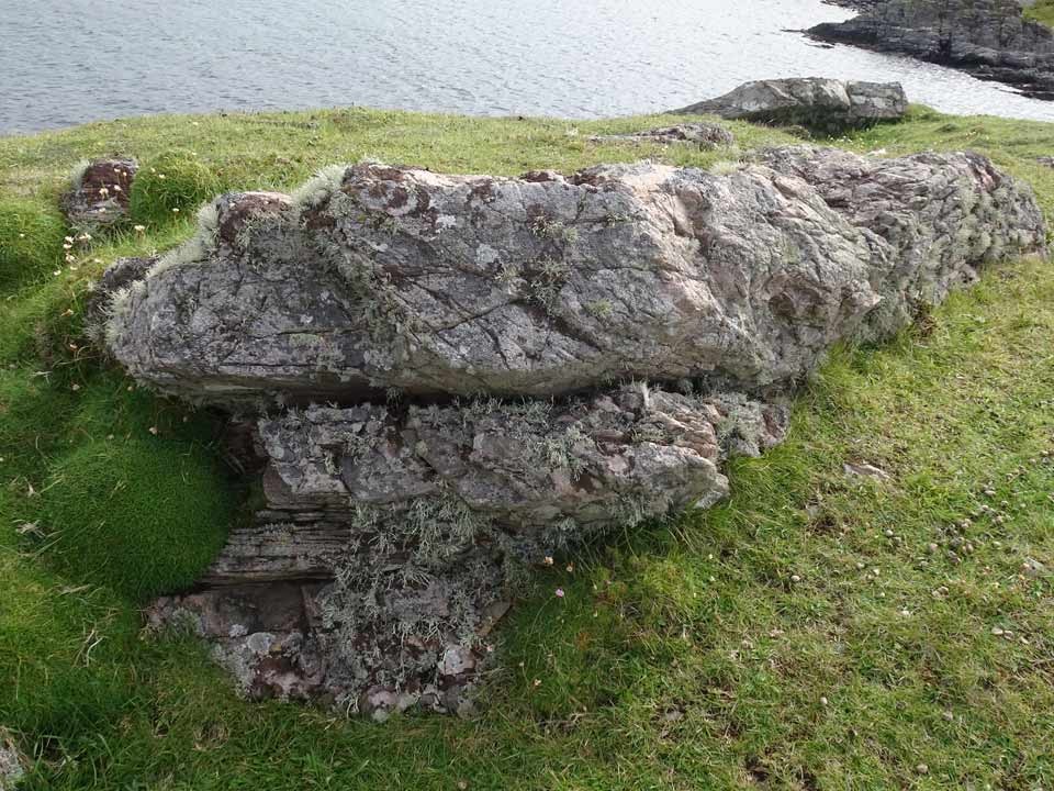
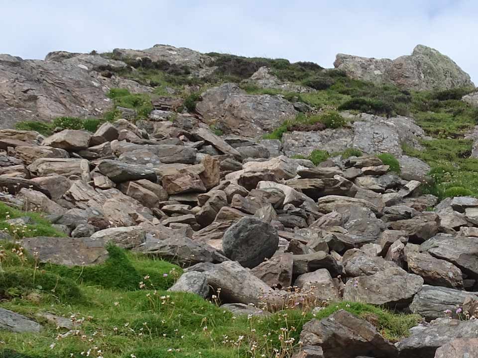
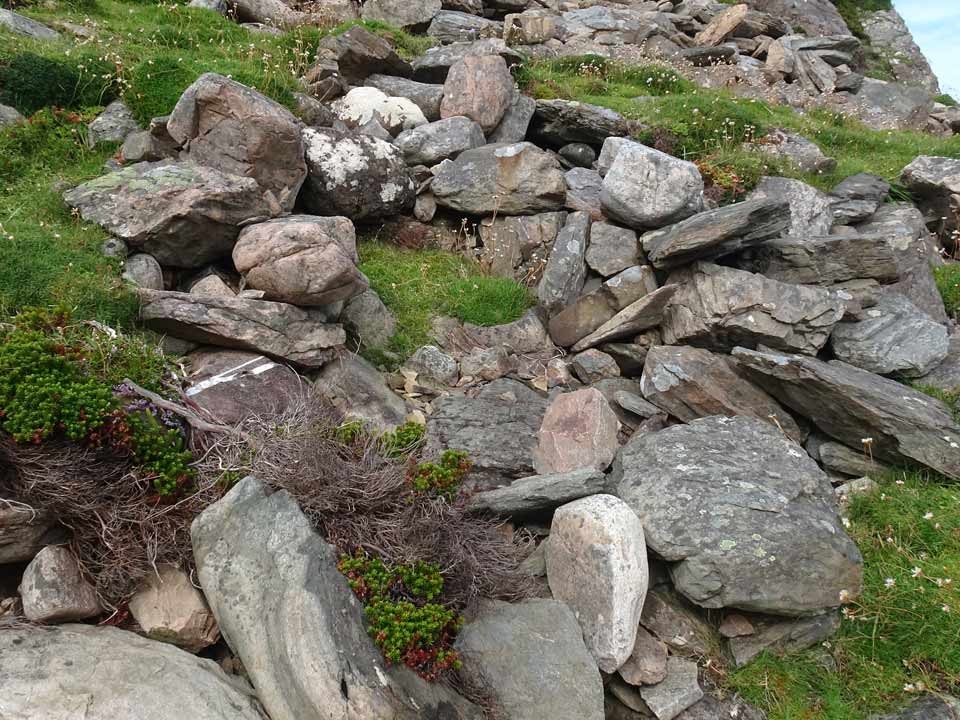
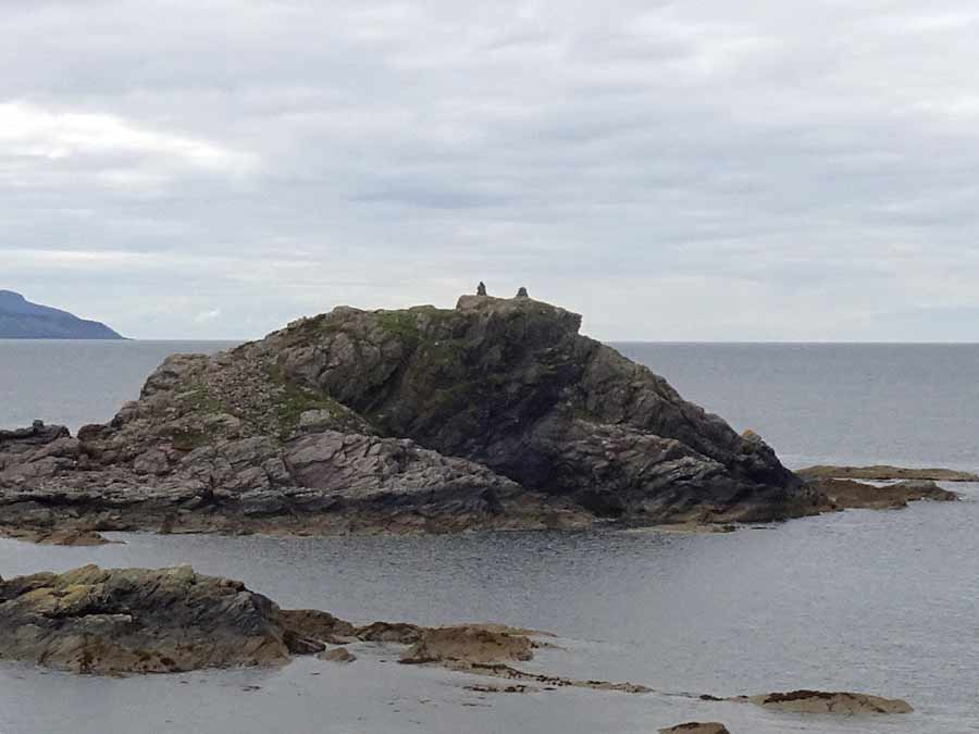
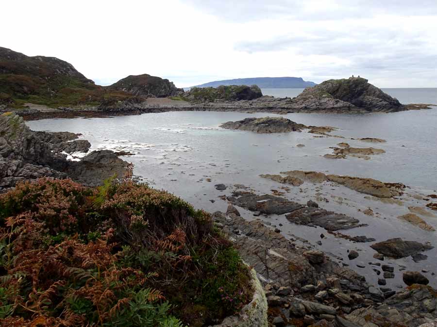
Visited: August 16, 2022 Almost a year on, on a superb sunny morning, I renewed my quest to visit Acairseid an Rubha, which is Gaelic for 'The anchorage of the peninsula'. On the OS map this looks a mere stroll, but in practice attainment of the goal is a pretty hard slog and not a task for the unprepared. The approach starts with an approximately two mile walk in along a good estate road from the car park at Point of Sleat. As you approach the coast the path crosses a stream, and shortly after two tracks head left towards Point of Sleat. Ignore these and continue a little farther till the track passes a cottage before arriving at the beautiful Point of Sleat Harbour. Here a notice warns of a difficult rocky coastline ahead. It looks quite daunting and certainly requires a strong pair of boots and, I suggest, not a little experience of navigating rocky Skye terrain. If you are unsure, do as I did on first approach and ascend the hillside to make a route around this section. I did, however, return by the coastline, and found that by making use of a number of grassy oases within the coastal rocks, it proved less daunting than it had appeared from the other end. Canmore has little to say about this site other than that it is a 'possible dun' and referring you to the website of Historic Environment Record for The Highland Council area, which explains that the site was recorded as recently as 2011 as a possible Iron Age dun from around 550-560 CE, but noting that 'Nothing remains of the structure, but a large amount of fallen stone forms a scree on the east facing slope. The basal stones of an inclined possible access path remain, in one place attaining a height of 3-4 courses of stone. ' After negotiating the coastline, Acairseid an Rubha sits at the extremity of the bay, connected to the mainland by a narrow strip of dry land. From here it is no problem to ascend the ridge that appears to lead to the dun: but it doesn't, and I had to return to near sea level and negotiate more awkward coastal rocks to make my way round to a small beach almost immediately below the headland. From here it was still a steep climb to the summit, where two modern stone cairns, clearly visible from across the bay, stand. The summit of Acairseid an Rubha is grassy and really quite small, and shows no obvious signs of antiquity. On the slope below, the scree on the east side was certainly in evidence, and above it a section of rock that just 'might' have been part of ancient walling. Below the scree was a section that seemed to have a degree of structure, perhaps part of an entranceway. The Acairseid an Rubha headland is undoubtedly a superb lookout point and provides stunning views seaward and towards the Cuillin. But in view of the difficulty of access—I've never had to work so hard to visit any broch or dun previously—would our forbears have actually constructed a small stronghold there? Maybe round the far side there is an easier point of access from the sea, by boat, that makes it a realistic possibility. |
 Posted by LesHamilton
19th August 2022ce Edited 20th August 2022ce |
|
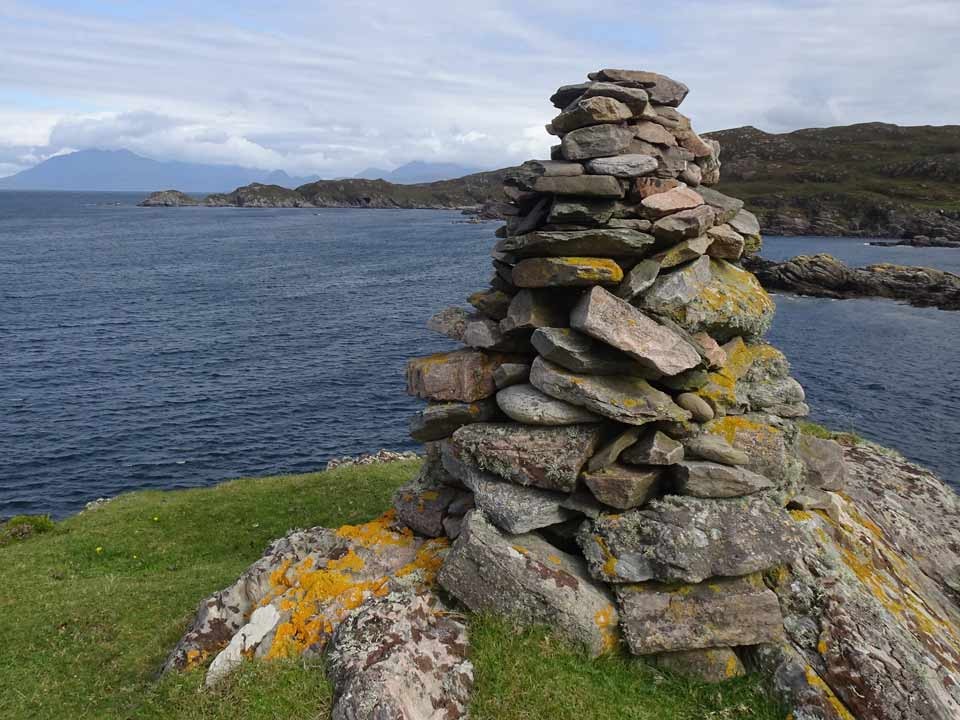
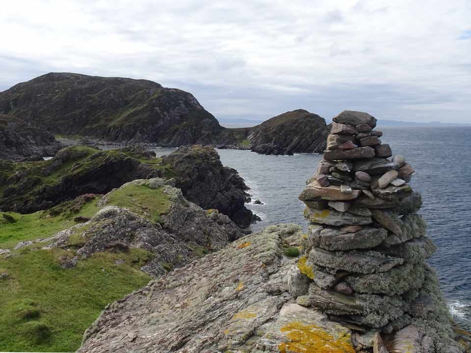
September 12,2021 Rather embarrassingly, on returning from a trip to the Isle of Skye, I discovered on checking the GPS data in my photographs, that I had not in fact visited Acairseid an Rubha promontory fort. I had in fact visited a headland on the opposite (north) side of the bay! Fortunately, I found that two of the coastal scenes I had photographed did in fact include Acairseid an Rubha and they are presented above. Acairseid an Rubha is accessed from the car-park at the end of the A851 from Broadford, where a wide metalled track heads to Point of Sleat. After two kilometres, at the point where the signed path heads sharp left southwards towards Point of Sleat, the track continues towards the west coast. It is now under a kilometre to the fort. As for the fort, I hope to visit it next time I'm on Skye. Very little seems to be known about it, and even Canmore has nothing significant to state other than that it is a "possible dun". |
Posted by LesHamilton 16th September 2021ce Edited 18th September 2021ce |