|
|

|
|
Ivington CampHillfort
|
||||||||||||||||||||||||
|
|
|
Images (click to view fullsize) |
|
|
Fieldnotes |
|
|
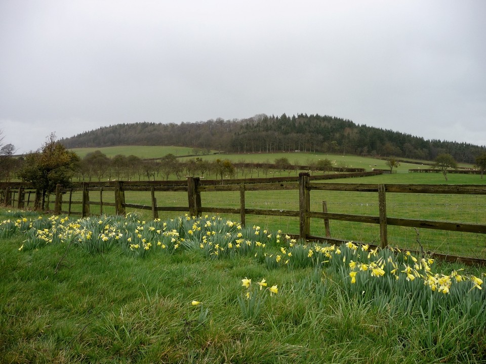
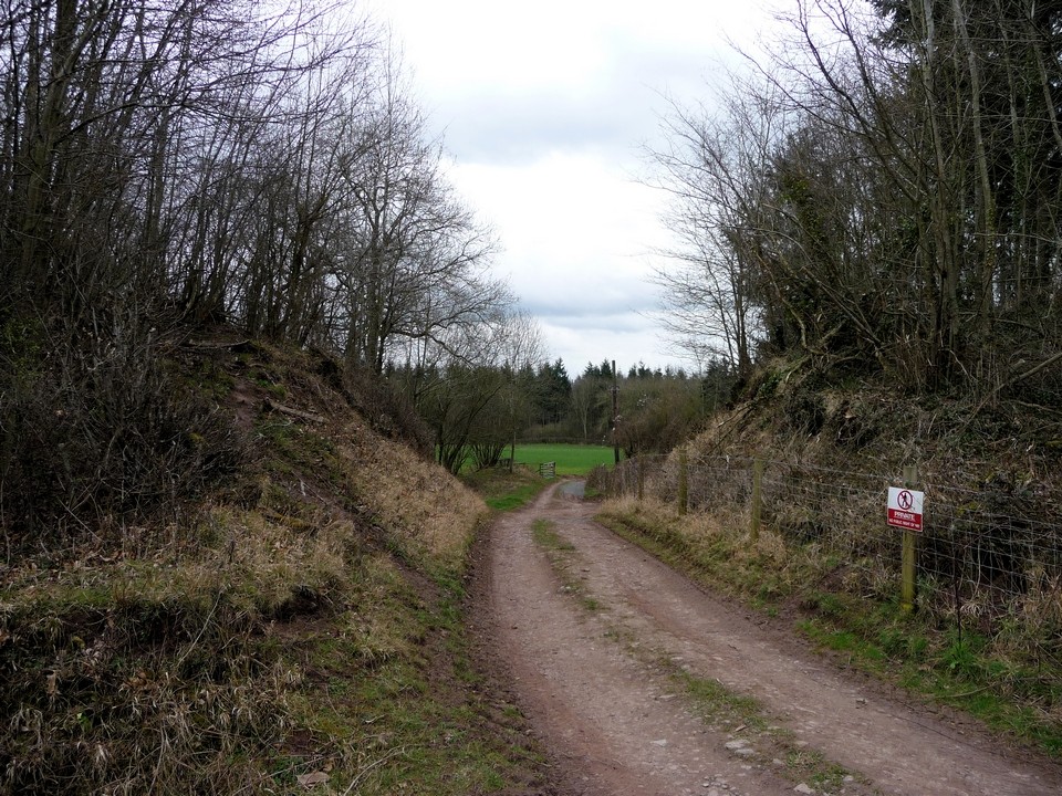
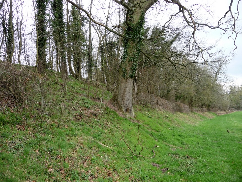
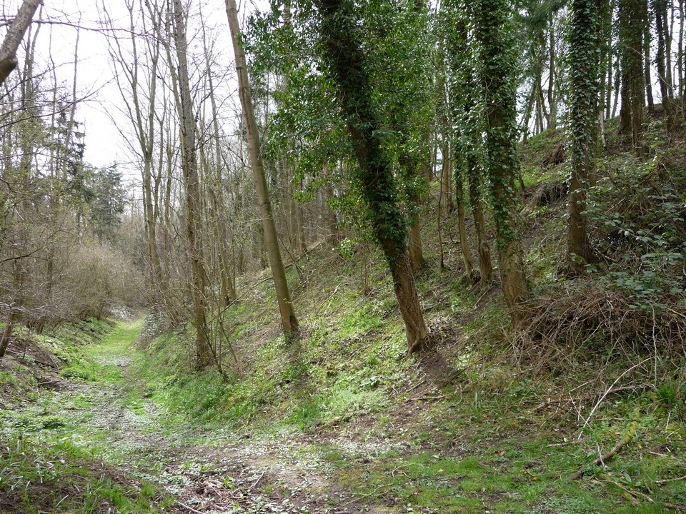
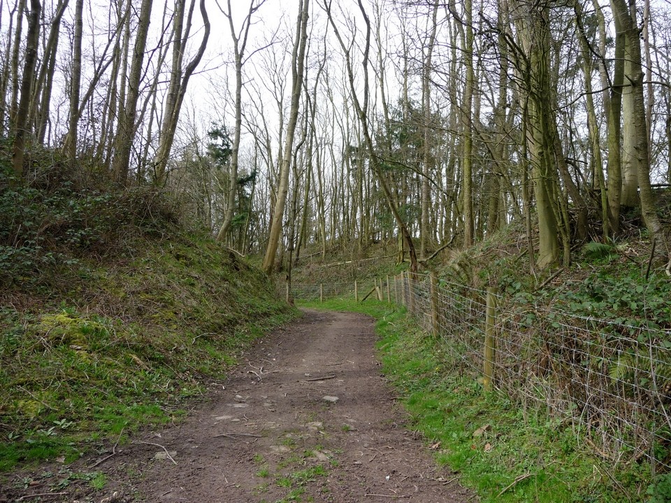
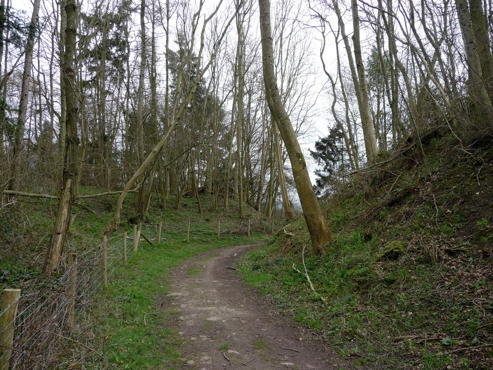
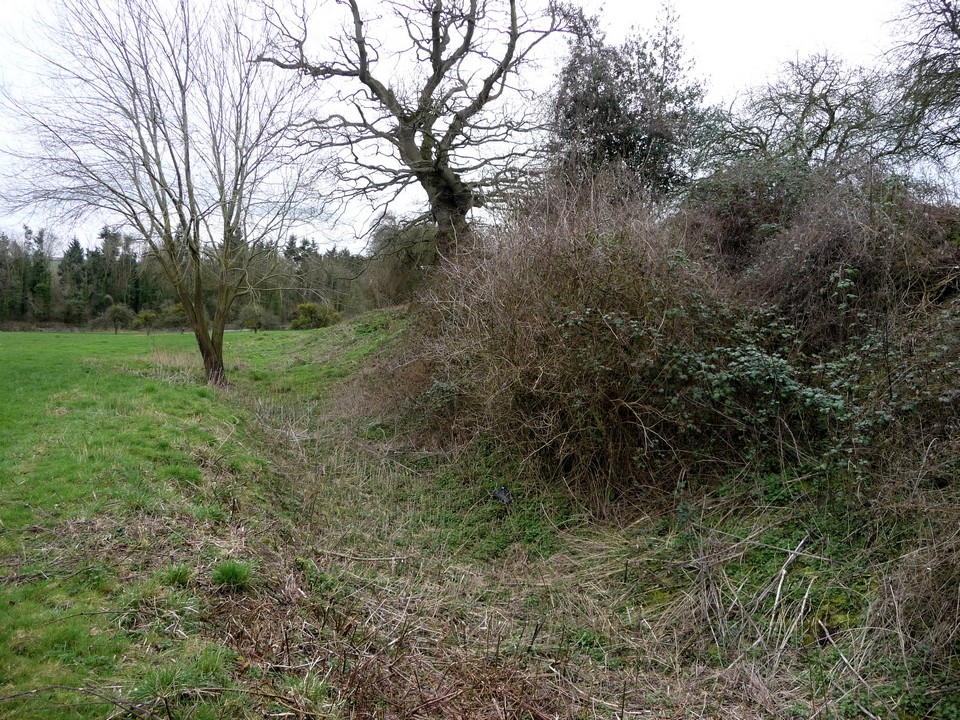
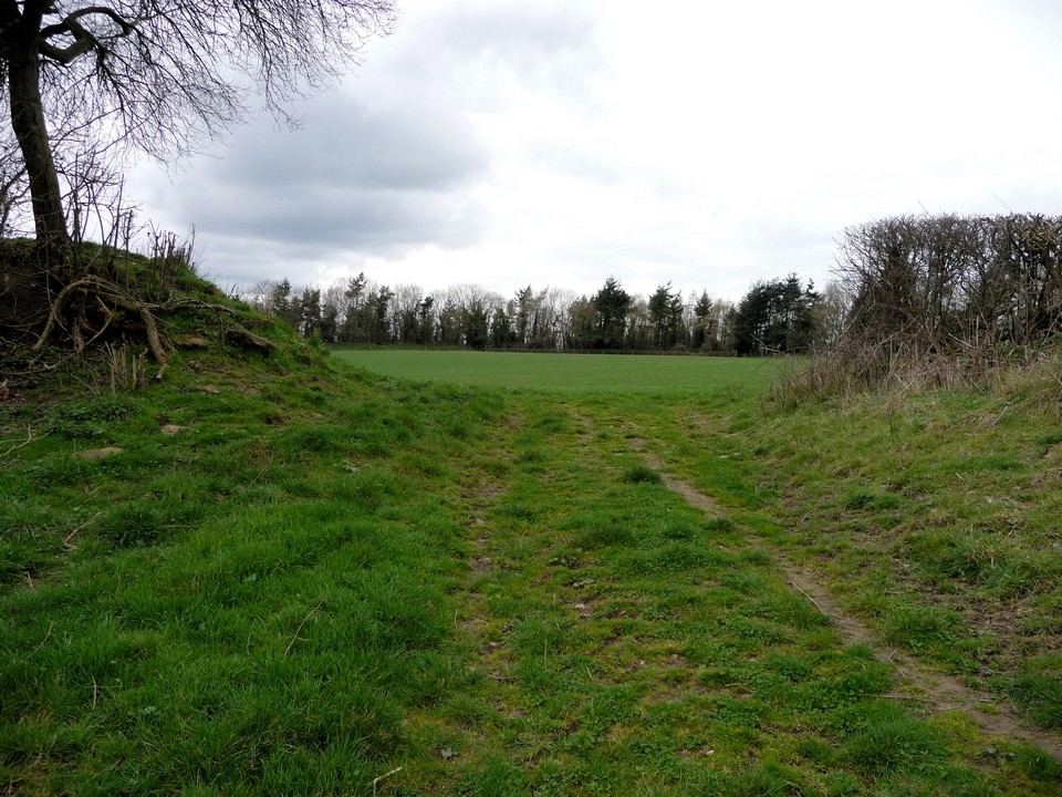
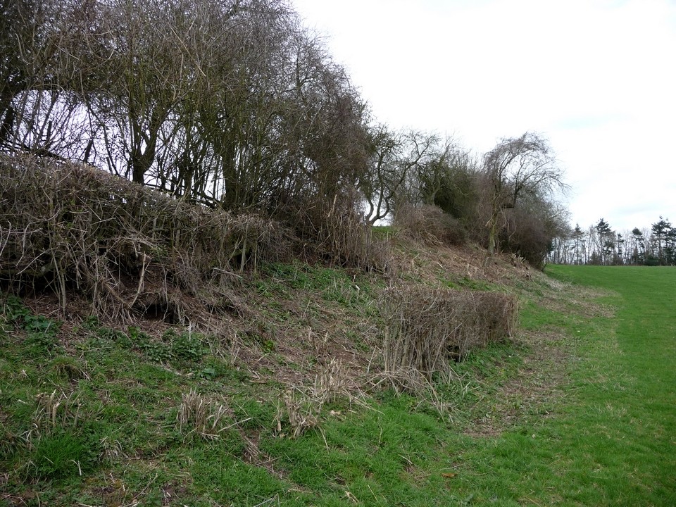
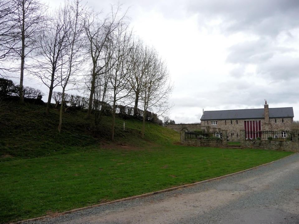
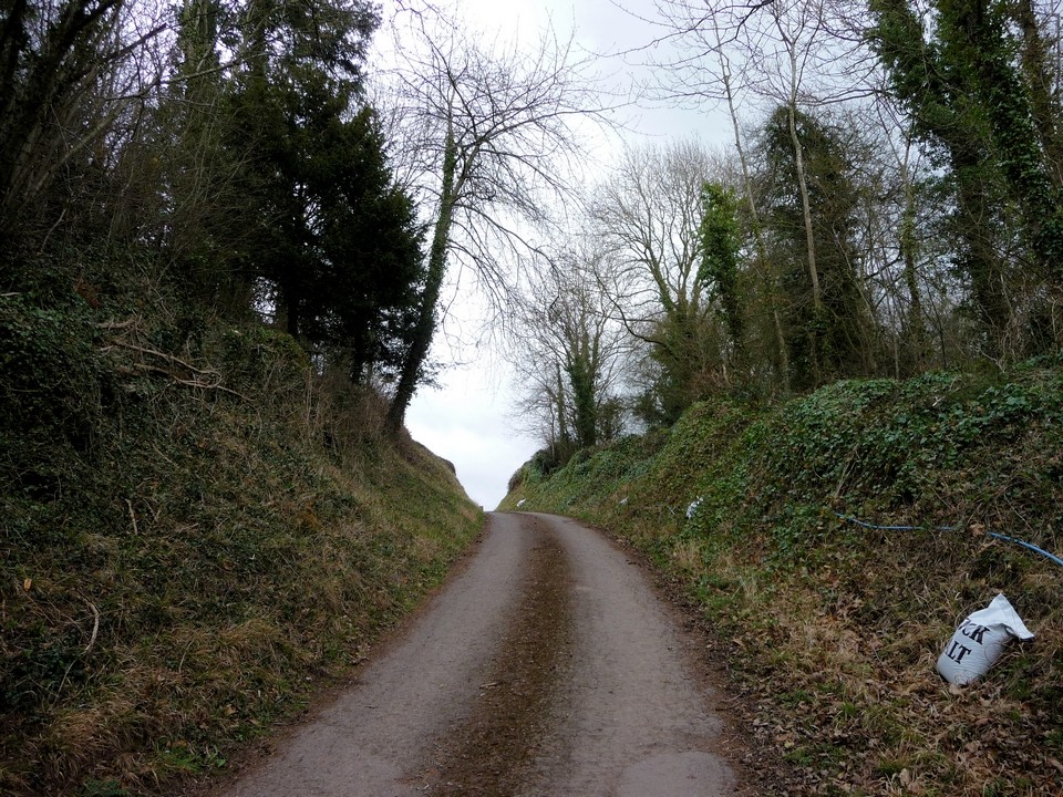
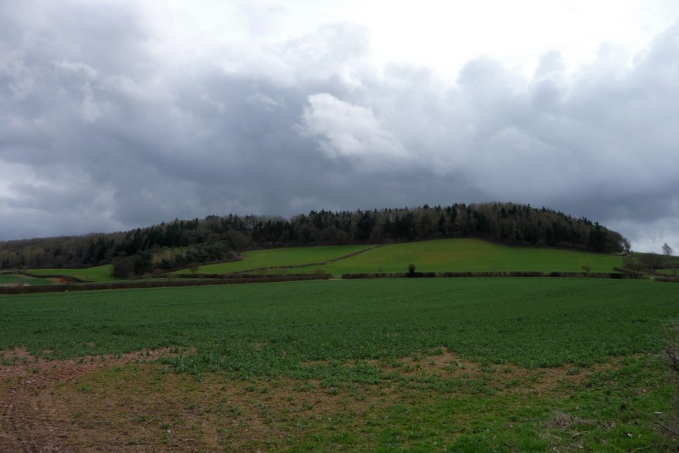
Fieldnotes with a changing heart (17.3.2012). The 501 bus driver obligingly drops me off at the end of the Ivington Park drive, along which a metalled bridleway heads straight up to the fort. I don't really know what to expect from this, a supposedly fine hillfort with a farm in the middle of it. This obviously has the potential to make access a little tricksy. So with some trepidation I head along the bridleway. Past Ivington Park, a couple of farmers are busy rounding up sheep in a nearby field. This approach affords a decent view of the hill, but trees cover the slopes and you can't see the fort. As I get closer, movement in the field immediately below the treeline catches my eye, and I realise I'm looking at a small group of deer, some in full antler. They look over in my direction (I'm a couple of fields away), then languidly turn and head back up into the trees. Coming from this direction, the ground slopes gradually and it's worth pausing to look at the views behind and to the sides. To the northeast, the unmistakeable scarp profile of Titterstone Clee Hill can be seen, with the flatter - but higher - Brown Clee to the left. Over to the WNW, the view is of the hills of the Welsh border and Mid-Wales. I think Wapley Hill may be visible, as is the ridge that Offa's Dyke follows between Presteigne and Kington. Beyond, although it's an overcast day, I can make out the much higher Radnor Forest tops, Black Mixen, Bache Hill and the Whimble. To the north, the highest point is The High Vinnals. Reaching the northwest corner of the trees, I momentarily size up the options for a scoot around the outside of the ramparts, but the fences are very barbed and the vegetation is very dense. Besides which, the right of way is going straight into the fort. I carry on up the bridleway, past a green sign telling me that entry is only permitted on foot and horseback and that there is to be no parking (Carl). Interestingly, a scratched-out part of the sign states "By order of English Heritage". I'm not aware that this fort has ever been in state care so presumably there may have been some kind of stewardship arrangement with the landowner. To my left the hillside slopes steeply under cover of the trees and what appear to be ramparts become visible. There are lots of "no entry" type signs everywhere here. The bridleway, still metalled, now cuts through into the rampart. The banks on either side are steep and formidable, I'm not sure that this was an "orginal" entrance though (looking at plans later suggests not). Once through the banks, the surreally manicured lawns of Carl's fieldnotes come into view. I'd seen aerial photos of the fort which show Camp Farm as a working farm with barns and so on. Now the farm buildings have been turned into rather nice stone-built cottages. But that's not why I'm here and I don't really want to intrude into the domestic scene. Immediately to my left as I enter the fort, another decent rampart curves away past the houses. This was a fort of two very distinct phases, a smaller wedge-shaped promontory fort now inside the northwestern corner of the much larger camp. This bank on my left is the outer bank of the original camp, which I am outside of. Over to my right, the open interior of the later, larger camp stretches away to the trees. The inside of the rampart is clear to see and well-preserved, showing a decent amount of counterscarping. The bridleway however follows the metalled driveway of the houses and I follow this round, feeling somewhat under scrutiny from the blank eyes of the house windows. Past the houses, the bridleway continues alongside the rampart of the earlier fort. A hedge has been planted on its top. At this point, I'm feeling quietly irked. I could go and ask at the houses for permission to explore more thoroughly, but something in my nature would prefer to miss out than have to ask. Typical bloody-minded Englishman probably. So I stick to the bridleway as it follows the rampart around. A gateway (possibly the original access) offers a sight of the grassy interior of the earlier fort. At length I reach the northern edge of the fort. Here a choice of routes awaits. A footpath heads through the rampart before dropping away down the northern slopes, while the bridleway follows the northern rampart to the northeastern corner of the fort. I haven't entirely decided on my route away from the fort yet, so I start off by going through a gate onto the footpath. The gap here is another non-original access and reveals the steep slopes of the hill, as well as showing the stone-construction of the bank. There are more signs on either side indicating that there is no access but in any case the slopes are heavily overgrown and the ramparts not at all easy to see. I elect to return to the interior and take the bridleway, which passes some old quarry pits and then follows the inside of the northern rampart. The rampart itself is fenced off as a nature reserve. Arriving at the northeastern corner, it's clear that I've found the original entrance at last. Impressive inturned banks flank a curving passageway, which the bridleway follows. This is the most impressive accessible bit of the fort. Passing through the banks reveals a deep ditch, with another lower bank thrown up on its outer side. The Malvern Hills come into view in the distance. It appears that a path runs south along the ditch, but again a number of signs indicate that this is not accessible. At this point, shooting starts up somewhere in the woods close by, just to reinforce the point. I hope it's not the deer that are copping for it. However, reaching the northeast corner changed my view of this site rather. As well as the bridleway sign, a small white sign stating "permissive path" indicates that it is actually possible to walk all the way around the inside of the later fort. There's even a bench, which I take in the spirit in which it's presented and stop for my lunch. Although the shooting goes on, somewhat reducing the ambience! Unobtrusive signs mark the permissive way around the inside of the rampart, allowing a good view of the counterscarping. Another access into the fort opens in the southeast side, possibly original but not entirely obvious. As I make my way back to the northwest, to rejoin the bridleway, noise overhead makes me look upward, to see the brilliant sight of five buzzards and a single red kite, all wheeling above me. Sadly at this point it starts to rain, but I've come to appreciate this fort much more than I expected. The permissive path is a real breath of fresh air, after all this is essentially someone's garden (albeit the fort was here first!). So even the rain taking a turn for the heavy, just as I leave the cover of the trees and take a footpath across fields south-westwards, can't detract from the experience. There are some minor whines of course, not least that it would have been nice to see the impressive eastern bank and ditch from the outside. But a word at the houses might allow that too (possibly not while there's shooting going on though). The footpath emerges onto another bridleway north of Gattertop, where another good general view of the hill can be had. A fine fort, well worth a visit (on foot or horseback, naturally). |
 Posted by thesweetcheat
21st March 2012ce Edited 21st March 2012ce |
|
'Visited' 3.9.11 Situated to the south of Leominster, off a minor road from the B4361 This was a bit of a strange one! What looked like a straightforward visit to a Hillfort turned out to be nothing of the sort. We drove north through the hamlet of Upper Hill and then turned right along the (private?) road leading to Gattertop Farm. There was then a turning on the left leading up towards the Hillfort. This was when the fun began. The lane was little more than the width of the car and we soon approached a formidable large double gate which was clearly sending out the message of 'keep away – private'. This was confirmed by a number of 'private property' / 'no parking' / 'access only to paths by foot or horseback' signs along the road! Unfortunately there was nowhere to turn around so I contemplated having to reverse all the way back down the hill. At this point Karen got 'twitchy' and pointed to what looked like a camera pointed at us. Then the gates suddenly opened – it was a sensor not a camera. I thought 'sod it' and decided to chance my arm to carried on driving forward – Karen was not impressed. We drove up through the western defences and a ditch/ramparts approximately 3 metres high was clearly visible either side of the road. Once we arrived near the very posh house we were in the centre of the Hillfort. Now, I am sure that most of us have visited a Hillfort where the centre of the site is a large grass field. In this case it was a large 'bowling green' type lawn – complete with golf buggies to get around!! The bank of the Hillfort surrounded the 'lawn' and the whole circumference was covered in trees. Fancy living inside a Hillfort – how cool is that?!! I must admit that at this point I started to get 'twitchy' as well and decided that discretion was the better part of valour and turned around and headed back down the hill. Then we approached the now closed gates! I had visions of having to walk up the house to ask to be let out – and all the explaining that would involve. Luckily the sensor worked this side as well and the gates swung open – phew! We were soon back on a public road and could at last relax. Looking at the O/S map the safest way to visit would be via the public footpath from Ivington Park. This looks as though you would be able to see the western defences although everything else looks to be private. Good luck! |
Posted by CARL 5th September 2011ce |
Miscellaneous |
|
|
From "Hereforshire Register of Countryside Treasures" (1981) H&W CC: "Area within mainly natural contour defences of this early Iron-Age fort is about 24 acres, and, with outworks, camp covers about 48 acres, but over the years has suffered from ploughing and quarrying. Original entrances are at SE and NE ends. Apart from double ramparts, a very substantial inner one rises about 20ft above the enclosure in one place. Unusual feature is berm forming walkway along much of its length. This is one of the most impressive hillforts in the County." Access to the fort is via bridleways running from Ivington (to the NW) or Brierly (to the NE). |
Posted by thesweetcheat 21st January 2009ce |