|
|

|
|
Vespasian's Camp and Blick MeadHillfort
|
||||||||||||||||||||||||
|
|
|
News |
|
Ancient platform 'damaged' during Stonehenge tunnel workArchaeologists have accused Highways England of accidentally drilling a large hole through a 6,000-year-old structure near Stonehenge during preparatory work for a tunnel... continues... |
 Posted by moss
7th December 2018ce |
Mesolithic dog on long walk from Yorkshire?https://www.theguardian... continues... |
 Posted by Rhiannon
7th October 2016ce |
Groundbreaking finds by Stonehenge teamUpdate for 2014. Pre-history may have to be re-written following a recent dig by university students near Stonehenge. Signs of human habitation 8,000 years ago have been discovered by Archaeology MA students from the University of Buckingham, led by senior research fellow David Jacques... continues... |
Posted by moss 1st November 2014ce |
|
Settlement near Stonehenge dates back to 7500BC Bravo! Great work by David Jacques and his team. http://www.bbc.co.uk/news/uk-england-wiltshire-22183130 http://www.telegraph.co.uk/history/10004598/Stonehenge-occupied-5000-years-earlier-than-previously-thought.html |
 Posted by tjj
19th April 2013ce Edited 19th April 2013ce |
|
Mesolithic camp sheds light on the origins of Stonehenge This article appeared in last Saturday's edition of The Times under the heading "Discovery of Mesolithic camp sheds light on the origins of Stonehenge". It relates to the exhibition held at Amesbury earlier in the year on the finds and work around Blick Mead. http://www.sis-group.org.uk/news/stonehenge-mesolithic.htm (Source: "Current Archaeology" No 271:28-33) |
Posted by tjj 20th September 2012ce Edited 20th September 2012ce |
Archaeology project in AmesburyWHILE internationally-sponsored archaeological work at Stonehenge and Durrington Walls has seized the public interest, Amesbury's very own project has unobtrusively continued just a short distance away... continues... |
Posted by moss 4th January 2009ce |
Images (click to view fullsize) |
|
Photographs: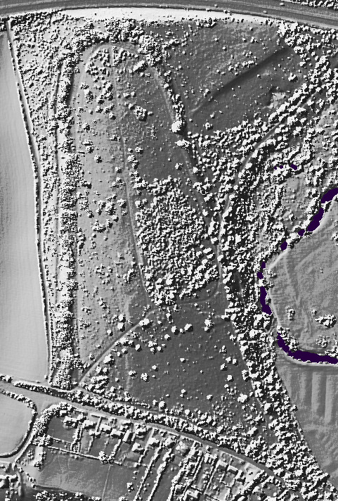


 Maps / Plans / Diagrams:
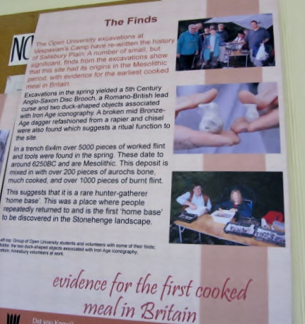
 Artistic / Interpretive:
|
Fieldnotes |
|
|
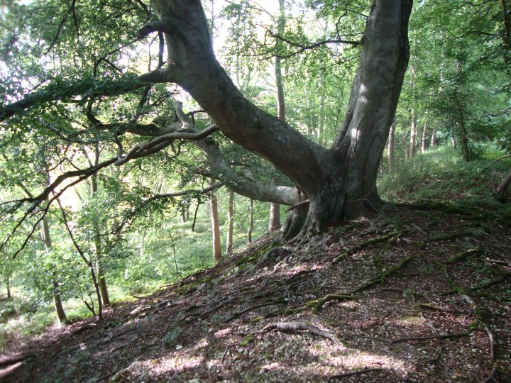
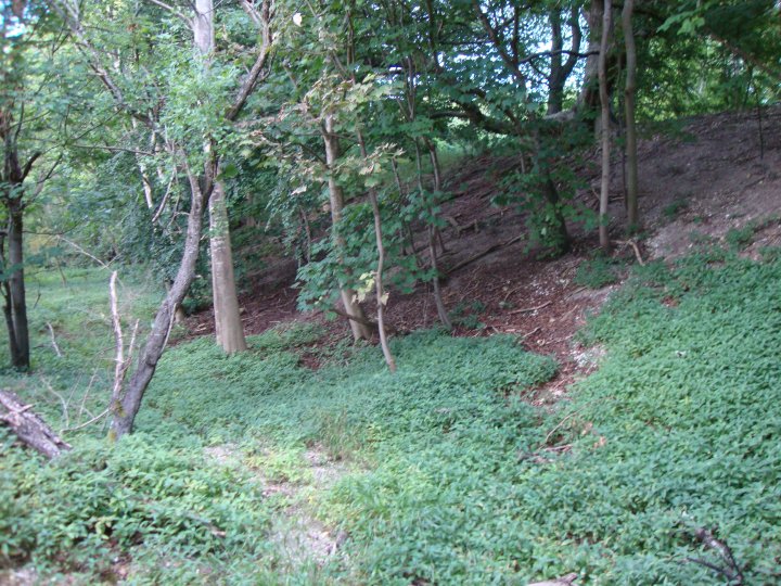
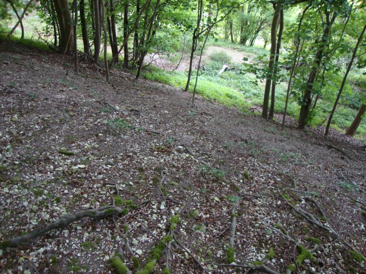
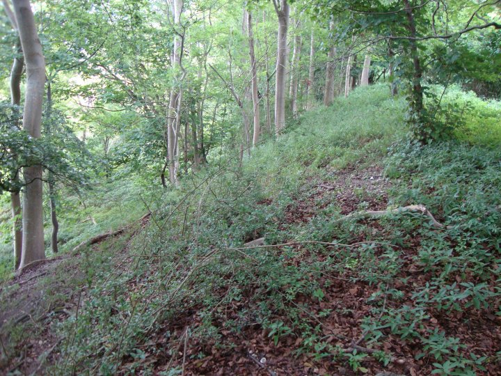
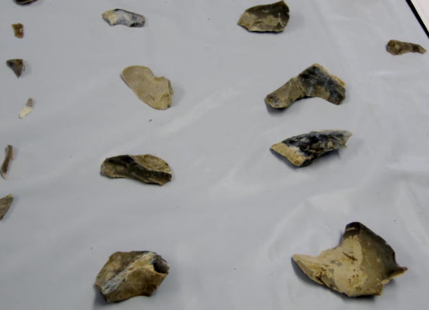
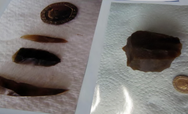
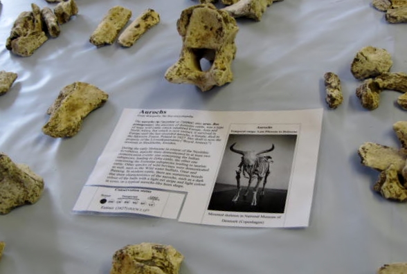
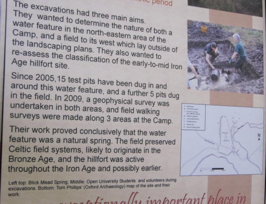
Not possible to visit this site as I was told it is on "very private property." Today (yesterday now) I made the long bus journey to Amesbury - really worth the effort. The small exhibition in what appears to be an old scout hut grandly called Mellor Hall really captured my imagination. Lots of exhibits of flint arrow heads and auroch bones which have been found at Vespasian's Camp, also at the nearby site of a spring known as Blick Mead. Vespasian's Camp is located 1.5km between Stonehenge and Durrington Walls. It overlooks the Avenue and Bluestonehenge on its western side and the river Avon to the south and east. Excavations on what was thought to be an Iron Age hillfort reveal the site is much older than previously thought. The finds date back to the Mesolithic period making it 8000 years old; 10,000 pieces of flint and bone have been found. It had previously been dismissed by archaeologists as is in the grounds of Amesbury Abbey which were subject to extensive landscaping in the 18th century. However, David Jacques, Open University students and volunteers undertook small scale field work between 2005-2011. Blick Mead is a small open basin next to Amesbury Park and immediately south of the southern carriage way of the A303. There is a shallow water course running from it which is currently dry and an artificial drain which would take the water down to the river Avon in wetter conditions. Geologist, Peter Hoare, gave a short, very interesting talk about spring sapping and the effect of water tables rising and falling. He also reported that some dumping of materials had taken place during the building of the A303 which accounted for a layer of clay and flint below the chalk bed rock. |
Posted by tjj 9th April 2012ce Edited 9th April 2012ce |
Miscellaneous |
|
|
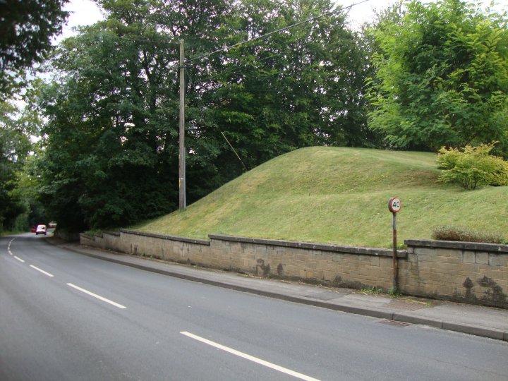
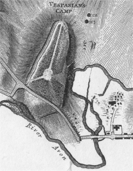
Details of site on Pastscape A univallate hillfort of probable Iron Age date, enclosing an area of circa 15 hectares situated on the southern end of a narrow spur within a meander of the River Avon. The hillfort has an entrance to the north and another probable entrance in the south. Road widening in 1964 showed the rampart to have two phases of construction, with pottery recovered from both phases (the first phase was associated with sherds described as Iron Age "A/B", the second with Iron Age "C"). The rampart survives to a maximum height of 2 metres on the west, north and south-east sides. Elsewhere it is present as a scarp with no surmounting bank. Part of the eastern rampart has been modified by 18th century landscaping, and a grotto (SU 14 SW 217) is incorporated within it. The interior was also landscaped during the 18th century when the hillfort was incorporated within the park of Amesbury House (SU 14 SW 261). The southernmost part of the hillfort is separated from the remainder by Stonehenge Road and has been built on. |
 Posted by Chance
22nd September 2012ce Edited 23rd September 2012ce |
The camp at Amesbury called Vespasian's CampThe camp near Amesbury, between Stonehenge and the town, upon elevated ground, was, according to Stukeley, commonly called Vespasian's, and he endorses the name. It is locally known as "the ramparts". Sir R. Hoare considers that this was originally the stronghold of those numerous Britons who inhabited the plains around Stonehenge, an asylum in times of danger, for their wives, children, and cattle; and that like other camps of the same kind, it was occupied, as occasion or necessity required, by Romans, Saxons, and Danes. Stonehenge and its Barrows by William Long, Esq., M.A., F.S.A. 1876 |
Posted by Chance 10th June 2010ce |
|
It seems curious that this large site so close to Stonehenge had not been already added to TMA? I guess it's fairly incognito. But the scheduled monument record on Magic says Vespasian's Camp is the only Iron Age fortification in the Stonehenge area. They call it 'an outstanding example of its type' (ie a univallate hillfort) - probably because it's not been disturbed much. It was even fashionably incorporated into the grounds of the local big house in the 18th century, so it has got a few tracks across it. It's wooded now. There are older barrows inside its banks, that the later inhabitants must have deliberately preserved (or ignored). The bank on the west (Stonehenge) side is huge, at 6.5m from the bottom of the ditch. Look on the map and you'll see how the fort on its hill nestles nicely in the 'neck' of a meander of the River Avon. The main road runs immediately to the north (where one of the entrances was) so if you've been to Stonehenge you may have seen the fort even if you didn't realise it was there. I don't think you can see the stones from the fort though. Might be wrong. Why it should be attributed to Vespasian particularly is anyone's guess. The Stonehenge World Heritage Site website says that it was William Camden, in Elizabethan times, "that gave the hillfort its rather romantic name." Romantic?? Perhaps that's just a euphemism. http://www.english-heritage.org.uk/stonehengeinteractivemap/sites/vespasians_camp/01.html (this web site also has some tiny maps / photos). |
Posted by Rhiannon 18th January 2008ce Edited 24th March 2008ce |
Links |
|
Live ScienceWild Auroch hunting near the site of Stonehenge. |
Posted by tjj 25th April 2013ce Edited 25th April 2013ce |
Vespasian’s Camp: Cradle of StonehengeCurrent Archaeology magazines article on the whole dig which started in 2005; Thanks to Digital Digging for the link, which is a fascinating read and mentions springs. |
Posted by moss 19th April 2013ce |