


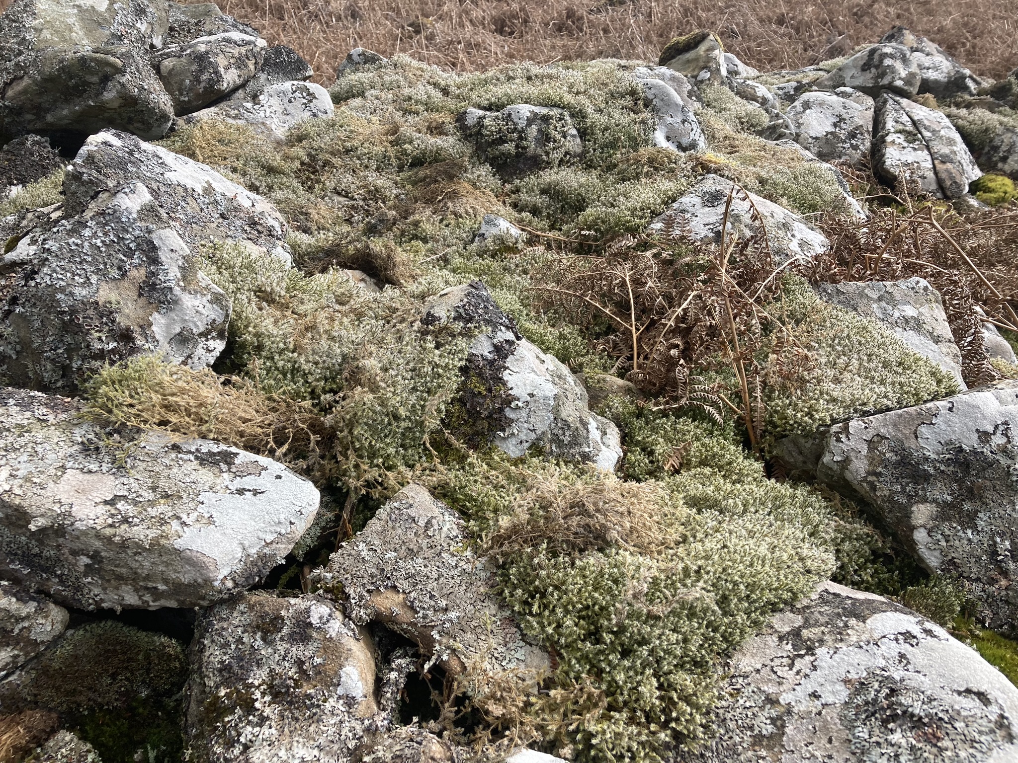
Carpet of Moss on N Arc of Craignarget Hill Cairn.

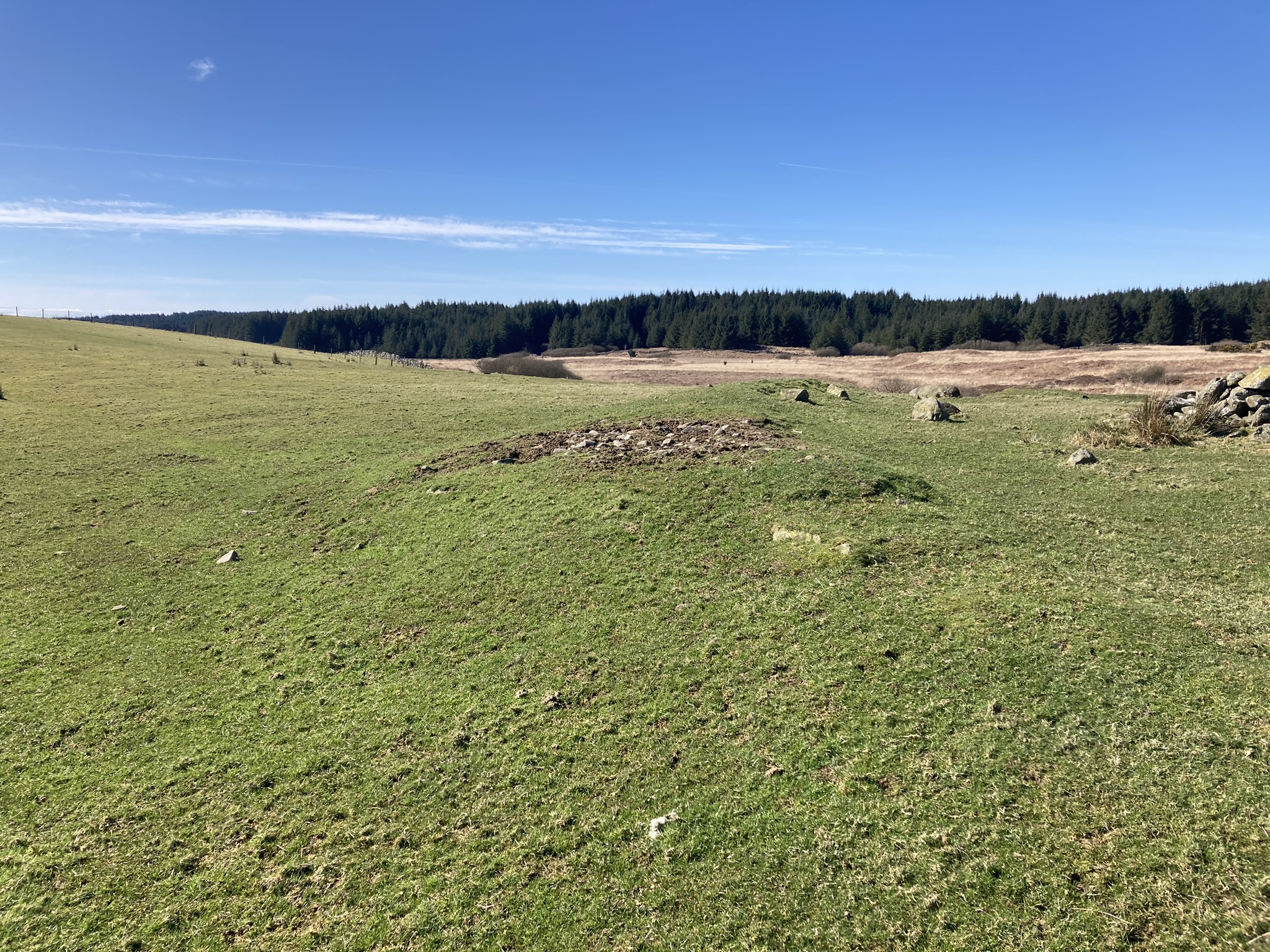
Excavated Centre of Craignarget Hill Cairn viewed from S.
Visited 02.04.23
Craignarget Hill Cairn is a stony cairn on the S slope of Craignarget Hill c. 5 miles SE of Glenluce in Dumfries and Galloway It is situated 0.4 miles of the Rocks of the Garheugh (pronounced Garchy locally) on Luce Bay.
The cairn measures c. 10 yards in diameter reaching up to c. 5 feet high in the undisturbed N Arc. There is a carpet of moss on the N & E Arcs. The S half of the cairn has been extensively robbed leaving a hollow in the centre of the mound.
Canmore ID 62200 has further details of Craignarget Hill Cairn.

Tinnis Hill viewed from Windy Edge Long Cairn.


Low remains of S Arc of Outer Enclosure surrounding Tinnis Hill Summit Cairn.

Tinnis Hill Summit Cairn topped with a Stone Shelter & Trig Point viewed from S.

Tinnis Hill Summit Cairn topped with a Stone Shelter & Trig Point viewed from S.

Exposed Rubble of Stones on Tinnis Hill Summit Cairn.

Tinnis Hill Summit Cairn topped with a Stone Shelter & Trig Point viewed from E.
Visited 26.05.12
Tinnis Hill Summit Cairn is located c. 4.25 miles ENE of Langholm. The round cairn lies 0.25 miles E of the Scottish Borders/Dumfries and Galloway border. There is an oval grass mound on the summit of Tinnis Hill. There are low remains of a stone wall enclosure at the base of the mound. On the N & S Axis the wall is c. 40 yards from the summit and c. 25 yards from the summit on the E-W Axis. The cairn was constructed on the centre of the mound. It has been greatly reduced over the centuries to a low grassy mound measuring c. 20 yards in diameter and 2 feet high, according to Canmore ID 67879. A trig point has been erected on the E edge of the cairn. A horseshoe-shaped stone shelter up to c. 4 feet high surrounds the trig point on the N,S & W Arcs.
When visiting this isolated site it is worthwile extending your route 1 mile S to visit Windy Edge Long Cairn and Windy Edge Stone Circle sites in Dumfries and Galloway.


Field Clearance Stones on N Arc of High Gillespie Cairn.

Possible Capstone on NE Arc of High Gillespie Cairn.

Recent Excavation on E Arc of High Gillespie Cairn.

Badger’s Sett on E Arc of High Gillespie Cairn.

Exposed Cist in S Quadrant of High Gillespie Cairn viewed from N.

Centre of High Gillespie Cairn viewed from W.
High Gillespie Cairn is a ruined grassy mound located in pasture land c. 4 miles SE of Glenluce in Dumfries and Galloway. The surface of the sub-circular cairn has been smothered by gorse bushes. Field clearance stones have been dumped on the N perimeter of the cairn. The current mound measures c. 110 feet in diameter and 5 feet high on a summit plateau.
Canmore ID 62207 states that High Gillespie Cairn had a facade on the E Arc with 5 visible stones. There are no signs of a facade and visible stones in the E arc today. In fact there is evidence of recent excavation on the E Arc. This may be related to a badgers sett dug into the E perimeter of the mound.
Canmore ID 62207 also states that the main axis of the cairn was ENE-WSW, with at least 6 chambers constructed therein. This is difficult to confirm given the ruinous state of the cairn. I located a possible square capstone, measuring c. 4 x 4 x 1 feet, on a collapsed cist on the NE Arc and an exposed cist, measuring c. 5 x 3 x 3 feet on the S Quadrant. The S cist consists of a buried N end slab, an E slab measuring c. 5 x 3 x 1 feet, a missing S slab and a W slab measuring c. 7 x 3 x 1 feet.


Grass Track bisects Castle Loch Cairn on a NE-SW Alignment


Displaced Kerb Stone in W Arc of Castle Loch Cairn.


Field Clearance Stones deposited in Centre of Castle Loch Cairn viewed from N.
Visited 27.03.23
Castle Loch Cairn is located c. 500 yards N of Castle Loch, c. 5 miles ESE of Glenluce in Dumfries and Galloway. It is accessed via a rough track running E from Culroy Farm, opposite White Cairn (Culroy) (listed on TMA).
Castle Loch Cairn is a flat grass circular footprint, c. 75 feet in diameter, with earth banks on the S and W Arcs. The S bank measures c. 9 feet wide and 1.5 feet high. The W bank measures c. 5 feet wide by 1 foot high. There is a gap in the perimeter on the SW, possibly due to a farm track which runs from NE-SW across the cairn. There several possible kerb stones on the W Arc: an embedded stone on the SW, a large displaced stone on the W and a recumbent stone on the NW. Field clearance stones have been deposited in the grassy centre of Castle Loch Cairn, creating a stony mound c. 15 feet in diameter and 3 feet high. The mound is offset c. 10 feet to the S.
Castle Loch Cairn is listed as Canmore ID 62234, titled as Drumwhirn. I named the cairn after the nearby Castle Loch because there is already a Drumwhirn Cairn listed on the TMA Dumfries and Galloway page.
Directions to Castle Loch Cairn: Take the A747 Port William road off the A75 at the E End of Glenluce. Turn left onto a single track road for Whitefield Loch after 1.8 miles. Stay on this narrow lane for c. 2 miles to reach Culroy Farm Track. Head E along a rough track. The track reaches a vehicular dead-end at a gate after c. 2 miles. Walk c. 450 yards E along a rocky road to reach a gate. Turn right here, heading NE for c. 400 yards into a narrow rectangular grass field to reach Castle Loch Cairn. There is an evident stony mound in the centre of the cairn.


Kerb Stones on W Arc of Smittons Bridge Kerb Cairn.

E Half of Smittons Bridge Kerb Cairn viewed from N.

W Half of Smittons Bridge Kerb Cairn viewed from S.