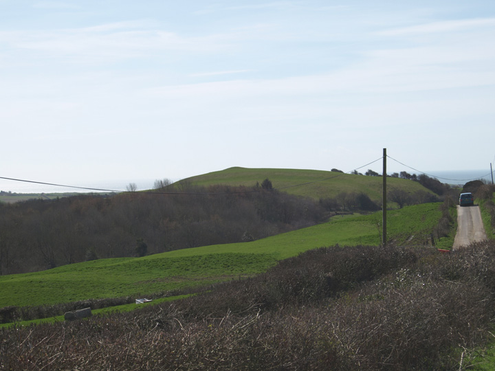
I finally decided to see what’s at the top of the hill. It looks impossibly steep to climb and it is from most directions. However if you park on the western side just above Hammiton farm only the last 20 yards or so are steep.
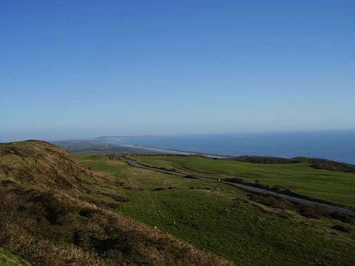
The views from the hill are panoramic. I could see at least four hillforts from the top, namely Eggardon to the north east, Chilcombe to the east, Abbotsbury castle to the south east and Pilsdon Pen to the north west.
Also to the south west is Golden Cap, Colmer’s Hill and Hardown Hill are to the west and I think I could see both Lambert’s Castle and Coneys Castle to the north west as well.
I’m not sure this is a hillfort in the sense of there being any defensive banks or ditches, of which I could see no evidence. Having said that I’m not sure these would be neccesary as this would be an ideal refuge without any obvious banks etc. It is easy to see any approach to the hill from any direction.
There are some curious looking banks and ditches below the main hill which could wel have been the site of a settlement.
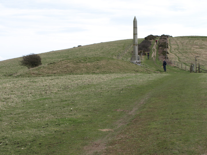
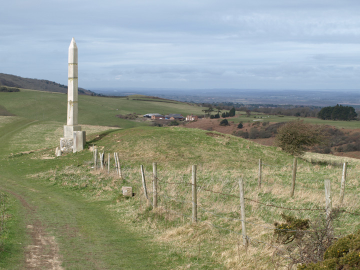
Grinsell thought there was a low barrow on the hill, the only place I could see that could be a barrow is the site of an O.S. trig point. It is indistinct and would have been disturbed by the building of the trig point anyway. I suspect also that the site was used during WW2 as an observation post, there was some brick work up there and what looked like a small chimney stack in the field below the hill.
formicaant

The top of Shipton Hill, the trig point is possibly on top of a barrow.
Image credit: Mike Rowland 01/04/10

The barrow is on the north west side of Hammiton Hill which is to the south of Shipton Hill. It is about 25 metres across and 1 3/4 metres in height. It’s in good condition and is not part of an extended group or cemetery.

The barrow from the top of Shipton Hill, looking south.
Image credit: Mike Rowland 01/04/10
The barrow from the north west, below Shipton Hill.
Image credit: Mike Rowland 01/04/10

The more prominent north barrow, looking east towards Studland Bay.
Image credit: Mike Rowland 28/03/10
This is a large bowl barrow at the western end of Ballard Down, to the south is the small hamlet of Ulwell from which the barrow takes it’s name. It looks in pretty good condition, although there are signs of an excavation on the crown, the damage is not too bad. Some damage has been done to the eastern edge by the disturbance created by a stone obelisk. This is a curiosity, it was placed there to comemorate the coming of clean, fresh water to nearby Swanage, the reservoir is to the south of the barrow. The obelisk was originally in London, outside the Mansion House. It was removed from the barrow in 1941 so as not to be guide to german bombers, it was re-erected in 1952 by the army.
I approached the hill from the north, Studland side as it is much less steep than the southern Swanage side. I parked by a farm gate, it was obvious many people had parked here before me. The hill is pretty steep but Ballard Down itself levels out and is a nice place to see the surrounding sites, megalithic or otherwise.
These two bell barrows are in a valley bottom to the north of Ballard Down and are part of a group which includes the Fishing barrow which is to the est of it. The maps show another bowl type near these two but I couldn’t see it.
The barrows are very scruffy and covered in dead grass at this time of the year, in summer they are obscured with gorse and bracken.
These are very easy to visit as they are just north of a large layby and observation point with easy parking.
I have wanted to include this barrow for a long time but have never been able to actually see it. Thanks to our hard winter and late spring the undergrowth is low enough for me to take a photo of it. It is a bowl barrow in reasonable condition, some tree damage but no apparent excavation signs.
It lies in a valley and is just off a small road that leads to a farm, it appears to be part of a scattered group, to the west is at least one barrow on Whitcombe hill and to the east is Huck Barrow.

An absolute pig to photograph, hidden in dense undergrowth and trees as it is, this is a bowl barrow about a 1/2 mile west of Huck Barrow.
Image credit: Mike Rowland 28/03/10

The Agglestone from Ulwell Barrow, with Poole harbour in the background.
Image credit: Mike Rowland 28/03/10

Southern of two bell barrows on Godlingston hill.
Image credit: Mike Rowland 28/03/10

The more northerly bell barrow.
Image credit: Mike Rowland 28/03/10
The barrow from the west, looking east along Ballard Down, with convenient walker for scale.
Image credit: Mike Rowland 28/03/10
Ulwell Barrow from higher up on Ballard Down.
Image credit: Mike Rowland 28/03/10
This is a multi ditched plateau hillfort on the Hartland peninsula in north Devon, also known as Ditchen Hills. I don,t really like to post sites I haven’t at least been to or have much information about, but will be in the area in a few weeks and will try to visit it soon.
I posted these photos last year as “The Two Barrows” before Exmoor was split between Devon and Somerset. I have now deleted that seperate post. Anyway the barrows lie to the east of the nearby Five Barrows group, actually nine in number.
The barrows I photographed are on opposite sides of a small road, the northern one is a fairly large bowl barrow. The southern one was hard to take pictures of as it is low and indistinct.
There are another two barrows nearby, slightly to the north and according to how they look on MAGIC these appear to be the actual Two Barrows. In the way of these things sometimes it is not easy to say which barrows are which purely from map sources, I will visit here soon again as there are other things I want to see nearby.

Across the road from the bowl barrow is this indistinct, low barrow, in the distance is the eastern most of the Five Barrows.
Image credit: Mike Rowland 18/03/10


The most prominent of the barrows seen from the nearby Five Barrows to the west.
Image credit: Mike Rowland 18/03/10

The outer bank and central mound of the large disc / henge barrow.
Image credit: Mike Rowland 18/03/10

The east inner and outer banks and ditch.
Image credit: Mike Rowland 15/03/10


The south side of the hillfort with the Chesil beach and Portland in the background.
Image credit: Mike Rowland 15/03/10

From the ditch in the south east corner.
Image credit: Mike Rowland 15/03/10

The eastern inner bank and ditch and outer bank.
Image credit: Mike Rowland 15/03/10

This is a large 18th century folly in the north part of the fort interior.
Image credit: Mike Rowland 15/03/10

I took the opportunity to visit this barrow while taking some photos of East Hill barrows. The maps and MAGIC etc show two, but I could only spot one of them. Some of the barrows in this extended group along the South Dorset Ridgeway are very slight and hard to see, I suspect that may be the case with the other barrow.
The visible barrow is quite a curious example as it seems to have been turned in to a water tank holder. This appears to have been done to it some time ago as grass has grown over the concrete lid.
The White Horse is 18th century and depicts king George the 3rd on horseback, he was responsible for making nearby Weymouth a fashionable resort and popularised sea bathing.

One of a pair of barrows immediately north of the White Horse hill figure.
Image credit: Mike Rowland 15/03/10

This pair of barrows have the road to Broadmayne seperating them.
Image credit: Mike Rowland 15/03/10

The smallest of the central group of four.
Image credit: formicaant 15/03/10


What the barrow cemetery used to look like before most of it was ploughed out.
Image credit: formicaant 15/03/10

The bowl barrow with the bank barrow to the right of it.
Image credit: Mike Rowland 15/03/10

The barrow from White Horse hill to the north.
Image credit: Mike Rowland 15/03/10

A small bowl barrow on a hill to the east, between is what remains of Mount Pleasant henge.
Image credit: Mike Rowland 15/03/10

Conquer barrow is in the clump of trees, the crop mark about a third of the way down the photo is what remains of the bank of Mount Pleasant henge.
Image credit: Mike Rowland 22/03/07

The very large, tree covered Conquer barrow from the south.
Image credit: Mike Rowland 15/03/10

Two bowl barrows from the road down the valley.
Image credit: Mike Rowland 15/03/10

Gorse covered bell barrow across the road from the east end of the bank barrow.
Image credit: Mike Rowland 15/03/10

The bank barrow and associated round barrows from the top of a bell barrow in the east hill group. Shame about the power lines!
Image credit: Mike Rowland 15/03/10

One of the western barrows with Bincombe Bumps in the background.
Image credit: formicaant 15/03/10

The north barrow from the east.
Image credit: formicaant 15/03/10

The most northerly barrow from the south, this is across the track from the main group.
Image credit: formicaant 15/03/10

A very slight, almost ploughed out barrow in the centre of the group, it appears as a mound from all directions.
Image credit: formicaant 15/03/10

The most easrely barrow, from the east.
Image credit: formicaant 15/03/10

Bell barrow with the pond barrow in the foreground.
Image credit: formicaant 20/05/07