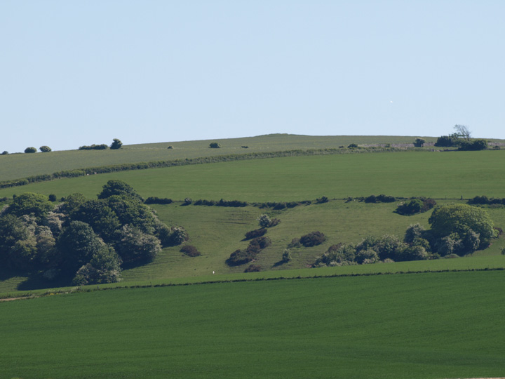
This is one of a series of 7 cross ridge dykes which straddle the crests of the surrounding hills. It is situated south of the nearby promontory hillfort at Nettlecombe Tout and is west of the Dorsetshire Gap. The pictures were taken from the tiny hamlet of Folly in the valley below.
formicaant

The cross dyke on Windsbatch hill from Gould’s hill, looking south.
Image credit: Mike Rowland 03/06/10
A cross ridge dyke on Windsbatch hill, just south of the South Dorset Ridgeway. This ditch and bank can be seen from the Gould’s Hill and Ridge Hill barrows which are to the north of it. It can be accessed via the Jubilee trail and is close to the village of Upwey.
I have long meant to see if this site is visible. It can be seen from the minor road which runs between Winterbourne Abbas and Portesham, I parked in a small layby on the west side of the road. The verge by the road had just been mowed and I walked along this, although this is a minor road it is very busy. The stones can be seen to the north, behind a water trough. They are quite small and I needed a long lens to get a photo of them.
This site is comparable to West Compton Down or Two Gates, which is several miles to the north near Eggardon Hill.

A low barrow on the spine of the hill.
Image credit: Mike Rowland 03/06/10

A close up of one of the northern barrows.
Image credit: Mike Rowland 03/06/10

The stones on a long lens from the roadside to the south. The stones are behind the water trough.
Image credit: Mike Rowland 03/06/10

The most easterly of the group from the road, looking north west.
Image credit: Mike Rowland 03/06/10

A large bowl barrow from the Winterbourne Abbas to Portesham road.
Image credit: Mike Rowland 03/06/10

Two of the Four Barrows in the foreground, with two of the Ridge Hill group in the background. The photo is taken from Maiden Castle.
Image credit: Mike Rowland 03/06/10
One of the central barrows seen from the south side of Maiden Castle.
Image credit: Mike Rowland 03/06/10

The bell / disc hybrid from the south rampart of Maiden Castle,shot with a very long lens borrowed from a friend.
Image credit: Mike Rowland 03/06/10

One of the bowl barrows from Maiden Castle looking south.
Image credit: Mike Rowland 03/06/10

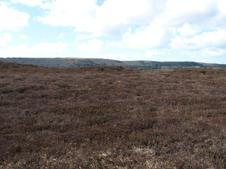
Looking south towards The Dorsetshire Gap from Rawlsbury Castle.
Image credit: Mike Rowland 23/05/10


One of a series of cross dykes on Lyscombe Hill.
Image credit: Mike Rowland 23/05/10

The hill which is protected by the bank.
Image credit: Mike Rowland 23/05/10

A Dorset type disc barrow, across the road to the north of the main group.
Image credit: Mike Rowland 19/05/10

The two adjacent barrows seen from the agger of Ackling Dyke, looking west.
Image credit: Mike Rowland 18/05/10

The main barrow in the photo is a large bell type just to the north of the main group. The other green areas which show out of the rape crop are much smaller bowl types.
Image credit: Mike Rowland 18/05/10
As Dickie says this barrow has been very seriously damaged in the past. Happily the current land owner seems to value it, as they have taken the time, effort and expense to fence it off. This is a very peaceful place to be, I had it completely to myself, and saw a young fox playing in the lane which leads to it.
From the barrow, to the south west Bokerley Dyke can be seen clearly, with its barrows and the parts of Grim’s Ditch associated with it.
I parked in a small layby a couple of hundred yards into the village and walked up the road into Long Barrow lane, it’s a flat walk and I spent about half an hour at the barrow. Worth a visit if you get the chance.

A panorama of the bank barrow from the south.
Image credit: Mike Rowland 18/05/10

The pair of barrows, on the ridge above Oakley Down barrow cemetery, looking south from the cemtery.
Image credit: Mike Rowland 15/05/10

Bokerley Dyke from the lane next to Martin Long barrow, the barrow is to the right in the photo.
Image credit: Mike Rowland 15/05/10


This is a surprisingly large structure on the Wiltshire / Dorset border. It’s 365metres long with a 40 metre gap where the modern road cuts through it.
This is part of a group of cross ridge dykes which straddle the Dorset / Wiltshire border, thought to be iron age in date, their purpose is uncertain. They appear to mark the extent of an area of land, but do not appear to be for defensive use as they are not long enough and only extend across the tops of hills.

Fenced off round barrow about 100 yards west of the dyke.
Image credit: Mike Rowland 01/05/10


At last I’ve managed to find this elusive long barrow, after about the 5th attempt. It is in dense beech woods north of the other long barrow nearby. This barrow is generally listed as Vernditch Case long barrow, the other is usually listed as “long barrow south west of Vernditch Chase”, but what’s in a name?
The barrow itself is quite slight and difficult to see, I’m happy that this is it, as it is in the right place. However there are various bits of Grim’s Ditch in this area and I have seen photo’s that purport to be the barrow which look more like the ditch, i.e. much too long and thin. This is one for completists (like me, I suppose) as it is small and has probably been ploughed in the past.

The long barrow from the north.
Image credit: Mike Rowland 30/04/10

The full length of the bank barrow from the east, adjacent to the Poor Lot barrow cemetery.
Image credit: Mike Rowland 26/04/2010

The main Poor Lot grouping, looking south from the hill opposite.
Image credit: Mike Rowland 26/04/2010

This is the most northerly of the group, across the road from the main set.
Image credit: Mike Rowland 26/04/2010

One of the eastern barrows, newly cleared of trees.
Image credit: Mike Rowland 17/04/10
A pair of round barrows on the ridge of Limekiln Hill. The barrows are bowl type and are either side of the B3157 coast road. The northern one is the larger of the two and has some damage done to it by animals. I could not get to the southern barrow as it was surrounded by young bullocks and I bottled out, having been chased in the past.
These mounds are part of a scatter of barrows along this part of the coast, to the east are Tulks Hill and Puncknowle to the west. Five hundred metres to the south is the wonderfully named Labour-in-Vain farm.

The southern barrow, with added bullocks.
Image credit: Mike Rowland 17/04/10

The north barrow, with Puncknowle in the background.
Image credit: Mike Rowland 17/04/10

A piece of prehistoric pottery found 20 yards from the barrows.
Image credit: Mike Rowland 04/04/10
The third barrow, with the Purbeck Hills in the background to the south.
Image credit: Mike Rowland 04/04/10
A barrow cemetery comprising five bowl and one bell barrow on the west of Godlingston Heath. This is a curious cemetery, the like of which I’ve not seen before locally, it is in the shape of a crescent. The arc is roughly a 1/4 of a circle and looks like a small arena. The barrows overlook the north part of the heath and Poole harbour from the top of an inland cliff. The five bowl barrows make up the arc shape with the bell barrow just behind, almost touching them.
The barrows are covered in low heather at the moment and get larger and higher as they go from the first barrow – north west to the sixth barrow south east. The only barrow that is visible from the south is the bell barrow, from which can be see two of the barrows on Nine Barrow Down, to the south, I’m pretty sure the long barrow is one of them.
These barrows are not on the main part of the heath with the marked footpaths but the whole area is open access land and there was a path that could be followed. These are not marked in any way on the relevant O.S. maps and I only found out they existed while looking at something else on MAGIC, where they are marked and described.
On the way back, about 20 yards from the barrows I was lucky enough to find a piece of Bronze Age pottery laying next to the track. It looks like the local black burnished ware and is part of a rim.
All in all they are an unusual group in the context of Dorset barrows and are well worth a visit – look them up first on MAGIC and they are quite easy to find, if not this is a large heath with lots of lumps and bumps on it which aren’t ancient.

Two of the Nine Barrows from the barrow cemetery on the west of Godlingston Heath to the north.
Image credit: Mike Rowland 04/04/10

The southern bell barrow.
Image credit: Mike Rowland 04/04/10

The largest and most easterly of the bowl barrows.
Image credit: Mike Rowland 04/04/10
The fourth, central barrow.
Image credit: Mike Rowland 04/04/10

The second bowl barrow.
Image credit: Mike Rowland 04/04/10

The first and most northern bowl barrow.
Image credit: Mike Rowland 04/04/10

Five bowl barrows in an arc on the western edge of Godlingston Heath.
Image credit: Mike Rowland 04/04/10

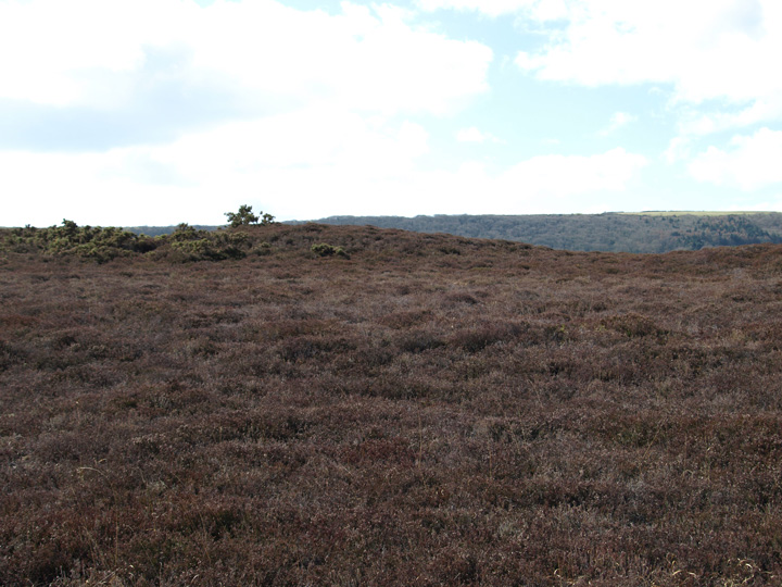
The top of the hill from the north in the valley below.
Image credit: Mike Rowland 01/04/10