
Central bowl barrow with a slight ditch evident.
Image credit: formicaant 20/05/07
Central bowl barrow with a slight ditch evident.

Pond barrow next to the bell barrow.

A low bowl barrow in the east of the group.

The central bell and bowl barrows with Came Woods in the background.

The bell barrow from the side of the large central bowl barrow.

Looking across Martin Down from the top of the dyke.

The bank and ditch, close to the road where it is at its slightest.

The central part of the ditch as it crosses Martin Down.

The main, southern part of the dyke as it snakes its way up Blagdon hill.

The northern part of the dyke, this is not far from the main road.

The two western pairs from the valley below.

The barrows from the valley below, looking south.

The full expanse of the hillfort from the south looking north above the village of Askerswell.
This is one of several dykes which run across the ridge of hills which the A35 now follows. This one is a few hundred yards east of Chilcombe Hill and from it can be seen Eggardon Hill to the north. Probably by coincidence it is directly in line with a modern milestone.
There are quite a few of these ditch and bank structures in Dorset and they are thought to be late bronze age to iron age in date. The purpose of them is unclear but is thought to be as some kind of division of land.

The cross dyke above Askerswell with Eggardon Hill in the background, viewed from the other side of a very busy dual carriageway.

The large barrow from the east with Deverel barrow in the background (dark green trees).

The large barrow from the style into the field.


The first and smallest of two barrows off the down.

The second of two bowl barrows on a track just off Deverel Down.

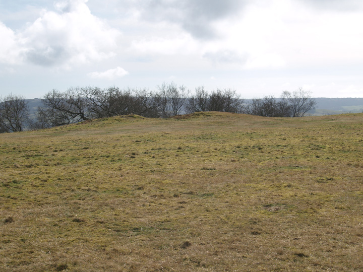
I’m not sure about this, it could be natural, although the name suggests not. Unfortunately Grinsell is no help as he never visited it for Somerset Barrows. If it is genuine then it is large and in good condition. It is the highest point for some distance around and gives its name to three small hamlets.


The hillfort from the valley below, the stone pillar is a war memorial.
This is also known as the Isle of Athelney and is most famous as the refuge of King Alfred during the Danish invasion of the 9th century, where he burnt the cakes.
This would once have been a proper island, being as it is one of the few high points in the Somerset levels. The levels were drained and the local river Parrett diverted. The site is on private land and there is no public access to it, there is a large layby next to it with a very good information board in it.
The Iron Age part of the hill is at the western end and consists of a bank and ditch.


The isle of Athelney with the memorial to king Alfred.
Another visit to this hillfort after 3 years, last time I came it was a grey day and I wasn’t happy with the photo’s. This is a huge site, not including the hillfort, it was in use for many hundreds of years. Firstly there is a very badly damaged bronze age barrow within the hillfort and the iron age monument itself. There are norman pillow mounds, it was used as a racecourse in the 18th and 19th centuries. There is evidence of a napoleonic signalling station and a fair was regularly held here.
I know none of the above is necessarily relevant to this website on the face of it but I think it illustrates the importance of this site in the local area. The nearby villages are tiny and scattered and this must have been a focal point for trade. The banks are very slight and doubtful as a defensive position. Also there are other properly defensible positions very close by, Pilsdon Pen and Coneys Castle are much more viable places to be when under attack.

The south east corner, with Colmer’s hill in the distance.


Bronze age round barrow in the interior of the hillfort.


The ditch of the southern side of the fort.

The southern bank and modern entrance.

The northwest corner of the hillfort from Whitfield farm long barrow, the railway tunnel which saved Poundbury from being destoyed can clearly be seen. The wall in the foreground is an old firing range.

The long barrow is in the centre of the photo, on the top of the ridge, now appearing much reduced by the plough.

A much ploughed round barrow to the north of the long barrow, in the same field.

A round barrow taken from the Hellstone.

The Hellstone before it was rebuilt in 1866, from John Hutchins History of Dorset.

Crow Hill from The Valley of Stones.

The eastern entrance of the hillfort, from the south.

This earthwork is on Ternnants Hill, the photo is taken from the road which runs above the Valley of Stones. The bank of the hut circle is at the extreme right of the photo.
The barrow is about 200 yards north-west of Kingston Russell stone circle.

The Valley of Stones from the east, next to the edge of Blackdown.

A single bowl barrow on a small hill 200m north-east of church, photos to follow.
OTTERFORD 1 – 9a.
Robin Hood’s Butts. Nearly all the recorded folklore seems to relate to the South Group (6-9a).
“On the top of each barrow was a small excavation like a bowl....This hollow was sagaciously alleged by a neighbouring farmer as a proof that the popular tradition whence these monuments have derived their name was well founded. “Robin Hood and Little John undoubtedly used to throw their quoits from one to the other......for there is the mark made by pitching the quoits!” (English Traditional Lore (Gent’s Mag. Library, 1885) quoting from Vol.88(1818), ii, 306-7).
I saw this site from the valley below while visiting the nearby Setta barrow and five barrow hill. From below it does not look very substantial, sadly I ran out of time so could not get up to it, good excuse for another trip to these parts.