


Small standing stone, with upper cairn in the top right


Looking north up Piperstown Hill over the largest of the cairns. There are 2 more cairns in the background of the shot.


During the spell of dry weather earlier in the year a massive fire consumed a lot of the vegetation on the southern slopes of Piperstown Hill. I’d passed by a couple of times and wondered if the fire had burnt back any of the gorse and heather at the cairns. I got my answer today. Yes… and it also exposed what I believe to be 2 more, unmarked burial mounds/cairns! That makes 5 in this small area, 4 in the north-south alignment and a small one to the west of the largest, what I once thought of as the middle cairn.
The 2 ‘new’ ones are barely visible, both about half a metre proud of the surrounding terrain, but I suspect there is much more under the peat.
The bottom cairn of the 4 aligned cairns finishes just above a natural platform. From here, the views west across the Glenasmole valley and up to Ballymorefin, Seahan and Corrig are splendid. South there are two very deep cuts in the horizon, one where the Dodder falls towards Glenasmole, the other called Cot Brook, a stream that meets the Dodder at Cunard.

Yet another cup-marked stone at Drummin. The cups in this one are less eroded than both Drummin II and Drummin III, but not as well preserved as Drummin I. It’s a large earthfast boulder, hidden in the gorse 40 metres or so west from Drummin III. There are about 15 cups in all, some more eroded than others.
I was surprised at the fine condition of the barrow. Called a bowl barrow in the Wicklow inventory, you can drive to within 100 metres of the site up the track, across the commons from the Kilmacanogue to Roundwood road. The fosse and bank are still very visible and the central mound is now home to many rabbits. The Sugar Loaf broods to the north-east.
Mentioned by Price and ‘re-discovered’, ‘re-recorded’ by Fourwinds @ Megalithomania 8/4/07 megalithomania.com/show/site/1741/Sleanaglogh.htm


A 4th cup-marked stone at Drummin. There may be more!


Looking north-east with the Sugarloaf in the background


4/6/07
Another couple of weeks and it’ll be hidden

12/5/07
The clearance of the chamber continues. Last time I was here (24/12/06) I had to lay flat and shimmy down from the rubble in the chamber to get access into the passage. Not any more. The entrance has been cleared, exposing the sillstone that separates chamber from passage. Even more of the roof rubble has been cleared from the chamber itself, revealing more of the giant capstone and some more of the collapsed corbelling. All this moving of stones, while it exposes more of the chamber, cannot be good for the structure. The collapse of the roof had settled for god knows how many years and seems to have supported parts of the chamber that may well collapse if any more is removed. Some of the lintels and roofstones around the chamber entrance are looking in a very precarious condition. While the clearing of the stones opens up the monument that bit more, the inexpert nature of the ‘excavation’ doesn’t instill confidence. Lighting fires on the old capstone can’t help either.

The south and west recesses showing more of the rubble clearance

Since I was last here quite a bit of the rubble has been cleared from the chamber entrance at the end of the passage
Arch. Inventory of Co. Meath says: Possible stone circle (site) Destroyed by quarrying in the eighteenth and nineteenth centuries, the surviving records indicate a circle of large stones set on end some 21 feet in diam. (Studia Hibernica 7, 142-5)
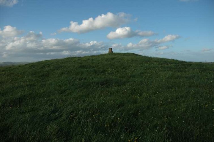
Grass-covered cairn at Kingstown & Carnuff Great, about 30 metres in diameter


Said by some to be a passage grave, this robbed out mound is oval in shape and shows no signs of a kerb. It’s about 200 metres east-south-east of the excavated henge of the same name that has been cut into by a modern factory.
It’s roughly 25 metres on its long axis and has a dug out depression at its eastern end.

From the gate up to the inhabited summit, you pass along this track which runs straight through the remains of one of the flattened barrows with its ditch and bank much in evidence
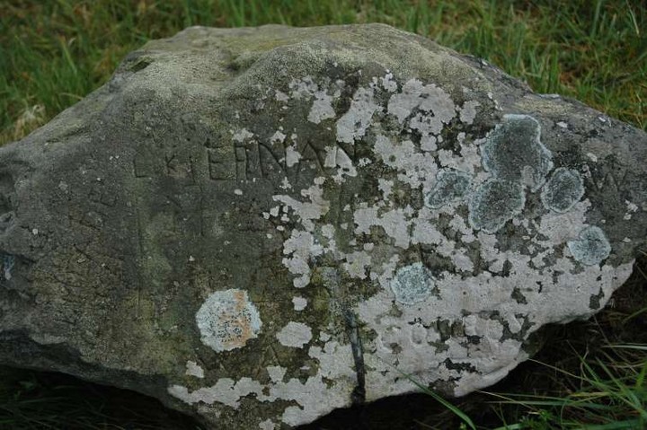
This graffitied stone rests on top of the the most northerly barrow. The carvings are quite weathered

The most northerly and best preserved of the barrows. Extremely difficult to photograph, but it does retain some of it’s ditch and bank
Arch. Inventory of Co. Meath puts this in Rathbranchurch, the neighbouring townland, and lists 18 barrows in all.
There are ten red dots on Sheet 36 denoting this barrow cemetery. Three of them are beside the road with two on the road itself. The other five are in an arc aligned roughly south-west to north-east. To be honest I wasn’t expecting to find much and I wasn’t greatly disappointed. I did however locate the remains of about seven of the barrows. They’re quite hard to make out and most of the mounds have been flattened, but a little scouring shows plenty of evidence of circular banks and interior fosses. The one mound that remains to any great height is the most northern one. It’s about 2.5 metres high, roughly circular.
Slieve Breagh falls dramatically away to the north-west from this place and the views across Meath, Monaghan and Cavan and north into Armagh and beyond are spectacular. There are many peaks away on the distant horizon. A quite lonely and windswept place but worth the trip on this cloudy, windy and sunny Irish day.
Very few details given in the Arch. Inventory of Co. Meath: “Drystone built, L-shaped passage (L. 11m) terminating in beehive chamber with air vent.”


Souterrain entrance in the ditch by the side of the road

Smaller, southern stone in the undergrowth to the left, larger stone top right

The larger, northern stone, looking into the bowl (south)


The glade at the spot that’s marked on Geraldine Stout’s map.
The entrance to this souterrain is in the ditch by the side of the road. It’s marked on the map well into the field and the farmer had just dug a hole in the vicinity of the mark so I thought this must be it. Happily the farmer happened by and showed me where to look. He said that I could crawl in, that there’s “a big cave in there”. “Thanks all the same,” said I.
The lintelled entrance is to the south. Immediately, after about a metre, there’s a sharp right turn and the souterrain heads down. It looks like an ideal spot for a badgers lair and I had no torch. I would love to come back here with some proper kit and a companion less claustrophobic than I.
In her book “Newgrange and the Bend of the Boyne” (Cork University Press) Geraldine Stout has this marked on both of the overview maps of Brugh na Bóinne, and yet there is no mention of it in the index and I haven’t come across it in the text, so far. I did see it mentioned somewhere else but can’t remember where. Having bought Geraldine’s book I decided to see if I could find anything.
I approached from the eastern end of the complex and just where the bend of the road turns sharp right on the long approach up to Dowth there’s a small wall. Over this and about 100 metres further west are 2 bowl-like arenas, like hollowed out inverted mounds. Was this where the stone circle once stood? The one further west seems like the most probable. It has 2 large fallen stones that may have come from the circle. One, the northern of the 2, is huge and has definitely been worked/shaped, though, from what I remember, the stones were blasted when the circle was destroyed. The other lies to the south and is thinner and smaller, about 2 metres long.
I’ve had limited experience of stone circles so I don’t know if I’ve found the precise location. The bowl like depression is about 10 metres deep on its southern side. The floor opens out to the north and drops off until it reaches the modern road about 8 metres below.