


Newgrange mound with ruined passage tomb k in the top right of shot


The best preserved remaining part of the mound, with the chamber-like structure visible

Looking north along the mound towards the burial chamber

Burial chamber is to the right, with kerb-like stone to the extreme left. There is cairn material all along the mound.
It was hard to tell what this is due to the livestock time limitations I had here. The large capstone says a portal tomb, but this stone could be a roofstone from a wedge tomb. As the tomb is in court-cairn country, it just might be so, but there’s no evidence of a court.
The mound that the burial chamber is in is completely overgrown. It stretches back from the chamber by about 20 metres and contains cairn material at the flatter back end. There are kerb-like stones on its eastern side, so are we talking a passage grave?
Lost and forlorn in a hedge and ditch are these sad remains of a wedge tomb. I was brought up here by the farmer who owns the land and who has a keen interest in all the historic and pre-historic features of his area.
There’s not much left to see. Two stones are set into the ground with the remainder tossed about in a jumble. The whole structure measures just 6.5 metres by about a metre and a half.

This stone is set about 9 inches into the ground (according to the farmer) and may have been one of the entrance stones to the tomb
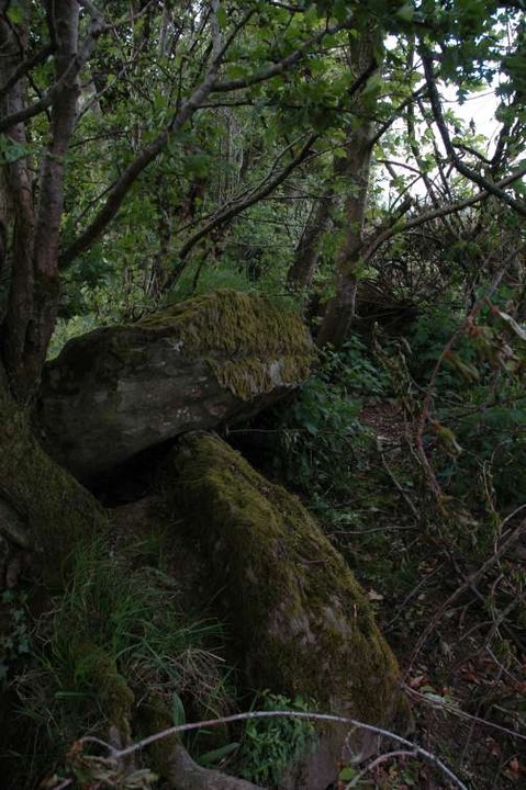


The quite large capstone is held up be the remaining standing portal, which in turn is kept upright by a hawthorn tree

Arch. Inventory of Co. Meath says there’s a possible doorstone in there somewhere

Hidden in the hedgerow, Ervey portal looks deceptively small. The capstone is actually comparatively large and this seems to have resulted in its collapse.


In the bank of a rath/enclosure are the remains of Edengora wedge tomb


Like great big teeth, the entrance stones of Lisnadarragh wedge tomb


The highest point of the site with cairn-like collection of stones showing

The covered area of the ‘main’ find, a ‘woodhenge’ or timber circle


The site is on an an undulating ridge, aligned south-east to north-west, north-west of Rath Lugh. The cleared area is roughly 120 metres wide by 600 metres long. This whole area has had its topsoil removed down by about half a metre, revealing a sandy layer.
At the north-west end, at the highest point of the area, there is what looks like a mound, containing rough cairn-like stone. It’s one of three smaller areas that are co-ordoned off and under excavation. South-east of this is a massive plastic-covered rectangle where the ‘woodhenge’/timber circle has been found. Just east of this is a long line of test trenches, presumably part of the promised exploratory trenches that were dug ‘every 20 metres’ all along the 59kms of the motorway.
Slightly north of east of here, and about 150 metres towards Rath Lugh, is what the Sunday papers are calling ‘a high status burial chamber’. It’s circular, with an inner trench/ditch of about 2 metres. I guess there’s still quite a bit of work to be done in and around this site and the ditch may not really be that deep when the remaining covering sandy soil is removed.
This barrow is surrounded by a fence that has been placed right up to the bank. It’s circular and roughly 30 metres in diameter. The stone and earth bank and the inner ditch are quite well preserved though partially destroyed in the north-east quadrant. The top of the mound, on which has been placed an official fógra, rises to about a metre and a half. The monument can be reached from the track to the north of Rhode village.


Well defined ditch and bank in the south-east quadrant


The stone on the right is a possible collapsed upright

The massive, prostrate stone at the ‘back’ of the tomb, with bag for scale

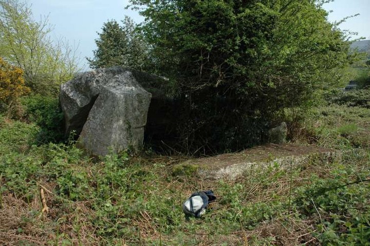
If you want to get an idea of the layout of this monument, now’s the time to go

The large prostrate stone that shows in O’Neill’s drawing: megalithomania.com/show/image/5326


The capstone rests against the remaining upright, which is roughly 2 metres tall
