

When you reach this ruin, you`re there! Lacra A stone circle is just above the gable end of the ruined farm building in the pic. Lacras D and E and the row are beyond A. The avenue commences by the stone wall on the right and goes down the hill-side. Lacras B and C are on the right-hand side of the top-most stone wall, out of shot.

A plan of Gray Hill showing its archaeological features – including a possible enclosure surrounding the stone circle and row.
The stone`s description as it appears in the SMR (N.M.No.33951):
A recumbent tabular stone 1.4m in length includes grooves and a dished area consistent with its use for the shaping, whetting and polishing of Neolithic stone axes. Excavation around the stone in 1963 demonstrated that it had originally been upright, whilst an iron wedge and a coin showed that it had been split in the 13th century AD.

What you see when you approach Little Lodge Long Barrow from the nearby minor road


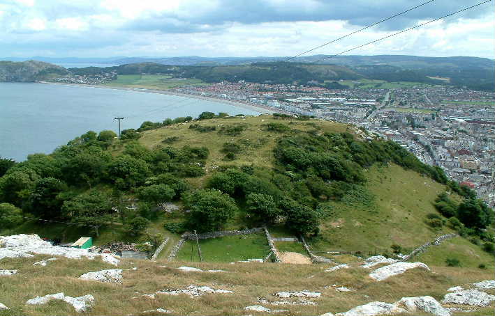
Chumbawala may have encountered horses here, but I had to watch out for the feisty cattle protecting their calves.
At Three Cocks, on the A438, take the minor road heading east signposted to Llanigon. After just less than a mile, the barrow is in a field to the south of the road.
The site is dominated by two old trees which hampered the excavation carried out here in 1929ad. The remains of five males were found.
On approaching, I first saw a large blocking stone(?), followed by a small mound, then the remains of the burial chamber.
GPS: SO 18226 38060


The name of this stone is given as Maes Mochnant standing stone in the SMR


You have to pass by the Pistyll Rhaeadr waterfall to get to the Afon Disgynfa cairn.

Possible candidates for the title of The Goose Stones at SP2570128746
On a recent visit to The Rollrights, I thought I`d go and have a mooch around for the Goose Stones on Chastleton Common, just a couple of miles away.
Approaching from the north-east on a singletrack road, as I crossed over the cattle grid leading on to the common I was dismayed to see a sign saying PRIVATE PROPERTY. NO PARKING.
I thought uh-oh, this is going to cramp my style, and it did. Slowly driving down the road, I spotted some stones to my right, so I abandoned the car in the middle of the road and set off to get some pics. These stones were the ones that hamish had seen, at SP2626228769.
Then I heard the sound of a vehicle approaching, so I had to dash to the car to allow the postman to pass. Further along the road, I saw some more, more embedded stones on the right. I had to carry on driving a short distance to the entranceway to a farm and parked there while I investigated my find. These two stones are at SP2570128746 and look more promising than the previous pile.
Carrying on in my quest, near to the south-westerly edge of the common, I saw another likely candidate, to my left. I parked next to the cattle grid leading out of the common and walked a short distance to a stone standing out of the ground at SP2537828682. This is the same stone that Celia Haddon has on her website Goose Stones
The published location for the Goose Stones (SP265288) seems to come from Paul Bennett and Tom Wilson`s booklet The Old Stones of Rollright and District, however, they were unable to find them.


I came across this stone at SP2537828682. Perhaps it`s the last surviving Goose Stone


Within 1/2 mile of Lower Swell, on the far side of an arable field which is next to a minor road running west from the village, lies this long barrow. The crop in the field had been recently harvested, so I was able to walk downhill across the stubble to see it.
It appears to be in an unusual location, very near to the bottom of a dry valley, with a conjunction with another dry valley on the opposite side. The barrow retains some height, too, although it was difficult to estimate due to its complete covering in bush and other vegetation.
The north side is twice as high as the south, due to the barrow being oriented along the side of the valley. There are many animal holes dug around its base. Although I saw rabbits, from the size of the holes I think that badgers have made a home here. No megaliths visible.
GPS: SP 17015 25774

Cow Common Long Barrow GPS: SP 13511 26272
Not much of interest to say about this long barrow. It lies like an island in the middle of a large arable field next to a minor road just over 2 miles west of Lower Swell. I walked up the tractor tracks in a field of wheat to reach it. No megaliths are exposed.
On my way back to the road, I startled a deer hiding in the wheat, which didn`t bound very far away. Shortly afterwards, I was startled by a fawn jumping out of the crop in front of me.


See that band of darker grass running through the centre of this pic? Well, that`s all that`s left of the bank of Condicote Henge. The road, which I`m standing on to take this photo, runs through the centre of the henge.


This bump in the grass by the side of Kingstanding Lane, in the district of Kingstanding, is all that remains of the last surviving barrow in Birmingham (that I am aware of).
If it hadn`t been for an incident in comparatively modern history, there`d probably be houses on this one, too.
During the English Civil War, on the 19th of October, 1642AD, King Charles I stood on this round barrow to address his local recruits, hence The King`s Standing.
Great location. It`s exhilarating just to be here, high up over the Wye valley with Hay Bluff breathing down your neck.
BUT......
The only lay-by for miles around on the single-track road has been placed right next to the circle. There are always cars parked here. Most people who park here seem to be totally unaware that there is a stone circle right infront of their eyes. I was angered by the totally unnecessary degradation of the location. To top it all, one of the bollard-stones from the lay-by has become incorporated into the circle.
GPS: SO 23942 37358


The one stone which remains standing of Pen-y-Beacon stone circle, on the right. The stone on the left has strayed from the lay-by.
Taking the forest road out of Hay-on-Wye signposted to Capel-y-Ffin, the single-track road rises steeply on a southerly course. At the top, where the scenery opens out over mountainous moorland, lies the large Twyn-y-Beddau round barrow, as if standing sentry before the even higher land.
GPS: SO 24148 38612


The Giant`s Foot stone lies just to the west of Shap, in a field behind the houses lining the A6.
It is said to be one of the stones in the Shap Stone Avenue.
GPS:NY 56297 14781
This stone stands by the side of the B4348, 1/2 mile west of the village of Dorstone, by the side of a field entrance. It has been used as a gatepost in the past.
There is a cup mark under the vegetation.
GPS: SO 30558 42261


Asper`s Field standing stone. Shot taken (with zoom) from the nearby Goggleby Stone


Four miles south of Arthur`s Stone stands Herefordshire`s tallest standing stone, Wern Derys (or the King Stone).
You need the OS map to find this one. It`s about 1/2 mile down a no through road leading to a farm. On the left-hand side there`s a gate with a large notice saying something like `STOCK – PLEASE CLOSE THE GATE`. It`s in the field beyond that gate. There`s no footpath, but the sign on the gate didn`t say `BUGGER OFF`, so I went in.


One of Avebury`s secrets. A holed stone within a stone setting