Stone around 50 metres down hill from Doll Tor stone circle. Circa 1.5m high with deep rilling.


Just to add to that. This statement if weird – “It is on the left-hand side of the road as one travels from Ringinglow to Fox House and near to the last-named place. I was not permitted to approach the spot for fear of disturbing the young grouse, but as far as one could judge from the road it is a heap of stones scattered here and there. I cannot say more without a nearer examination.”
Whilst the location here is correct, if you were travelling the old road (as he were) the Fingerem stone would be easily visible, almost within touching distance in fact, so the how he could not see it, if it still existed doesn’t make sense. Take a look at the placed marked on the old map and how the feature is right by the road. It doesn’t make any sense.
I searched extensively for this stone but found nothing bar the one in the pic i just uploaded. Pretty surprised to see this site listed here to be honest, given there’s no evidence for it being of any age.
Another strange thing is it being listed as “Cairns/Destroyed”, i highly doubt that was the case, seems 2+2 came out as 5 imo.
The area to the (very) immediate N/NW is very boulder strewn and could easily be mistaken for a cairn site from the view given in the old text. I guess some of this is natural added to with clearance. I very much doubt this refers to a cairn/cairns. More likely a way marker of some form that’s now long gone.

A stone that lays in the right area but out by maybe a few metres.


A planning application has been submitted to the local authority in Wiltshire to build a modern burial mound.
Developer Tim Daw wants to construct a new “long barrow” mound near All Cannings to give people another place to leave cremated remains.

This is a fake/recent piece (one cup) laying close to the circle.

Close up of the cup and double ring.


The now missing cup marked stone.
Including walks from Avebury and Marlborough, and live music.

Jago Cooper, curator, British Museum
At the end of May, I returned to the British Museum from an exploratory research visit to an uninhabited national park on the island of Mona in Puerto Rico. My colleague Dr Alice Samson, McDonald Institute for Archaeological Research, and I had found more than we planned or expected when we flew to the Caribbean two weeks earlier.
blog.britishmuseum.org/2013/07/09/new-discoveries-of-cave-art-in-the-caribbean/

Close up of the polishing area.

Close up of the grinding marks.

An avenue stone revealing a former life.


Silbury and WKLB from Harestone Down “stone circle”.


To add to Chance’s pic of the wall with the ten stones, there’s another six in Orchard farms drive wall, so sixteen in all. I don’t know is these stones have been noted before but no-one i knew had noticed them, maybe due to the two dogs that come racing to the gate if you go anywhere near ? Anyway my mate easily tamed them whilst i took the pics.
Another visit today, probably my tenth, maybe 15th as it’s only a short drive for me, but once again....wow.
I never tire of this place with it’s expansive views through 360 degrees with backdrops including Stanedge Edge, Ladybower Tor with it’s rock art, the dramatic Win and Lose hills and in the far distance Kinder scout. Get there before 3pm and there’s even a bloody sarnie caravan, what more could anyone want ?
Idiot proof directions here.
:)

The possible outlier first pointed out to me by Paul Blades (Bladup). The circle is visible in the distance.


The “outlier” as described by Bladup at roughly 220 degrees SSW of the circle.

Like finding a needle in a haystack. !
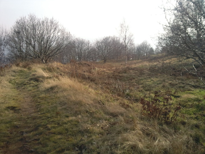
This pic may help as the TMA marker is so far off, and it’s an absolute sea of shoulder high bracken !

A great viewing platform, shame about the erosion. Mam Tor to the right in the distance.

The slight rise in the ground from the nettles extreme left centre to the conifers at the top of the pic is one bank of the Stonehenge avenue.
How cool is that. ?
Credit also to Pete Glastonbury for leading us to the site.

Standing alongside the Avon. BSH is over the bridge and to the left behind the trees.
Credit also to Pete Glastonbury for leading us to the site.

A stonehead for scale.
Credit also to Pete Glastonbury for leading us to the site.

Showing how close the henge is to the river Avon, the gate leads to it’s bank via a small bridge. You really could lose whole days sitting at this location.
Credit also to Pete Glastonbury for leading us to the site.

Looking across the excavated area of Bluestonehenge.
Credit also to Pete Glastonbury for guiding us to the site.
“Brilliant news! We have just been notified that the Planning Inspector has dismissed Investates appeal to build houses on the historic Wincobank Hill. The land will remain green open space and an important part of the setting for the iron age hill fort which is a scheduled ancient monument.
A big ‘thank you’ to all of you who signed the petition, it really did make a difference.”

A panorama taken during my one and only visit to the site. I must get back when time isn’t an issue. So much to see so little time, As always. *Sighs*
We appeal to the Planning Inspectorate to safeguard our national heritage by upholding the decision of Sheffield City Council to refuse planning permission to build on the line of an ancient monument known as ‘The Roman Ridge’. Planning Inspectorate Reference: APP/J4423/A/12/2180681/NWF.
This 27km ancient earthwork, not yet fully understood or dated, runs along the side of the Scheduled Iron Age Hill Fort at Wincobank. As a Celtic defensive frontier against both the early Roman invaders and the later Saxons, it has the same historic value as Hadrian‘s Wall and Offa’s Dyke. It is a monument of local and national significance.