
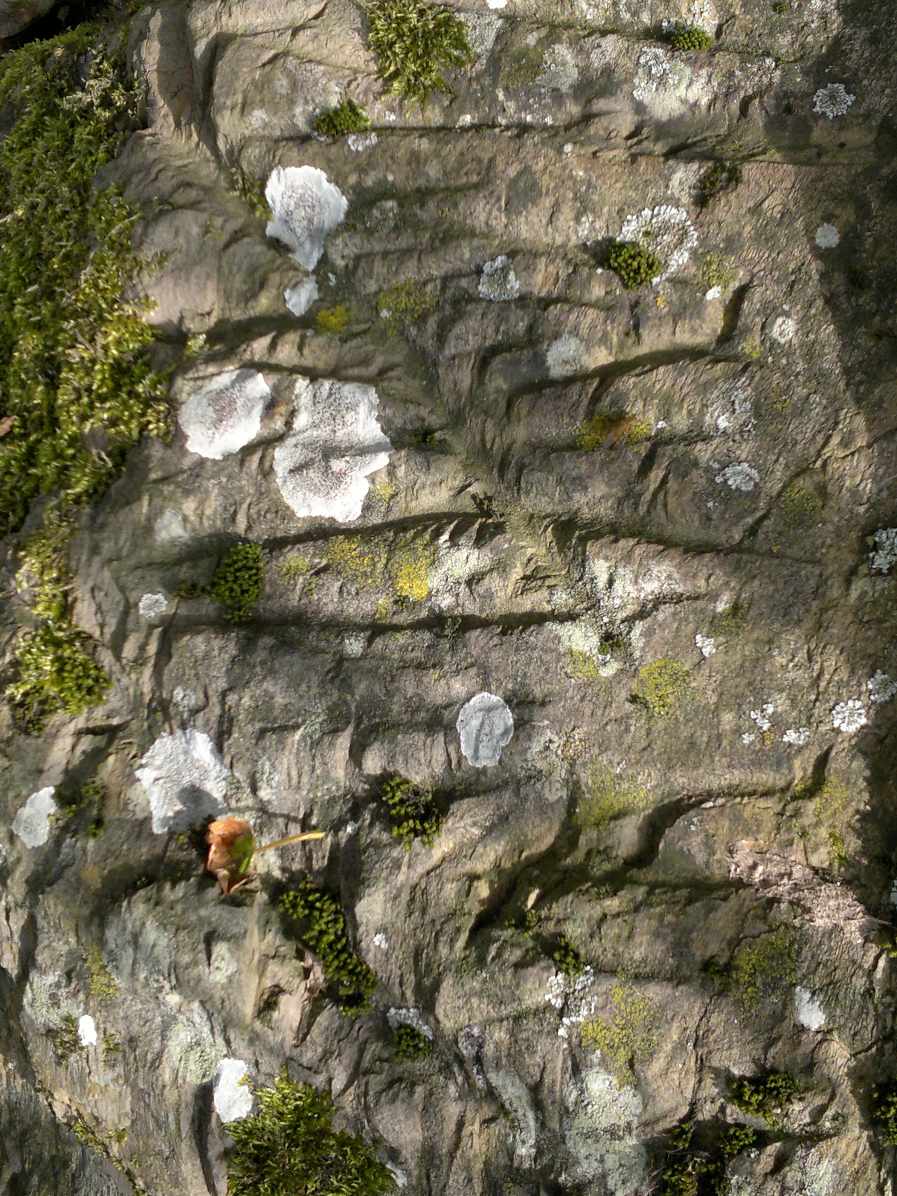
The east side of the fort.. the ramparts just visible as a level line at the bottom of the gorse
Image credit: Mike Purslow
The east side of the fort.. the ramparts just visible as a level line at the bottom of the gorse


Ancient and modern


The broch viewed from the cliff above. A fine footpath onward from viewing point.

The western side of the dun, below the lighthouse platform. There is no eastern side... : (

The terrace on the S side of the fort looking W to the sea.

Kemp’s Wark viewed from the beach, W, at low tide, showing the terrace on S side.

Another view of the ‘rune’? stone on the western side of the nest.
The ‘rune’? stone on the western side of the Nest.

Two stones in the N-S dyke to E of and aligned with Wren’s Egg, believed half buried and in situ.

A view of the Galloway dyke that surrounds the enclosure, looking inland towards Slochmill fort, from near the coastguard station.

A view NW from the terrace of the bottom rampart. Middle and upper ramparts to L. Hearting stone of middle rampart exposed through livestock erosion.

The three ramparts of the fort. ‘Ramps’ between each level, possibly indicating construction was not completed. Stone hearting to lower, nearest, rampart visible.

Stones from the three rings of the circle, L-R outer ring, middle ring, inner ring.

Five stones from the inner circle of the three. Flat topped, very evenly spaced.
Click on the red wording above to access an aerial view showing Slockmill enclosure, circular features therein, the stone circle or setting – near top right, and, to its left, the fort ramparts. Separate TMA site entries, fieldnotes and images for all. Crammag Head lighthouse and dun – and perhaps earlier cliff fort – is in the foreground.
On my walk from Slochmill to Crammag Head to inspect the dun at the latter, indicated by the OS map, I encountered a fine turf covered Galloway dyke en route. As I know such features can be of great antiquity and as it was curved, starting from the clifftop south of Crammag Head and ending near the clifftop on the Head’s northern side, and also as it had what may be a ditch, I was tempted to submit it to TMA as a dyke. What has made me change my mind and classify this site as an enclosure was what appears to be revealed by the aerial photograph that I found online after returning home, which is accessed via a link, below, to these fieldnotes. I advise making a paper copy of this image. At the time I did not notice anything unusual as I passed through the northernmost of the three entrances through the dyke – the middle one being the largest and roughly knocked through perhaps to gain access when the lighthouse at Crammag Head was constructed. The long grass was bumpy in places, but I thought nothing of it. Finding the photo changed all that. If studied carefully there would appear to be well over a dozen circular features of varying size which may be hut circles or the remains of their drip trenches. These are most heavily concentrated at the mid point of the dyke and away from the cliff edge. Only excavation for want of a better aerial image would confirm this. Note how, on the left hand side of the image, the dyke ends where it reaches the Mulrea Burn a short distance before the latter commences its steep descent to the sea, thus providing a point where water could be obtained by man or beast within the bounds of the dyke, and also note the southernmost or right hand entrance through the dyke near the coastguard lookout station, and the staight path or causeway running from this entrance – or exit – to the stone circle, visible as grey – white dots, which is the subject of separate TMA fieldnotes – via the ‘sites within 20km’ facility at the top left of this page. From what I have read subsequently hut circle size increased towards the end of the Bronze Age, so, if the circular features are of this origin, the image may be an indication of sustained occupancy of the site commencing at an earlier date. Another image of the enclosure showing the circular features on the seaward side of the dyke is attached as a link to my fieldnotes for the TMA entry for Crammag Head’s dun.. once again, accessed via the ‘sites within 20km’ facility herewith. Date of visit 3rd October 2015.
Click on the red wording above to view a photograph taken from Dunman cliff fort showing Crammag Head and the southern and eastern sides of the dark, gorse covered outcrop inland which is unfenced. It would appear that the forts ramparts are deliniated by a level contour, with pasture below and gorse above, and may perhaps be distinguished by what appear to be indentations or notches in the gorse on the seaward side of this feature. The only unramparted side of this fort is therefore on the western side, where a high vertical rock scarp may have been thought sufficient defence.
Having visited Crammag Head’s dun and then found what may be either a stone circle or setting while fieldwalking inland I started to head back to my car at Slockmill. Within a hundred feet of leaving the circle I realised I was walking upon the upper rampart of three of what I assume is a hillfort. These encircle a raised outcrop covered in gorse, and are for the most part are obscured by this. The three tiers of ramparts of the length that I was able to fieldwalk are connected not by ditches but by level terraces. I had found another example of a level terrace on the southerly side of the promontory fort up the coast, Kemp’s Wark. It is possible, though, that any ditches had infilled over time or that this is an incomplete structure – one image herewith showing what look like ramps between the tiers perhaps supports this. Ramparts may perhaps have been thought unnecessary on the western side owing to the presence there of a high stone outcrop. There is another example of a triple-tiered fort nearby, believed Iron Age, at nearby Kirkmaiden, called Core Hill. The stucture of the latter has been badly damaged, but the triple arrangement is discernible through stock erosion on its eastern side leading to the exposure of three bands of fine rocky material. Another example of a triple arrangement may be found down the coast at the southernmost of the Mull of Galloway earthworks, increasingly believed of Iron Age origin. Based on these similarities I am tentatively dating this site to the Iron Age also. An image of the eastern side of the fort showing the line of the ramparts also herewith. I did not attempt a full circumnavigation and fieldwalk due to my injured leg, but am reasonably confident that the large gorsey outcrop is almost completely encircled by earthworks after subsequently finding a photograph taken from the south from the much higher cliff fort at Dunman, which I have placed as a separate link, below, to these fieldnotes. The presence of only a single rampart in the vicinity of Slockmill stone circle – or setting – may be due to this western area being the entrance to the fort. NB, I named this site Slockmill fort after failing to find any reference to it on the internet, including Canmore, in order to distinguish it from the dun at Crammag Head, which some believe to be a fort also due to site reuse. It therefore seemed correct to ascribe the name Slochmill to the stone circle at Slochmill fort’s western base, and, due to aerial photographic evidence – see the entries for the stone circle and Crammag Head dun for links – showing a direct pathway or causeway and entrance connecting the stone circle to the circular features, possibly hut circles, within the neighbouring enclosure bounded by the dyke, name this feature similarily too. The name Crammag is not, apparently, known locally in any case. Should these sites already be known and named so be it. An aerial image showing the fort and its position relative to the enclosure and stone circle can be found as a link from my TMA fieldnotes for both – accessed by clicking on the ‘sites within 20km’ feature at the top of this page – in addition to the image linked to my entry for Crammag Head. Date of visit 3rd October 2015.
Clicking on the red wording above will reveal an invaluable image showing the three Slochmill sites. Paper copy adviseable for those interested. To locate the stone circle – or setting – first look a the structure to the right (south) of the lighthouse. This is a WW2 Coastguard lookout. The dark line heading up the image from adjacent to the lookout is a wire fence. It intersects with an inverted crescent shaped feature which crosses from one side of the photograph to another. This is a Galloway dyke. Moving from the intersection with the fence leftward around the dyke’s circumference a gap is visible with a straight, possibly stone topped path or causeway leading outward and upward from the dyke. It leads directly to the stone circle, some component stones of which are visible as grey-white dots. The path to the circle looks to have degraded ditches either side not seen when fieldwalking, denoted by darker vegetation, and there seems to be the faint trace of a ditch surrounding the circle, once again not noticed when fieldwalking. Inward, or seaward, of the dyke there are a number of circular crop marks, if the image is studied closely. Most are close to the dyke, predominantly towards the centre of its curvature. That they may be hut circles would only be confirmed by excavation. As before, they were not apparent when walking to Crammag Head dun. If proven though, they could be contemporary with the stone circle. The three ramparts of the fort commence due left ie. North, of the circle and encircle the base of the gorsey outcrop. Construction of this may have been incomplete as there are terraces between each rampart, not ditches, and I found ramps between each terrace. A three terrace fort from the Iron Age exists at nearby Kirkmaiden – the Canmore name of that site is Core Hill – for which there are separate fieldnotes on TMA. The similar construction of Slochmill’s fort may indicate it is of contemporary date. My gut feeling is that at least some of the hut circles, if that is what they are, are of earlier date, perhaps mid Bronze Age.
I had visited Crammag Head to explore and photograph the dun there, and had on my way found a long, crescent shaped turf covered Galloway dyke of obvious antiquity. This and the intriguing gorse covered outcrop nearby prompted me to do some fieldwalking subsequently. After first inspecting the adjacent abandoned coastguard lookout station I then noticed nearby a small exit through the dyke which on close inspection, looked an original feature. Passing through this I made my way up the sloping terrain towards the outcrop and then climbed it as best I could. Part of its summit and surrounds were covered by gorse of sufficient density to deter further exploration, and I therefore descended, but by a slightly different route. Walking southwestwards towards a field fence to get a photograph of nearby Dunman with its sensationally sited summit cliff fort I then found at my feet something that I had never encountered before.... poking through the turf by only an inch or two was an arc of four or five flat topped stones which were equally spaced to what seemed geometric precision. I then became aware that this arc was part of a circle as other stones were exposed in places, and little mounds indicated that more probably remained in situ just under the turf. I then realised that other exposed stones outside of this ring were part of another, surrounding circle, and that further exposed stones without the latter ring indicated yet another, larger surrounding circle. What I had found was tri-concentric. I stepped from stone to stone round the initial, inner ring that I had encountered, and found that by stamping my feet as I did so that indeed most if not all of its non-visible components remained in situ hidden under the turf. Maintaining an equal pace proved that all components were evenly spaced. A megalithic yard? My estimate is that this inner ring comprises fifteen or sixteen stones, giving an approximate circumference of the ring of 45’. The distance between this inner ring and the middle ring of stones and the latter and outer ring was approximately five feet in both cases. I did not do a test walk round the circumference of the outer rings, but I could see from such exposed stones as there were that, once again, they had been placed with geometric precision, but did not establish if there was a radial linkage with the inner ring. I photographed – in retrospect not nearly enough – trying to absorb this phenomenon. Initially I thought that it was the degraded remains of a cairn, but then discounted this as there was no evidence of spoil in the surrounding area, and also the inner ring, being on a slight dome, should have had most damage, whereas in fact it seemed the most visibly complete. One of my photographs suggests faint traces of shallow ditches between each ring, not noticed at the time. Photography using a drone overhead may reveal the true nature of this site much better than I was able to. The best definition I can think of for it is a tri-concentric stone setting – it doesn’t fit the conventional notion of a stone circle, even though it is circular with stone components. None of the proscribed TMA definitions when adding sites to the database are really appropriate, so this site is a circle by default...the most accurate description from those available. This site is an enigma......sacred, ceremonial or astrological function I know not. It may even be unique. I hope that other more experienced and learned minds will be interested enough to want to discover which. In view of their proximity there may be comparable sites in Ireland or the Isle of Man... but from what reading I’ve done there’s nothing comparable recorded on the latter. What I do know though, through subsequent discovery of online aerial images – see link below – is that there is a direct physical connection to the Galloway dyke and the enclosed land beyond in the form of a straight path or causeway of which some stones appear to be visible, leading from the gap in the dyke that I had come through straight towards the centre of the site. This path or causeway appears to have faint traces of a ditch at either side from dyke to circle and that these ditches appear to surround the outer ring of stones and meet each other thus enclosing the entire site. The presence of this causeway would, like the absence of spoil, point towards this site not having been a cairn. On close study of the aerial photograph linked below to these fieldnotes, which is accessed online by clicking on the red ‘Photographer’s Resource’ wording – I advise making a paper copy ‘in case’ – it is possible to discern well over a dozen circular features of various sizes on the seaward side of the dyke, none of which being apparent as I made my way to my initial destination at Crammag Head. It is feasible that these features are hut circles, or remnants of the drip trenches thereof, and that therefore there may exist here in the hinterland of Crammag Head both the remains of a settlement and a contemporary physically interlinked circular feature of unknown function. I will leave it to others to find out and confirm. It could be that both are related to the earthwork westward, on the landward side of Crammag Head’s stone fort or dun. Some authorities appear to believe that the dun is of later date than the earthwork. Of indeterminate date though, is the hill fort, the three ramparts of which I then found poking out of the gorse at the bottom of the NW side of the aforementioned nearby outcrop as I made my way in my already somewhat taken aback state back to my car at Slochmill, for which, like this site and the enclosure there are separate TMA fieldnotes – see the ‘sites within 20km link’ at the top of this site’s webpage. I have checked at length online and there appear to be no records for either circle, settlement nor fort. Quite a day: I would always advocate fieldwalking the vicinity when visiting known sites as you never know what you might find, and remember to look down as well as around – there is a lot more out there.......... NB: As this site is so hard to see till you’re on top of it, apart from walking up the causeway feature perhaps the best alternative way to find it is to follow the wire fence that runs from the coastguard lookout near Crammag Head light uphill towards the rocky outcrop. As you approach the latter you will see a metal gate in the fence. When reaching this, head away at right angles a few yards, and you should start to see the stones at your feet. Make what you will of this place.. archaeological investigation is surely metited. Site visited – or discovered? – 3rd October 2015.
Aerial views of Crammag Head lighthouse, and the remains of the dun which it has been built on top of. Near to and on the landward side of the light an encircling earthwork is just visible, of possible earlier date than the dun (or fort or broch – ID is inconclusive). The Slochmill sites are visible further inland, including the circular features within the enclosure, but are better served by a different, higher quality, aerial image, a link to which is attached to the TMA site entries for the stones and enclosure
I parked opposite the two houses by the entrance to Slochmill Farm, and then made my way to the start of the footpath leading to Crammag Head, as indicated on OS 82. This turned out to be accessed by slipping round the end of an out of kilter iron field gate. Thence the track leads eastward to a rather overengineered bridge crossing the Mulrea Burn composed of two heavy duty concrete slabs, and then becomes undefined thereafter, but follows the course of the burn. This part of the walk was an absolute pleasure, listening to the burbling water, with iris and primroses along its banks, which must be beautiful sight in bloom. I had not done any research of the site beforehand, and had, based on such information I could glean from the map, thought that the dun was on top of the large gorsey outcrop that was ahead of me. It certainly looked a good place for a defensive position, so I headed off the illdefined path towards it. At that point I saw a dogwalker who, when I called over to her for confirmation, pointed me not to the outcrop but over the brow alongside it. As I crested it the top of the lighthouse at the Head came into view. There was still no sign of the dun, but what grabbed my eye was nearer. I had never seen one before, but, having an interest in walling, knew what it was immediately: a turf covered Galloway dyke. Like Cornish hedges and the field boundaries of West Pembrokeshire these can be thousands of years old. It curved round in a crescent from cliff edge to cliff edge, and had what was either a ditch or depression caused by centuries of stock erosion. I could not tell which, but was sure that it’s structure and form alone merited mention in TMA as an archaeological feature. Dykes, sacred springs and holloways do, to me, deserve equal note as other archaeological features. There are other things apart from stones, forts and cairns. I was very intrigued and took several shots. Still no dun though. I carried on walking over the verdant and bumpy grass towards the lighthouse. Where was it? Through the gate to the light. There was a cresent shaped degraded rampart encircling the outcrop the light was built on, obviously ancient. Some of its structure was exposed by stock erosion. I photographed away, but was aware that it was not what I had come to see. Where on earth was it? The puzzlement increased. I approached the stubby light on its concrete plinth.....and then became both aghast and incredulous. There, at the western side of the plinth, was a curved foundation structure of large stone blocks. The lighthouse had been built on top of the dun. I expored what remained, then descended some steps to a structure that may once have housed a foghorn. Turning to look southward along the cliffs is an experience I shall not forget. I knew that there was a fort on top of neighbouring Dunman, and had intended to go there. What is in no way possible to glean from the map is just how stunning the sight is that awaits you. I know of no finer setting for a cliff fort than Dunman’s. The ramparts are on the skyline, and its westward edge is a drop over four hundred feet to the sea. My superlatives are inadequate. I stood looking for a while, trying to take images that did it justice, then retraced my steps to the gate. A clifftop sheeptrack towards Dunman beckoned. I went some way along, enough to make me pretty sure it went all the way there. My leg injury from broching dictated otherwise. 2016. Please. Back to the gate. Near it was an abandoned two storey lookout station. I climbed up its steps to its viewing platform. How I would love to buy it for a few grand and bodge it into habitability... what a view to Dunman and the light. Dreams... I then descended the steps and decided to do some fieldwalking inland, prompted by finding the dyke and that still intriguing gorsey outcrop. What I found deserves separate mention, suffice to say that a walk across Slockmill’s farmland to Crammag Head’s dun is a walk through history. Even if there was no archaeology there whatsoever it is still necessary for that view and probable access to Dunman’s fort. But there is.... See separate site entries for Slochmill enclosure, stones and hillfort. Canmore ID 60437. Date of visit 3rd October 2015.
One of those sites I’d meant to do on my previous visit to this side of Luce Bay in ‘14 but got tripped up by ‘busman’s holiday’ garden visits. I’d made it to Barsalloch, but not here. So near yet so far. A return to Barsalloch first, a contemplative chill and bask there, then, yes Wren’s Egg, I’m on my way. I parked in Monreith and went across the fields to Blairbuy Stones first – see fieldnotes. The Wren’s Egg and Nest called me in. Through the open gate with lady at farm’s ready approval, then up the slope to the Wren’s Egg and attendant smaller stones, sadly unmentioned in the name of this place. Like Barsalloch, I was it seems, having read his notes subsequently, following in CARL’s wake. Woof woof, pitter patter, widdle. Same impression as him and Postie. Bloody nice place, especially on this blue sky autumn day. Why, why, why don’t more people make it here??? Ffs, latitudinally it and MoG over the other side of lovely Luce Bay are south of Carlisle and Newcastle. The A75’s a fine drive, a Euroroute even, and the A747 from Glenluce is even finer. Come. Please. Anyway, rant over. I circled the Egg, then had a look at the two stones, checking the alignments with those at Blairbuy. Snap, snap, snap. Then, as is my wont, off for a fieldwalk. I headed east away down the rise to check on the alignment of the Small Stones – they at least deserve capital letters – with the Egg. Then walked further away towards the the N-S field wall with its belt of trees behind, and farm buildings beyond them. As I approached the wall something in it caught my eye....... TWO ADDITIONAL STONES...... I have walling experience, and looked at what was before me from a structural, non fanciful perspective. I was adamant that the stones in this wall were in situ, but in light of info recieved now accept that they have been probably placed there in more recent times... however they are of the same shape and distance apart as the two by the Egg, and align with it. The wall has been built around them, and at present the ground level on the ‘Egg’ side means they look very squat, but I am confident that they are of the same size as the Egg’s attendants, should a test excavation take place. Further stones from the site, displaced? I stood and looked at them for a bit, and had already decided there was more to this place than met the eye. Back up the slope to Egg and Stones for an alignment double check, then I decided to have a good look, circle and scramble over the oak covered Nest. Exposure by stock of soil and stones on it makes it plain that it is not a natural feature. What it is, pass, but.... not natural. Like the strange gorse covered conical mound by Terally Stone and the identical gorsey conical top to the outlier at Kemp’s Walk, I’d love a ground penetrating survey out of curiosity. I carried on round the Nest, circling its perimiter anticlockwise, looking at the bare soil exposures and pretty uniform small rocks within. Under a tree on it’s western side between about a third and half way along I found a large stone in the long grass. It had a fine, laminated structure, running from top to bottom. Something caught my eye again.. the light was right. There were about eight lines of long horizontal incisions on the lefthand of its ‘field/W’ side. Each line had other shorter cutmarks leading off from it, either at right angles or at an angle. Convinced then that this was made by human hand, I now accept Tiompan’s judgement that what I had found were ploughmarks. It just goes to show how the inexperienced can be decieved. At the time though I confess I was a bit blown away after finding this stone in addition to the other two. Drumtroddan and more awaited though. My last day. Back to the open gate, and I thought I’d walk along the road back to Monreith. After a few yards walk along it I thought I’d get some more Egg pics and leant against the field wall. I looked over the wall to my right. Two further stones, resting against each other, incorporated in it. On the ‘road’ side of the wall they don’t look much, on the lower, ‘field’ side they are revealed to be the best part of five feet long. Uprooted Wren’s attendants? They are visible in this TMA image: themodernantiquarian.com/img_fullsize/126593.jpg Look at the left hand edge of the left hand stone, then to the field wall beyond. Two whitish lines therein. Another, possibly, to their left. While stamping back the grass on the road side of the wall to take some pics of the stones, herewith, a couple approached with their dog. She was a local, and had never noticed what I’d found. We had a natter, and I told her the purpose of my trip. She then told me about some carved and cup and ring marked stones locally, “plain to see when I was young, now covered in nettles and brambles”. Oh, how I wish I’d had the presence of mind to ask her to point out their location on the map in my hand. I have not checked others Blairbuy fieldnotes yet, but, there may be yet more to find and record around here. I have read on preceeding fieldnotes Julian’s assessment of this place as a ‘protoneolithic temple’. Too right, Drude, too right. NOW will someone else come? A fine, intriguing and undervisited site.
This is a site that my visit did not do justice to...one of those victims of my ‘it’s not dark yet – time to squeeze one more site in’ syndrome. I know that I am not alone in this though. It was the end of the first day of my Galloway, and, having first been in birdwatching mode and spent a while on the Scaur on Loch Ryan’s Wig Bay watching the oystercatchers and wheeling golden plovers I realised it was high time to start going to sites, the prime reason for my visit. Dunskirloch – Corsewall to the OS – and Dounan Nose were revisited after first being there in 2014, then, as the sun was setting I thought I’d give Portobello a go..it’d been on my hitlist last year but the round tuit intervened. It’s not far down the coast from Dounan. Off I went. Down the dead end road, west towards the sea. The road became unmetalled past the last inhabited house, but was ‘doable’ in my little old Fiesta..only a couple of big watery ruts to carefully negotiate, until the driveable bit ended by a derelict croft on the right hand side. There was ample room to turn round. That’d do. Onward westward on what was now a grassy farm track, until a leaning rusty gate in an extreme state of decrepitude was reached, wire either side, wire supporting. I knew it was permissible to venture further thanks to a list of beaches and directions at my campsite, the excellent North Rhinns Camping near Leswalt (I WILL be back. Second visit in ‘15). The farmer’s cool about visits, and the council are due to put in a new gate. So: don’t be deterred. I scrambled round the gate and over its accompanying wire. Straight ahead my goal was visible. No cows. The fort is on a promontory, the southern side of which drops to Portobello beach. I did not find a finer sheltered landing spot on my entire trip. To our forebears this place must have been a ‘des res’ for that reason. If there was no fort here I’d still say go regardless. Like Dounan, Broadsea Bay (Kemp’s Wark), Killantringan (dun) and Ardwell Bay (Doon Castle) it is an excellent site to visit if with family perhaps less enamoured by archaeological sites. Low tide paradises. Back to the purpose in hand. Oh to have read Canmore beforehand. Yes, I ‘think’ I found it, but the light was fast receeding. I had seen enough to put the place on my ‘must return to’ list. A good vibe. I attempted a few shots and retraced my steps, meaning to return in the following few days. As I got to the rickety gate a short eared owl flew from an adjacent roofless croft’s gable. It was the night of the full Supermoon, which hung over the further croft where my car was parked. More low light blurry clicking. Bye Portobello, I like you. Back tomorrow perhaps, or day after, promise. Sigh. Promise not kept. 2016. Off to Morrisons in Stranraer to stock up on stuff, raid the reduced for quick sales. Then, dammit, footloose, on holiday.. carpark mapread...dammit, I’m off to Knock and Maize for a quick bit of flashing. I blame that full moon. As an update, I’ve now found that it is permissible to walk south along the coast from Portobello to two further nearby forts at Strool Bay and Juniper Rock, both apparently worth a visit. Can’t wait.
I had visited so many sites on my trip to Galloway, this would be categorically the last. It looked very near the road on the map, I just needed to have an antidote to my experience at Torhousekie Stone Row... my fieldotes for there give the details....somewhere to stand, take a deep breath and reflect. A wind down and quiet finale to my adventures over the preceeding eight days in this sumblime and underappreciated part of this island of ours. Hole Stone and adjacent White Cairn got the short straw. My headlights were on as I drove, I took a wrong turn, then had to stop a couple of times to check the map on the road that should take me there. A farms namesign by the road told me I was close, the geography lined up with the maps contours, then I made out a faint pale grey blob in a field on the left hand side of the road. It had to be White Cairn, Hole Stone had to be nearby. I parked, climbed a little bank by the road, leant over the wall. There it was. I wanted to go to it, take some closeup flash photos as I’d done at Knock and Maize and Terally, but knew I could not. On the horizon there stood a large number of cattle. No. I crossed the road to the other side of the road where the vantage point was better. At least I could take some zoom shots. The hole in the stone was visible despite the poor light, and the stone itself looked redoubtable, and quite large compared to most I’d visited. Three shots without flash, then a rumble. The entire herd of what turned out to be about forty bullocks charged down towards the stone, carried on past it till they reached poor, denuded, nettle surrounded White Cairn, then wheeled round and returned to their starting point. I don’t think they’d even seen me, but even if so I’d already decided my quest was impossible and had seen enough to know that this site deserved a visit in good light. There would be another time, if permitted. Enough.....home.
Visit Torhousekie Stone Row and you have to visit Torhousekie Stone Circle..and vice versa. Whether they are contemporary chronologically I know not, but they are duo. Little and large. Ish. The same layby for both. Through the little gate on the east side of the road...the stone row’s on top of a rise, you don’t have to search for it. I approached and as I walked a herd of cows came into view. Most were a few hundred yards away, and the few nearer, initially hesitantly inquisitive, ambled off to join their kind. Cud and grass more interesting than prat with a ponytail. I eyed them with caution nonetheless. They had been an almost constant factor throughout my trip. At Cairn Pat near Stranraer I’d not got within half a mile of the site, I’d not liked the look of the bovines in front of me, a voice inside said ‘no’ and I’d taken heed. At Fort Point I’d been extremely circumspect but, hunch correct, no problem. Bulls were an automatic no, apart from at Caves of Kilhern, where I hadn’t spotted one till my return leg. These ones looked OK. Onward. Mind the pats. The three stones looked bedded down for the night against the the last rays of the setting sun. I moved round to their eastward side to get silhouette shots, only achievable by lying down due to their short stature. The cowpats just about permitted, their creators, heads down at distance, munched away. I got what I wanted, circled round them, took in the stone circle, listened to the sounds of its visitors happy chatter as they posed and took their pictures, looked at the horizon and land about and the late sunset’s glow. Trip over. I turned to go. Supper, tent and drive home in the morning. I walked slowly down towards the car. Then I heard a rumble. Turned. There were about twenty cows coming over the rise. Running. At me. I was being charged. It is an interesting experience. I looked round at that little gate. It was too far. I knew I wouldn’t make it. I froze, then realised all I could do was face them and hope. Run and I feared they would follow, and overtaking and its consequence would be inevitable. I made myself look as big as I could, stood four square, looked straight at the head of the herd. Whatever would be would be. On they came, then as the leaders passed the westernmost stone they wheeled round it, perhaps fortyfive feet away. Surreally as the leaders did so I said to myself ‘it’s like Ben Hur’, meaning the chariot race in the Colosseum, where the speeding vehicles had wheeled round 180 degrees at each end of the central barrier. It felt like I wasn’t there, watching on a big screen. I then knew I was safe, spared. I turned round and the stone circles visitors were still there, prattling away, happy, oblivious. I stood quietly, and then, anger overtook me. Anger at myself and at at the cows. I didn’t want the end of such a great holiday to be like this. Bloodymindedly I retraced my steps to the stones. The cows were back where they’d been, heads down, munching as if nothing had happened. I stood and pointedly took a couple more shots, trying to do likewise. Then a bull appeared in the distant gloaming and promptly proceeded to fulfil its function. I walked back to the gate as unobtrusively as I could, got into my car and thought. Sometimes you think that something’s going to turn out one way and the opposite occurs. Torhousekie, I decided, would not be the end of my site visits and holiday, whatever the light. I looked at the map. Hole Stone looked ten minutes drive away. Goodbye stones, goodbye cattle. I was still alive and would do something I loved. Onward.
When planning my trip to Galloway I had resolved months previously that Torhouskie and the adjacent stone row would be the finale...on my visit to the area in 2014 I’d driven within a couple of miles, but, being more focussed on garden visits I’d not done much research beyond scanning a map and tourism website or two. Cairnholy 1 – Torhouskie 0. No regrets about Cairnholy... a ‘must’ for anyone even vaguely interested in stones, and Cairnholy 2 was subsequently my HH avatar for some time... but having subsequently researched more about other Galloway sites I felt chastened that Torhouskie had been overlooked. No mistake this time. It had been a gorgeous final day of site visiting.... Barsalloch, Blairbuy, Wren’s Egg and Nest.. where fieldwalking had revealed things other than what had been expected or recorded, Drumtroddan, Rispain. Now, with the sun dropping to the horizon and a dreamed about sunset in prospect in minutes, everything had fallen into place. I had reached my goal, and the photos I’d hoped for a click away. I had not met any other site visitors all holiday, had places to myself, absorbed, photographed without heads appearing over stones or popping out from behind them, such a contast to my visit to Callanish in 2012. A holiday of solitary bliss. Apart from f**king my leg broching that is. I parked in the small layby adjacent, through that little gate. I had not looked at any images beforehand, and had not either realised or remembered from reading how small the stones were. Sunset shots would have to be achieved by lying down, contortion or a combination of the two. The fence surrounding the site is far too constricting, my only criticism of this place. I circled the stones within the fence, climbing up on its western side, trying to get as much of the sunlit side of the circle into shot as possible...holding my camera and smartphone above my head, hitting and hoping. In retrospect this was the one site where photography had way too much precedent over absorbing, chilling. I need to return as an act of contrition. I even forgot to pat. A cow over the other side of the fence stood looking at me balefully while performing its bodily functions while I teetered atop the wire. Fair comment, perhaps. Now for the artyfarty contrejour. I moved round towards the gate, laid down on the manicured grass, looked at the red sun on the horizon perhaps a little too long, got my silhouettes..such was the closeness of the fence that I could only get three stones in one shot in front of the smouldering orb however much I pressed against the wire. I felt I had done my best. The stone row awaited on a rise over the other side of the road. I closed the gate and as I got to the other side of the road a car drew up. Visitors. I had missed them by under a minute. My site solitude record remained intact. Thank you circle, thank you sun. Sometimes things work out.
A photograph of Dunman taken from the cliff below Crammag Head dun is, if seen in ‘two photo in line’ format, three rows down, right hand side, and a view to Crammag Head from Dunman Fort’s N ramparts is two rows down, right hand side.
Quite simply, this is the most superbly situated cliff fort that I know of in Scotland. There is no need for defences on the SW side... the drop to the sea is over 400’. While the OS map may give a hint of it’s situation and Canmore may detail what remains it is only by viewing it from the northern lower cliffs at Crammag Head, the dun on which I have added to TMA as well, that visitors will truly appreciate the utter magnificence of this place. On seeing it from the vantage point of the aforementioned site I stood lost for words, and then said ‘wow!!!!!’ even though there was noone to hear. It took my breath away. The translation of its name is Hall of the Gables... but Eagles Lair would be equally appropriate. It must be a lowering presence from seaward, and, indeed, such is its height that a Beltane fire there must have been readily visible from Ireland. Occupancy would have meant implicit dominance of the lands around.. it is the fort of forts of Galloway’s South Rhins, still an impressive sight on the skyline when viewed from inland, as I subsequently did from the minor road two miles northward near Barncorkrie. I have yet to make it all the way to the summit due to previous leg injury, but as far as I was able to tell, the sheep track that skirts the cliffs starting from the abandoned WW2 coastguard station at Crammag Head goes a considerable way there, and I do not think there are any fences to cross en route. Access to the fort itself, according to Canmore, is possible from the NNE, S and possibly N. Other routes to the site may be from Slockmill Farm, the farmer being agreeable to responsible visitors to his land – Crammag Head is popular with climbers and sea anglers – and also continuing on foot from the dead end road which terminates east of High Slock may be another option, livestock being the perpetual caveat. I have seen several pictures on the net taken at the site, so am sure access is possible. Go in early summer, when the surrounds are apparently a riot of wildflowers – an indication of the absence of livestock – and the bracken hasn’t got too high... but, failing that, regardless of the time of year, go. Having seen this place I am smitten. Some places you want to go to, some places you need to. Next year I hope to wild camp there, watch the sunset, see the Ireland’s lighthouses winking in response to Crammag Head’s sweeping beam, listen to the sea far below...absorb this place. Be careful – I’ve read of someone going over the edge sixty years ago – but if the presence of vast amounts of exposed and undisturbed stonework is not a prerequisite and you need to visit a truly dramatic site then look no further. Should any further persuasion be needed then click on the Mapcarta link below. Go.
The fort is right next to Kirkmaiden church, and I think that the churches entrance may well have been the original way in. The gorse covered rampart is about 25’ higher than the adjacent road, and access to the site is via a small gate half way along the forts length, thence a climb round the end of the gorse adjacent to a hedge and house beyond. The interior of the fort has for the most part been levelled off, but it is possible to track the course of its three ramparts on the SE/E side as turf has been removed by stock erosion revealing the ramparts stonier ghosts against the surrounding soil. A small section of the ramparts remains adjacent to the churchyard wall, but these have been landscaped away on the wall’s far side. Gorse has been quite recently been scraped away from the western rampart’s edge, and with it a small amount of fort stonework accompanying general debris. Some of the ramparts stonework was visible in the gorse alongside the wall separating the site from the church entrance. I did wonder whether there had ever been three banks on the W, road frontage, and whether this arrangement had only encircled the fort’s E and S sides. Luce Bay was visible E, and the Irish Sea W from the fort’s top. From what I’ve read the levelling the site happened in modern times for the creation of a quoiting green, iirc. A neglected site, particularily when juxtaposed with the immaculately maintained churchyard over the wall. Of note in the vicinity is the very fine, photogenic and obviously ancient nearby holloway down which I drove to Low Curghie.. this must have been the connecting route between the sea and the higher lands of the interior, and put me back in a better mood after seeing the fort’s neglect.
I drove up and down the adjacent minor road looking for the stone without success, and then pulled into a track on the roads western side approximately where the Landranger indicated the stone should be, and walked up the sloping track towards a gate, thinking that the stone was in the fields beyond. There was a huge silage dump topped with tyres adjacent to the gate. One lorry tyre was propped up by the gate..then I disbelievingly realised what it was propped up against: the stone. The metal barrier retaining the silage was only about three inches away from it. I rolled the tyre away, took some pictures and then rolled the tyre back, as it would have provided protection from heavy farm vehicles. The stone looks redoubtable, and should outlast the dump by many centuries.. but what ignominious surroundings at present. It got a very big pat. Visit and do likewise.
Dunskirloch is the most northerly site on Galloway’s ‘hammerhead’, and is a short distance E of Corsewall Point,with its fine lighthouse. I had visited in ‘14 and failed to find the site, and nearly did so again. I climbed up to the promontory, most of which was bare rock. Truth be told, I did not notice at the time the mound on top of the promontory mentioned by Canmore, only read subsequently – a degraded cairn? – and only found some large stonework of a foundation course when descending. The builders had made full use of the adjacent stone scarp in construction. Sadly most of their efforts must be in neighbouring field walls or in the surrouds of the lighthouse. There are narrow clefts on the E and W sides of the promontory which could have been used as boat landings, but the one on the W side now contains a fair sized debris dump. Only by examining a photograph herewith of the latter subsequently did I notice what may be further lurking unrecorded stonework. I need to go back for another look...hardly a chore as I like it there. A good place for a sunny day chill. Fine view to Ailsa Craig, the Irish ferries toing and froing.. but if you’re thinking of visiting solely in hope of significant remains you’ll be disappointed. Why the site was chosen is readily understandable. One for the visualisers.
It is possible to drive to the beach and park very near the site.. when the tarmac road ends continue slowly down the stone track – being mindful of its raised centre – till you come to a couple of houses. Opposite the yellow painted one there is a gate with cattle grid and beyond the track to the shore. Drive down this – or as most folk do, down the grass alongside it, and you can park at the bottom where the track turns north sharply. Dounan Nose’s promontory is a couple of hundred yards south through a gate. Both sides of the promontory are in places sheer, but the top is still reachable elsewhere with a little scramble. The site is pretty flat topped, and there’s not much in the way of archaeology visible now – see Canmore. I found a little area of stonework on its inland, southern side, that was it. Despite this, and like, it seems, all the coastal sites of Galloway’s western shore, still worth a visit, and if you’re also a sea angler even more so.
I’d been to Glentirrow and thence to cairns north of New Luce on the Barrhill road, the sun was sinking.. time for this today too? Not really, but couldn’t resist, despite gammy leg. The Caves had been on my hitlist when planning my holiday, and the photos had sealed it – this place was a must see. Parking at the side of the minor road where the Southern Upland Way crosses, then up the track to the gate with side gate for walkers, and up the slope alongside the plantation. The Way here is undefined, choose any rut from several. Another gate came into view. Beyond, a hairy silhouette with big horns. Gawd, not a g a i n. A highland cow, calf alongside. Since there was a gate between I approached. A motley collection of other cattle were there too. All turned and ambled off. Should I continue or head back? The former. The more distinct track was boggy in places. The trees were behind me, a stone wall to my left. At the top of the rise was another gateway which had no gate. The left hand gatepost is an old railway sleeper. Had I looked to my left there I would have seen the site, but I kept my eyes front as more cattle came into sight. Warily I continued down the track, crossed over a stream and then bore sharp left on another track, up and over a rise. The cattle were a few hundred yards away and stayed put. Like Glentirrow, in 2015 there’s no signs to your destination. Beyond a wire fence and gate I saw a rectangular fenced off area, and thought the Caves were in it. No. The foundations of a building, covered in black plastic. Where were they? The sun was setting and the light was going. I looked to my left and saw a capstone’s silhouette on a rise about two hundred yards away. Phew, just in time. I tried to get to them, and found that the ground between contained very deep, hidden drainage channels. Be warned. Really. I picked my way across, and made it. It was worth it. A great place. If only I could have stayed longer. The sun was hitting the horizon. I stood a minute or two, circled, took some pics then headed for the wire fence, thinking, rightly, that the drainage channels would cease before it. The fence was followed back to the gate by the rectangular fenced area. Soggy footwear was a better price to pay than a fall in one of those drainage channels. It was then that a bull started roaring. F**k. I had to go in that direction to get back to the Way. I kept a low profile as I returned to the top of the rise. Which of those dark lumps beyond was the bull? A second then roared somewhere in the distance in response to the first. Back on the track I walked as quick as I could, looking behind, listening for footfalls. None. Onward, back to the ‘sleeper’ gateway, paused. The Caves appeared ghostly against the vegetation surrounding them. I resolved to return, said farewell, returned to the other gate. No highland cattle. Relief. It was very nearly dark. The plantation was now a roost to inumerable crows and jackdaws, and I thought of recording their cacophany as a new ringtone for my phone. No time. Onward... I could scarcely see where I was going, but knew at the bottom of the slope was the final gate. I was glad to make out its shape, and knew that a little way down the stone track beyond was my car. Boy, was I relieved to sit inside it again. Finding that the Southern Upland Way has bulls on it and no warning signs is something future visitors should note. Back to lovely New Luce. It has a fine pub, the Kenmuir Arms. Good Beer Guided. Driving, I couldn’t drink, despite temptation. Back past Glentirrow’s stones to beyond Leswalt on the North Rhins, my tent and chicken curry under the stars. Memo to self and others: Friday night at the Kenmuir is haddock and chip night. They smelt good. Next time...
Yet again inadvertedly following in CARL’s wake – I hadn’t seen his fieldnotes till just before posting this – this was my fourth site on my final day in this lovely part of the world, and I had a further three on the day’s hit list, trying to catch up after doing my leg a mischief. Perhaps I wasn’t in the right frame of mind, but the single standing stone and its fallen friends – yes, they should definitely be re-erected – didn’t really grab me despite their magnitude. A lot of this may be due to their immediate surrounds.. I felt that the fence was a bit superfluous, unless it was to delineate ownership of the site, and that the very neatly cut grass somehow didn’t suit as well as natural length pasture would have. The site felt cooped up, tamed. I spent about half an hour there, but a fair bit of that was scanning the horizon, looking at the high points, trying to reconcile them with the Landranger. I took about twenty pics, turned and left. Yes, I want to return, yes, I do not want to put others off from visiting here, but I got far more from visiting the Wren’s Egg and Nest, particularily since I’d found what I’m now sure are further unrecorded or unrecognised in situ outliers tucked away there when fieldwalking, immediately before this visit. My head was still abuzz, and these stones may well make a bigger impression on return, which, all being well, is a certainty as I didn’t visit the other sites in the immediate vicinity. What a hotspot Monreith and its environs is. Certainly, though, stone size to me is unimportant. I think I ‘got more’ out of dumpy, abused little Knockinaam. Each to their own. Stones patted, nonetheless.
I totally agree with what CARL says. My visit, some three months after his, was in the late afternoon of a blue sky day. It was a change to visit a site that was well signed. The only other vehicles iin the visitors carpark were heavy farm machinery. Up the track beyond a short distance and an access gate came into view on the left. Through this, and there was the camp, with access directly ahead to its middle. Grass, as per Barsalloch fort, pretty manicured. Historic Scotland does its job. I circled anticlockwise, snapping away with camera and smartphone. I had visited over twenty five sites and found no one else there. Same here. I could take the place in undisturbed. I disagree with CARL about the ditch height, which, particularily at the far end, was well above my head when I descended to its bottom. Climbing up at halfway along the far end I continued snapping away.. I think the best view of the place is from here. I held my camera above my head to capture panoramic views, and then noticed that the sun setting behind me was casting my long shadow over the earthworks. I snapped some more. Such a well preserved place. Those that doubted its antiquity pre excavation can be readily forgiven. Continuing my circuit I reached the second last corner, and looked down. There at my feet on the grass at the edge of the ditch was a syringe. If ever there was a more unpleasant juxtaposition of ancient and modern... my photography became darker. The sun was going down and would be setting in under an hour. This was the last day of my holiday, and I had resolved at its outset that the finale would be at Torhouskie. Time to go.
How to find Teroy – it’s worth the effort, simple if you know. After leaving the A77 I parked on the other side of the minor road to the single storey house that precedes Craigcaffie and walked down the adjacent very pleasant tree-lined stone farm track, straight initially. After the track crossed a stream it curved NE, following the stream’s course, whereupon a strip of forestry came into view. I walked round the end of a very dilapidated metal gate and up an overgrown track with the sound of the burbling stream on one side and forestry on the other. After a couple of hundred metres or so another gate came into view, which was by no means vertical, held up by wire, and had to be climbed. Beyond was pasture, and visible at the other side of this was another metal gate at the edge of a far more substantial area of forestry. This one could be opened and shut. The overgrown track resumed, stone wall on the stream side. The track was virtually impassable with verdant bracken and gorse. After a few yards a very well worn animal track – I assume deer – headed into the forestry on my right. I took it and walked between the conifers, climbing uphill looking for signs of the broch... which I eventually found – but directions for finding are based on my return journey. So: walk keeping parallel to the overgrown track about three trees into the plantation so your eyes dont get poked by low dead branches. Eventually as you climb gently you will come across, in close proximity, a strip of corrugated asbestos, a large curved piece of corrugated iron, and then a large rough tressle table with a corrugated iron top. When you get to the latter, look uphill along the conifer row. You will see a clearing, sky beyond, with a small tree – a hawthorn – on its left. You are looking at the broch. Walk up between the conifers and you will find a very peaceful place. There are some roughly circular stone outworks some three feet high which also make use of a natural stone outcrop – I wonder whether these are part of an earlier structure, and whether the place was reused by the brochs builders, building their structure on the NE part of these. There is a more substantial natural stone outcrop on the SE side. Devoid of forestry this promontory broch would have had a fine view over Loch Ryan. The stonework of the broch itself is only about a foot or so high, but of a fair thickness. In summer it will be difficult to fully appreciate the sites construction due to the covering of bracken, nonetheless I found greenery of any nature a pleasant contrast to the surrounding conifers. It really was a fine place to be on a sunny day. I heard a raptors call, and then a goshawk flew over, and another called in response. I pottered around photographing, and found a stonework lined void a couple of feet deep on the E, landward, side side, where I assume the entrance was. I clicked away, and then a piece of moss covered stone that I was standing on gave way. I fell into this void, camera in one hand, smartphone in the other, unable to arrest my fall. My right thigh muscle hurt rather a lot. End of visit. I was able to hobble back to the car, thankfully. There had been no mobile phone signal had I not. A most salutory lesson. Things could have been worse. There can be perils in solo adventures of this nature. Visits to subsequent sites had to be based on nearness to my car, some shelved for another time. My leg took days to mend. Nonetheless, I want to return to Teroy. It was a little peaceful green island. So, plenty of archaeology to see and ponder over... a reused site? Make sure you don’t fall into it, though.
One advantage of autumn holidays in this part of Scotland is that like as not you can have places to yourself. I particularily appreciated it here. The farm track remains driveable since Broch’s visit, with stone bases to the wheel ruts. Drive slowly, mindful of the ridge between, and you’ll be fine. It was certainly worth it.. a glorious sunny day, empty car park, and Ardwell Bay is superb. You have two choices of route to the broch, the walk round the point from the bay, or taking the track that leads to the cottage a little bit beyond the car park, and then a path, vertiginous in places, leading from the cottage round the point, when the broch comes into view.. or you can treat the walk as a circular one, as I did., taking Broch’s route. As you approach the broch, the path runs along a very narrow ridge with drops either side. This would have been the original path used during occupancy as there is no other feasiible approach, and it is worth looking at the block stonework underneath your feet, very probably original. The two entrances to the broch renained sufficiently intact to get the gist of the place, and somebody has tried to rebuild a little bit of the walls to create more substance, but weather should make short work of this. The rest of the site was substantially degraded, but nonetheless this remains a place well worth visiting and spending time. Next to Stairhaven it’s the best preserved broch in these parts. I recommend climbing a way up the adjacent slope and looking down, seeing how it fits into the land and seascape and why the site was chosen. It is surrounded by drops to the sea on three sides, with one sheltered cleft with could have been used for boat haulage. A site high on ambiece. It was low tide, and I walked along Ardwell Bay’s footprint free sand after completing my circular walk, munching on the edible seaweed, while a pair of divers and their young fished as they traversed the bay parallel to me, no more than a hundred feet away. If the weather’s on your side a fine place to chill. For those visiting with family in tow this place is a must.
What a rare pleasure it was to visit some stones and not find cattle in the field. Yes, there’s a little bit of erosion round their bases, but they look set for another thousand years, easy. I spent some time circling round them, photographing, using them to frame the Wrens Egg and Nest, basking in the autumn sunshine in the field downhill and over the road. I walked from Monreith over the fields to get to these and the latter, on the way encountering an elderly lady and helping her with a troublesome gate. We had a good chat as we walked slowly, and I asked her if she thought the farmer would mind me visiting the sites on thier land. Oh no, it would be fine. She carried on when I stopped to photograph...and then went into the farmhouse. No problems here. Enjoy. What I do regret is not visiting the nearby Fell of Barhullion, which lowered over the far side of loch. The Wren had blue sky, the Fell a backcloth of dark cloud. A leg injury while broching meant I had to ration my walking somewhat. The Fell, capped with dark vegetation, I assume gorse, looks a place with presence. Next time. Ditto all the cup and ring marked rocks. There’s scope for a daysworth of exploring within a small radius of Monreith. Not as big a hotspot of sites as, say, Kilmartin, but, nonetheless, lots to see. All that I went to I want to revisit.. lots to absorb too. Why Galloway and the Machars seem to be so little visited, both by contributors to TMA and generally, is a mystery. I’m hooked.
I visited this site in 2014 and thought it a ‘must’ to return to this year... one of those places that has a nice, very tranquil feel to it. Well cared for by Historic Scotland. It is unexcavated. Views over lush farmland eastward, and great views over Luce Bay westward and below.. I’ve sat and watched the sun sink over the Mull of Galloway: a recommended experience. Worth the climb up those steps from the small car park, even though they’ve made me blow a bit. Take a look at the slightly raised almost complete circle of stone rubble that protrudes from the manicured grass at the cliff edge midway between the two westward ends of the D-shaped ditch overlooking the bay – remains of an earlier cairn, perhaps? If driving down the A747 to Monreith with all it’s nearby sites, stop. It is right by the road. Be warned though, you may find yourself lingering for longer than you intended. Time stops here.
