The number of times I’ve driven along the A621 over the last twenty years and not known the delights of the moor alongside...coming from Sheffield you’ll see Minninglow on the horizon, so near yet so far. There are laybys either side of the road, well used at the weekend, even when the weather is pretty foul, like it was when, finally, after looking at the OS, I decided this would be the destination for much needed post-Christmas solo perambulation and stone therapy. I’d no idea that there was a stone circle so close to home. Through the fresh painted white gate, late in the day, passing a few groups of people making their way homeward in the mizzle. I was the last outward bounder, had the muddy track to myself after a few minutes. As per the increasingly damp map, there was the circle, or at least the tallest stone, visible up the slope to my right, with path leading to it. I became aware that the entire area was covered with cairns..what a place. At the circle the tallest stones current offerings were a trio of spent shotgun cartridges, while a neighbour sported a plastic reindeer. This wasn’t the Nine Ladies.. though the path indicated plenty of visitors none wanted to paint or carve. Plastic reindeer welcome. The very modest size of the stones mattered not. A fine setting, and so many other sites, recorded or not, within sight and under foot. Try visiting before the bracken and grass grows – so much more visible in the bleak months. Has the vicinity really, really been properly fieldwalked? Be sure to visit Barbrook 2 close by, and wander round the other cairns, and, if time, explore further. ‘Sites within 20km’ above reveals more a few minutes walk away, but fading light precluded that for me, but if there was nothing else apart from this circle I’d still want want to return, and will. My jobs are only a few minutes away, and on summers evenings what a place to wind down afterwards. I WILL be back. Recommended.

spencer

The view south from the beach below the fort to Killantringan Bay and its dun.
Image credit: Mike Purslow

The start of the level terrace at the fort’s entrance that follows the southern contour round to the seaward side.
Image credit: Mike Purslow

The original way up to the entrance to the fort on the inland side.
Image credit: Mike Purslow

The track back from the fort to where is currently the furthest point where ‘normal’ vehicles may be driven and turned round, by the derelict croft. The Supermoon rises.
Image credit: Mike Purslow


The view south along the coast from Fort Point, fort bottom right. Kemp’s Wark promontory fort at Broadsea Bay is below and to the left of the high point on the horizon, and, beyond, Killantringan Bay’s dun is on a promontory below and to the right. Three fine beaches even if no sites.
Image credit: Mike Purslow

Well..this was an adventure. Prompted by studying OS Landranger 82 I thought it worth a mooch, which in the end proved more of an endurance test. However, no regrets. A 7.5 or 8/10 site certainly as far as ambience.....Turning off the B738 I drove seaward down the sweet rough road to Meikle Galdenoch with its indicated car park. OK, outside the scope of this forum, but I defy anyone not to fail to admire and photograph the adjacent castle. Small, yes, character huge. Anyway, back to subject. Point number one: the map is wrong. There’s clearly never been a way to the coast that starts as indicated. The true course starts on the other side of a farmyard with buildings either side. Understandably the farmer would appear not to want casual visitors venturing here, and there is a footpath sign pointing in the opposite direction. Dutifully I followed the track indicated for a short distance till a gate blocked the path. On the other side: cattle. Lots of them. Fortunately there was another gate to an adjoining field of stubble separated by a wire fence, so, over that, and following a parallel course towards where the footpath was indicated on the map. This was doubly a good move, as a fine bull made its presence known. The footpath came into view.. it was in fact a fenced unmetalled track. Once again, though, when I got to the nearest fence progress along it was barred by the presence of aforementioned bovines the other side of a gate across the track. Fortunately though, there was an identical means of avoidance and further progress in the form of another gate on the opposite side of the track with pasture beyond, once again separated from the stock by a wire fence. Same procedure as before, follow the fence westward till the field’s end. Entering the cattle’s field was unavoidable, but only briefly. Over a gate, then over another adjoining one which crossed the track. Metal between me and the bull and harem and, finally, progress as the map indicated. Phew, about time. I walked along the track with a forestry plantation to my right, shortly found a small quarry with forlorn abandoned digger, and then skirted a small loch with an unusual octagonal wooden building landward and small jetty with chairs on opposite. The farmer’s place to chill, doubtless. Onward seaward... and damn. The track curved round northwards, while the map indicated the footpath I wanted headed due west, through a gate to another field of pasture. There: more cows, another bull. Yup, more swearing. Bugger was justified. I followed the track hoping for another way. On my seaward side – this now in view and an incentive that my goal wasn’t too far away – was an unfenced area of uprooted gorse and sedge. It looked a bit of a obstacle course, so I didn’t attempt to cross despite the sea and a possible clifftop route being beyond and continued along the track, realising that as I did so I was walking away from my target. After a few minutes I gave in and headed towards the sea, over a barbed wire fence and turned south along the clifftop. Fine views and geology, yes, way to the fort, no. An unclimbable deer fence, which in any rate had a sheer drop feet from the other side. I climbed over the adjoining barbed wire fence into the uprooted gorse as a shortcut back to the track. I’d given up, wanted out, knew there were other sites nearby. I followed the deer fence uphill towards the track. After a bit the deer fence stopped and headed at right angles south. A normal sized wire fence replaced it. Lo and behold, there was a little stile. If ever there was a morale booster. Over that, enthusiasm returned, as I was heading where I wanted to go. I followed the deer fence southward along the edge of a field of barley. Then more cattle came in sight on the fence’s seaward side. Deer obviously a past enterprise. They saw me, and all ambled unhurriedly away. I became emboldened, and carried on despite seeing that my way was blocked at the far end of the field by another fence. Over that, I could see from the map, should be the footpath. All the cattle walked slowly past me and headed off uphill inland when I got to the fence. It felt like a miracle, a reward for perseverance. I was surely only a few hundred yards from my destination, still out of sight, tantalising. I hoped it would be worth it. After making sure the cattle were all well out of the way I climbed over the fence, footpath rejoined. Seaward it became undefined, but I could tell from the map it followed the top of a bluff. The shore came into view, and then.....the remains of the fort. No mirage. Most importantly, not a disappointment. Canmore does a far better job of describing it than myself. Yes, greatly robbed for other buildings associated with salt manufacture and farming, themselves now gone, but the fort’s foundations remain, a bleached white ghost. It had obviously been a fair size. I paced it out, but forgot the dimensions subsequently. Iirc approximately thirty five paces east to west. My photo’s should give the gist. Despite its depleted state it was the best preserved site I’d found thus far on my D&G wanderings. I liked it there, and the view down the coast was another attraction. Kemp’s Wark at Broadsea Bay and Killantringan’s dun were both in sight – see photo. The latter was my next planned destination, so after a good potter it was time to retrace my steps. No cattle in sight, thankfully. Over the fence, back along the edge of the barley field to the stile and then, this time, uphill through that uprooted gorse and high sedge wilderness. Others may prefer to hug the barleyfield’s fence when toing and froing from the stile should bovines demand but the going wasn’t too bad. Anyway, you never know what lies hidden by gorse.. our forebears appreciated its defensive merits while we today curse it. I beg to differ. Two roe deer jumped up, alarmed, and I watched their white rumps bounce away with greater agility than mine. After a ten minute yomp the track was regained, and from then on the return was simple and stress free. I knew what I was doing, where I was going. how long it would take. It was a fine blue sky evening. I photographed a raven and buzzard hunting in tandem, soaring over the stubble. A steady plod saw me back at the car, with a sense of fulfillment. The stubborn head had won and been rrewarded. Definitely a place to return to. During the summer and autumn months it’s bound to be lucky dip as to which field has stock, but winter and up to mid spring should see the stock indoors and a clear run. Yes, worth the effort, and you’re very unlikely to see another soul if solitude appeals, as it does to me. Back at my campsite the owner, a long time resident, said she’d never made it down and she didn’t know anyone who had. I have, and am far from superhuman. I hope the directions herewith in the event of bovine presence will encourage others.


A view down the coast to the bay from Float Bay, taken from below Kemp’s Wark promontory fort. The dun’s promontory is to the right and below the distant high point towards the left of the image.
Image credit: Mike Purslow


The only officially recorded extant stonework is to be found when climbing the area in the top middle of the image.
Image credit: Mike Purslow

Looking down from the fort to the sheltered landing on the western side. Recent era rubble dumping on right, but possible contemporary stonework bottom left, unnoticed at the time of visit.
Image credit: Mike Purslow

The sheltered inlet below the promontory fort’s western side, the probable reason for it’s existence.
Image credit: Mike Purslow

The natural coastal defences below the dun looking north up the coast.
Image credit: Mike Purslow

Galloway dyke in foreground, descending to cliff edge, L. Top of earthwork perhaps earlier than dun and contemporary to Slockmill enclosure visible at base of pole R of lighthouse.
Image credit: Mike Purslow


The promontory top, looking west. Most of the fort’s interior today is bare rock. No defences, possible cairn. Still a nicr place to visit on a sunny day, though.
Image credit: Mike Purslow


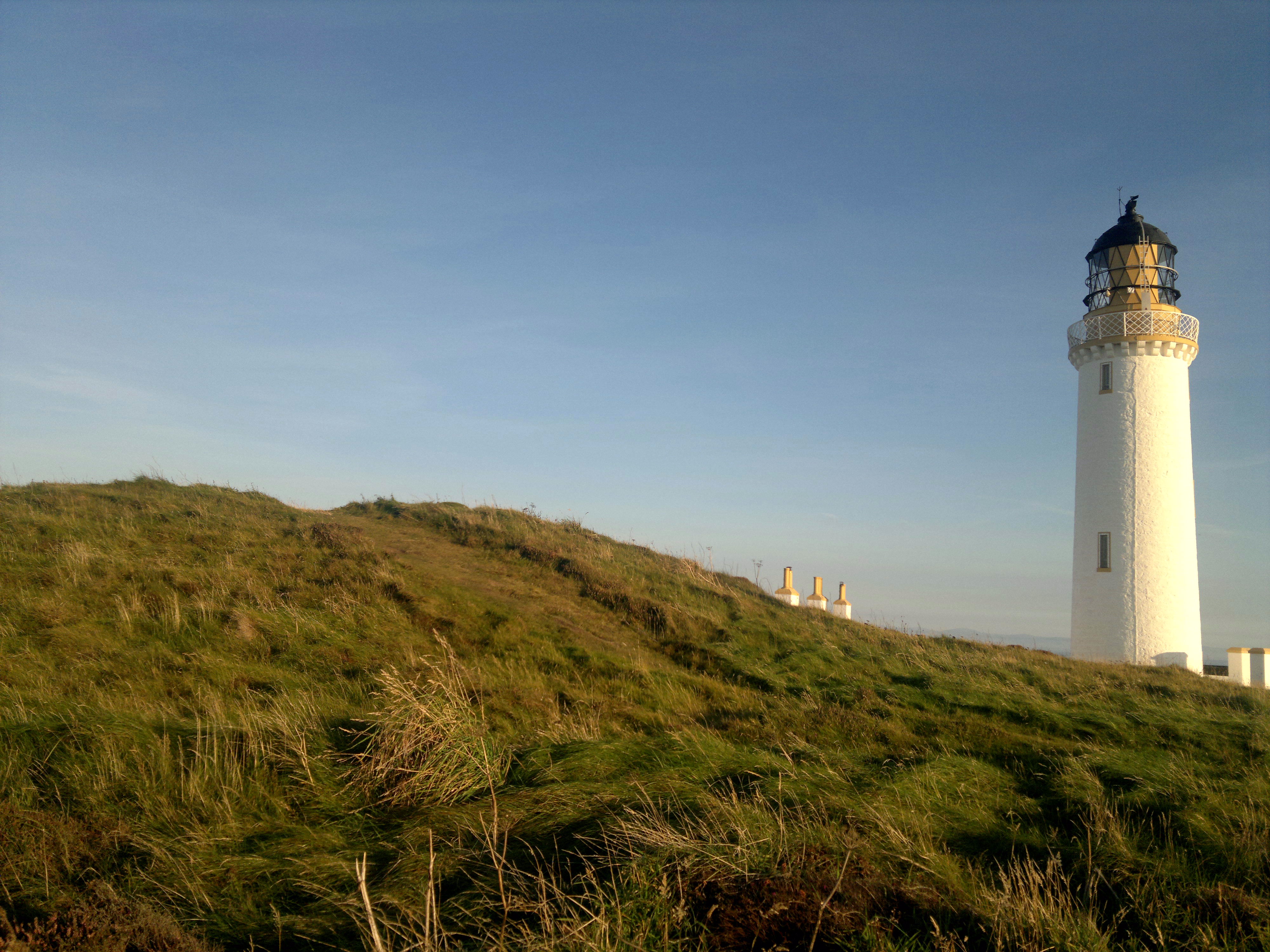


This is my most visited site..a dozen times or more. I love it here, standing on top, looking across to the Isle of Man, the Lake District, Whithorn, Snowdon on a very clear day, and the Irish coast...... watching the birdlife, the resident roe deer, the seething high tide, and, after dark, the beam of the adjacent lighthouse sweeping overhead. To find, just drive south from Stranraer till the road ends. Half an hour non stop, but see how many times you stop en route for scenery and sites, not least the superb triple banked linear earthwork, increasingly believed to be Iron Age, that you pass through near your destination. Park in the car park north of the lighthouse, visit Gallie Craig, the great eatery – with loos – cum travel centre and emporium, walk towards the light. The cairn is on the skyline, left, as you approach. As Canmore – ID 61039 – describes, it’s been knocked about a bit. Until recently there was a flagpole atop. Two watertanks have been incised into its western side. This site is symbolic, and deserves an entry in TMA for this if no other reason. Like so much of Scotland’s ancient archaeology, degraded by the millennia and man, but still a prescence, battered but unbowed. It is the country’s most southern site. ‘Just’ a cairn... but a nation’s archaeology starts – or ends – here.


A blog by a walker who has stomped all over Dumfries and Galloway in all sesons solo and with other ramblers. Many sites visited despite these being in a by the by context. Many photos, highly ‘visually informative’ despite the frequent presence of lines of walkers therein. Good as a reference for routes and permitted access too. Site dormant since May 2015 following his involvement with an online admirer..hope all ok there. For practical purposes Google Glebe Blog and then destination or location you’re interested in. MoG, Torhouskie, Cambret, you name it, he’s probably been. I’ve found this site invaluable and therefore recommend it highly.
Hundreds of flint tools have been unearthed during excavation work prior to constructiom of Lincoln University’s Isaac Newton Building. They include tiny cutting blades and are up to 11000 years old.


