
I kinda thought this might be the remains of a former entrance
Image credit: Robert Gladstone
I kinda thought this might be the remains of a former entrance

Southwestern flank towards the cairns of Esgair Fraith and Craig Twrch... so much going on around here.

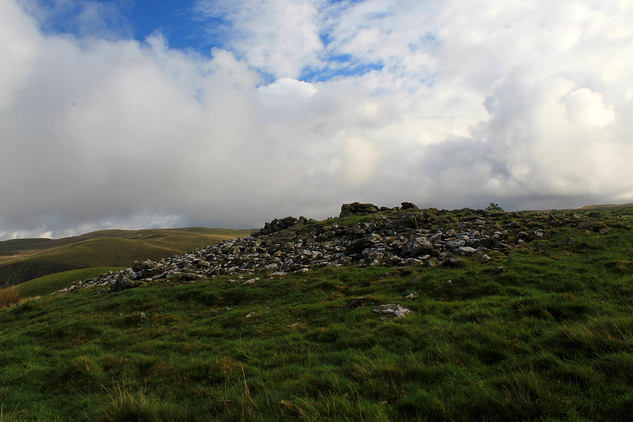
Substantial remains upon the south-eastern flank

Approaching from the approx south-west – the hillfort lies beyond the tree line.

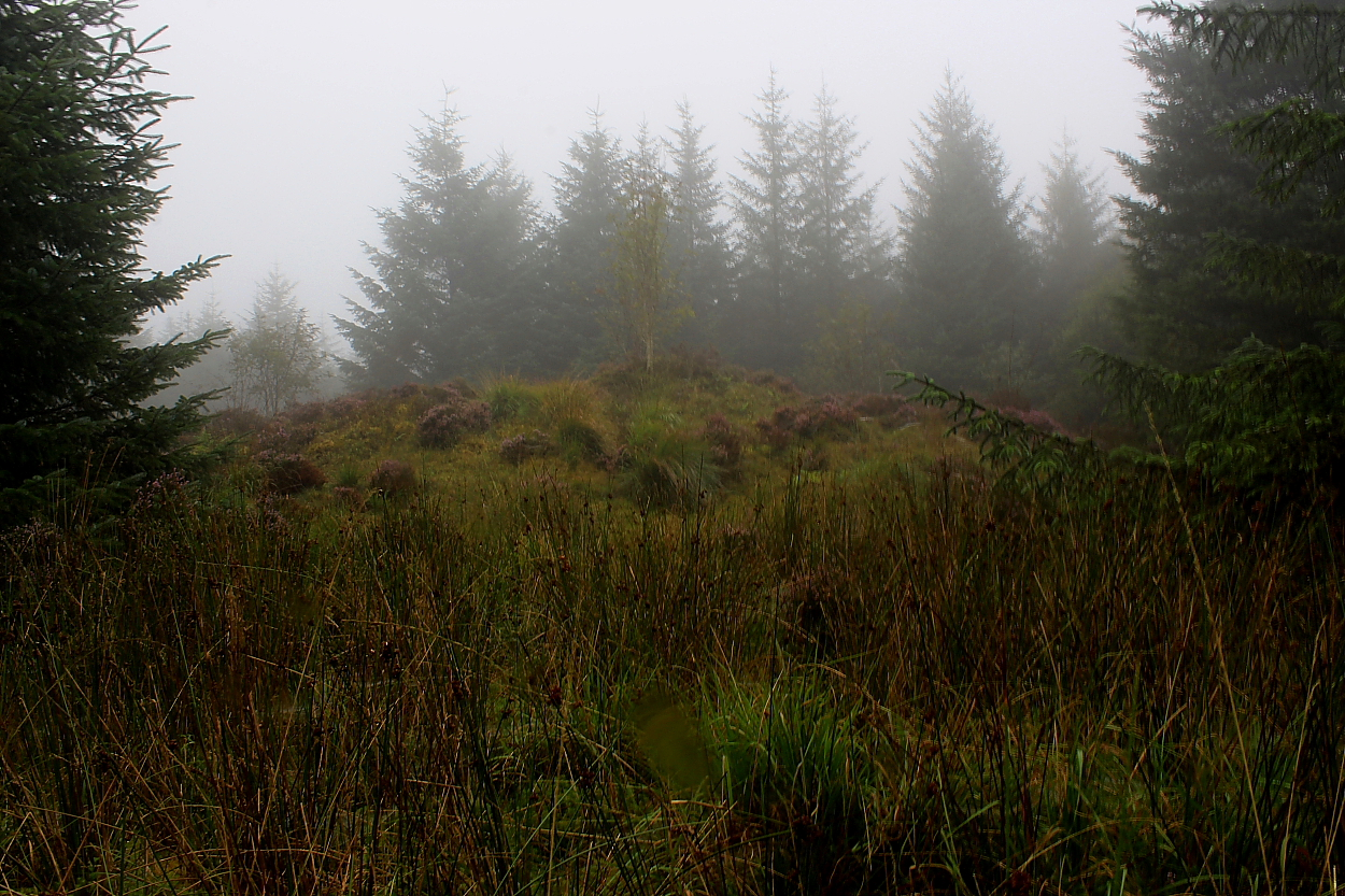
If you didn’t know it was here.........

Looking across to Bryn Rhudd and Banc-y-Gwyngoed...


Towards Llanddewi Brefi. It’s well worth taking a trundle over to the right for some pretty decent views down into the cwm. Just saying...


Looking east(ish) towards upper Cwm Brefi.. Blaendoethie and the wondrous Bryn y Gorlan stone circle are that-a-way.


Looking across Cwm Brefi from Cnwch Mawr...

If one were to get lost between the moon and New York City, guess one could end up here, perhaps? Is that you, Arthur?


This – and its (near-ish) neighbour beside the summit trig – are worthy companions to the great Crugyn Amlwg

Another substantial monument within the forestry...


Impressive monument, this. In a chaotically dishevelled manner...
Not the best of conditions – to put it mildly – but at least there was no view to spoil...
This, another of Wales’ ‘White Cairns’, is almost completely subsumed within seemingly impenetrable forestry covering a minor hilltop to the west of Pumlumon. So much so that The Citizen Cairn admits to having a pretty hard time locating it, despite the monument apparently being some 50ft across. However, all’s well that ends well, as they say. If not exactly ‘all-white’.
Yeah, despite – or perhaps because of – the difficulty reaching the cairn, the intense woodland vibe, amplified many times over by whatever it is that these prehistoric sites do to the receptive human psyche, has me doing mental cartwheels in short order. Indeed, one supposes the proverbial ‘knife’ would make little impression upon the atmosphere to be found here. Bring a chainsaw. No, on second thoughts, don’t! And to think we’ve a myriad myopic muppets jumping up and down on Salisbury Plain... presumably, Pumlumon doesn’t feature upon Papa’s Range Rover’s sat nav?
Coflein doesn’t have a lot to say:
“A much disturbed round cairn, 15m in diameter & 1.5m high, set upon the highest point of a ridge.” [J.Wiles 23.07.04]
Interestingly, Coflein reckons the ‘Mynydd March’ stone may once have been known as Mynydd Tarw... so once upon a time, we may well have had ‘Bull, Cow and Calf’ stones:
“A shattered monolith is located just off the south edge of a road, set back from it about 3m in what is now a ditch between the road and an old field bank which forms part of a forestry boundary. The stone is in three (visible) pieces. The largest is 1m high, 0.7m wide and 0.5m thick. Two much smaller pieces have become detached from each of two sides of the stone.
The stone is portrayed on Lewis Morris’s map of 1744 where it is named Maen Tarw. About 100m along the road to the east is Buwch a’r Llo standing stone pair (which is not shown on the 1744 map. However, the latter are shown on Gogerddan Estate map of 1788, annotated `Maen Tarw?. [David Leighton, RCAHMW, 7 February 2013]”
Revisited during an extended visit to Twll yr Ogof from the Fford Ddu roadside near Cyfarnedd-fawr, I had forgotten how substantial this – The King’s Grave – actually is... some c62ft across. Suffice to say, it’s well worth a primary visit in its own right.
Coflein notes:
“The mutilated ruins of a cairn stand upon a saddle between two mountains at the head of Cwm-llwyd. It is near circular, some 18-19.5m across and survives up to 1.2m high. It is crossed by a comparatively recent sheep shelter wall. The cairn was dug into in 1851, when a cist or slab chamber, 0.9m by 0.7m and 0.5m deep was uncovered. This contained fragments of human bone and had been covered by a 2.0m by 0.9m capstone. In 1851 ‘sheperd-huts’ were observed around the base of the cairn. The cairn was already robbed. The shelter wall is built over the displaced capstone and so must post-date the excavation. [Source: Wynne foulkes in Archaeologia Cambrensis New Series III (1852), 96-9] – John Wiles, RCAHMW, 22 February 2008”
This, the ‘Middle Cairn/Barrow’, appropriately enough stands between Crug Melyn and the unnamed ‘Tumlumus’ shown upon the 1:25k map... although quite why it is named... and its substantial western neighbour is not... I guess only local folklore may be able to explain?
Coflein notes:
“Bronze Age cairn or barrow, 17m” [c56ft] “in diameter, standing up to 2” high, has been ‘opened’. [J.Wiles 20.02.02]”
Less than a mile to the west of the suspect charms of Llech Ciste (which I consequently forgo), what I envisaged as being a minor group of barrow/cairns... in very short order became a fine Bronze Age cemetery worth a considerable journey.
To be fair, owners of the 1:25k map will note that three of the linear alignment of monuments are named... so perhaps I shouldn’t have been so surprised, but there you are. This, the ‘Yellow Cairn’ crowning 1,070ft Pen-crug-melyn at the eastern extremity, is pleasingly bathed in an orangey/yellow(ish) glow as the sun briefly reasserts its dominance following a couple of hours of intense downpour. So, needless to say, the locals know where they’re at. As usual.
Speaking of which, I encounter the farmer in his Land Rover and he beams a smile as bright as that fiery nuclear globe while confirming I’m OK with my parking arrangements. No problem at all, so please don’t take the piss and block his gates should you approach from the south.
Coflein doesn’t say much (if 14m also means nothing to you, that’s c46ft in proper terms):
“A disturbed cairn, 14m in diameter and 1.3m high.
[J.Wiles 20.02.02]”
This, marked as ‘Tumulus’ upon 1:25k OS mapping (presumably owing to the grassy mantle obscuring any expected cairn attributes), stands between Crug Canol and Crug Bach (SN49632863), the latter located near the entrance gate to Mynydd Bach Common and quite hard to distinguish amongst vegetation. There are apparently other monuments nearby I wasn’t able to discern with any certainty.
Although lacking the profile of the two great eastern cairns, this is nevertheless a substantial monument worth lingering at for a while, measuring approx 65ft across and 3ft in height.
Coflein reckons:
“SN49632863, reported as mutilated, c.13m in diameter and 0.9m high, with the eatern of the two.. at SN49882864, being 20m in diameter and 0.9m high. [J.Wiles 19.02.02]”
Bit breezy, but so glad I postponed from last year since classic views are to be had here...
This is an obscure, yet wondrous Bronze Age cairn – some 52ft across – located upon Cnwch Mawr, not far from Llanddewi Brefi in deepest Ceredigion. Unlike many other ancient sites in the locale, this is not annotated upon current OS mapping, meaning a perfect vibe was more-or-less guaranteed.
The monument is substantial and, although I made the usual ‘pig’s ear’ of the approach, access is not too taxing from the southwest via Waun Maenllwyd... suffice to say (in retrospect), ensure you don’t take the direct route across the felled forestry wasteland upon reaching the fence line, but rather circle around to the left. Much easier!!
OK, sure, the weather closed in later on giving me a veritable kicking – and then some. However, hill fog was mercifully absent, ensuring sublime views into Cwm Brefi rewarded a subsequent walkabout. Note that the standing stone ‘Carreg Samson’ is nearby should that also interest... plus, of course, the great cairns upon Crug, Garn, Carn Fawr, Pen y Corn, Craig Twrch etc, etc, etc. Wondrous area, this.
Coflein reckons:
“This is a large Bronze Age summit cairn, which has been shown on Ordnance Survey maps since the Original Surveyors drawing were made in the early 19th century. It has suffered some disturbance over the centuries, but still survives as a substantial stone cairn, 16 metres in diameter and up to 1.25 metres high. A small shelter has been built on its eastern side” [R.P.Sambrook, Trysor, 26 March 2013]


Looking approx east through clearing mist towards Crug Canol (approx centre right) and Crug Melyn (at the summit, before the trees).

To my mind, the most identifiable of the group... and substantial, if somewhat overgrown and difficult to photograph


There is at least one more substantial monument upon the common (seen rising before temperature inversion from from Crug Canol) – amongst several other less upstanding examples ....


Although located close to the farm of Caer Cadwgan, this impressive hillfort, overlooking Cwm Ffrwd Cynon near Lampeter, is traditionally known as Caer Maurice (as confirmed by such an annotation upon the original OS maps of 1834).
For once – yeah, it happens occasionally – The Citizen Cairn is pleased to relate that, although not directly accessed by a public right of way, a concessionary path has been negotiated for visitors. This is to be applauded as an example to other landowners harbouring designs towards embracing community responsibility since this is a hillfort to cherish. Substantial remains and sublime views: what’s not to like?
Now, you know how it is? How some things can linger upon the ‘to do at some point’ list for, well... ages, right? Anyway, for some reason this site, hidden away upon the north-eastern flanks of Y Carneddau’s Creigiau Gleision, finally bubbled away to the top of The Citizen Cairn’s version. Good thing, too, since the monument, some 40ft in diameter, is pretty substantial.... the views sublime.
I approached via the unfeasibly steep Llyn Cowlyd access road from Trefriw crossing Cefn Cyfarwydd (we’re talking Hardknott/Wrynose Pass-grade inclines here) traversed numerous times before in passing. A lesson that one must always look to indulge the supporting cast of any story.
The glorious rainbows were the icing on the proverbial cake and – speaking of ice – well worth the fast moving hail showers disgorging their frozen cargo ‘at pace’, as muppet project managers like to say nowadays.
CADW’s scheduling notes:
“Remains of a burial cairn, probably dating to the Bronze Age on the SE-facing slopes of Cefn Cyfarwydd. Circular in plan, measuring c. 12m diameter and up to 1.2m in height. The cairn has a large hollow at its centre, presumably the result of antiquarian investigation. A small marker cairn has been built on the S. side of the cairn. FF 13/01/2004”