Looking West as the sun sets behind Ratchill Hill and Trehanna Hill.
Image credit: Howburn Digger
Looking West as the sun sets behind Ratchill Hill and Trehanna Hill.

The wedge shaped top. The green hill to the left of the white pole is the site of Tinnis Castle, a set of medieval tower stumps in the middle of an older hillfort.
The bumpy green hill to the right of the white pole is Henry’s Brae hillfort.

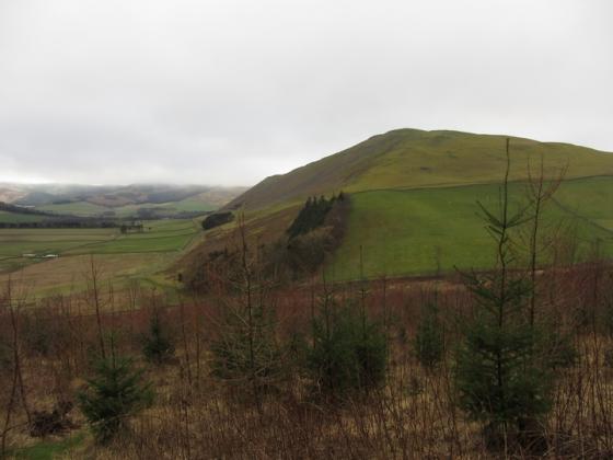
Looking North West to the wide top of Hammer Head.

Looking North East with a Biggar & Broughton (Culter Fell & Dollar Law) Explorer OS Map (Sheet No 336) for scale.
Pandemonium on Drumelzier Haugh Thursday 9 September 2010
This is not the easiest stone to get to. The last time I visited was about ten years ago and it was a simple walk across two fields of barley stubble between the stone and the Drumelzier – Dawyck road. Those fields are now under a ten – twelve foot high Willow plantation. When I looked from across the Tweed on Dreva Craig on Wednesday evening I could see the stone occupying a little fenced off corner still under grass.
I parked at a pull-in near Dawyck and started the walk in only to be met by a big herd of very flighty sheep with a big horned ram snorting and stamping at me. I live on a farm and I’m used to livestock, however the beast obviously felt I was a threat to his harem of a hundred ewes so I quickly moved myself to the other side of a fence and continued towards the Tweed. I was then chased by a barrel-bodied pony-horse hybrid which galloped up to me and kept nudging me in the small of my back with her snout. In order to escape Dobbin’s attention-seeking behaviour, I carefully picked my way over a collapsing dry stane dyke injuring my shin and found myself faced with a six foot burn to traverse. Despite a long, limping run and jump I fell short of the far bank and ended up knee deep in the burn. Still a field length to go before I could reach the Tweed and the walk upstream to the stone, I picked up my pace and was met by a gang of stirks as I turned the corner to cut along the last field boundary. These young bullocks were very agitated by my presence and stamped and huffed at me from the other side of a too-low fence. I felt my enthusiasm for the lonely stone trickle away like the stinky water oozing out of my bootlace holes. But I squelched on anyway. The bullocks formed a guard of honour on the far side of the fence and mooed loudly as they accompanied me on the last stretch of my journey to the stone. The sun had already passed behind the steep hills which hem in this lovely valley.
Then the stone was in front of me. What a delight! Lichened, squat and sitting proudly in its little fenced-off reserve, its angular wedge top cocked a snoot at the sky’s dying light. On one of its lower faces, the stone appeared almost glassy, like the blue-ish chert which I keep finding in my tattie patch. Now hemmed in by the willow plantation, the stone is sort of cut off from the wide valley floor which it used to look out on. Did it have any brothers or sisters originally? I could see no tumbled brethren and no big stones re-used in the dyke which propped up the low fence which was still holding back the bullocks. I was surprised to see the ring ditch and soutterain were visible close by in the stone’s little fenced-off reserve. Their outlines were betrayed by deep curving lines of clover growth and they were exactly as they appear on Google Maps.
They proved impossible to photograph from ground level of course.
The return tramp to the car held a similar spate of livestock incidents as my outward journey had and I got wet twice more evading livestock and making unnecessary crossings of what turned out to be a loop in a burn. The fates continued to conspire as an engine warning light and a SRS seatbelt light came on simultaneously en route home. Pandemonium indeed.
Local legend connects the stone with the burial place of Merlin the Wizard. Merlin was said to be buried 183m NNW of Drumelzier Church, close to the right bank of the River Tweed. There are no structural remains and none have ever been recorded at the place in question, but it is possible that the tradition may have been originated from the unrecorded descovery of a Bronze Age cist in the area, which links to the Drumelzier Stone.
A five foot high stone stands on a slight elevation near the river, north of Tinnis Castle. RCAHMS says it has a wedge-shaped top.
There’s also thought to be a ring ditch and souterrain at NT 1396 3544, 30m from the stone.