Sites within Tap o’ Noth

location_on photo ondemand_video forum description link

location_on photo ondemand_video forum description link

location_on photo ondemand_video forum description link

Images

Image of Tap o’ Noth (Hillfort) by thelonious

02/04/2025 – Photo looking over the ramparts north to reds and greens of the northern lights.

Evening walk up Tap o’ Noth in Aberdeenshire. We took the scope and spent 4hrs on top, just sitting, having a brew and chatting to the stars. It was chilly but we hid behind the ramparts so it was OK. Aurora, stars, galaxies and nebula on a dark night, it was all pretty magic.

Image of Tap o’ Noth (Hillfort) by thelonious

24/02/2023 – Day off. Visit to Tap o’ Noth hillfort. Rain mostly held off which was a bonus. Quiet walk. The interior of the fort was looking nice today.

Image of Tap o’ Noth (Hillfort) by thelonious

24/02/2023 – Vitrified section of rampart also the top of the hill. I love vitrified hillforts.

Image of Tap o’ Noth (Hillfort) by thelonious

30/08/2022 – Evening visit to Tap o’ Noth hillfort. Bit cloudy but the view north over the vitrified walls was as good as I’ve seen it. The Caithness hills, 110km away, stood out really well. Big Morven in middle, the 3 tops of Scaraben to its right. Also far left Ben Uarie in Sutherland.

Image of Tap o’ Noth (Hillfort) by costaexpress

Well I drove overnight to get here early morning (500 miles), the weather forecast was unbelievably hot, however, Tap ‘o Noth refusing to reveal itself just yet

Image of Tap o’ Noth (Hillfort) by thelonious

10/03/2018 – Tap o’Noth from my settee.

Rainy day today so we had a play about with Lidar data sets. Just wish the whole of Scotland was covered but it was nice to find Tap o’Noth on there. remotesensingdata.gov.scot/collections We used QGIS, which is a nice free bit of software, to view the data.

Image of Tap o’ Noth (Hillfort) by drewbhoy

Northern skies for Spencer, looking towards the Tap O Noth.

Image credit: drew/amj
Image of Tap o’ Noth (Hillfort) by thelonious

04/09/2016 – Spectre from Tap o’Noth hillfort. A misty early morning on the hill.

Image of Tap o’ Noth (Hillfort) by GLADMAN

Tap o’Noth is a fabulous viewpoint, it has to be said.

Image credit: Robert Gladstone
Image of Tap o’ Noth (Hillfort) by GLADMAN

Looking from the night’s stop upon Suie Hill....

Image credit: Robert Gladstone
Image of Tap o’ Noth (Hillfort) by GLADMAN

The final approach to the enclosure...... quite a steep climb, but well worth it. Note the OS Trig pillar.

Image credit: Robert Gladstone
Image of Tap o’ Noth (Hillfort) by GLADMAN

Bennachie (top right) and the Dunnideer landscape (top left) from the lee of the south-eastern rampart.

Image credit: Robert Gladstone
Image of Tap o’ Noth (Hillfort) by GLADMAN

Looking from the west across the north-eastern ramparts as a hail front is hurled across the sky by (apparently, according to the radio) 100mph plus winds. Impossible to walk the ramparts. A crab-like ‘two-forward-one- back’ stagger was my limit.

Image credit: Robert Gladstone
Image of Tap o’ Noth (Hillfort) by GLADMAN

The mighty rampart on the north-eastern flank, enduring very, very strong winds.

Image credit: Robert Gladstone
Image of Tap o’ Noth (Hillfort) by GLADMAN

The entrance to the enclosure......... calm before the storm.

Image credit: Robert Gladstone

Articles

Tap o’ Noth

12/02/2022 – I need the quiet places more with each passing year. Early starts or late to avoid folk. Everywhere seems so busy at the moment. Heading out round sunset has been a bit of a life saver over winter. We were thinking of heading more inland today but the wind wasn’t great so decided to go to Tap o’ Noth. Got there about 30 mins before sunset. Empty car park so we had the hill to ourselves. Starting our walk in lovely late sunshine, it’s less than an hour to the top. We looped round east on the way up instead of the normal climb from the west. The Sun had gone to bed by the time we reached the hillfort. Twilight, I love these next two hours. The wind was cold as we walked to the trigpoint and the top just beyond, a really good lump of vitrified wall. We ducked out of the wind and plonked ourselves down inside the fort to have our tea. The walls of the hillfort shut out all the lights from down below, leaving just us and the emerging stars as the sky started to darken. Just a few days to full moon so no need for headtorches. The fort was now gently lit by moonlight. I’ve been trying to remember better the names of constellations recently instead of pointing and saying to Mrs T, ‘What’s that one called again?’ all the time. I’m pretty hopeless at it. Why can’t they all be easy like Orion. I stood up after a bit as I had been sitting cross legged for a while, which is always comfy until it isn’t. Sticking my head up over the walls, the wind reminded me quickly why we were sitting where we were. It felt colder in the dark. I didn’t stand long on the walls and soon hurried back to the sanctuary inside the fort and another warm brew. Last time we were here in the dark, I didn’t have a great feeling but this evening the fort felt safe and from inside the walls, the sky looked a perfect planetarium. We stayed as long as we could but the cold was getting into my hands so it was time to go. The walk down was by moonlight and we only needed our torches when we reached the trees. Tap o’ Noth is a fantastic place and wonderful hillfort. Just a lovely trip there today, away from the busy world.

Tap o’ Noth

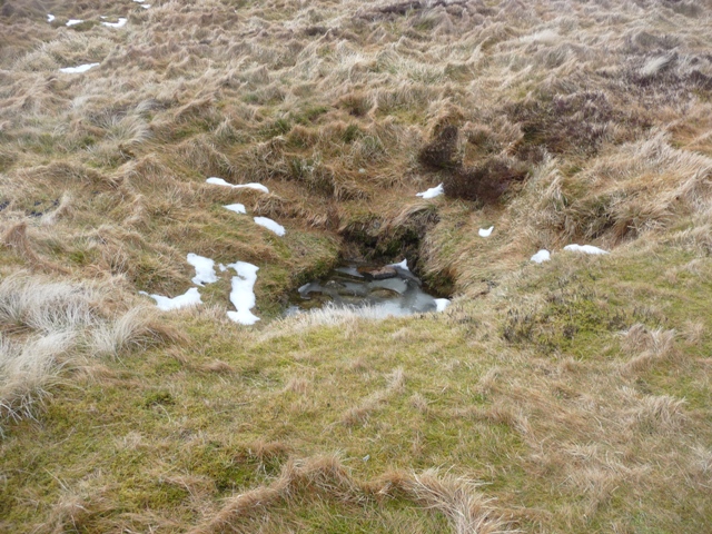
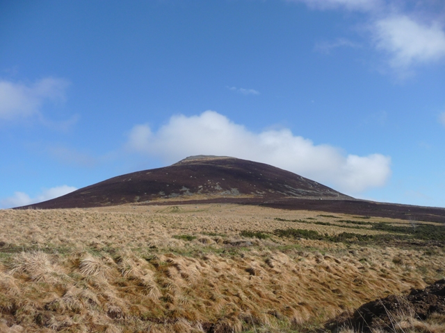
I awake to a promising dawn; dry, with high, broken cloud, albeit the wind having escalated quite considerably once again. The second of Aberdeenshire’s ‘legendary’ hillforts it is, then.... Tap O’ Noth. Yeah, as with the nearby Mither Tap, the ‘breast’ analogy is only too obvious upon arrival at – in fact well before – the spacious car park. Cope waxes lyrical (in the paper TMA) concerning the relationship these ‘mother hills’ had – still have, in fact – with the myriad RSCs, in various states of preservation, within visual proximity. I must admit I read this with a certain degree of cynicism at the time .... before I came and saw for myself. There really is no substitute for seeing with thine own eyes.

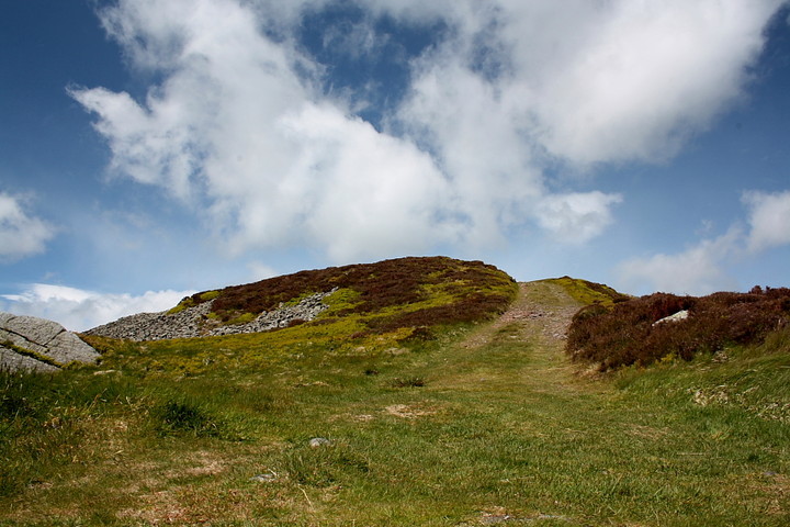
Drewbhoy’s notes have nailed the directions, so I won’t labour the point further.... except to say that upon the final approach the traveller has a choice of keeping to the main track, or taking a narrow ‘sheep track’ which ascends the mountainside to the right, towards the prominent ramparts crowning the summit. Note that a new ‘deer fence’ was being erected at the time of my visit – assume there will be a gate? Anyway, being impatient I took the latter route, and to be honest struggled a little in the fierce wind; however bear in mind that this conical hill, at 1,851 ft (564m), is more like a minature mountain in terms of terrain/vibe – so dress accordingly... for the worst. Yeah, after 20 odd years of walking Britain’s uplands I was certain I had all bases covered. Wrong! Suffice to say you never have everything completely sussed upon Britain’s hills.

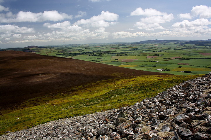
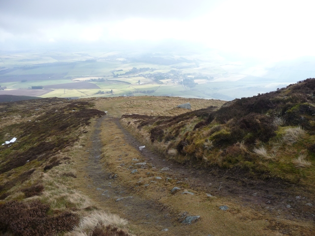
Walking through the entrance, sited at the south-eastern corner of the great drystone ramparts, I suddenly leave the safety of the lee of the mountain and realise that, not to be outdone by Bennachie a few days earlier, Tap O’Noth is about to give me a serious ‘kicking’. With great big hob-nailed boots on! A group of youths, engaged upon some expedition or other, sit huddled below the OS triangulation pillar which crowns a section of vitrified rampart to the west. If this is their first taste of the hills, some introduction, lads! I check they are OK and proceed to take in the stunning view east to Dunnideer, the fragment of medieval tower crowning the much smaller ‘mother hill-cum-vitrified-hillfort’ clearly visible. Not to mention the iconic skyline of Bennachie itself to the approx south east. The view to the south-west is just as exquisite, ditto the other points of the compass (with a more woodland vibe), albeit into the teeth of the gale. And herein lies the problem... it is very, very difficult to stand, and impossible to move without bracing every step with trekking pole fore and aft. However I cannot leave Tap O’ Noth without traversing the mighty ramparts, the volume of stone contained within which is seriously impressive. Canmore records state that the defences consist of ‘a single wall... which may have originally been more than 20ft (6.1m) thick and encloses an area about 335ft (102m) by 105ft (32m)’. It is thus not the largest of enclosures, yet it takes me about 45 minutes to complete a circuit in, all things considered, the most extreme wind I’ve every encountered. In a way the titanic struggle I have today is appropriate... everything about Tap O’ Noth is extreme. Siting, defences, vitrification, views... and, last but not least, surely symbolism? To ensure I get the point Nature hammers it home with a very violent hail front which fair hurtles past. Strewth. I won’t forget my visit here in a hurry. Which is how it should be.

Tap o’ Noth

From the centre of Rhynie take the A941 west and look for the sign post to the Tap O Noth car park. The first stage of the path is grassy and boggy then turn west. At the moment the path is now a mud bath thanks to the construction of a man made lake. After a 1/2 mile of this the path turns north and starts to climb and improve. This is on the sheltered side and there still is a lot of snow on the path but as the path goes to the front of the hill the snow lessens.

The summit of the Tap O Noth supposedly an extinct volcano, the 2nd highest hillfort in Scotland, has a rampart surrounding it. On the southern side the rocks are vitrified. The reason for building it is obvious – the all round views. To the north the fort at Durn Hill, to the eastern side various hillforts including Wheedlemont, Cairnmore, Dunnydeer, Hill of Christ’s Kirk and Mither Tap can all be seen.

This is a very pleasant climb, steep in bits but the weather is changeable. Today the climb was fine but on the next hill north a blizzard raged as can be seen in some of the pics.

Visited 17/2/2011.

Folklore

Tap o’ Noth
Hillfort

A strange little anecdote, from “’A description of the parioches of Essie and Rhynie’ (circa A.D. M.DCC.XXX.)” (ie 1730):

The Top of Noth is a very remarkable hill here. It has a fountain on the very summit, without any current from it on the outside; but if a taper rod be put into the vein of the fountain, it comes forth, in twenty-four hours space, at a large issue at the foot of the hill, called Coul’s Burn, after being carried three miles under ground by the force of the current.
Here are monuments in several places, thought to be the remains of heathen superstition, though many other fabulous stories are told of them. [Though not at the moment, because this is where the anecdote cruelly finishes, sadly]

I wonder if this hillside Pooh-sticks is a local story, or sort of a Geologists’ story? Quite strange whichever way.
On page 178 of Antiquities of the Shires of Aberdeen and Banff. Second Volume.’ 1847. Readable online at Google Books.

Sites within 20km of Tap o’ Noth