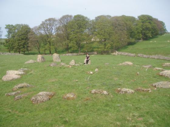


Compare this picture with Fitz’s taken two years previously, looks like the site owners are happy to let the stone vanish behind the foliage.


Heading back towards Penrith, we soon found ourselves pulling into a weird little industrial site just off the A66. We followed Fitz’s instructions, and right enough, there was our 2nd upright stone of the day! What a strange situation and how lucky that the stone survived the industrial units being built all around it. Similar in size and shape to the one at Winderwath and no longer sitting amongst some bushes, this has the air of abandonment about it – only nettles and thistles were in the way today. As we were poking around, the local farmer came over and stared chatting; he said there had been a 2nd stone close by that had been cleared some time ago and mentioned that the original roadway had run from Eamont Bridge (where Mayburgh & Arthur’s henges are) following the watercourse and came out here. This started lots of ideas whizzing round our heads, wondering if this roadway had followed an ancient route, marked by these lovely big monoliths??? Vicky and I love theorising about such things and often convince ourselves of stuff that we have no evidence of – and here we were again – we got out the map and starting trying to find an obvious route, linking various sites in the area. Oh, what fun we can have with a little knowledge and such fertile imaginations!
Visited 18.9.10
Fairly easy to access but don’t look out for a Lilliput Lane sign as they are now gone!
Directions: Come off the M6 at Junction 40 and take the first exit (if heading north). Then take the first small turning on your left – easy to miss as it looks like a private drive. The road actually leads you to a pretty little business park – it has a well and a thatched cottage! Park in the visitor’s car park and look to your left for a long, white walled, single storey building (not pretty!). This is where Lilliput Lane was – empty when I visited. To the right of the building you will see a metal gate (by the fire exit). Immediately next to the gate on the left is a small overgrown area of bushes. Amongst these bushes you will find the standing stone.
It is difficult to see the stone properly due to the bushes but it is worth checking out when in the area.
My previous failure to find this stone was down to one thing – piss poor map reading.
Stu and I dropped into the council depot to ask for permission to search their yard for the stone. The lady in reception looked at me a bit strangely then went off with my map to talk to the boss. When she returned she told me I was in the wrong place, I thought she was just trying to get rid of me until the penny dropped...doh! She was right of course.
So guess where this lovely stone is? Lilliput Lane, the home of those little pottery houses that adorn many a twee shop.
To get there from the east, head west over the roundabout that sits over the M6, the turn off is the first on the left after the roundabout and is marked Lilliput Lane. Me and Stu were a bit worried that someone might see us driving into the place and mistake us for a pair of punters looking for a 3” high cotswold cottage to complete our collection. Park up in the visitors car park and walk round the side of the workshop and there it is a 6-7 foot tall beast of a stone with it’s own little garden, right beside the fire escape. I think the workers playing footy round the back must have thought we were someone official because they soon scarpered.
Well worth checking out.
This one eluded me today.
It’s marked on the OS Explorer.
I just couldn’t get to it.
I first tried down the lane from Mayburgh..dead end
Then from Yanwath..dead end
Then into the Skirsgill depot site from the M6/A66 roundabout...no joy
I thrashed around a farmers field and found nothing but a small low lying glacial boulder at the foot of the embankment of the A66.
There is a farm there and you can see the lane, but were it starts and how to access it beat the crap out of me today.
next time .......
Judging by an old map, there were a few wells in the vicinity of Skirsgill (the house) which would be a mere step away from the stone. Though which one might be referred to here I don’t know. The site is right next to the river, just like Mayburgh (but now on the other side of the motorway).
PENRITH WELLS.
..Penrith was once noted, and has some fame still, for the number of its wells. The whole month of May was set apart for special observance of customs and ceremonies to be performed on each Sunday. There were four wells with a Sunday allocated for honouring each well. The Fontinalia opened at Skirsgill on the first Sunday; then in order Clifton, afterwards the well at the Giant’s Caves, supposed to be St. Ninian’s; and, lastly, at Dicky Bank, on the fellside, where the festivities were concluded.
From p42 of ‘Legendary Lore of the Holy Wells of England Including Rivers, Lakes, Fountains and Springs’, by Robert Charles Hope (1893). online at antipope.org/feorag/wells/


