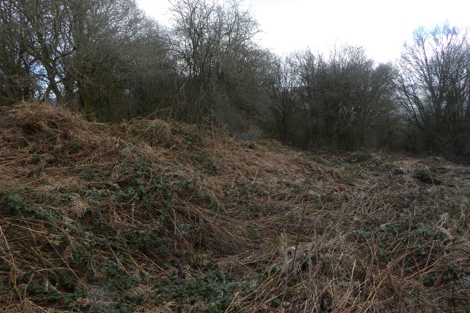
The Modern Antiquarian
Log in
|
Register
Home
Latest Posts
Forums
Maps
Help
Browse Sites
News
Blog
Contributors
The Books
Select
-
Belgium
Denmark
Eire
France
Germany
Greece
Italy
The Netherlands
Norway
Portugal
Republic of Malta
Spain
Sweden
Switzerland
United Kingdom
Wales
Powys
Radnorshire
Bryn yr Hydd
Enclosure
Bryn yr Hydd (Enclosure) on The Modern Antiquarian, the UK & Ireland's most popular megalithic community website. 6 images, plus information on many more ancient sites nearby and across the UK & Ireland.
Image © A. Brookes (25.3.2023)
Nearest Town:
Hay On Wye (3km ENE)
OS Ref (GB):
SO18654138 /
Sheets: 148, 161
Latitude:
52° 3' 51.72" N
Longitude:
3° 11' 12.57" W
Added by
thesweetcheat
Images (6)
0 discussions
Start a topic
Show |
Hide
Web searches for Bryn yr Hydd
Flickr
Google
Google Images
The Megalithic Portal
Bing
Stone Pages
Streetmap.co.uk
Wikipedia
Show map
(inline Google Map)
- Sites within 20 km -
-
Moll Walbee's Stone (0.63km ENE) (6 posts)
Clyro Court Farm (3.07km NE) (7 posts)
Coed-y-Polyn (3.11km S) (9 posts)
Maesgwyn Mound (3.12km WNW) (1 post)
Little Lodge (3.4km S) (26 posts)
Pen-y-Wyrlod (4.06km E) (26 posts)
Spread Eagle (4.33km SW) (2 posts)
Pipton (4.94km SSW) (9 posts)
Crossfoot Farm (5.39km NE) (6 posts)
Bryn y Groes (5.47km SSW) (2 posts)
Lane Farm (5.85km NNW) (1 post)
Neuadd Glan-Gwy (6.03km WSW) (6 posts)
Twyn-y-Beddau (6.1km E) (15 posts)
Rhos-Goch Chapel (6.22km NNW) (1 post)
Boughrood Court (6.31km WSW) (1 post)
Maen Hir (Boughrood) (6.48km WSW) (12 posts)
Ffostyll (6.63km S) (37 posts)
Pen-y-Beacon (6.63km ESE) (44 posts)
Pen-rhiw-wen (6.79km WSW) (11 posts)
Pen-y-Beacon (7.37km ESE) (31 posts)
Pen Cae Newydd (7.47km W) (1 post)
Archenfield (7.58km ENE) (4 posts)
Twyn y Garth barrows (8.15km W) (7 posts)
Twyn y Garth (8.25km W) (10 posts)
Wern Frank Wood (8.28km SSE) (13 posts)
Parc-y-Meirch (8.3km E) (0 posts)
Pen-twyn Camp (Brilley) (8.31km NNE) (1 post)
Llan Oleu (8.45km E) (4 posts)
Y Das (8.73km SSE) (15 posts)
Gold Post (8.91km E) (1 post)
Blaen Henllan (9.28km W) (1 post)
Talgarth Camp (9.29km SSW) (1 post)
Cefn Hill (9.31km E) (2 posts)
Mynydd Bychan (9.37km SSE) (22 posts)
Mynydd Brith (9.43km E) (8 posts)
Nant Bwch (9.98km SE) (3 posts)
Tre Durn Wood (10.42km SW) (1 post)
Penyrwrlodd (10.49km SSW) (23 posts)
Milton Hill (10.51km NE) (1 post)
Six Stones (10.55km NNW) (2 posts)
Cefn Wylfre (10.71km NW) (4 posts)
Bwlch Bach a'r Grib (10.77km SSE) (22 posts)
Hillis Camp, Llanfilo (11.21km SW) (2 posts)
Castell Dinas (11.3km S) (36 posts)
Pen-yr-Allt (11.5km SW) (1 post)
Gannols Farm (11.84km ENE) (4 posts)
Pen Trumau, Black Mountains (12.17km SSE) (20 posts)
Wern Derys (12.34km E) (20 posts)
Ty Isaf (12.38km S) (11 posts)
Duke's Farm (12.84km E) (1 post)
Drostre Bank (13.13km SW) (0 posts)
Arthur's Stone (13.22km ENE) (92 posts)
Mynydd Troed (13.22km S) (20 posts)
Pen y Gadair Fawr (13.31km SE) (28 posts)
Mynydd Llysiau, Black Mountains (13.4km SSE) (4 posts)
Giants Grave (13.77km NW) (16 posts)
Mynydd Llangorse promontory fort (13.88km S) (22 posts)
Dorstone Hill (14.06km ENE) (2 posts)
Caeau Enclosure, Cockit Hill (14.16km S) (4 posts)
Banc y Celyn (14.32km W) (22 posts)
Maen Llwyd (Twyn Du) (14.32km SE) (28 posts)
Mynydd Troed cairn (14.39km S) (16 posts)
Tywn-Y-Gaer (near Llaneglwys) (14.52km WSW) (1 post)
Twyn-y-Big (14.55km W) (21 posts)
Pentre House (14.55km ENE) (11 posts)
Cross Lodge (14.6km ENE) (7 posts)
Hundred House Common (14.75km NW) (1 post)
Glascwm Mill Cottages (15.03km NW) (1 post)
Blaneau-draw (15.26km S) (11 posts)
Llanveynoe Crucifix Stone (15.33km ESE) (1 post)
Gwaun Ymryson (15.37km WSW) (8 posts)
Mynydd Llangorse (15.39km S) (9 posts)
Cefn Clawdd (15.41km WSW) (9 posts)
Bryn y Maen (15.7km NNW) (12 posts)
Mynydd Epynt (Eastern) (15.79km WSW) (0 posts)
Twyn-y-Post (15.79km WSW) (11 posts)
Loxidge Tump, Black Mountains (15.86km ESE) (12 posts)
Pen Twyn Glas, Black Mountains (15.89km SSE) (8 posts)
Gwern Dyfnant (15.95km NNE) (1 post)
Black Darren (16km ESE) (27 posts)
Bryn y Maen fallen monolith (16.02km NNW) (4 posts)
Twyn-Llechfaen (16.06km SW) (2 posts)
Cwm Shelkin (16.12km S) (9 posts)
Garth (Duhonw) (16.14km W) (8 posts)
Blaen-y-Cwm Uchaf (16.59km S) (4 posts)
Cwm Bwchel, Black Mountains (16.74km ESE) (25 posts)
Church of St Michael (16.83km NNW) (2 posts)
Wiral Cairn, Black Mountains (16.88km ESE) (23 posts)
Llanfihangel Nant Melan (16.92km NNW) (1 post)
Pen Tir (17.02km S) (6 posts)
Nant yr Ychen (17.02km SE) (3 posts)
The Whet Stone (17.08km NNE) (6 posts)
Fedw (17.11km NW) (6 posts)
Cwm Stone (17.13km NW) (5 posts)
Pen Allt-Mawr (17.19km SSE) (30 posts)
Longtown Stone Circle (17.29km ESE) (1 post)
Cefn Moel (17.36km S) (4 posts)
Coed y Gaer (17.41km S) (12 posts)
Llanerch Stone (17.42km NNW) (6 posts)
Carneddau Hill (Builth Wells) (17.45km WNW) (11 posts)
Ty Illtyd (17.46km SSW) (21 posts)
Llanhamlach (17.51km SW) (5 posts)
The Van (17.54km NNW) (12 posts)
Cwm Berwyn, Carneddau (Builth Wells) (17.57km WNW) (14 posts)
Poston Camp (17.58km E) (1 post)
Castle Bank (17.75km WNW) (24 posts)
Graig-ddu, Black Mountains (17.83km ESE) (28 posts)
Graig Camp (17.88km NW) (11 posts)
Pen-yr-Heol Las (17.92km S) (7 posts)
Cwm Maerdy (17.95km NW) (7 posts)
Allt yr Esgair (17.95km SSW) (19 posts)
Ffynnon Las I (18.12km S) (3 posts)
Pen Gloch-y-pibwr (18.23km SSE) (13 posts)
Carneddau North (Builth Wells) (18.26km WNW) (14 posts)
Slwch Tump (18.37km SW) (15 posts)
Garn Wen (Crucorney) (18.39km SE) (29 posts)
Parkwood (18.64km E) (1 post)
Rhiw Arw (18.67km ESE) (14 posts)
Bwlch Cairn (18.73km S) (11 posts)
Old Radnor Church (18.8km NNE) (6 posts)
Gelli Hill Cairn (19km NW) (10 posts)
Gilestone (19.11km SSW) (3 posts)
Pen Cerrig-Calch (19.21km SSE) (35 posts)
Pen y Crug (19.21km SW) (30 posts)
Gelli Hill (19.24km NW) (19 posts)
Gelli Hill stone (19.3km NW) (8 posts)
Harpton Court Barrow (19.31km NNE) (3 posts)
Crossway Barrow (19.32km NNE) (1 post)
Disgwylfa (19.35km SE) (10 posts)
The Tretower Stone (19.48km S) (12 posts)
Gilwern Hill (19.74km NW) (7 posts)
Walton Green Cursus (19.75km NNE) (2 posts)
Bwlch Standing Stone (19.8km S) (11 posts)
Hindwell Cursus (19.94km NNE) (3 posts)
Fennifach (19.98km WSW) (3 posts)
Hatterrall Hill (19.99km ESE) (31 posts)
- Facilities within 20 km -
-
Builth Wells Tourist I... (Tourist Information: 17.7 km WNW)
Brecon Tourist Informa... (Tourist Information: 19.1 km SW)
Brecknock Museum and A... (Museum: 19.2 km SW)
- Add -
-
Add news
Add an image
Add fieldnotes
Add folklore
Add miscellaneous
Add a link
Add a nearby facility
Add an alternative name/spelling
Images
(click to view fullsize)
Add an image