|
|

|
|
Mynydd Carn-y-cefnCairn(s)
|
||||||||||||||||||||||||
|
|
|
Images (click to view fullsize) |
|


|
Fieldnotes |
|
|
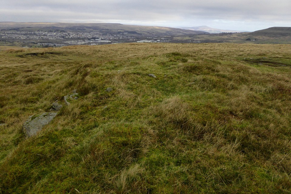
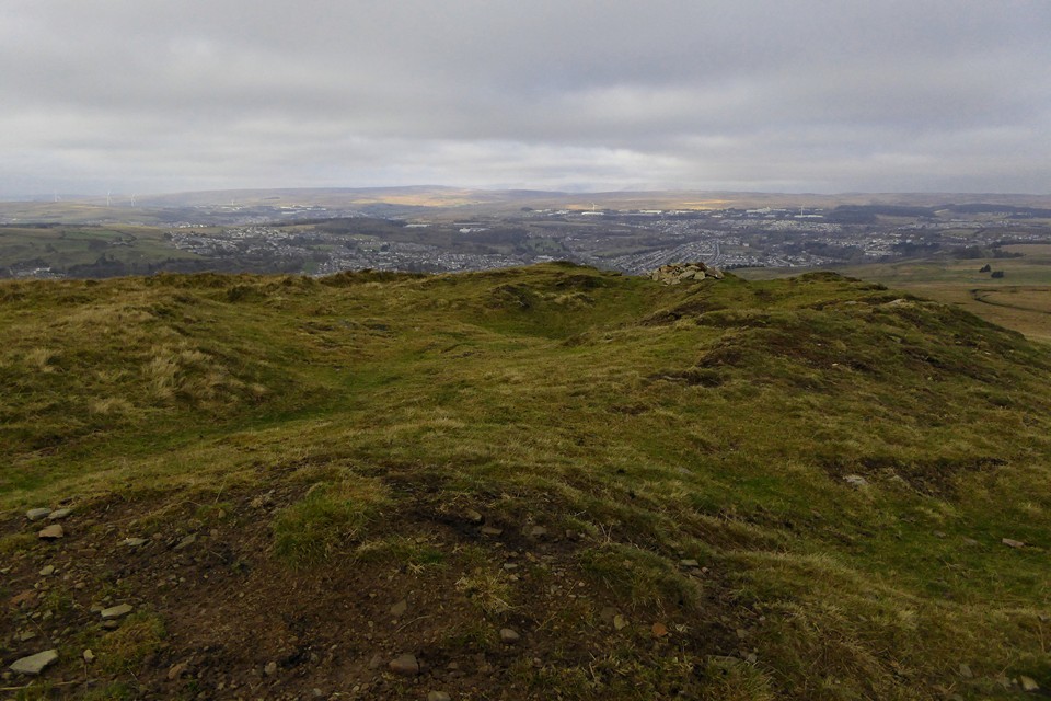
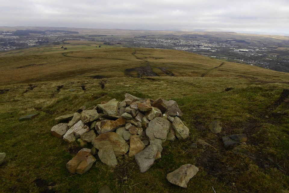
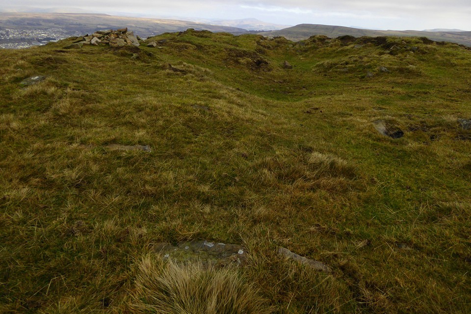
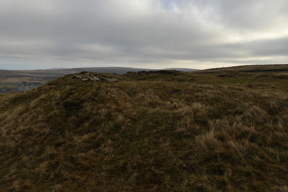
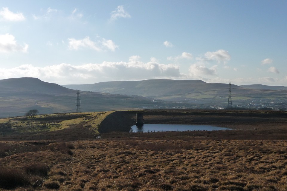
A hot, sunny trip involving a horseshoe walk around Mynydd Coety and the ridges above Blaenavon in May 2021 reminded me how much I have been neglecting South Wales recently, but even so it has taken me until the turn of a new year (22.1.2022) to act. It's freezing cold when the near-empty train drops me at Ebbw Vale Parkway station, a hard frost rendering the pavements slippery. The sun is shining though, and as I start to make my way uphill on a zigzag path to Waun Lwyd, there is a great view of Y Domen Fawr across the valley westwards. If my legs permit, I hope to get up there later today, but it looks like a long walk to get all the way around the head of the valley and up the other side. First things first though, I already have one steep hill to negotiate above me. The scruffy path climbs to a reservoir, where further four-wheel vehicle access has been blocked by huge stones. Sadly two wheel vehicles are not prevented, as will become apparent later. Above the reservoir, the escarpment climbs steeply and I'm soon feeling pretty warm underneath layers of clothing. I'm relieved to make it onto the top of the ridge, although the path becomes increasingly lost in heather and grassy tussocks. From the south a big cloud-front is now moving overhead, and my hopes of a lovely blue sky are quickly smothered. Still, it's great to be back up on the ridges again. The views are fine despite the overcast sky. My only company as I make my way across the heather to the summit trig is a herd of ponies, wary of me but no trouble. The trig is placed on the highest point of the ridge, giving good long views but absolutely no good views of the valleys either side. For that you need to head to the edges of the escarpments either side. It's not a great place for a Bronze Age cairn and the builders of such monuments have clearly taken this to heart. To find what I've come up here for, I have to keep heading north along the ridge. Unfortunately the damage caused by motorbikes now becomes apparent; a broad black line cutting through the surface vegetation into the peat below, stretches all the way to the end of the ridge and the solitary cairn at its end. The tracks sadly continue onto the ruined monument itself, no respect given here. In truth the cairn is in a pretty sorry state even without this latest desecration, a ragged rim of earth and stone around a central scoop, the southern edge almost down to ground level. However, the views and location make up for the state of the archaeology. A sweeping panorama stretches from Y Domen Fawr across Ebbw Vale to the west, taking in the Brecon Beacons (mostly hidden in the cloud), the limestone plateau of Mynydd Llangatwg and Mynydd Pen-cyrn, with the Black Mountains behind, and the solitary peak of Mynydd Pen-y-Fal (The Sugarloaf) beautifully framed by valleys to the northeast, then across eastwards to Mynydd Coety with Blorenge peaking out beyond. A superbly placed monument, for all its unloved, battered state. It's 11 years and a handful of days since I wandered across the limestone of Twr Pen-cyrn and got my first long distance views of Mynydd Carn-y-Cefn. It's taken far too long to get up here. I stop at the cairn for a good while, partly hoping the cloud will lift but it's not happening. Eventually I follow the scarred tracks steeply down to the flat area below, named Bwlch y Garn (Pass of the Cairn) on the map. At the north-western end of this flat area is another irregular mound. GGAT dismiss this as a clearance cairn and they may be right, but the setting would be excellent for a Bronze Age monument. From here the definite article is clearly visible on the lip of the escarpment rising behind me to the south. I head off downhill via crumbling paths to Ebbw Vale town centre, a drab place on what has become a grey day. But I'm not stopping, I have another hill to climb, and set my weary sights upwards on Y Domen Fawr. |
 Posted by thesweetcheat
30th December 2022ce Edited 31st December 2022ce |
Miscellaneous |
|
Coflein description:A cairn, 14m in diameter and 0.6-1.5m high, marking a community boundary and traditionally a beacon mound. GGAT description by comparison suggests this wasn't the Beacon site: A grass covered round cairn some 14m in diameter and varying in height from 1.5m at the northern edge to 0.60m at the south. It has been dug into at the centre and shows traces of stone and earth construction. There are no indications to show that this was the site of the beacon mentioned by Edmund Jones in 1779 and the description given by him is no way similar to this feature. The Beacon described in detail by Edmund Jones in 1779: The Beacon, called Ty Wyneb y Nith, i.e. Nest face House, because of its resemblance, to a Bird's-nest, because the stones at the top falling inwardly round and within, and falling partly outwardly about it on all ides, hath given it very much the shape of a Bird's-nest both within and without, but much broader at the bottom than at the top. The compass of the Terrace at the bottom being about forty Yards, the compass of the mouth or brim about twenty Yards. It is not perfectly round, either within or without, but very much so, nor is the hollow mouth of it very deep, yet when the Wind blows very strong, there is a shelter in it for any one that would lie down, or sit in the hollow of its top; as I myself experienced . . . It is the ruins of a very old Edifice built for a prospect, and to give warning to rise the Country in time of war for their own defence . . . a little to the South from it, there is a Pool of Water of several yards compass, and of a considerable depth; which I think is not a natural but an artificial one, made at the time, and for the use of the Building. |
Posted by thesweetcheat 13th August 2012ce Edited 30th December 2022ce |