Images

Image of Druim Dubh (Cairn(s)) by GLADMAN

The Allt an Leth-bheinn is crossed by stepping stones giving dryshod access to the superb cist within the western cairn. Two further cairns, both featuring remains of cists, stand upon the right hand bank of the river. The fabulous vista beyond is dominated by Blà Bheinn rising across Loch Eishort. The sharp-eyed may also note Beinn na Caillich keeping tabs on things top right.... and the rain splodge on the lens from the vicious storm fronts. Idyllic? Not a chance.

Image credit: Robert Gladstone
Image of Druim Dubh (Cairn(s)) by GLADMAN

The well preserved (main) cist within the western cairn

Image credit: Robert Gladstone
Image of Druim Dubh (Cairn(s)) by GLADMAN

Looking from the western cairn the unobtrusive nature of the eastern cairns is clear.... they actually sit immediately behind the drystone ruin seen across the Allt an Leth-bheinn, centre right. Lacking a map they required quite a bit of searching out. Incidentally I also found these ruins very evocative, haunting remnants of a bygone age...

Image credit: Robert Gladstone
Image of Druim Dubh (Cairn(s)) by GLADMAN

The western cist stones feature some markings which may – or may not – have been natural

Image credit: Robert Gladstone
Image of Druim Dubh (Cairn(s)) by GLADMAN

Western cairn. The unobtrusive – yet superb – cist, with capstone to one side, can be seen to the bottom right of image. The brooding sky promises another drenching.. but the light!

Image credit: Robert Gladstone
Image of Druim Dubh (Cairn(s)) by GLADMAN

My trekking pole emphasises the depth of the western cairn’s fine cist...

Image credit: Robert Gladstone
Image of Druim Dubh (Cairn(s)) by GLADMAN

Across the river (stepping stones save the boots) the western cairn looks a mere distraction at first. But it harbours a wondrous secret...

Image credit: Robert Gladstone
Image of Druim Dubh (Cairn(s)) by GLADMAN

The northern cist is also very overgrown – not surprisingly given the location; however that seemed to merely heighten the sense of privilege to be here, to be honest.

Image credit: Robert Gladstone
Image of Druim Dubh (Cairn(s)) by GLADMAN

Interior of the northern (eastern) cairn.

Image credit: Robert Gladstone
Image of Druim Dubh (Cairn(s)) by GLADMAN

The northern of the eastern pair possesses a much better defined cist...

Image credit: Robert Gladstone
Image of Druim Dubh (Cairn(s)) by GLADMAN

A capstone with a view... no need to be flash when you’ve an outlook suitable for eternity and beyond.

Image credit: Robert Gladstone
Image of Druim Dubh (Cairn(s)) by GLADMAN

The cist of the southern, eastern cairn. OK, impossible to portray.

Image credit: Robert Gladstone
Image of Druim Dubh (Cairn(s)) by GLADMAN

The southern of the two eastern cairns with what I took to be a capstone resting in front of a very overgrown cist.

Image credit: Robert Gladstone
Image of Druim Dubh (Cairn(s)) by GLADMAN

Looking across the Allt an Leth-bheinn to the site of a third, wonderfully preserved cist (perhaps others, too) immediately above the ruin, extreme far right. The river is crossed by stepping stones...

Image credit: Robert Gladstone
Image of Druim Dubh (Cairn(s)) by GLADMAN

The eastern pair of cairns are – to be fair – not exactly upstanding. However both contain the remains of a cist. And the vista across Loch Eishort to The Black Cuillin (at the time engaged in battle with successive weather fronts) is beyond magnificent.

Image credit: Robert Gladstone

Articles

Druim Dubh

Ah, Sleat .... at last. Yeah, this is the first occasion I’ve ventured forth upon Skye’s southern-most, less mountainous peninsula. A sorry state of affairs that reflects more upon my ‘upland’ prejudices than any lack of intrinsic beauty to be enjoyed here. A fact that can be categorically verified by anyone taking the time to visit the small coastal hamlet of Isleornsay, overlooking an idyllic harbour sheltering small boats from the more extreme vagaries of The Sound of Sleat.

Hmm... it might therefore seem a little obtuse, perhaps, to abandon this wondrous coastline shortly afterward, following Gleann Meadal across Sleat’s rocky spine to the peninsula’s opposite flank. But rest assured it’s not, the River Ord’s sinuous course guiding the traveller unerringly to the eponymous township (An t-Ord in Gaelic) and a beach with quite wondrously stunning views across Loch Eishort to The Cuillin. The single track road climbs steeply away from such sedimentary grandeur before reaching a small parking area, this just before a cattle grid upon the southern flank of Sron Daraich. Light woodland screens the panorama so – boots on – I head north to pick up the line of a fence crossing (more-or-less) the summit of the hill, this veering to the left to make a rough, heathery descent toward the merging of the Allt an Leth-bheinn and Loch Eishort at Inbhir Amlabhaig. Whoah... quite an odd experience, this. Clearly I’m not used to descending to see cairns. Or most other prehistoric monuments, now I come to mention it. But there you are.

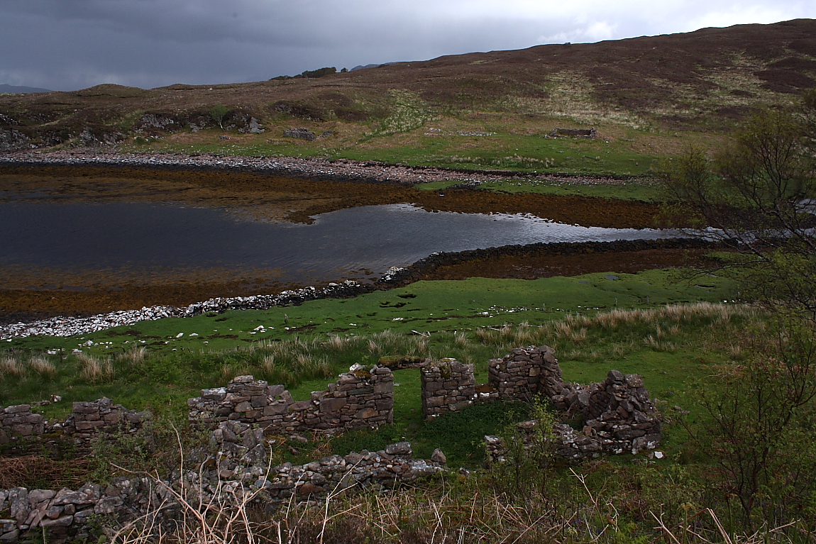
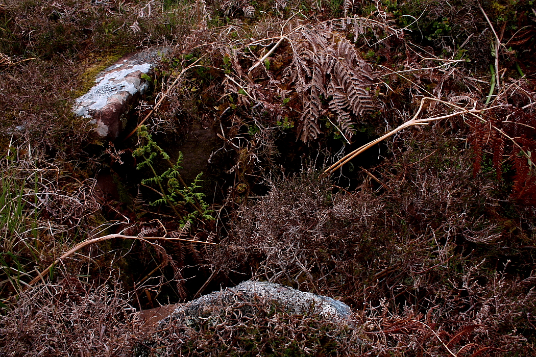
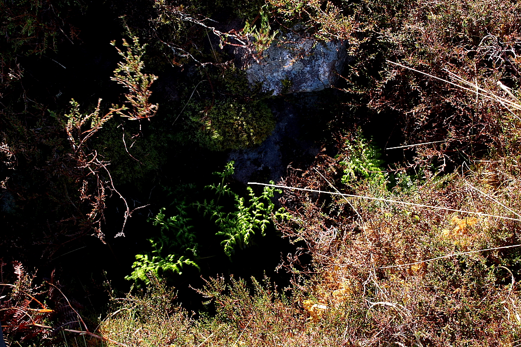
Now if I had a 1:25K OS map finding the monuments would, maybe, have been a doddle. Needless to say I’ve just an old 1:50K edition lovingly procured from Oxfam in Chelmsford in my possession. Consequently I head for what are obviously the cairns.... to find that ‘they’, just as obviously, are not. Anyway to cut a long story short – as Tony Hadley once crooned – prospective visitors should head directly for the near bank of the river, not far from loch side, where two very forlorn-looking cairns stand most unimpressively behind the foundations of later dry stone structures. Both are choked with the ubiquitous heather virtually to the point of not resembling cairns at all... or at least to any noticeable degree.

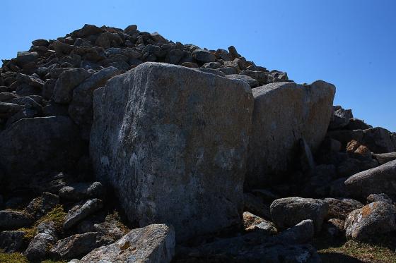
However it is what lies within their hollow, albeit obscured interiors that makes the soggy downhill stomp more than worthwhile... the clear remains of cists. TSC’s misc post has the technical detail; however I have to say that here – more than ever – it is the sensational landscape context that defines the sublime nature of the site. Proclaims it as if a loudspeaker fed through a Marshall amp turned all the way to eleven! Yeah, the silence is so overwhelming it is almost too loud to process. If that makes any sense? Archaeology and vibe in perfect harmony. Having said that the visuals are pretty good, too. Now I’ve often heard it said that perhaps the finest mountain view in Scotland is that of the Black Cuillin from Elgol? The place where Midge Ure and friends take a boat ride in Ultravox’s ‘Lament’ video. If so the vista of the same serrated peaks, Bla Bheinn to the fore, rising across Loch Eishort from these cairns takes that celebrated scene to the wire. No really. I reckon it does.

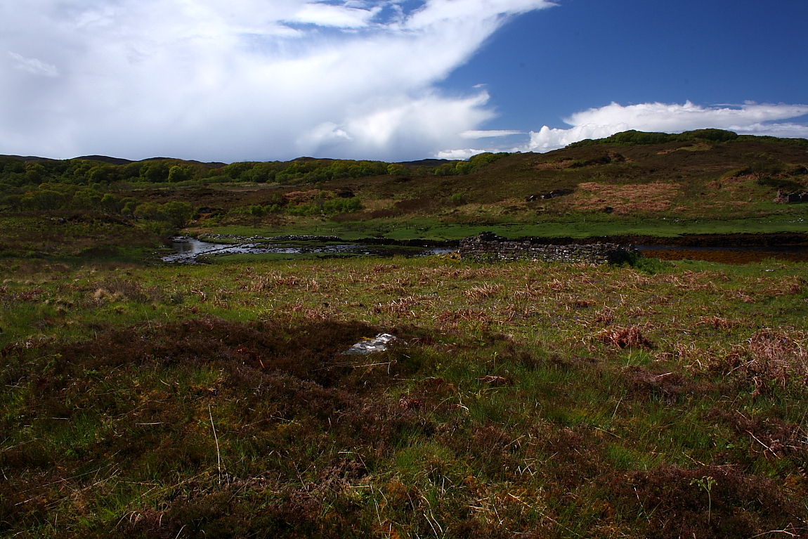
But wait, the best is yet to come. As I lay back and proceed to not do an awful lot (now there’s a contradiction in terms) – except ride out the periodic storm fronts and bask in the light of the interludes – I recall that, according to Canmore at least, there is a further cairn overlooking the far (western) bank of the Allt an Leth-bheinn, apparently placed upon the crag looming above another, more substantial dry stone ruin.... the shell of an old school house? Now elsewhere reaching said far bank might well be an issue. Here, however, as luck (or rather resourceful locals) would have it, the river is crossed by stepping stones a little upstream. Yeah, functional and aesthetically pleasing... everyone’s a winner. I therefore wander across dryshod to take a quick shufti and duly discover a very well preserved cist with capstone slipped to one side. OK, like its neighbours to the east the cairn is pretty nondescript as a stone pile... but so what with such marvellous internal attributes? What’s more a pretty persuasive case could be given for this cairn to actually have contained multiple cists in its time. What a haunting, ethereal location this is. Why, one of the cist’s substantial orthostats even possesses an enigmatic circular marking. Whether this is natural or artificial I’m not competent enough to determine. But it sure wouldn’t surprise me if it was the real thing.

The Black Cuillin, taking matters very literally indeed, glower across the water beneath a positively Wagnerian sky... as the progressively more vigorous movement of a couple of trees, their small stature clearly at odds with herculean survival tendencies, pre-empts the arrival of yet another storm front.

Sure enough the downpour catches me midway across the stepping stones. But I am dry before reaching the car.

Miscellaneous

Druim Dubh
Cairn(s)

Cairns, with well-preserved cists, either side of Allt an Leth-bheinn outlet. Canmore descriptions:

Western site

On the oppisite side of the stream from NG61SW 3 on the summit of a knoll rising abruptly behind a cottar house some 40 yards distant from and 40ft above high-water mark, are the remains of a much dilapidated cairn of stones. A fine cist lies uncovered, formed of four slabs of red grit, and measures 2ft 9ins in length, 2ft in breadth and 2ft 6ins in depth, the longer axis running ENE by WSW. The covering slab lies beside the grave. About 1ft to the E. is the side slab of a second cist still in position, which had been built parallel to the first cist, but the other slabs of this grave have been removed. There are indications of two other burial chambers which have been destroyed.
RCAHMS 1928.

The remains of a cairn with cist; as described by RCAHMS. It is so mutilated and robbed that its size cannot now be determined.
Visited by OS (A S P) 15 June 1961.

Eastern site

Near the shore at Inver Aulavaig, on the E side of the mouth of a small stream, Allt an Leth-bheinn, some 40 yards distant from and 22ft above high water mark, are the remains of two circular cairns of stone occupying a rough heathery ridge.

The first cairn measures 18ft in diameter and barely 2ft in height. It was opened many years ago when the greater portion of the northern half was removed, and a short cist containing a skeleton in a contracted position was discovered in the centre of the mound. The side slabs and one end are still in position and the covering stone lies beside the grave. The cist lies nearly NNE – SSW and measures 3ft 4ins in length, 2ft 2ins in depth, while the cover which is almost square in shape, measures 3ft 9ins long, 3ft 7ins in breadth and 6 ins thick.
The second cairn lies some 15ft (10.0m) SE of the first and is of the same dimensions but better preserved. It contains a central short cist, of which the sides and ends are still in situ. It lies almost due NE-SW and measures 3ft 4ins by 1ft 8ins by 1ft 10ins the cover-stone, which lies quite near, is of irregular shape and measures 3ft 4ins by 2ft 6ins and is 6ins thick.
The W slope of the ridge between the cairns and the estuary shows numerous small heaos of stone said to be the remains of other cairns. Some 27 yards SSW of the second cairn is a small cottar house, immediately to the N of which are the foundations of a former schoolhouse. When the material was being removed, a cist is reported to have been discovered under the floor which is no more than 12ft above high water mark.
RCAHMS 1928.

Two cairns with short cists as described by RCAHMS.
‘A’ NG 605 127 Cist (Site of).
There is now no trace of the cist in the schoolhouse.
Visited by OS (A S P) 15 June 1961.

Sites within 20km of Druim Dubh