The Modern Antiquarian
Log in
|
Register
Home
Latest Posts
Forums
Maps
Help
Browse Sites
News
Blog
Contributors
The Books
Select
-
Belgium
Denmark
Eire
France
Germany
Greece
Italy
The Netherlands
Norway
Portugal
Republic of Malta
Spain
Sweden
Switzerland
United Kingdom
England
Southern England
Hampshire
Merdon Castle
Hillfort
Merdon Castle (Hillfort) on The Modern Antiquarian, the UK & Ireland's most popular megalithic community website. 1 image, plus information on many more ancient sites nearby and across the UK & Ireland.
Image © Open Source Environment Agency LIDAR
Nearest Town:
Winchester (6km NE)
OS Ref (GB):
SU421265 /
Sheet: 185
Latitude:
51° 2' 8.65" N
Longitude:
1° 23' 58.21" W
Added by
ginger tt
Images (1)
Miscellaneous (1)
0 discussions
Start a topic
Show |
Hide
Web searches for Merdon Castle
Flickr
Google
Google Images
MAGIC
The Megalithic Portal
Bing
Stone Pages
Streetmap.co.uk
Wikipedia
Show map
(inline Google Map)
- Sites within 20 km -
-
West Wood (2.91km NW) (7 posts)
Farley Mount Enclosure (3.27km WNW) (9 posts)
Texas Barrows (3.5km ENE) (5 posts)
Withering Corner Barrows. (3.67km WNW) (6 posts)
Oliver's Battery (4km ENE) (7 posts)
Dirty Mount (4.99km W) (4 posts)
St Mary's Church, Twyford (6.14km E) (5 posts)
Oram's Arbour (6.27km ENE) (2 posts)
St Catherine's Hill (6.47km ENE) (22 posts)
Flowerdown Barrows (6.67km NE) (15 posts)
Love Lane (7.13km E) (3 posts)
Twyford Pumping Station Barrows (7.51km E) (3 posts)
Littleton House Bowl Barrow (8.26km NNE) (2 posts)
Magdalen Hill Down Barrows (8.39km ENE) (11 posts)
Toothill Fort (8.84km SSW) (4 posts)
South Wonston South-west Long Barrow (9.43km NNE) (5 posts)
Chilworth Ring (9.53km S) (2 posts)
Woolbury (9.66km NW) (11 posts)
Stockbridge Down (9.79km NW) (2 posts)
Crawley Clump West Barrows (9.92km N) (4 posts)
New Farm (9.96km NW) (1 post)
Crawley Clump East Barrows (9.98km N) (3 posts)
Heardulfes Hlaewe (10.2km NNW) (1 post)
Telegraph Hill Barrow (10.21km ENE) (7 posts)
Little Somborne Hillfort (10.22km NNW) (1 post)
Cheesefoot Head Barrows (10.45km ENE) (4 posts)
Leckford Barrows (10.62km NNW) (1 post)
Chilbolton Round Barrows (10.65km NNW) (1 post)
South Wonston Long Barrow (10.9km NNE) (6 posts)
South Wonston East Long Barrow (10.96km NNE) (2 posts)
Wallers Ash Barrow (11.03km NE) (2 posts)
Dunwood Camp (11.32km WSW) (2 posts)
South Wonston North Long Barrow (11.34km NNE) (3 posts)
Longwood House Long Barrow (11.46km E) (6 posts)
Owslebury (11.46km E) (6 posts)
Lockerley Camp (11.68km WSW) (1 post)
Barton Stacey Barrows (11.77km N) (1 post)
Chilbolton Down Long Barrow (11.78km NNW) (1 post)
Moody's Down (12.15km N) (2 posts)
Moody’s Down Farm (12.28km N) (2 posts)
Newton Down Farm (12.37km NNW) (2 posts)
Moorgreen House (12.87km SE) (1 post)
Monarch Way (12.87km SE) (1 post)
Testwood Lakes (13.36km SSW) (1 post)
Gander Down (13.79km ENE) (2 posts)
Waters Down Farm (14.04km WNW) (1 post)
Danebury Round Barrows (14.12km WNW) (1 post)
The Turret (14.36km W) (2 posts)
Whiteshoot Hill (14.45km W) (2 posts)
Kitson’s Clumps (14.61km NNE) (1 post)
Micheldever Woods (14.76km NE) (13 posts)
Danebury Long Barrows (14.79km WNW) (7 posts)
Danebury (14.79km WNW) (43 posts)
The Millbarrows (15.11km E) (5 posts)
Tatchbury Mount (15.11km SW) (2 posts)
Norsebury Ring (15.28km NNE) (5 posts)
Money Hills (15.33km SW) (2 posts)
Netley Hill (15.46km SE) (1 post)
Itchen Stoke Down Barrows (15.51km ENE) (2 posts)
Danebury North-East long barrow (15.6km WNW) (1 post)
Cheriton Church Mound (16.06km ENE) (4 posts)
Andyke (16.1km N) (4 posts)
Tidbury Ring (16.91km NNE) (5 posts)
Lamborough (17.14km ENE) (2 posts)
Stagsbury Hill (17.14km SW) (8 posts)
Cheriton Long Barrow (17.15km ENE) (7 posts)
Cranbourne Wood Long Barrow (17.37km NNE) (1 post)
Hinton Ampner Park (17.58km ENE) (1 post)
Kilmeston (17.74km ENE) (3 posts)
Ashleys Copse (18.12km W) (2 posts)
Bury Hill (18.6km NW) (20 posts)
Oliver's Battery (18.92km ENE) (3 posts)
Balksbury (19.24km NW) (4 posts)
North Yew Tree Heath Barrows (19.28km SSW) (5 posts)
Marchwood Inclosure (19.38km S) (4 posts)
Suddern (19.44km WNW) (1 post)
Pheasant Hotel (19.75km W) (1 post)
Freefolk Wood Barrows (19.8km NNE) (1 post)
Ashurst Lodge (19.83km SSW) (8 posts)
Three Barrows (Laverstoke) (19.87km NNE) (1 post)
Cobhill Barrow (19.9km W) (2 posts)
- Facilities within 20 km -
-
The Milbury's Inn (Pub: 14.6 km E)
- Add -
-
Add news
Add an image
Add fieldnotes
Add folklore
Add miscellaneous
Add a link
-
Add a site
Add a nearby facility
Add an alternative name/spelling
Images
(click to view fullsize)
Add an image
Miscellaneous
Add miscellaneous
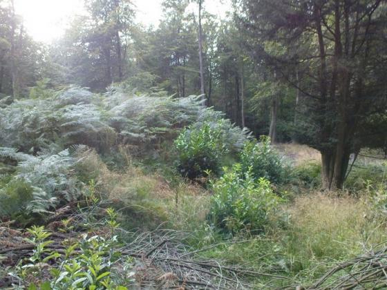
Earthwork remains of an Iron Age univallate hillfort and a Medieval motte and bailey which reused the former site
Comments (0)
|
Add a comment
|
Permalink
Posted by
ginger tt
26th October 2009ce