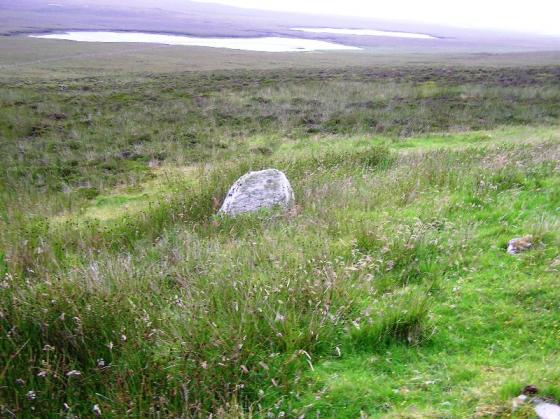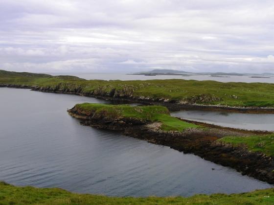


A fellow CFC fan I met on top of Brankam Hill sent me this.

The causeway nearest the road/path/info board.

Thickness of the walls, like most brochs, is almost unbelievable.

The eastern side.

The broch’s stones were used in medieval times.

Wouldn’t it be magic if they could put the lintil back up!

The massive lintil at the front door.

The northern side.

I’d been wanting to come here for years and years, finally made it :-)

Looking back from the broch.

Half way across and no falling in.

The causeway to Dun Sticir.

The causeway to the eastern shore.

Looking from one causeway onto another.

You’d have to say the first causeway was well made.

The causeway to the island left, Sticir right.

Sticir with Beinn Bhreac behind.


The second causeway... so there you have it. You’ll find a broch at the end of the rainbow.

Dun An Sticir was near the top of the list for visiting. A stunning site with stunning surrounds.
From the B983 follow the path to the first causeway, onto a wee island, a second causeway to the island of Loch Sticir and then a superb causeway heading north to the site. Another causeway or stepping stones leads to the eastern shore. Looking at the maps on Canmore it looks like a space ship more commonly found on Star Trek.
Galleried dun or broch, it doesn’t really matter as the remnants are stunning, a testament to the building skills of the Iron Age stone masons. There is far to much going on here for me to describe, check the Canmore link below. What a vibe there is here, a sort of elation for me. Maybe for MacDonalds the excitement might not be so great, but for Murrays like me, no problem :-)
A superb end to a very long day which had started at 4.30am, my legs were done, no idea how far I’d walked but I knew I was in need of a few drams.
Visited 27/7/2019.
Visited 29.5.12
We decided to catch the earlier ferry to Harris so I didn’t have time to properly explore this Broch and had to settle for a view from the road.
From a distance the walls of the Broch appeared to still be about 2 metres high and covered in vegetation. The causeway was easily visible.
I would have been nice to have had the time to walk out to the broch but there you go, you can’t have everything.
Bit surprised to find nothing already existing for this fabulous site at the northern tip of North Uist, sited on an island within Loch an Sticir.......
One of the best preserved brochs in the Western Isles, I was most impressed by the entrance arrangements here, with a causeway leading to an island, from which a second causeway leads finally to the broch – sort of like a prehistoric precursor of Bodiam Castle, for all you castle-heads out there.
The medieval connection is upheld, since a rectangular house was apparently built upon the island at some time during the period, the existing causeways being adaptations of the original arrangement.
Legend has it that a poor sod named Hugh Macdonald – I take it he was a Scot! – hid out here before being taken to Skye and imprisoned within Duntulm Castle.... with salt beef and an empty jug. Nice.
Not far from Newtonferry on the Berneray road off the B893.
Dun an Sticir, North Uist
In about 1600, Hugh Macdonald sought refuge on this fortified island after a plot to overthrow his cousin as chief of the MacDonalds of Sleat was exposed. He held out for a year, living in a stronghold that was built on a 2,000-year-old broch on a tidal loch. The only way to get at him was along two stone causeways that are exposed at low tide. The name Dun an Sticir – fort of the skulker – probably comes from this episode.
There is no happy ending. Macdonald was betrayed and captured. He was taken to Skye and thrown into the dungeon under Duntulm Castle where a grisly end awaited him. Given only salt beef to eat but no water – his captor kindly provided him with an empty jug – Macdonald died of thirst.
Steve Farrar
Dun an Sticir
An Iron Age broch situated approximately 9.5 kilometers north of Lochmaddy in a lake on North Uist in the Scottish Outer Hebrides. A building was erected on the site in the late medieval period. Hugh MacDonald of Sleat inhabited Dun Sticir in 1602. In 1586 he hatched a plan to murder his cousin, Donald Gorm, 8th Chief of the Macdonalds of Sleat. After his plan was discovered, he fled to Dun an Sticir
De Tha Tol
Visit Outer Hebrides
The Iron Age broch
Sometime between 2,000 and 2,500 years ago, a great circular drystone tower house was built, which functioned as a well-defended family residence, and as a conspicuous demonstration of power. The walls were 3.5 metres thick walls, within which were chambers and galleries, but the only opening to the outside world was a single small doorway. The causeways were narrower than they are today, and may have included a “rocking stone”, which could alert the occupants of the broch to the approach of unwelcome visitors.
A Medieval Estate
Between the 9th and 13th centuries AD the Outer Hebrides were under the overlordship of the Norsemen, who abandoned the old centres of power in favour of new sites. By the 16th century, however, Dun an Sticir had again become the centre of an important lordship. A new hall was built inside and around the old broch, and the larger middle island, the “Island of Bad Council” also contained at least one substantial building. This echoes Finlaggan on Islay, where the Lords of the Isles held council. In 1601 Dun an Sticir was the scene of dramatic events in when Hugh Macdonald was seized by his enemies and taken to his death in Skye.
This site has never been investigated: many details of the above reconstruction of the hall and other buildings, such as roofing material, are therefore conjectural.
The outer islet has been used as a secure stronghold since prehistoric times. During the Iron Age, more than 2,000 years ago, a massive galleried dun or broch was built, which would have been occupied by the local tribal chieftain. In the turbulent later Middle Ages a rectangular hall was inserted into the pre-existing circular dun, and the islands once again served as the residence and refuge of the local magnates.
Once again Canmore surpass themselves.


