The first glimpse of the broch and chapel on the track from Northton.
Image credit: drew/amj
The first glimpse of the broch and chapel on the track from Northton.

Towards Leverburgh.

Its a lonely looking place.

Looking towards Ceapabhal with its hat on.

The hills are Scarista, beside the bay the remains of an ancient settlement.

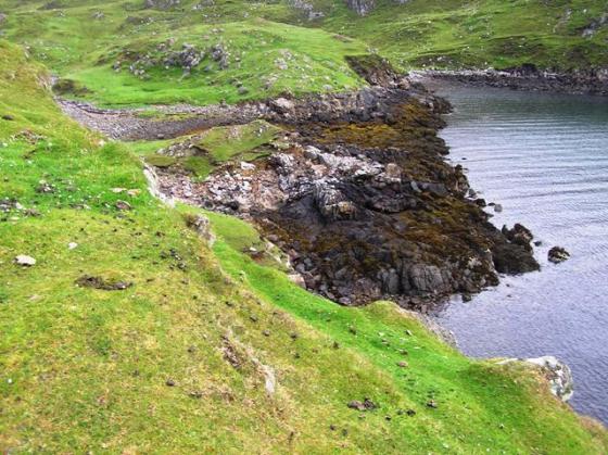
Looking south east.

Looking north west, bits of foundation remain. Island of Copaigh in the distance.

The enclosure on the sea side of the broch. Pabbay in the distance.

From the notice board.

From the north east, the chapel was built with stones from the broch.

Remnants of the broch scattered on the south.
From Croft 36, Northton, keep heading north until the road and village end at a gate. Beyond is a track which has lots of farm machinery old and new abandoned at the track side. Keep following the track taking the second track going west. Should be said that the track from Northton to Toe Head is very good and fairly flat. This will lead straight to the broch on the western edge of Ceapabhal. The scenery is of course stunning, the first part of the walk looks onto the Sound of Taransay, the second part has the rugged coastline and the Atlantic. All the time Ceapabhal watches over the comings and goings.
All the prehistoric ages are represented here with evidence of Mesolithic through to the Iron Age. Traces of these can be found nearby as settlements, rock art etc have been found along the coast to the south. My next trip to Harris will involve a walk looking for them, todays main aim was the broch at Toe Head.
A lot of the broch still stands. Sadly for it, it stands as part of the ruined chapel Rubh’ an Teampuill, point of the temple. Other parts of the broch can be seen on this lonely promontory. The site is built on the highest part of the promontory with traces of wall to the north. In fact traces of the wall can be seen all round the church suggesting it must have been huge, some of the walls must have almost 1.5 wide. As well as being used for the church, stonework had been used to build a dry stane dyke on Ceapabhal. To the west end erosion has taken place, the cause of this being easy to see. Weather changes here quickly and wind had grown very strong, the sea very rough. After a decent look round it was time to get the feet moving again.
Wonderful place and a place to let the imagination run wild, or in my case run riot. Next stop, the long hike to the stunning Dun Borve.
Visited 4/8/2017.
The headland was also an important landmark over 2,000 years ago, as it was the site of a ‘broch’ a large and impressive tower of two or three storeys that served as an Iron Age chieftain’s residence. All that now remains is the circular foundation course, partly build over by the chapel. All of its other stonework has been removed, probably re-used in the construction of the nearby buildings including the chapel. One or more possible lines of enclosure on the landward side across the narrowest part of the promontory may also been part of the defensive strategy.
In earlier prehistoric times, up to 5,000 years ago, people left enigmatic ‘cup marks’ (small circular depressions) on the rocky ledges of the headland. 500 metres along the shore are the eroding remains of their settlements, which had been occupied periodically since the time of the Mesolithic hunter-gatherers.
Notice Board at site.