
The western entrance
Image credit: Chris Bickerton
The western entrance


Looking towards the site of Dovedale Henge from Middle Dodd. Cumbria isn’t my favourite place... but this is truly exquisite.

Dovedale Henge, on the N bank, looking E, with the more obvious “standing stones”. They are definitely on top of the bank, therefore they have been put there after the construction of said bank. Hints at henge, although stones on top of a bank isn’t too usual, is it? 26/05/09.

Dovedale Henge, on top of the N bank, looking W, with the make-up of the bank visible. 26/05/09.

Dovedale Henge, outside the N bank, looking W into Dovedale and Dove Crag. 26/05/09.

Dovedale Henge, looking S across the interior from the N bank, with High Hartsop Dodd behind. 26/05/09.

Dovedale Henge. The low E bank, looking N to the “standing stones” of the N bank. 26/05/09.

Inside Dovedale Henge, looking W up Dovedale to Dove Crag. 26/05/09.

Dovedale Henge, from low down on High Hartsop Dodd, looking NE. 26/05/09.

Dovedale Henge, from High Hartsop Dodd, looking NE. 26/05/09.

Dovedale Henge and settlement in its landscape setting, viewed from Dove Crag, looking E. 26/05/09.
After a quick look at a sodden Kirkstone it’s a short drive down the road into Hartsop, the car park is on the left. It is about a mile long walk along the lake that is not a lake, (there are no lakes in the lake district) Brothers Water, covered mostly by trees, it was in this autumnal beauty spot that I saw my second ever Red Squirrel. I’ve only seen two, both seen while out stone hunting, a movement off to my right drew my eye, but it was only a grey squirrel, but there half way up a tree behind the grey was a bright red Red Squirrel, I even got a photo of it, not a competition winner, just proof it happened.
After passing Hartsop Hall its into a field and over a river, thankfully bridged. From the Dovedale Beck you cant see the henge, just some big rocks over looking the river, but from these rocks you can see the henge.
What a site !
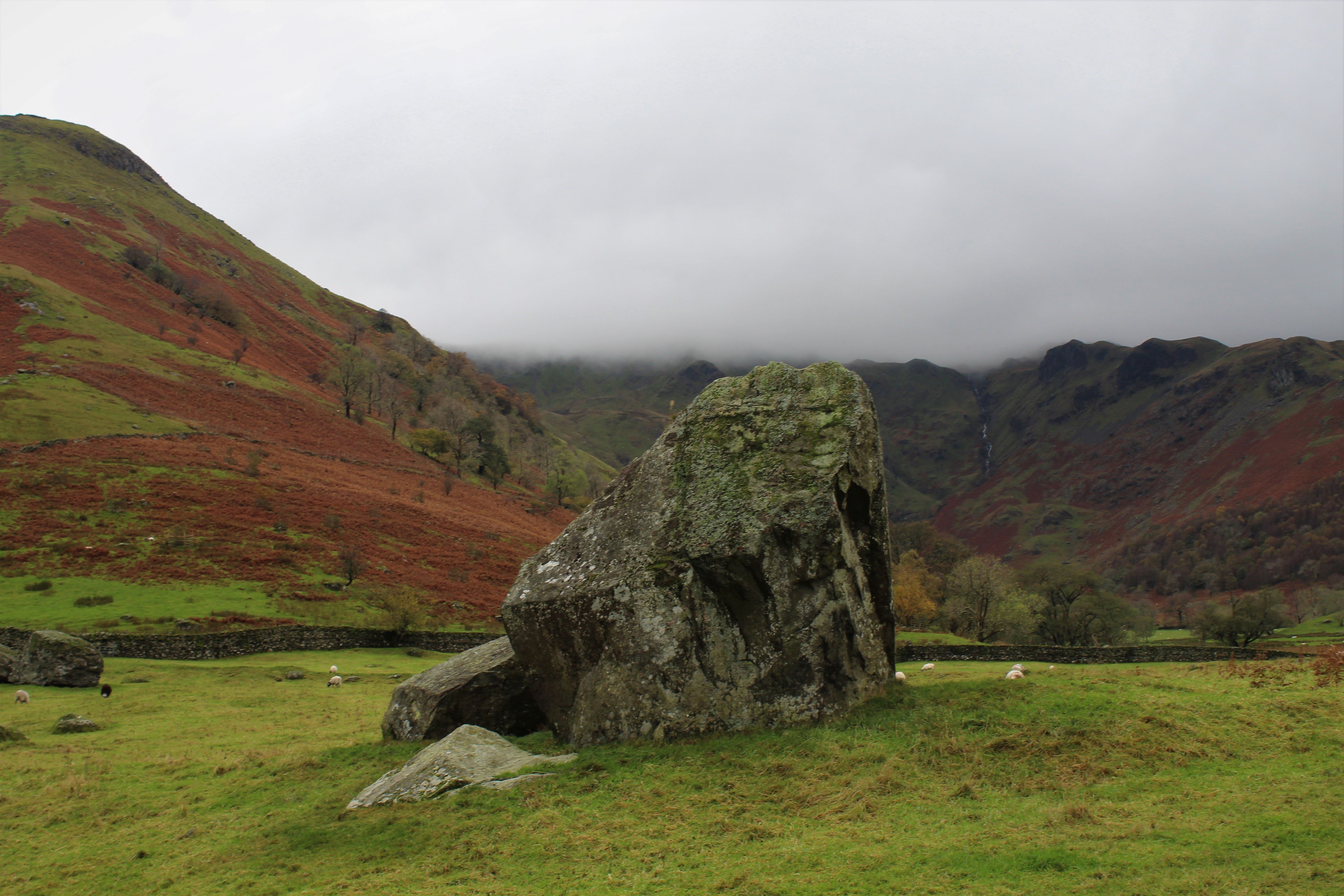
The biggest facet to this hidden gem of a site is High Hartsop Dodd’s northern sloping ridge, formidable and ominous it keeps an enduring eye over the whole site. The big rocks, some are on the henge and some are seemingly set into the bank, some are small, some are huge, some are confusingly in the henge itself. The henge has half gone, only the west side remains, there is an entrance.
I now have to do that thing that I have to do, not that, climb up the hill of course. With such a big hill right next to the henge I’d have payed to go up that hill (shshushsh!).
The view was really something, on the nice scale it nestled nicely somewhere in between not bad and very nice, plenty of scope for numerous superlatives there.
I went high, high enough for it to occur to me that if I went higher I would be more technically mountain climbing than stone hunting. So I sat and watched the world, it wasn’t doing very much so I looked long and hard at this henge of ours.
Just a few yards outside of where the north east sector would be is what looks like a round cairn, ruined but observable.
But the henge, was it really a henge? where has the other half gone? why are the stones where they are? some in some on the bank, some in the enclosure, it makes no sense. But if it was just a settlement why are they mucking about with these big stones? The placement of the site seems hengish, cornered in as it is by rivers and hills, but were the Neo’s as occupied with water as much as the bronze and iron ages?
I left the place puzzled and uncertain, I want it to have been a henge, I wouldn’t be surprised to find that out that it was, but I found myself coming down slightly more on the side of settlement in the end.
This site is thought to have started its life as a henge, later adapted by the Romano-British as a settlement with hut-circles. There is also evidence of a round cairn. See the ADS link below:-
ads.ahds.ac.uk/catalogue/search/fr.cfm?rcn=LDNPHER08-2983
It’s about 100 feet in diameter, with what appear to be standing stones on top of the bank, in places, which is highest at the northern quarter, and seemingly constructed of rocks, which appear on the surface in this quarter.
When you visit it, you are struck more by its henge-like appearance than by any hut-circles, and the “standing stones” certainly seem too coincidental to be true. Some do appear to be large boulders “placed” on top of the bank, but others seem to have been erected. Even so, why are they on top of the bank if they’re natural?
Visit it, and decide for yourselves. It’s worth it for the views into beautiful upper Dovedale. The Brotherswater campsite, Sykeside Farm, is a few hundred yards away, as is the pub, always a bonus.


