Follow Browfoot Lane from Staveley which bends left around the area called High Knott (on top of which can be seen Williamson’s monument). The road splits into two bridle paths; left to The Heights right toward High Hugill (also known as High Borrans). Follow the right path until it almost disappears and turns left onto a more disinct path. Ahead of you there is a grazing field and High Hugill is the field to its left from where you are standing. A quick hop over the wall is all that’s required to access the site. Whoever owns the field has erected a new sheep pen in one corner of the field. The site itself seems to be regularly shaped stone foundations in a dip lower than the rest of the area. The field adjacent to the East contains a spring which may have been the ancient water source for the farming community that was. Pictures to follow.
Articles
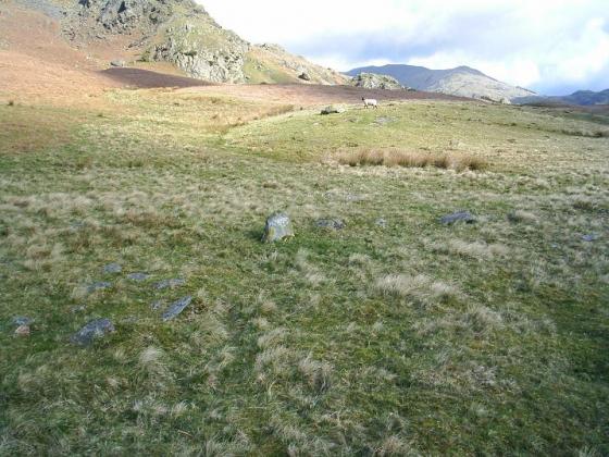
Attempted to visit 25/02/2011ce.
In his book Prehistoric Rock Art in Cumbria, Stan Beckensall describes the site as “a very interesting one, seldom visited as far as I know, although it lies just off a public right of way.”
Unfortunately, it would appear that the site will probably remain seldom visited, as access to the adjacent field (from which a gate led to the site) is blocked by a (brand-new?) barbed-wire fence and padlocked field-gate. As there was no stock in either field, I might have been tempted to continue had the field-gate not been padlocked, but as it was I took the hint and just went for a walk instead.
The site can be viewed from another adjacent field to the north (technically off the right of way), but unfortunately it was too misty for decent photography.
“At High Hugill, near Windermere, in Westmoreland, the site of the settlement consists of an enclosure, two sides of which are angular and two rounded. It was encompassed by the foundations of a wall or rampart, which has been, in places, 14ft in width. The foundations were apparently formed by stones set on edge, the spaces in between which was probably filled in with smaller stones. Within this enclosure are sundry ill-defined lines of division walls, courts, and hut-dwellings, one or two of which are circular, and measure about 7ft and 13ft in diameter.” Remains of the Prehistoric Age in England, Bertram Windle 1909.
Sites within 20km of High Hugill Settlement
-
Mill Rigg Settlement
description 1 -

Hird Wood Circle
photo 13description 3 -

Troutbeck Park
photo 6description 1 -

Potter Fell
photo 2description 2 -

The Kirkstone
photo 9description 4 -
Elterwater Common
forum 1description 1 -

Dovedale Henge
photo 21description 2 -

Selside Pike
photo 5description 1 -

Grasmere
photo 9description 3 -

Castle Crags, Mardale
photo 3description 1 -

High Raise
photo 4description 1 -

Low Raise
photo 2description 1 -

Berry Holme
photo 2description 1 -

Copt Howe
photo 62forum 5description 10 -

Castle Howe, Little Langdale
photo 2description 1 -

Beckstones
photo 19description 1link 1 -
Heaves Farm
description 1 -

Castle Stead
photo 6description 1 -

Dunmail Raise
photo 6description 6link 1 -

Wrynose Pass Stone
photo 4forum 1description 1 -
Banniside
photo 13description 1 -

Great Langdale
photo 17forum 1description 3 -

Rusland
photo 7forum 1description 1 -

Leven’s Park
photo 9description 2 -
White Raise
-

Levens Brow Earthworks
photo 3description 1 -

Four Stones Hill
photo 25description 4 -

Shap Wells
photo 4description 1 -

Harrison Stickle
photo 4 -

Thorn Crag
photo 2description 1 -

Loft Crag
photo 4description 1 -

Langdale Axe Factory
photo 46forum 5description 8link 2 -

The Shap Avenues
photo 31forum 3description 14link 2 -

The Galloway Stone
photo 4description 1link 1 -

Hardendale Fell
photo 2description 2 -

Towtop Kirk
photo 9forum 1description 4 -

Kemp Howe
photo 46forum 4description 9link 3 -

Bleaberry Haws Ringcairn
photo 6 -

Bleaberry Haws Cairn
photo 10description 1 -

Bleaberry Haws Summit Cairn
photo 3description 1 -

The Coombs, Martindale
photo 4description 1 -

The Thunder Stone
photo 2description 1 -

Mickleden Beck
photo 7description 2 -

Bleaberry Haws
photo 10description 2link 1 -

Torver High Common Dyke
photo 1 -

Long Scar Pike
photo 3description 1 -

Swarth Fell
photo 16forum 2description 5 -

Aspers Field
photo 18description 2link 1 -

Thunder Stone
photo 8forum 1description 4 -

Giant’s Foot
photo 7description 3link 1 -
Shap Barrow
description 1 -

The Goggleby Stone
photo 17description 9link 1 -

Shap Avenue
photo 2description 1 -

Skellaw Hill
photo 9description 6link 1 -

Lead Pike
photo 1forum 2description 1link 1 -

Oddendale
photo 37forum 1description 9link 1 -

Seal Howe
photo 7description 4 -

Oddendale Standing Stone
photo 7description 2 -

Wicker Street
photo 8description 3 -

Oddendale Cairn I
photo 9forum 1description 6 -
Oddendale Multi-Phase Ring Cairn (destroyed)
description 1