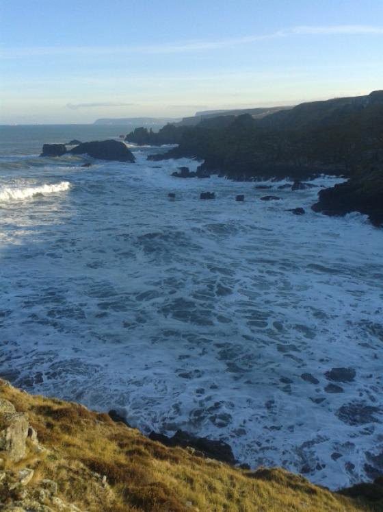
Taken from the Hill Of Foulzie.
Image credit: drew/amj
Taken from the Hill Of Foulzie.

From the south.

Looking southeast at the tail of Longman Barrow. The Photographer is standing in the saddle or gap of the barrow, slightly toward the west end of that saddle.

Longman Barrow viewed from the south flank of Longman Hill to illustrate the entire length of the barrow. Note the prominent notch separating the west from east end, and also note that the west end is of a higher maximum elevation.

Longman Barrow viewed from the north side, illustrating that the west end of the barrow (image right) is higher than the east end or “tail”. This image is a two stitch panorama.

Large stone I found by probing at the ground surface near the northwest of the Longman Barrow virtually buried in the tall grass. Such a large stone measuring approximately 80 cm in length is quite unusual to be found on the ground surface in this region; therefore, it is likely that this stone may have formed part of the barrow monument, possibly even as a kerbstone. This stone was lying approximately three metres away from the base of the long barrow.

Looking northwest along the southern edge of Longman barrow. The view is of the northern section of the barrow including the northern apex, whilst the photographer is standing within the gap betwixt the northern and southern elements of the barrow. Note the gorse and tall grass atop the barrow. The horizon is the north coast area near MacDuff at Banff Bay.

Quarry pit encroaching on northern side of Longman Barrow. Although much of the quarrying has been conducted in modern times to mine roadbed material, it is possible that the pit was begun in prehistoric times to produce some of the material for the barrow.

Looking at the southeast portion of the Longman Hill Long Barrow from atop the highest point of the barrow along its northwest segment. The distant horizon represents the hills around New Byth, approximately 12 kilometres to the southeast.
Mr Hogan’s notes are extensive so my notes will be brief. At the moment the fields are so saturated with the recent rain getting there is like swimming in a mud bath. He’s right about the views. As well as Cairn Lee the cairns at Fisherie and Balgreen are nearby. Windy, soaked and caked with with mud, great fun!!
Visited 14/11/09.
Longman Hill is a Bronze Age long barrow situated atop a prominent rounded landform near the north coast of Aberdeenshire. An almost 360 degree panorama is available from the barrow top, including views over the North Sea. A salient feature at this archaeological site is a massive pit on the northwest flank of the barrow, which was used in modern times as an excavation for road base material; however, the pit may have been the source of some of the rock and earth used in the barrow construction. Judging from the massive barrow size as well as the existence of extensive subsurface shaly sides of this pit, it is likely that the barrow has a somewhat higher percentage of stone in its interior than suggested by the Aberdeenshire Council website.
ASPECT. Based upon the commanding view afforded by the Longman Hill, this location would have been attractive to early man of this region not only for ceremonial purposes, but also for the strategic reason of being able to see hostile forces by land and sea for considerable distances. Views to the south extend to the Bennachie Range and even the Grampians on the distant horizon. To the northwest is the coastal plain along the North Sea including Banff Bay. To the west are views of the Moray Firth and Foudland Hills. Other distant features easily seen are Ben Rinnes, Bin Hill near Cullen and the Buck of Cabrach. The best lookout post is afforded by the northwestern apex, which is termed a circular mound by the Aberdeenshire Council. In reality, this feature is rather ovoid in shape, but clearly commands the most extensive views, largely because its height of approximately 4.4 metres exceeds the lesser height of the eastern end of the barrow. The only defect in an otherwise full panoramic view is a small topographic rise to the northeast, which occludes a small slice of the otherwise full 360 degrees. Pictish peoples clearly favoured such sites having an expansive coastal view for ceremonial and intensive use, with Kempstone Hill providing a parallel siting opportunity further south in Aberdeenshire. (Hogan, 2007)
BARROW GEOMETRY. The barrow length approximates 66 metres by my measurement, one metre less than the Aberdeenshire Council estimate, (Aberdeenshire, 2006) but about ten percent higher than the value set by Callander. (Callander, 1924) The barrow axis is approximately northwest to southeast, with the higher elevation end being at the northwest. Callander’s original photograph illustrates a western cairn face which is more clearly circular with evidence of more regular stonework than is now extant, suggesting that raiding of some of the surface stones likely occurred when the modern quarry was used to extract road construction material. The quarry pit is approximately six metres in depth.
At the monument’s northern end, there is a nearly circular cairn or mound I measured to be 21 metres in diameter and 4.3 metres in height (consistent with the 1924 report of Callendar). My measurement of the total monument length is 67 metres, also consistent with Callendar’s original recording and the more recent Aberdeenshire Council website. I also measured the elevation of the lower eastern end of the barrow, which earlier authors had not reported; that elevation is approximately 2.5 metres above grade level.
ARCHAEOLOGICAL RECOVERY. On September 18, 1886 a finely made urn 30 centimetres in height was recovered from the barrow’s west end. (Transactions, 1897) This vessel contained calcined bones and is deemed a secondary burial. Seventeen months later a second urn was found approximately 20 centimetres in height; this specimen was decorated with a zigzag ornamentation but contained no obvious human remains, although the discoverers opined it had a funerary purpose, possibly due to the black mould-like residues on the interior. The second urn was found with its mouth within a second saucer-like ceramic. Both urns had been exposed by recent rain erosion and were not found at the base of the cairn. A nearby ancient monument is Cairn Lee, situated approximately 1.5 kilometres to the northeast.
ECOLOGY AND HYDROLOGY. Soils on the flanks of Longman Hill are very fertile and produce robust crops of barley and other grains in current times. With the mild climate afforded by proximity of the North Sea combined with such soil richness, this locale would have presented the Neolithic farmer with an productive environment. While there is a paucity of larger rocks in the general area, the barrow itself has some sizeable rocks, especially at the base of the western edge, re-enforcing my earlier suggestion that this specific area may be a locally rich rock source. The Burn of Myrehouse, which drains to Banff Bay, is an important source of surface water, lying approximately one kilometre west of Longman Hill barrow. Furthermore the headwaters of one branch of the Burn of Melrose are situated as a spring about 1.2 kilometres to the northeast. Surface water would have likely been abundant to early man here, as suggested by the presence of the Bogs of Melrose approximately 1.3 kilometres to the northwest, in addition to the flow of the Burn of Myrehouse. It is also likely that the Burn of Myrehouse formed a more extensive prehistoric bog before the advent of field drains that generally appeared in this region in the Late Middle Ages; in fact the word root “myres” is associated with boggy areas within Scotland. Finally, the immediate local area abounds with place names such as “Boghead”, “Bloodymire” and “Burnside”, all suggesting an early local abundance of water.
REFERENCES
* Aberdeenshire Council (2006) “Longman Hill”
* C. Michael Hogan (2007) ‘’Kempstone Hill fieldnotes’’, The Modern Antiquarian
* J.Graham Callander (Dec. 24, 1924) ‘’Long cairns and other prehistoric monuments in Aberdeenshire and Banffshire and a short cist at Bruceton, Alyth, Perthshire’’, Proceedings of the Society
* Transactions of the Banffshire Field Club (1897-8) p. 38