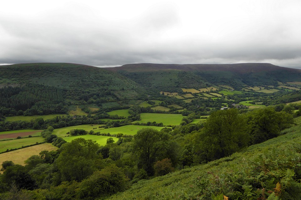
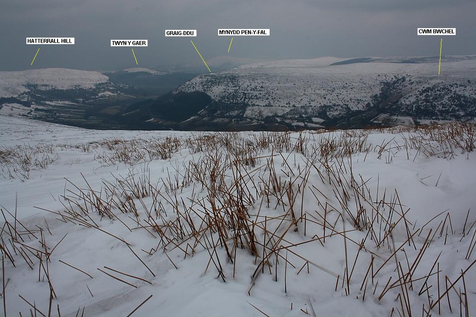
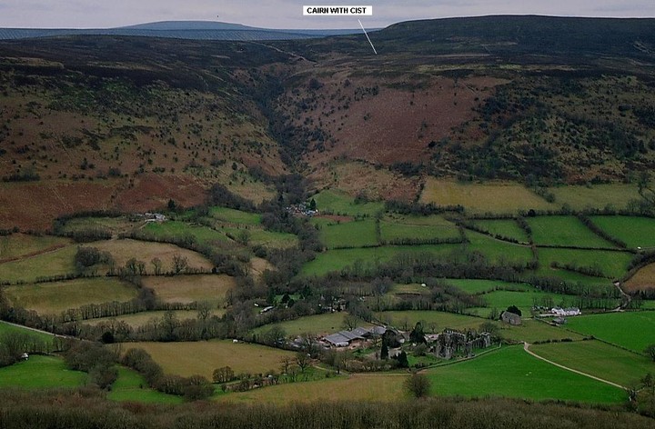
Set deep within the beautiful borderland Vale of Ewyas overlooked by the lofty, parallel ridges of the eastern Black Mountains, the little hamlet of Llanthony perhaps represents the very epitome of 'rural tranquility'. The vernacular settlement name apparently translates as 'Church of St Dewi on the River Hoddni'... however it is the ruins of the priory, established (according to CADW) around 1100, which provide the architectural focal point nowadays. Turner came here to undertake a preliminary sketch in 1792; less favourable visits include a severe thrashing during Glyndwr's uprising, not to mention Henry VIII's dissolution. Illustrious - and not so - names from the past aside, Llanthony has much to offer the modern day traveller, particularly since the large, free car park provides a fine gateway to the aforementioned mountain ridges with all their Bronze Age treasures. I'm here today to ascend The Ffawddog Ridge rising above Cwm Bwchel, the pretty comprehensive cloud cover not ideal, although not an issue as long as the cloud base kindly refrains from descending for a committee meeting with the landscape...
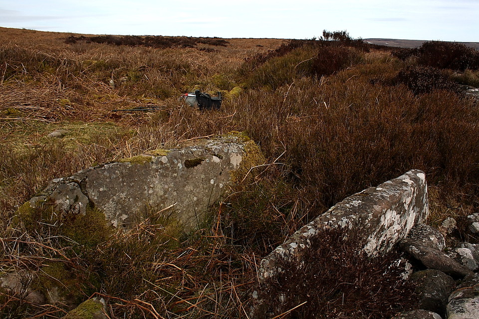
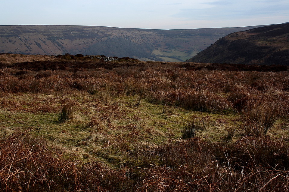
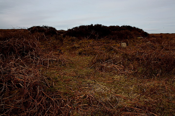
Upon exiting the car park look for a public footpath - signposted 'Bal Mawr' - across the main (ha!) road, said path shortly crossing the Afon Honddi, via a steel bridge, prior to beginning the ascent above the northern (right hand) bank of the stream cascading down Cwm Bwchel. The path is steep and uneven, as you would no doubt expect, intermittent icy patches adding an appropriately wintry, not to mention slippery vibe to proceedings. The 'going' eventually eases as I reach the headwall of the cwm, the bare ridge of Bal Mawr crowning the bleak horizon ahead. Here it is necessary to abandon the path and veer right (approx north) in order to locate amongst the heather a tangiable reminder of the people who lived and worshipped their gods in this small corner of Wales millennia before The Bastard and his bleedin' Normans arrived bearing trumped up apologia for conquest. Locating the Bronze Age cairn is not easy, to be fair, probably even less so in high summer when the hillside's covering of heather is at its zenith. However a glint of exposed stone eventually gives the game away.
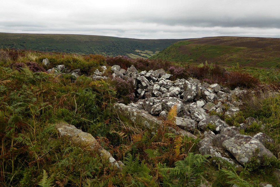
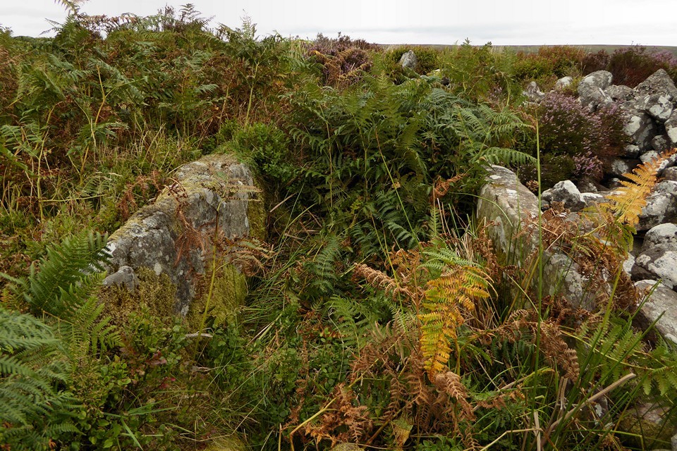
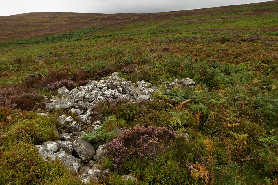
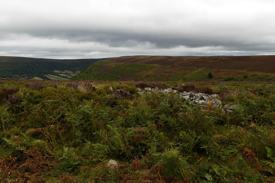
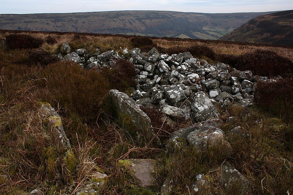
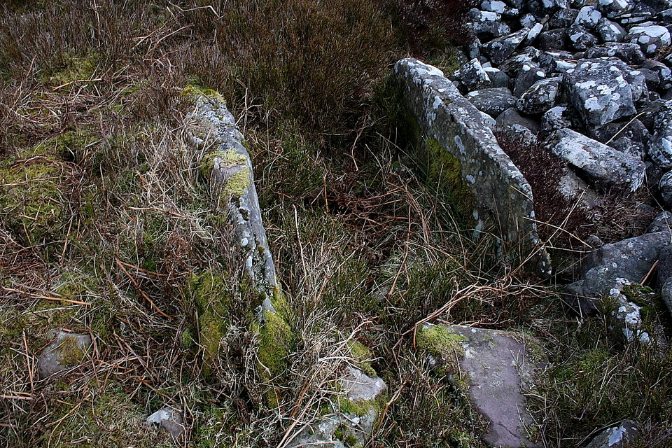
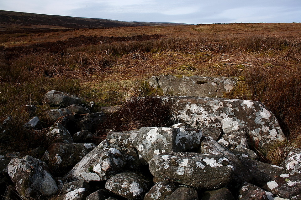
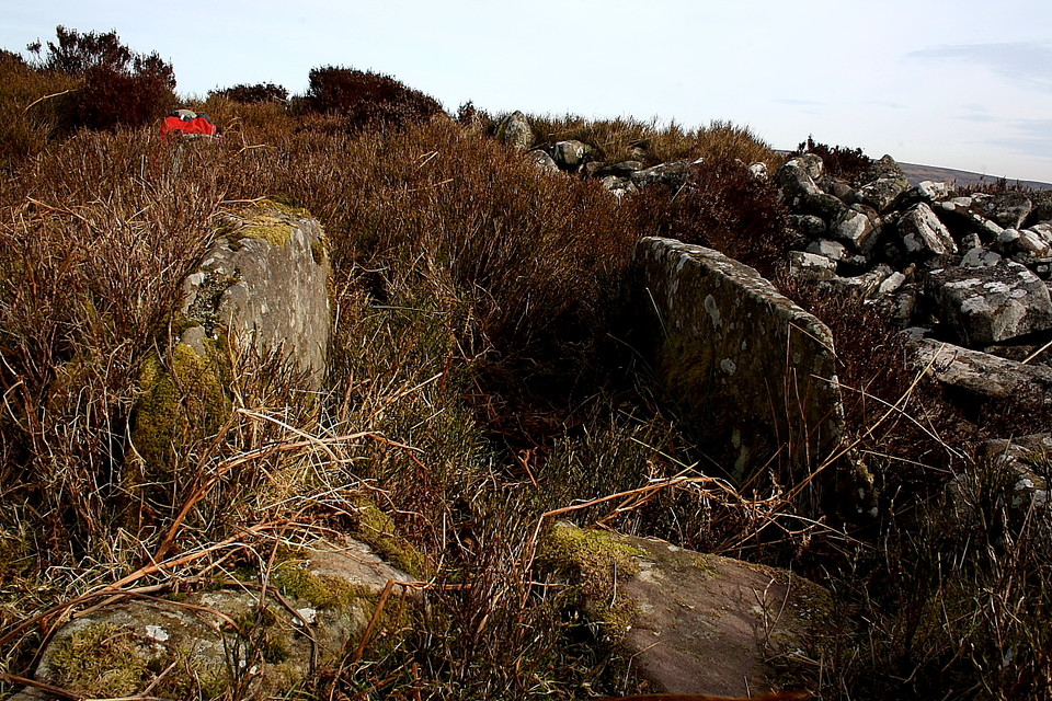
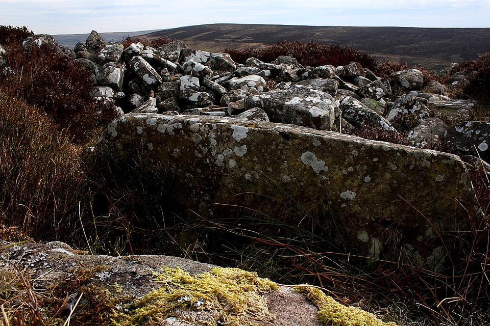
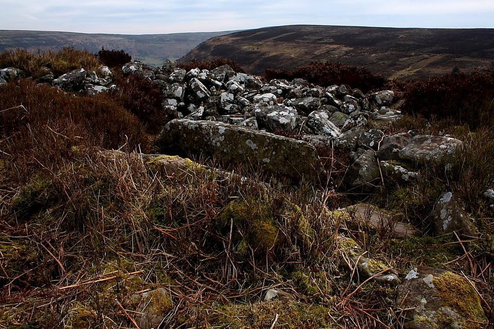
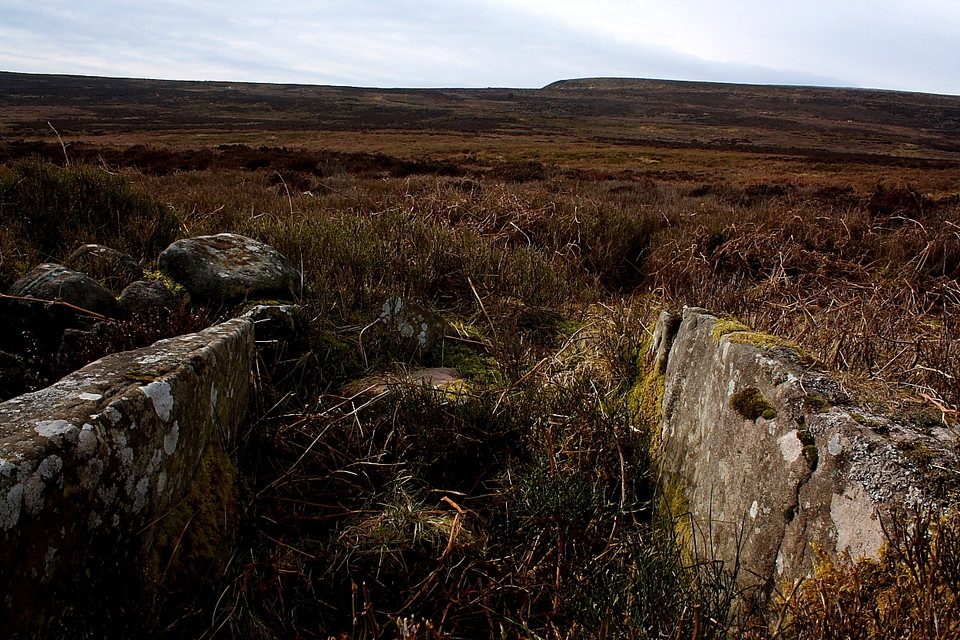
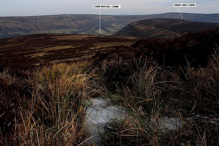
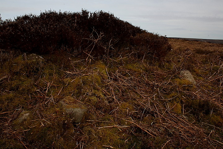
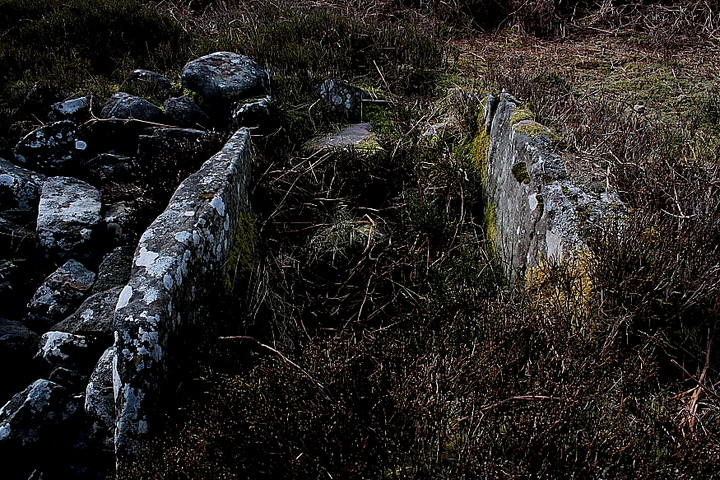
Despite its isolation away from the main path to the bwlch the cairn is very denuded. However there is an inherent detail which makes the effort expended getting here more than worthwhile, namely two large side slabs of a former cist remaining in situ, quite a rarity in upland cairns nowadays, it has to be said. Oh, not to mention that fabulous 'hear a pin drop' upland aura. Two details, then. Furthermore, as I recline betwixt the stones and drink my coffee, it appears to me that there may well be a case for suggesting the chamber was intentionally aligned toward the southernmost aspect of Bal Mawr... that is to say there was a direct association between mountain and monument? This aside, views are otherwise limited, the cairn apparently located so as to remain aloof from the pastoral wonders of the Vale of Ewyas far below to the east. Perhaps to ensure all focus was upon Bal Mawr? Yeah... the situation is bleak, brutal even. A wondrous place for contemplation.
As I sit and ponder I notice my poor old 1:25k OS map, annotated to within an inch of incomprehension over the years, nevertheless indicates another cairn in antiquarian typescript located upon the far (southern) flank of Graig-ddu, the hill rising beyound the head of Cwm Bwchel to the approx south-east. I decide it'd be rude not to pay a visit seeing as I'm in the area..... following a venerative sojourn upon Bal Mawr of my own, that is. I reckon the former occupant and builders of this now lonely - but once perhaps not so lonely - cairn above Cwm Bwchel would approve. It's the least I can do in the circumstances.
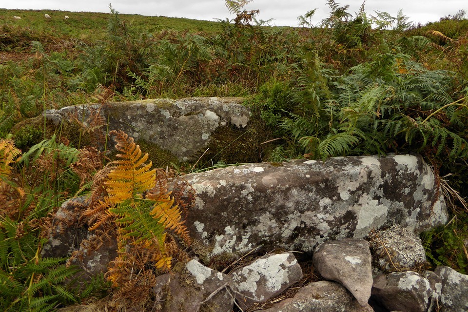
Slightly longer description of the cairn and cist from GGAT, hinting that there may be a deliberately incised V in one of the cist slabs:
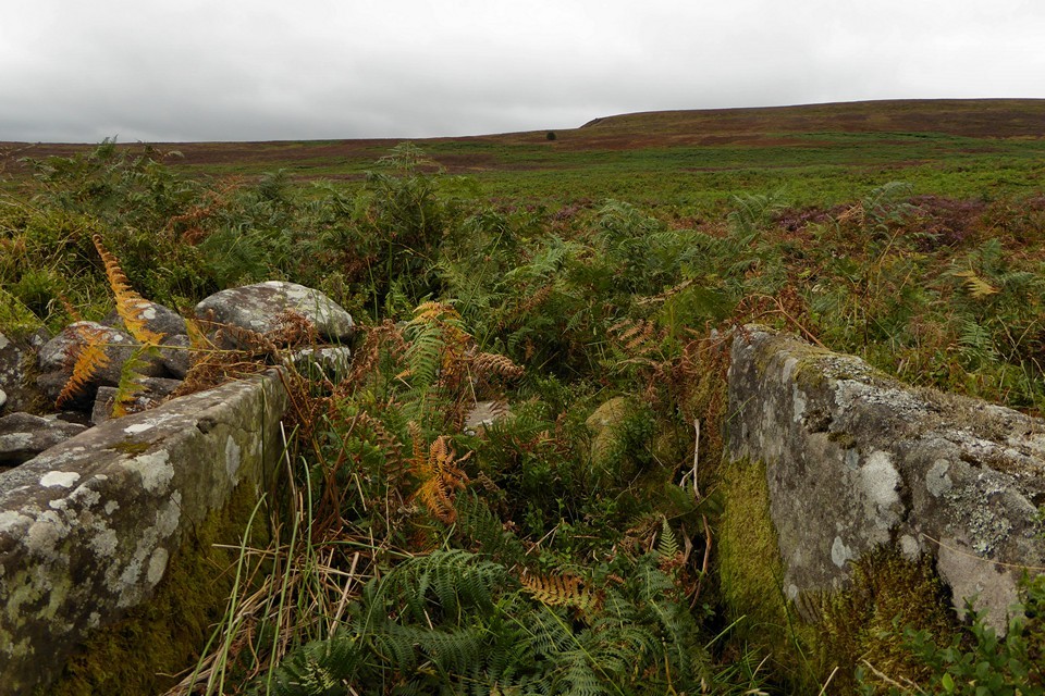
The cairn described by OS workers (1975 & 1979) is a partially destroyed round barrow cist situated in open heathland. The mound is circular in form, the N area is almost level whilst the SE area is more substantial in height. It would appear that the N-NW-W of the mound has been robbed away leaving a slight curved earthwork around the cairn's former boundary. To the central S area of the cairn is an impressive cist (diameter; 2m x 1.2m x height; 0.65m) of two long parallel flagstone slabs aligned NE-SW, with smaller slabs (0.4m) defining each open end. There is a linear incision mark (0.16m long) on the inside of the S cist slab that does not appear natural; the incision is 'V' shaped and may have been caused by prehistoric stone rubbing. To the S of the cist is the only area of exposed boulders.
Dimensions: diameter 15.5m; height 1.4m (max)

 Posted by GLADMAN
 Posted by thesweetcheat