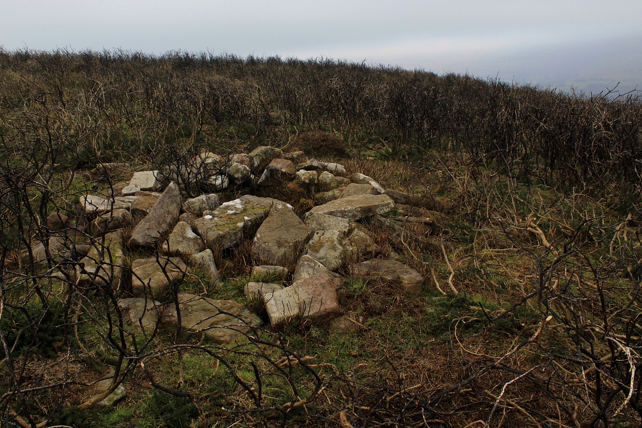
That'll be Northern Snowdonia, then. And a passing shower...
Looking to the approx southeast from the south, where 'modern' walling surmounts the ancient stonework.
Looking roughly north towards the great cairns of Gyrn Ddu..
The exceedingly well-preserved 'double wall' to the west...
Looking back towards Cwm Cilio farm from the 'main entrance'... top farmer, by the way. So don't take the piss.
Sitting in the car beneath the wondrous Tre'r Ceiri, the weather is so violent as to render any thoughts of venturing outside the apparent safety of my steel carbuncle – let alone of spending the afternoon upon a hill fort – seem ludicrous. In the extreme. Nevertheless, as another industrial strength hail shower thunders past bound for the Eifionydd, I decide to place my faith in the improving Met Office Mountain Forecast. What could possibly go wrong?
Taking the minor road looping through forestry from Llanaelhaern, I identify the long approach road to Cwm Cilio Farm. The sky, as black as you like, causes the doubts to resurface, uncertainties further exacerbated by the realisation that there is nowhere to park that wouldn't – if I was the landowner – make me want to give myself a slap. Or something like that. But hey, while I'm here I guess it would be rude not to make the effort...
As it happens, said landowner is mooching around in his digger-contraption (quite a feat, to appear that nonchalant aboard serious kit)... so, after conducting a quick Health and Safety Assessment – although I can appreciate a farmer 'digging' The Citizen Cairn's attitude, best not let things get too literal – I interrupt to ask permission to park and to generally have a chat. Wary at first, it transpires he is indeed not fond of tourists who park upon his land without having the courtesy to ask; is somewhat surprised I want to specifically visit Pen-y-Gaer at all, what with the (justifiably) celebrated Tre'r Ceiri looming nearby; oh, and a certain cow up yonder track is having some 'health issues', so would I please be careful not to startle it, etc. Presumably by acting like a gun-toting 'Texan' inexplicably engaged upon a walking holiday in North Wales? Otherwise, I am free to knock myself out. Again, preferably not literally.
So, after making myself look a complete freshman muppet by not sussing the farm gate 'slides', rather than swings open – duh! – I head for the great hill fort looming menacingly above. Clad in waterproofs and numerous additional 'under-layers' (to combat the anticipated adverse conditions at altitude), a couple more fast-moving showers kindly apply natural coolant as I begin to overheat, ushering me along as I make rather heavy going of the climb.... although, to be fair, it is 1,276ft. Not bad for a 'hill' fort?
Finally, and not before time, I reach the summit, whereupon the penny drops that the defences of this Iron Age enclosure are far more powerful than the distant glimpse enjoyed from Gyrn Ddu a few years back had suggested. The topography of the hilltop is such that the former inhabitants clearly massed the overwhelming might of their defences here, facing the west, a significant c15ft 'double thickness' of very well preserved drystone rampart showing these people meant business alright. The masonry curves away to north and south reducing in girth – albeit now topped by a 'modern' wall upon the latter arc. Hahaha! The irony is not lost upon me that I've just struggled up the 'path of least resistance' (since, as Phil Oakey would've pointed out, it seemed the only way), this fact emphasised by the even steeper crags protecting the eastern flank, stony residue suggesting the oft-used 'fill in the gaps' approach was employed here as well.
In short, I'm blown away by the impressive archaeology gracing this mini-mountain... as well as being periodically blown off it by wind seemingly steadily growing in velocity every minute I spend up here. Consequently, I seek out the lee – such as it is – of one of the eastern crags and settle down to enjoy the sweeping melodrama that is Northern Snowdonia. The sun breaks through, light streaming between a fast-moving, well-broken cloud base sending alternating washes of gold and deep shadow racing across a landscape that is truly a glory to behold. Looking eastwards, all the old friends are present and correct, many of those heights crowned by monuments to VIPs of an even earlier epoch. Indeed, it's tempting to wonder whether the people who lived HERE back in the day still retained folk memories of who those VIPs actually were? Long before your johnny-come-lately Llewelyns and Dafydds got in on the act.
The odd isolated shower – just-a-passing-through, can't stop – notwithstanding, conditions continue to improve until Yr Wyddfa (Herself) puts in a regal appearance upon the skyline betwixt The Nantle Ridge and Mynydd Mawr, not forgetting The Rhinogs rising across a shimmering Tremadoc Bay to the south-east. Such is the scenic splendour on display here that I decide that the supplementary site 'penciled in' for later on will have to wait for another time. Quite right, too. Such moments are to be savoured like a cordon-bleu meal. Only without the dodgy French 'sauce' and the muppet chef screaming expletives at everyone in earshot.
Finally, it is happening to me... an audience with the great chamber.
Hill fog (hence the visit) accorded a rather intense vibe to this substantial monument...
Suffice to say, the location of this heavily overgrown monument is not exactly advertised on the ground. My third time of asking... (the first unsuccessful through my ignorance; the second curtailed by a young, hostile 'farmer-type' trying – and failing comically – to berate me for straying from the path... while farcically having no clue whatsoever as to any 'burial chamber' on 'his' land)... this was actually well worth the perseverance over the years. In retrospect, an audience is easy enough: approach from the east, not via Sling (i.e. the Chwarel-goch road, where a former 'phone is annotated upon the map), head through the metal gate and look to enter the field to your left as SOON as possible... then follow the line of 'telegraph posts' uphill into the trees.
The Great Orme (appears to) rise above the hill fort Dinas Allt-Wen... viewed – with optical assistance – from Tal-y-Fan.
The strategic significance of the great hill fort's location, looming above Dyffryn Conwy, is obvious – viewed from Tal-y-Fan.
Optically-assisted close-up of the brutal south face of the 'hill fort'. The main summit of Y Berwyn rise beyond, Cadair Berwyn prominent.
Craig Rhiwarth and Y Berwyn are resplendent looking across Bwlch y Main from Carnedd Das Eithin to the south.
Foel Offrwn (centre) and Foel Faner (to right): two hillforts standing before the great escarpment of Cadair Idris. Yet more loom beyond overlooking the Afon Mawddach. Viewpoint is near Moel Cors-y-garnedd, above Bwlch Goriwared.
The great round barrow/cairn(?) at the summit. Yeah, pretty obvious when you consider it... The wondrous Pumlumon peeps above the shoulder of Foel Fadian (which, as well as possessing a fairly substantial barrow of its own, hosts a viewpoint dedicated to the late, great Welsh raconteur Wynford Vaughan-Thomas. Can't say fairer than that)
Gazing towards Southern Snowdonia – Cadair Idris is seen left skyline – from what is clearly a substantial summit barrow/cairn.
This is what can be seen at the spot depicted upon the map, looking across Bwlch Coch to the excellent Pumlumon outlier Foel Fadian. To be fair, there did appear some manner of circular feature here... and this would be a typically 'Bronze Age' location, set below and to the southwest(ish) of the summit. However, there is no doubt in my mind about the mound at the summit.
The monument can be clearly seen surmounting the 1,539ft summit of Moelfre upon concluding the very sharp ascent from Bwlch Glynmynydd to the (approx) northeast. Note that this is NOT where it is depicted upon current OS mapping... whether there is actually anything – or once was anything – at the said location would appear dubious.
Wondrous monument, wondrous location, and thus wondrous vibe...
Looking across the 'hollow' resulting from the c19th Century 'excavation' towards the site of the none too distant Afon y Dolau Gwynion chambered cairn, itself only rediscovered in 1993! According to CPAT: "...The c.1800 excavations produced "a piece of brass kettle" (possibly a small pot or cauldron) and some coins. Pieces of armour are reputed to have been found near the same place..."
Cadair Berwyn – the sentinel peak of Y Berwyn – can be seen rising above the stupendously 'rugged' hillfort of Craig Rhiwarth, top left.
The iconic main ridge of The Arans can be seen far left..
Located upon the 1,709ft summit of an outlier of Y Berwyn, this substantial round cairn is (apparently) some 6ft in height, c66ft in diameter. It seemed higher, no doubt utilising a natural knoll to good advantage.
The 'crag-top' enclosure before its magnificent parent
A decent upland cairn, albeit somewhat 'hollowed-out' by halfwits.
My interpretation – for what it's worth – is that the enclosure acted as an ancillary 'lookout post' guarding against a hostile party assembling here following an approach from Bwlch-y-maen to the south? Or maybe the enigmatic band of quartzite mirroring that below the cairn simply made this an 'important place'?
The central peaks of Cadair Idris lord it over the head of the Dysynni valley.