|
|

|
|
|
Ireland - At last! |
| I am sat here writing this feeling very, very lucky, I have been fortunate enough to visit Carrowkeel, a totally magical, unforgettable location equalling anything in Europe; anyway, more of that later. I had postponed visiting Ireland on more than one occasion due to bad weather, however, this time there was no turning back, the van was packed and the ferry tickets were in my hand. It was a quilt free trip as we had recently had 2 weeks in the sun and a short break to Cornwall and so a quick dash from Lincolnshire to Holyhead and I was soon heading for the Hill of Tara. I arrived to an empty car park just before 7.00am on a very blustery day, the rooks were screeching, diving into the wind only to be swept back to the trees surrounding the church and graveyard, all very eerie. Even as a total non believer I could feel the power and the energy radiating from this site as I walked up the ceremonial route to the mound of hostages and the stone of destiny, ancient voices carried on the wind, only they were speaking English, more people had arrived and I realised I was standing on a grassy mound in Ireland, nothing more, nothing less, time to move on. A short trip to the Boyne valley were I was going to visit Newgrange and Knowth. I had read that the only way to enjoy these sites is to accept that they belong to the day tripper and that you are their visitor not the other way around and to just relax and become a tourist yourself, and I have to say I had a thoroughly good day out. A very pleasant visitor centre a nice run around the countryside in the transit bus and perfectly manicured site and pathways to walk on. I didn't even get upset by the controversial quartz wall at the front of Newgrange, its there now, no one is going to knock it down or change it we have to live with it and just hope they do not employ the same team to give Stonehenge a makeover after it sinks into the tunnel beneath. Back in the van and off to Loughcrew where I spent the night before exploring the following day. It was Bank Holiday Monday and I guessed it might attract a few people so I organised with the local guide Fechin to go up Carnbane in the morning before it got too busy. Armed with the key to Cairn T we enjoyed a beautiful sunny day, the views were spectacular and the artwork inside the cairn stunning. I could see across the valley to Carnbane West where Cairn L is located, I had also read that public access has been denied for a number of years following the last outbreak of foot and mouth. Given that it was starting to get busy I decided to head off in that direction. A quick hop over a locked field gate and a surprisingly tough little hill and I was looking into Cairn L an immaculately preserved cairn, possibly better than T, however, the real shock was to discover that there are 6 or 7 Cairns in various states of preservation up there and I had the whole place to myself, not a single fellow trespasser nor angry farmer. I ended up staying there for the afternoon soaking up the warm sunshine. Next day it was off to Carrowkeel. I had read that approaching Carrowkeel is like entering a lost valley and that is exactly how it felt, cliffs to either side, road just wide enough for the van and no one else in sight. The walk up to the most visited cairns G, H, K, L is nothing short of stunning and the cairns fabulous with no barrier to entry, you can crawl through the passage and play around inside to your hearts content, further on there is a large sinkhole and on again standing stones. On the way back down detours to the seldom visited Cairns C and D and then a scramble up to E and F provided even more stunning views. A word of caution if visiting these last 4, the paths are ill defined due to lack of visitors and its easy to miss them coming back, there a cliff hedges and sink holes around so please take care. I really did not want to leave this beautiful valley nor the mountains, I loved every moment there and every part of it and will definitely go back to explore the cairns I could see on neighbouring mountain tops. With a heavy heart I headed for Carrowmore which I didn't really enjoy after Carrowkeel, it was far too manicured and sterile, however, redeemed to some extent by the way it sat in the shadow of Knocknarea as indeed did everything. Overnight in Strandhill and ready to tackle the hill in the morning in order to visit Queen Maeve's grave. A walk from the beach at Standhill to Sligo rugby club and then up what is called the 'New Walk' up Knocknarea, actually very exciting as it gains height quickly and then follows a 300m board walk up through the trees before gaining open mountain. I didn't stay too long as no one seemed to understand the 'Do not climb' signs and for some reason I found it upsetting. Back down to the beach and a quick visit up the road to the famous court tomb of Creevykeel. Next day a longish drive down to the Burren to see the famous Poulnabrone dolmen, why this should be the most photographed dolmen in Ireland escaped me, however, the barren lunar like landscape was a most enjoyable drive. Next day was a tour through Carlow (nostalgic as I used to visit with work) and stops at the incredibly impressive Brownes Hill dolmen with its huge capstone and Haroldstown dolmen situated on a nasty bit of road. Finally I headed back towards Dublin viviting the 3 stone circles of Castleruddery, Athgreany and less visited Broadlees on the way. Castleruddery was particularly fascinating being a henge as well as a circle. Anyway it was all over bar the shouting, ferry back to Holyhead and dash home. Cannot wait to go South to Cork on my next visit just need to keep the home points building up |
Posted by costaexpress 8th May 2017ce |
Winter sun gods |
| It was mid January, Christmas and New Year were well and truly over, my curfew was lifted and wife said I could go out to play again. My New Years resolution is to visit Ireland and I was keen to get on with it, however, the weather was atrocious. A quick look at the weather map indicated Portugal was the only place basking in sunshine, fearlessly, after tea, 'I softly mumbled, I'm going to Portugal on Sunday', 'Thought you were going to Ireland?' 'It's the weather', 'For Gods sake do what you want just don't involve me in it' With that ringing endorsement I threw some warm bedding in the van, food in the fridge and set off for the euro tunnel on a cold Sunday afternoon. Non stop driving through the night and following day found me nicely tucked up in bed just outside the Orca complex ready for an early start on the Tuesday morning. The jewel is the Orca dolmen itself, however, there are around 10 other sites scattered across the hillside between the villages of Fiais and Azenha. The sky was a cloudless blue and the sun bright and warm despite the low temperatures and I decided to walk. The hillside is covered with ancient trees and natural rock outcrops some with early Neolithic artwork etched into them, all in all one of the most pleasant 4 hours I have spent anywhere. Next day down to the Alpalhao region of Portugal to visit a grouping known simply as Alta 1 to 4. An unfortunate encounter with a farmer and I was off to visit more friendly sites. It was soon time for another trip further south first to the Pavia district and then on to Evora itself. In my humble opinion this area rivals Brittany, Wiltshire and Orkney for the range and close proximity of the megaliths among them the better know 'Anta Grande do Zambujeiro' and 'Almendres stone circle' although by no means the jewels in the crown, these belonged to the amazing stones at Cromeleque da Portela de Modos and Cromeleque de Vale Maria do Meio. A few wonderful sunny days in Evora and I was beginning to understand why our ancestors would want to worship the sun. All to soon it was time to point the van North. There had been some disappointment, some sites I could simply find no way through the fences and one site the long horned inquisitive cattle destroyed any bravado I had left, other than that I would gladly do it all over again, however, not sure how I am going to swing that particular trip at the moment |
Posted by costaexpress 4th February 2017ce |
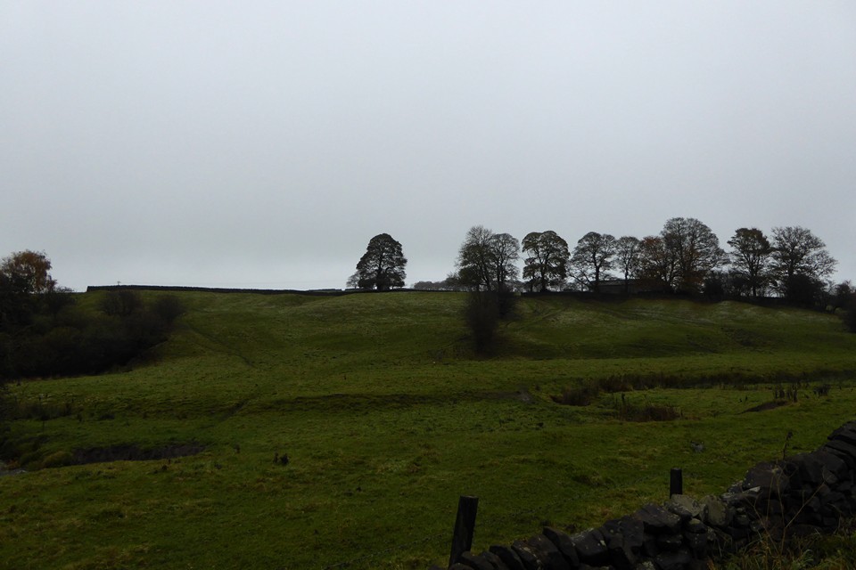
Raving on the Moors Part III – Big Moor 11 November 2016 |
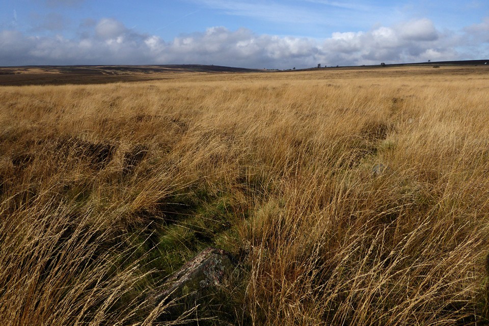
|
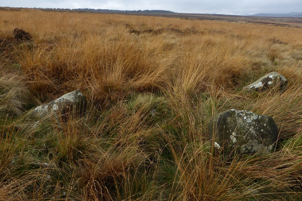
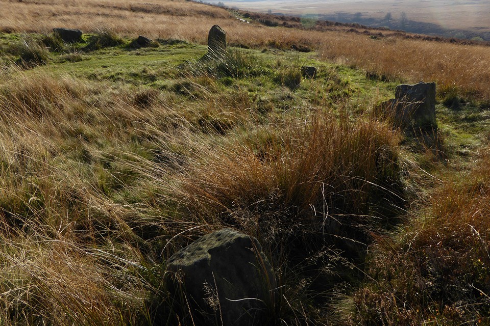
The third and final day of our Peak District trip is the Big One, the day out we were going to fit in no matter how bad the weather turned out to be. And in the end it’s a beautiful day, blue skies and barely a nip of autumn wind. After a revisit to Bakewell church to see the green men and huge collection of early medieval stones, we’re heading off to Owler Bar, little more than a pub and bus stop at the northeastern corner of Big Moor. Big Moor is a sea of umber and orange at this time of year, and despite the busy A road running along its edge, it manages to feel like a remote place. Features are limited, just a gentle rise to the high points, the curve and dip of the course of Bar Brook, occasional lone trees, and the glint of sun on the half-empty Barbrook reservoir. It’s towards this last feature that we head first, following a wet and muddy track running alongside Bar Brook itself. There are a few other walkers about, but they remain distant and unintrusive, leaving us to contemplate the gentle expanse of emptiness on either side as we head south. Barbrook III — Fieldnotes01.12.16ceThe first site of the day, Barbrook III will be the most difficult to find, rendered so by small stones and tall grasses. Leaving the embanked edge of the reservoir behind, we follow a faint path NNE, hoping that the stones will show themselves. Arriving at a darker ring of bracken, obvious amongst the pale oranges of reedy grass, I concede that we’ve gone too far this time, so we head slightly downhill and back on ourselves. Soon after the first stone appears, barely peaking its head above the vegetation. Then another, and another, and another. This is a laugh out loud circle, so easy to miss yet huge in size, if not stones, once discovered. It’s a bit squelchy, the stones are half-hidden, their spacing makes it hard to photograph more than a couple at a time, but it’s truly wonderful. The relative flatness of the moor makes the surroundings somewhat undramatic, but instead there is a sense of secrecy that has a charm all of its own. The play of light on the rising ground to the west, the gnarly lichen on one of the stones, the patterns of erosion and wear on the upper surfaces of others, all combine into a near perfect experience. We can see cars on the road, walkers in the distance, but it seems almost unthinkable that any of them might ever come here. Hidden in plain sight, a gem all the more precious for its coyness. Barbrook III — Images16.11.16ce
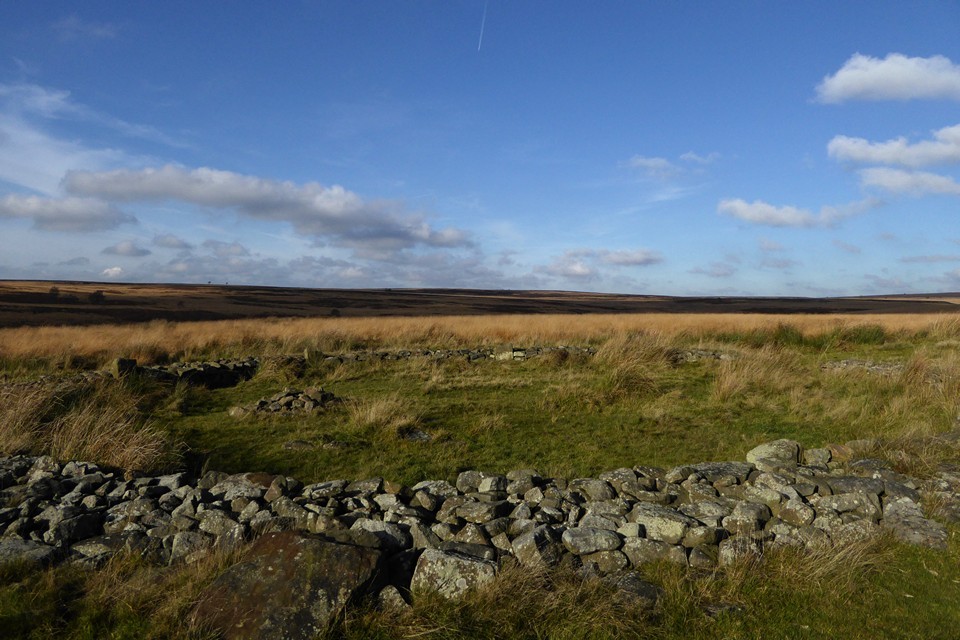
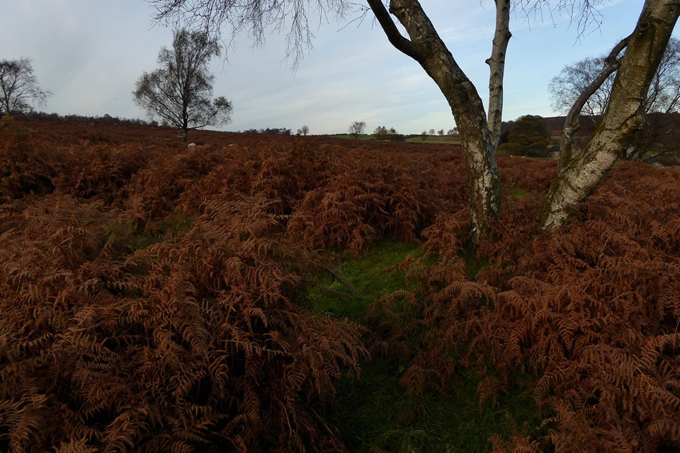
We retrace our steps towards the reservoir, then rejoin the course of Bar Brook heading south once more. The valley deepens slightly, the sides blocking the views and channelling us into a place of even greater quiet and solitude. We see no-one now, except a single doe silhouetted on the skyline to the southwest, watching our strolling progress. Closer inspection reveals the antlered head of a stag, keeping below the crest, and soon we pick out many more of the herd, blending into the browns of the hillside across the valley. As the path curves southeast, we leave it and cross onto the open moor. The sites here are concealed from the level of the track, but a substantial round cairn, covered only in a thin layer of turf, is the first obvious sign that we’re in the right area. We’ll have a look at the cairn group a bit later, but the next objective is something a bit more unusual. Barbrook II — Fieldnotes01.12.16ceBarbrook II is a bit of an enigma. A circle of free-standing stones, enclosed within a thick drystone wall that stands only slightly lower than the tops of the stones. I’m instantly in love with this place. We’ve never been before, another omission long awaiting correction. The circle feels utterly secluded, the wall and stones are low enough to escape attention from anyone but a deliberate visitor, especially as the Ordnance Survey map perplexingly shows no sign of the circle or nearby cairns at all, other than a misleading “field system” label. This is somewhere to spend time, to watch the clouds and the changing light over the moor. We sit here for a while, no-one comes, nothing intrudes. There are lots of details, the burial cairn inside the circle, the large stone propped against the outside of the drystone wall, there’s also a cupmarked stone in the central cist but I don’t even notice it. The next time I come – and I really hope that isn’t too long away – I’ll pay more attention to these little elements, but today I’m so overwhelmed by the whole that I couldn’t really care less. Perfect. Barbrook II — Images20.11.16ce
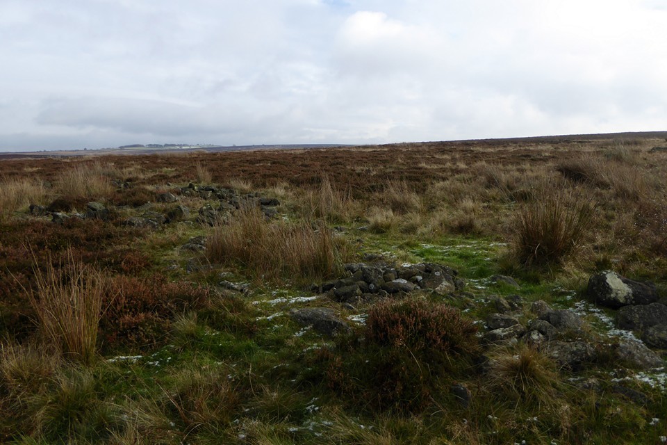
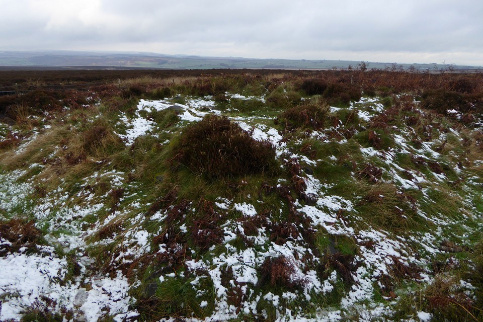
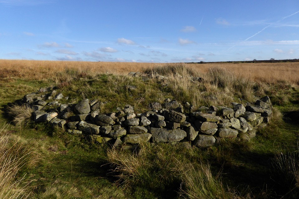
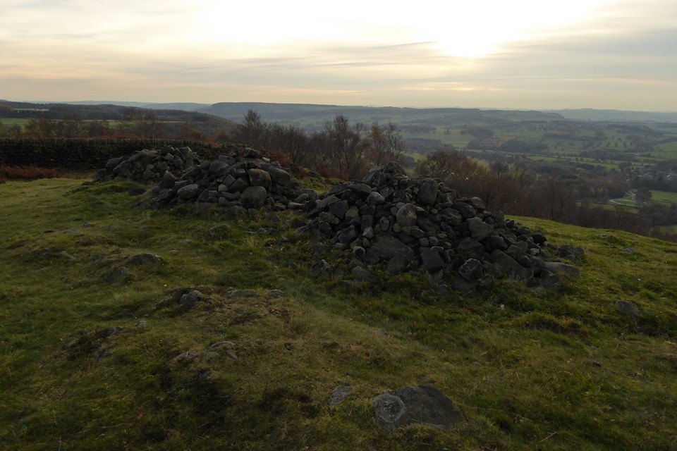
Barbrook cairns — Fieldnotes01.12.16ceThe cairn cemetery lying between Barbrook II and Barbrook I proves well worth a stop off. A widely varied group, mostly dug into in the mid-19th century, many have excellent kerbs. The star of the show is the rebuilt cairn closest to Barbrook I, a bit of a classic of drystone edging about four courses high. One of the stones in the surround shows an interesting weathered pattern that is probably natural, but just possibly could be the very eroded trace of cupmarks. From here we drop slightly to Barbrook I. Barbrook cairns — Images20.11.16ce
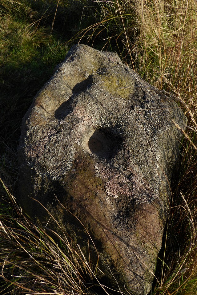
Barbrook I — Fieldnotes01.12.16ceThe third of today’s stone circles, and very different again from the other two. This is yer classic Peaks embanked circle, compact and neat. Unlike, say, Nine Ladies, the stones are quite varied in size, although with no particularly obvious grading towards a compass point. The top of one of the stones has cupmarks, something I was completely unaware of, but which recalls the stone at Stanage we visited yesterday. When we first got into stone circles, I read that the Barbrook sites and Big Moor were closed for environmental reasons – this was in the days before the Countryside and Rights of Way Act opened up swathes of access land, and before the internet might have told me different – so we never came here on our earlier Peaks holidays. As I’ve felt throughout these last three days, the long wait has both sharpened and sweetened the experience of finally coming to these sites. They compare with the best. The proximity of the track perhaps keeps this from quite reaching the heights of Barbrook II as a place to find solitude, but in truth no one passes our way in the time we’re here. We will definitely be back here. Barbrook I — Images20.11.16ce
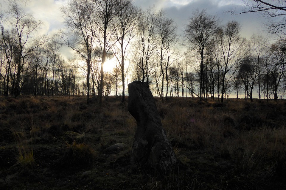
So we bid goodbye to Big Moor, a brilliant introduction to some of the best sites I’ve been to. We head across the A road and skirt the edge of Ramsley Moor, our progress temporarily halted by a herd of cows that really would prefer not to get out of the way. Once these are safely persuaded to give us passage, Gardom’s Edge lies ahead of us. The sun is sinking low now, our eyes dazzle. After crossing a slightly boggy patch of open moor, we head into the long shadows of a birch wood, stark black and white trunks surrounded by the darkening reds of dying bracken. There are a few people about, children’s voices carrying through the trees from somewhere ahead, unseen. Gardoms Standing Stone — Fieldnotes01.12.16ceThe main reason for coming here is the rock art panel, so memorably filled with pink flowers by Postman a few years ago. But first, I’m hoping to find the standing stone, something of a rarity in this area. We walk through the woods, trying to stay away from the treeless edge, as I know the stone won’t be found there. It turns out to be further south than I’d realised, another site that the Ordnance Survey map doesn’t show. Eventually it makes itself known, as we get towards the higher part of the wood. The light has gone strange now, the low sun filtered around the edges of a bank of cloud giving an ethereal glow to the woods and the stone. The stone is a good one, a little taller than I imagined and different from each angle and direction. Like many of the best standing stones, it gives off a feeling of sentience. Even though I know this is just projection on my part, it’s hard to shake once felt. There’s no malignance, or beneficence, just a presence. I often find woodland sites hard to leave, and the stone definitely exerts a pull. As we leave I’m compelled to look back, Orpheus to Eurydice. Gardoms Standing Stone — Images20.11.16ce
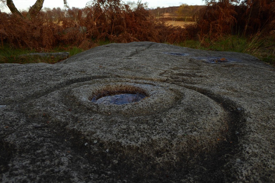
Gardom's Edge — Fieldnotes01.12.16ceNext up, we encounter the stonework of Meg’s Walls. Half-buried in the undergrowth, too large to take in easily, this is a fascinating survivor enhanced by a lovely woodland setting. But we’re really here for rock art. After a bit of rooting about in the undergrowth, we find it on the edge of the woods, looking towards the steep western face of Birchen Edge. The light is now too low to illuminate the panel, but casts a soft orange glow across the moor ahead of us. Despite knowing that it’s a replica, the panel itself is still very impressive. I love the variety of patterns, whatever it represents – or doesn’t. Water has collected in the deepest cup, reflecting the slender trees and blue sky above, an ever open, all-seeing eye on the world. Gardom's Edge — Images20.11.16ce
The Three Men of Gardoms — Fieldnotes01.12.16ceWe follow the arc of Meg’s Walls south, before leaving the wood to emerge at the Three Men cairn. The three stone piles are clearly modern, but they sit on a much larger footprint. The views from here are great, looking down on Baslow as the sun sinks further. It’s starting to get colder and it won’t be long now until dark, so we press on without lingering. The Three Men of Gardoms — Images20.11.16ce
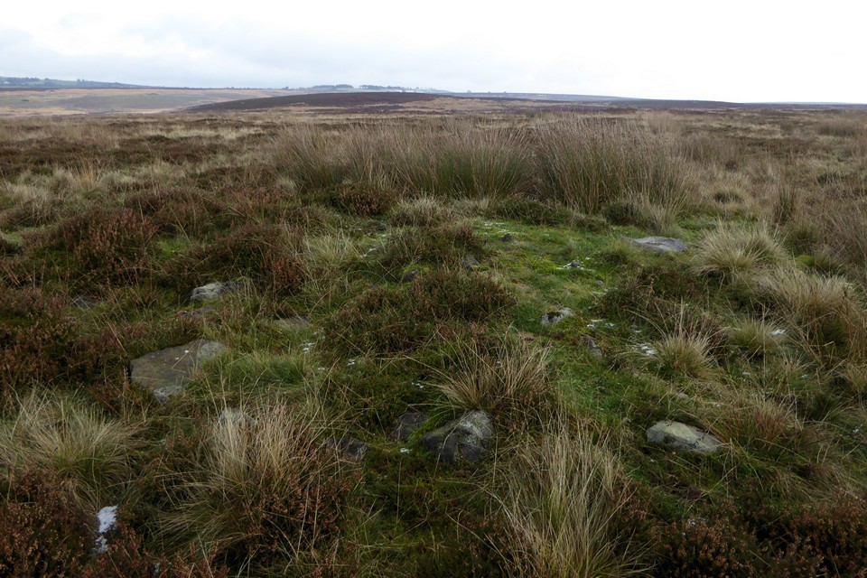
Gardom's Ring Cairn — Fieldnotes01.12.16ceThe path makes its descent, cutting through a cairnfield of pretty large, irregularly shaped cairns. The Gardom’s Edge ring cairn is completely hidden by bracken, but can be spotted by the forked silver birch that grows from its embanked edge. Once found, the course can be followed round easily enough, but really this is a place for a winter visit if you want to see it properly. Gardom's Ring Cairn — Images20.11.16ce
We drop down to Robin Hood, for the final bus journey back, near where we started the first walk of this break under snowy skies. I’ve been re-energised by these last three days, a shot in the arm of prehistory. Revisiting the area where it all started, finding so much still to see for the first time, a reminder why these wonderful, enigmatic sites captured my heart in the first place. |
 Posted by thesweetcheat
1st December 2016ce Edited 4th October 2023ce |
Raving on the Moors Part II – Eyam Moor 10 November 2016 |
|
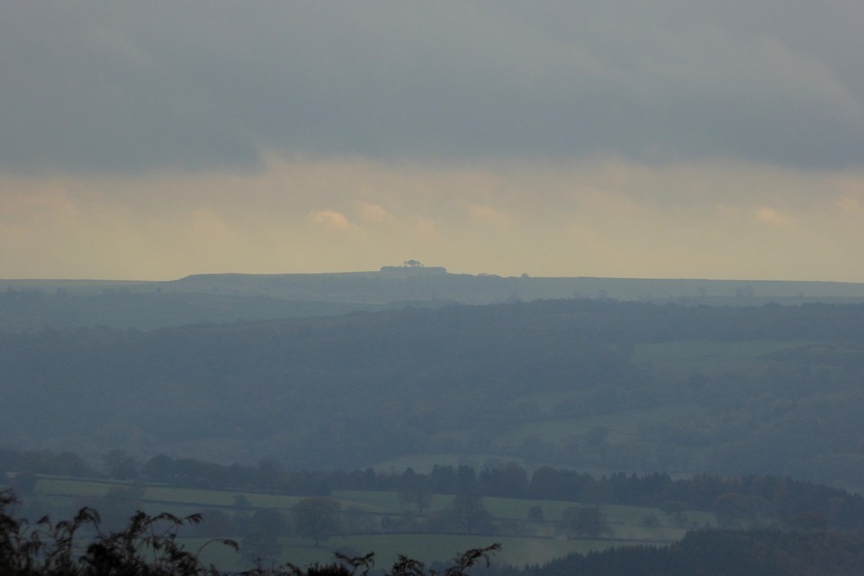
There is an annual tradition, or perhaps folklore, that says it always rains or hails on 10 November. I try to dispute this but more often than not it turns out to be accurate, so it’s no great surprise to open the curtains to see a heavy shower to start the day. Today we’re going to Eyam Moor, to visit Wet Withens and a cup marked rock that have been on my imaginary visits list ever since we first started going to see prehistoric sites. There was an aborted attempt, round about 2000, when we went to Eyam but never made it beyond the outskirts as the weather closed in. I recall Eyam as a gloomy place, the omnipresent plague history coupled with the grey and damp conditions that day doing little to lift the spirits. We’re off to Grindleford, a small village in the picturesque Derwent Valley, perched just below the eastern edge of Eyam Moor. There’s an initial steep pull up the road out of the village, enlivened by a steadily unfolding view of the moors and edges to the east, now under blue sky and banks of cloud that still carry the threat or promise of more rain. To the northeast is Owler Tor and the prominent outcrop of Mother Cap Stone, to the east Stoke Flat with Big Moor rising beyond. I’m hoping we’ll get across that way the next day. Mother Cap Stone — Images13.11.16ce
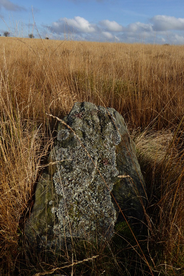
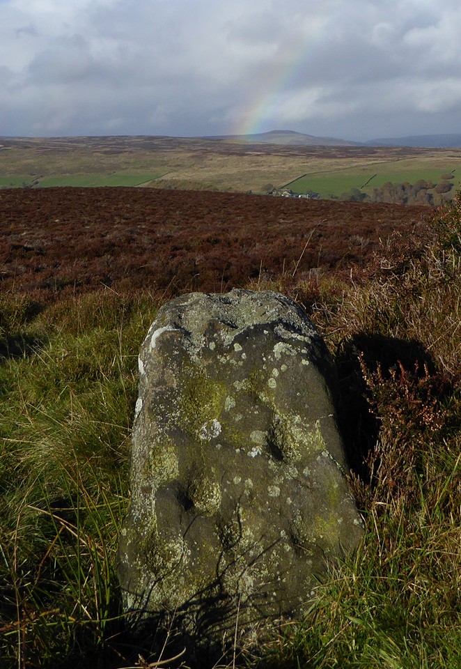
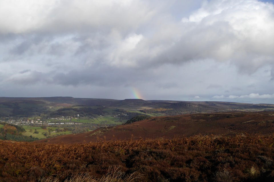
The road levels off as it climbs on to relatively flat moorland, with the obvious landmark of the mast on Sir William Hill ahead of us. After a mile or so we arrive at a junction with a rough, stony track heading towards the summit, and finger posts for footpaths heading off northwest and northeast across the moor. We decide to follow the track west, to gain the last bit of height and hopefully take in an expansive view north and west from the summit ridge. Unfortunately, just as we cross the step stile onto the grassy slopes, the rain starts to spit and by the time we’ve reached the trig point it’s become a downpour. We take shelter in a little quarry scoop and don waterproofs. Once we’ve done so, the trailing edge of the shower is starting to pass, clearing the views but leaving a keen, chilly wind in its wake. The views to the west and north are far reaching now that the storm front has passed. The bulk of the Kinder plateau fills part of the skyline, and in front of it I’m pleased to see the familiar face of Mam Tor. There are no prehistoric remains on top of Sir William Hill, even though it would be an obvious place for a cairn or barrow. The summit ridge drops gently to the NNE, and at a modern marker cairn we head more steeply downhill to the northwest, along a clear, grassy path that cuts into and through a dark sea of heather and provides a nice aerial view of our first site of the day. Stanage — Fieldnotes27.11.16ceWhere the ground once again levels off, Stanage cairn sits to the east of the path, surrounded by heather but prominent enough to stand clear of it. It’s a flat-topped mound at least 15 metres across, with a rubble bank poking through the vegetation on its circumference. It enjoys a great view to the north, with Mam Tor just peaking over Abney Moor. The most striking landscape feature from here is Win Hill, which reminds me of the Sugarloaf/Pen y Fal in South Wales. A good cairn in a lovely spot, but the real gem here is the cup marked stone in the edge of the monument. I’ve been aware of this stone for the best part of two decades, simply because I bought a postcard of it in Bakewell bookshop a long time ago. Somehow I’ve never quite found the time to get here until now, but it’s even better in the flesh. The cupmarks are large and cover two sides of the stone, as well as its top. We stop here for a while, watching the wind push the rain clouds of earlier further east, before revealing one last gift, an incomplete rainbow hanging beautifully over Win Hill. There are moments when time stops and lets you breathe, completely at peace. This is one of those, fleetingly brief but eagerly snatched. Stanage — Images13.11.16ce
Carl Wark & Hathersage Moor — Images27.11.16ce
From here it’s a matter of picking a route through the knee deep heather as best we can. It’s slow progress, each open area of tussocky grass between the heather coming as a relief. Eventually we attain the high part of the moor, just as the rain is coming down again. There are a few prominent but misshapen cairns up here, one of which we crouch beside, seeking to bury ourselves and avoid the heavy tail-end of the shower. Once that clears and we can see our surroundings better, it’s clear that we’ve crossed the moor too far south and need to head slightly downhill towards the northern edge of the plateau. Wet Withens — Fieldnotes27.11.16ceAs the sun starts to come out, it picks out a light grey amongst the browns and reds, revealing the presence of the mutilated cairn next to Wet Withins. With that fixed, the eye then finds the darkly curving bank of the stone circle itself, with one larger stone standing out at its edge. Wet Withens is another Peaks site that has lived in my mind and on my imaginary list for a long time. A feature in Burl’s guide, apart from the one swiftly abandoned attempt so long ago it’s eluded me up until now. Rather like Gibbet Moor yesterday, some of the joy of coming here is undoubtedly borne from relief and satisfaction at actually getting here. But as well as that, it’s a terrific site. Bigger than I expected, the clearly defined bank and neatly placed stones make it a wonderful example of the ubiquitous Peak District embanked stone circle. Add to that the colours of the moor, freshly scrubbed from the recent soaking and illuminated by the sun against the dark backdrop of billowing clouds, and we’ve got a bit of a classic going on. Wet Withens — Images14.11.16ce
Eyam Moor Barrow — Fieldnotes27.11.16ceThe barrow is a mess, the shape all but gone, straggling and ragged at the edges. But there’s still a lot of stone here, indicating that the upheaval wasn’t about robbing for walls. And the setting is perfect, better than the circle itself as it’s that bit closer to the northern lip of the moor. The countryside drops to a patchwork of green fields in the Derwent valley, with Hathersage the obvious settlement below. Beyond and above, the hills rise again towards the high uplands above Edale, the moors of South Yorkshire and the edges around Higger Tor. Our rainbow makes its last appearance of the day, a welcome splash of colour against the grey. I should have come here years ago, but it’s still a sweet pleasure to come now. Eyam Moor Barrow — Images14.11.16ce
The folklore rang true, the tradition was duly enacted and the day dispensed a deluge as foretold. But it also provided a long-overdue visit to a wild and windy moor, to sites that have waited long in the mind and now persist in the memory, in a light display refracted through the prism of pouring rain. |
Posted by thesweetcheat 27th November 2016ce |
Raving on the Moors Part I – Gibbet Moor 9 November 2016 |
|
The morning brings snow, the first of this season. It falls heavily on Bakewell, but doesn’t stick. Advice in the coffee shop suggests that if we want to see proper snow we should head northwest to the higher moors and sharper edges, but that comes with the risk of bus cancellations and a difficult journey back. Instead Gibbet Moor wins the right to be the first trip out of this Peak District break, a relatively low moor with an easy climb from the road to the north, perfect for legs reacclimatising themselves to the hills after absence. We start with a bit of a road slog under light drizzle that takes us past Stone Low, perched on the lip of valley to the north of the road. This cairn, once large and impressive, is now little more than a slight rim, a rise in the grass beside fieldwall and beneath trees. Nice position, but little else to see now. Better things await though, and we’re keen to get off the road and onto the moor. Stone Low — Images12.11.16ce
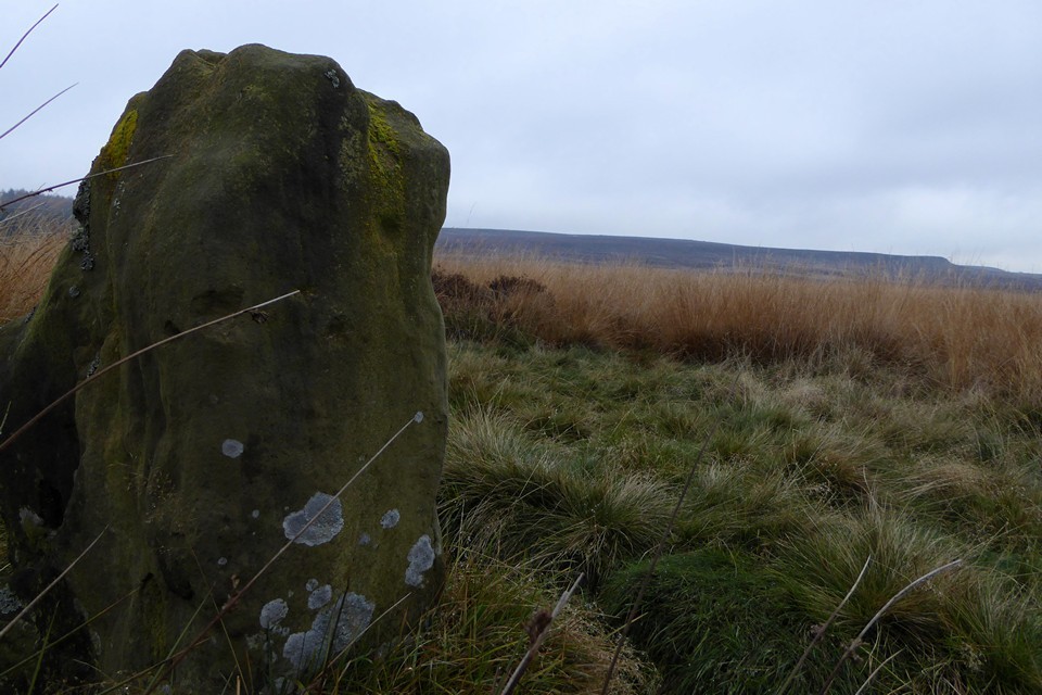
Gibbet Moor North — Fieldnotes23.11.16ceGibbet Moor is access land, and we make our way uphill, along a sturdy track running southwest from where the road crosses Umberley Brook. TMA shows all sorts of sites up here, but I only have eyes for the stone circle, three stones remaining of what might be a rare non-Scottish example of a “four poster”. I know the circle is somewhere about 500m to the southeast of the point where the track meets a drystone wall. From here the tussocky, reedy grass and patches of heather look decidedly unappealing and lacking in paths, but this is where we need to go. Setting off into the slight unknown, the vegetation isn’t as bad as it looked, low enough to step through without snagging ankles and feet. But it is wet, and within 20 yards of leaving the track my feet are soaked in my old boots. Nice. We wander around the gently sloping hillside looking for small stones in every reed clump and heather swell. There are plenty of stones, little stones, bigger stones, outcrops and individual rocks. But nothing resembling three stones of a circle. At one point I head towards an odd looking line of upright pallets, but nothing leaps out from the grasses. We’ve been going around in circles for about 40 minutes before I finally decide to look properly at the photos on TMA. The first couple are by Stubob, one showing the recognisable dark swell of East Moor, the next looking north across the valley towards a distinctive clump of trees on the opposite hillside. The conditions are different to our dull grey skies and distant snow, but the landmarks are unchanged. Getting to a position where both photos match the view from where we are involves heading into a particularly soggy patch of reedy grass, close to one of the pallets I noticed earlier. And suddenly, there they are: three stones, unmistakeably slim and upright, their heads barely poking above grasses. Without Stu’s photos we’d probably still be there now, so much gratitude is due to the Peaks pioneer. The lengthening grasses are threatening to drag the stones under, appearing quite a bit taller than in the previous photos. But despite the soggy setting and the even soggier feet, despite the small size of the stones and the absence of a fourth stone, I really like this site. Perhaps it’s partly the sense of relief and satisfaction at actually finding the circle, but it has a lot of charm. The views to the northwest and north are fine, across the valley and out to the distant edges. At this time of year the reedy grasses are a lovely shade of orange, which sadly the recalcitrant sun fails to properly light while we’re here. The stones are well chosen, shapely and lightly tapering. Whether this ever was a four stone circle, or just a three stone setting, I guess we’ll never know. But it’s well worth a visit, just wear something waterproof on your feet. Gibbet Moor North — Images12.11.16ce
Gibbet Moor and East Moor — Images13.11.16ce
Reaching the top of the moor, the views northwest open up to reveal a good coating of snow on the distant moors. The sky over us is closing in again, although there’s no sign of any rain or snow, just a dulling of the light giving the impression of dusk even at this early hour of the afternoon. The track edges southeast alongside estate wall and dense treeline, gradually climbing to the crest of the moor. The snow cover is a little thicker here, although you would be hard put to find enough to build a snow fairy. The next stop-off comes into view, heralded by a boggy bit of path and an information board. Hob Hurst's House — Fieldnotes23.11.16ceWe came to Hob Hurst’s House on our second Peak District holiday, pretty much exactly 18 years ago to the day. I remember a walk through the woods above Chatsworth, then crossing a boggy and wet moor under increasingly heavy rain. We were ill-dressed for open November moorland in the rain, and our first visit to a chambered tomb left both of us soggy and underwhelmed. Since then we’ve been to a lot more prehistoric sites, and I’ve wanted to return here for ages. Funny how your memory is both accurate in details and completely faulty in the broader picture. As soon as we get here, I instantly remember the shape, size and layout of the mound with its squared-off bank and ditch. But I don’t recall the exposed stones of the chamber at all. I also have a recollection of a fairly flat landscape, perhaps the rain and cloud condensed the world around us that day. Today the views to the south are extensive and sweeping, taking in the deep valley of Beeley Brook, with the sharp line of Harland Edge above, then onwards to rising ridges and long hillsides fading into grey. The unmistakeable feature on the skyline is Minninglow, for all that I’ve never been there. For the second time today Stubob’s presence in these hills is palpable. Eyup Stu. We stop here for a while and have a proper look at the chamber, noticing that the mound itself appears to be built at least partly of stone, another thing missed the first time. It’s too damp to sit and my wet feet are beginning to make me cold, and in any case there’s one more reacquaintance to be made today, so we head off downhill, following the line of the wood until we reach a field boundary. Hob Hurst's House — Images13.11.16ce
Minninglow — Images13.11.16ce
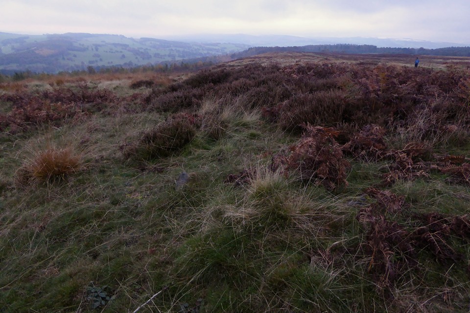
Park Gate Stone Circle — Fieldnotes23.11.16cePark Gate stone circle is not visible from the track, so it’s a matter of following the route until it starts to turn northwest, where another fainter path heads off north onto the moor again. There are a couple of stones in the circle that are big enough to stand above the reedy grasses, so it’s a lot easier to see than Gibbet Moor was earlier. This is the second revisit of the day, as we came here in 1998 on the same day as Hob Hurst’s House. At the time it was the fourth stone circle I’d been to, after Arbor Low, Nine Ladies and Nine Stones Close, three of the Peak District’s big hitters. So it’s probably not a great surprise that it felt a bit of a disappointment after those sites. Although there are at least ten stones in the circle, many of them are small and overwhelmed by the tufty, reedy grass that surrounds the site. The biggest stone, on the southwest of the circle, is leaning at an alarming angle over the top of a pit that threatens to swallow it whole if it ever goes the rest of the way. The most striking stone is the one on the east, a shapely upright with what appears to be at least one cupmark and some other dents that are apparently bullet holes and do have a ragged outline. This is the stone I remember from our first visit, and indeed the only one that I have a photo of. For all that, it’s actually a really good circle. In the 18 years since I last came, I’ve been to a lot of wrecked, dishevelled, uncared for, ploughed out, vandalised and generally unloved sites. So although there’s also been a lot of awe-inspiring, stop-you–dead-at-50 paces classics over the same period, my expectations are very different to how they were back then. Now, I see a fine circle in a good setting, looking towards Harland Edge particularly. It could do with a de-vegging, as the long grass is detracting from the sense of the whole site. Circle stones needn’t be enormous to make an impression, as anyone who’s had the pleasure of Cerrig Duon or Nant Tarw could attest. But they do need to be kept visible, and a judicious tidy up here would do it wonders. The only disappointment really is the terrible dullness of the day. It’s not even 2:30 but it feels like dusk, as though the sun has given up and set early, leaving a crepuscular greyness to the scene, even with the autumn colours of the moor. We head back to the track and head west. Park Gate Stone Circle — Images13.11.16ce
Beeley Moor — Fieldnotes23.11.16ceThe final site of the day is Beeley Moor ring cairn, an easy visit as it’s right next to the track. So near in fact that the track is slowly nibbling away at its northern arc. The monument itself is quite heavily overgrown with heather and scrubby grass on the circumference and bracken in the centre. Stones protrude from the bank here and there. It’s reasonably upstanding, but worth a stop off mainly for the excellent views down to the valley below. Beeley Moor — Images13.11.16ce
From here the path starts to descend more steeply – I have no memory of this being an uphill slog on our first visit, where we came from the opposite direction. At length we reach a step stile over the estate wall, and head into the lovely woodland of the Chatsworth Estate, eventually emerging into the park for the last walk into Baslow as dusk falls, for real this time. As well as the visit to Gibbet Moor, it’s been wonderful to return to Hob Hurst’s House and Park Gate after so long, the longest gap between visits of any sites we’ve been to. The intervening years have sharpened the interest, provided a lot more context and perhaps some better understanding. It feels rather like coming home. |
Posted by thesweetcheat 23rd November 2016ce |