Previous 50 Previous 50 | Showing 101-147 of 147 posts. Most recent first 
|
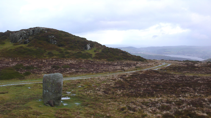
Small lane, very quiet, very small painted green metal railing around it, a tad to close to it though. It does have a great shape to it, almost childlike, toadstool like. In a beautiful area with views across
to the Carneddau.
|
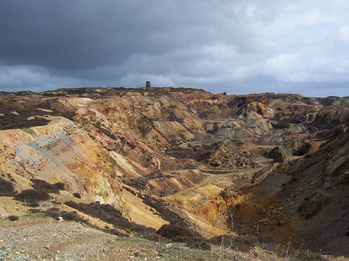
When I was there I met a very helpful bloke who was the part time warden, and he showed me a rock he was carrying in his bag, hand sized but heavy - from Porth wen (near bull bay) it had been fashioned into a hand tool. Because of this I asked him, wasn't the area mined in the copper age and long before the Romans, but he wasn't keen to agree with this. Yet he was showing me the evidence of pre-history mining in that area.
It's a great place to visit just after the rain as the colours are amazing.
|
|
Visited it in 2005, went across the muddy field too find it hunched in the corner, a strange sorry spectacle, with its huge concrete/brick crutch helping it to basically stay up. Be amazed at its resilience to time and man's indignity to it. Be astounded at the fact this structure has survived all this. It is for this reason it is always worth a visit.
|
Seems to be getting a lot of attention from the general P now. Every time I go I follow groups of families on "outings" I think a lot are disappointed as the chamber is locked, but the key can obtained from the wayside stores.
Nice new informative signs there now.
I suppose it's good to see people showing an interest.
|
 
|

|
       
|
 
|
 
|
    
|
 
|
 
|
One stormy night St Patrick was said to have been ship wrecked on the island of middle mouse below Dinas Gynfor. Being a very strong swimmer (!) he swam across strong currents to a cave beneath the present church of Llanbadrig (Badrig=patrick) finding refuge there and fresh water. He stayed and set up a Llan-thus bringing Christianity to these shores.
The church does date from the 6th century and there is a cave just below the graveyard with a spring running through it, so you never know this tale may have some truth in it.
|

|

|

|

|

|
|
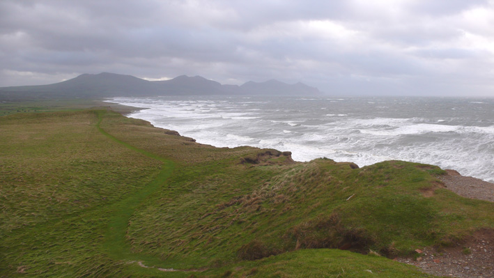
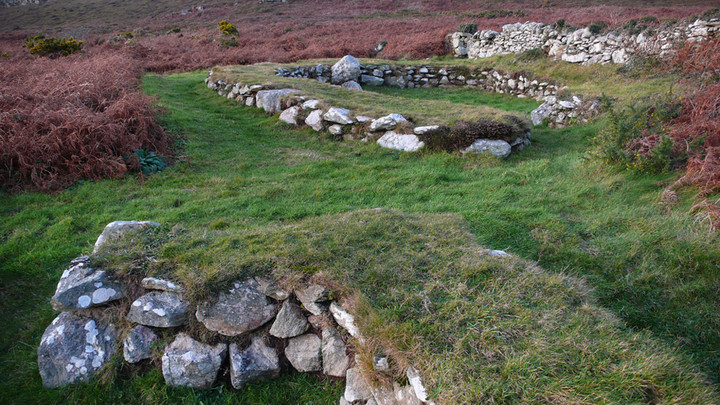
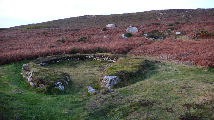
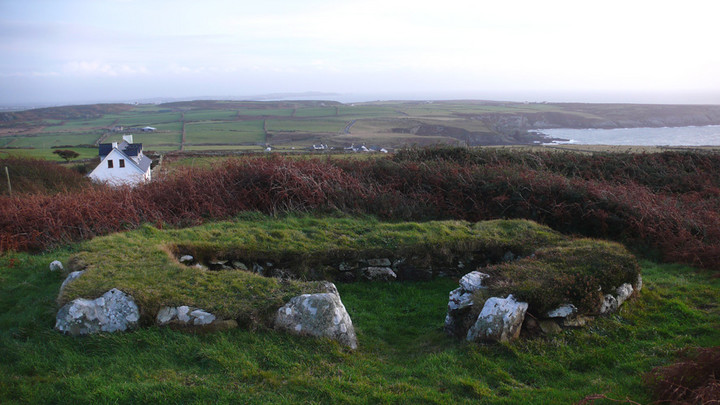
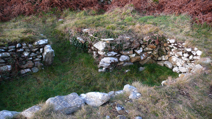
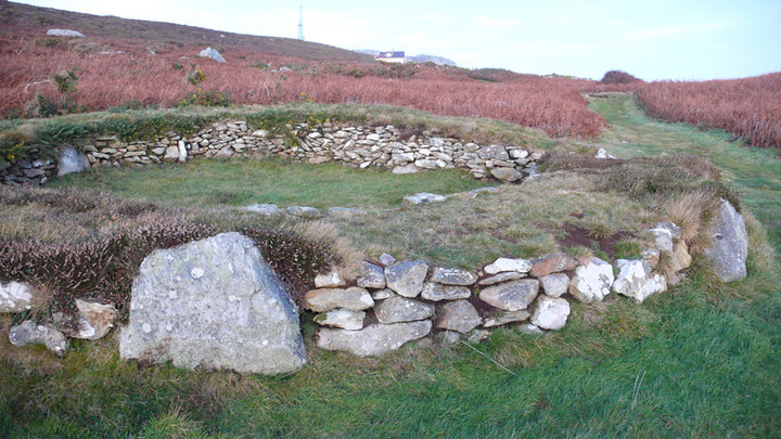
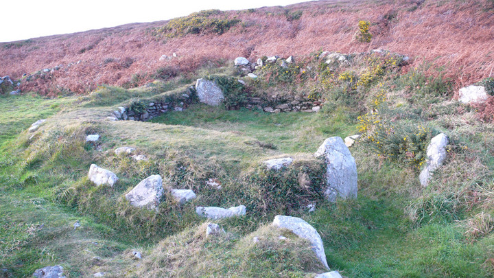
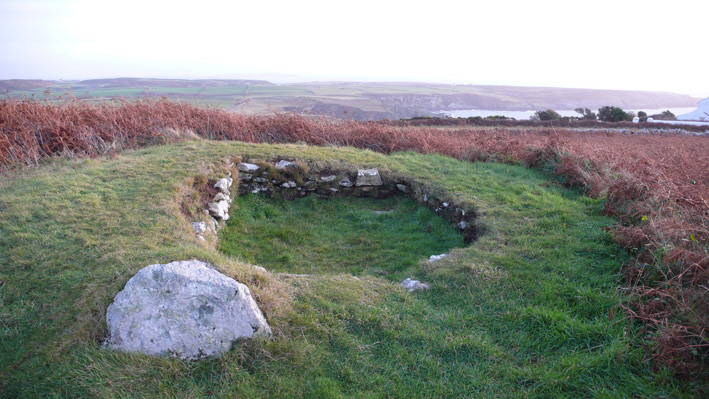
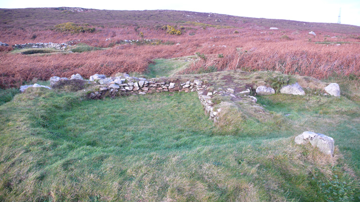
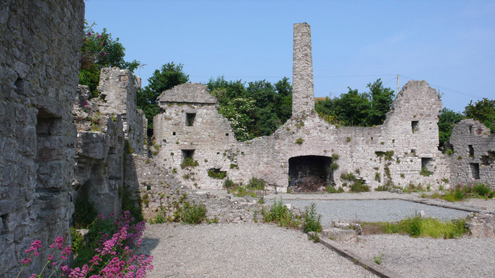
This is a cliff top Celtic hill fort near LLanbadrig on the most Northerly tip of Anglesey. It is reached by a cliff walk from the 12th century church of Llanbadrig or along old lanes. Part of the fort's wall is still clearly visible as a white band of rock, with rock piles and hollows. There's a ruined summer house on the most Northern part of the hill fort, looking out to ynys middle mouse. Beneath in the cove are the ruins of an old china clay factory, the cove was used as a small port to ship the produce out, also in the area was a medieval Nunnery, the whole area has a wild and remote feel to it, steeped in history.
|
 
|

|
I couldn't find anything either, I was walking around in the pouring rain trying to find the stone for at least half an hour before heading home.
Sanity prevailed in the end. I'll try another day, when it's sunny.
|
|
A large amount of wild orchids appear on the west facing slopes during the early summer months.
|
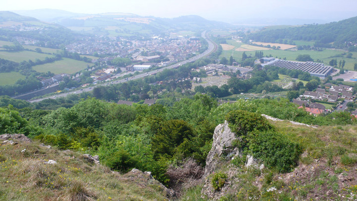
Great place to visit and great views of north Wales. It's the perfect natural vantage point for a hill fort.
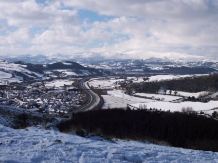
Originally the area below would had been marsh land, with streams and the original course of the river conwy, now the afon ganol (see pic from across the valley and imagine it full of water and marsh below).
Little is visible of the hill fort now, the top has a limestone outcrop running around it which can be mistaken for a wall or steps. A good view point to look at the hill fort is actually from the Colwyn Bay mountain zoo, you can clearly see the hill fort defensive walls from there.
The road beneath the hill is called Dinerth Road, this is a word that derives from the hill fort chieftan's (celtci tribe Deceangli) name 'the bear' and is also the name of the fort itself.
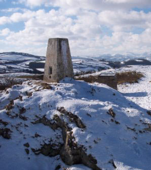
The Nant Semtpyr valley below (now the A55 runs along it- see second picture) is where (it is said and sometimes disputed) the romans were ambushed on their way to Angelsey, their leader Sepronious was said to be attacked there (Sepronious has connections with Hannibal).
In the Medieval times the hill was used as a rabbit warren. In WW2 it was used as an early warning signal outpost, a radio mast was fitted on top, signs of this are still visible. Behind the hill, from a small car park near a quarry, is the ruins of Llys Euryn with it's connections too Ednyfed who was the chief advisor to Prince Llewelyn ap Iorwerth and an ancestor to the Tudor King Henry 8th.
|

|

|
Just returned to see this site and couldn't believe it, they're building right next to it, I'm presuming they are building some kind of industrial site and widening the old lane to link it too Holyhead.
The fields are already bulldozed, the road must be to connect Trearddur to the Holyhead expressway. It's disgusting that such an important site is treated this way.
So the site will now have a more traffic in front of it and the expressway to Holyhead behind it, with a lovely view of the Aluminium works in the distance. Such a great shame as the actual site is still very interesting, and well worth a visit, but it's doesn't look good for the immediate area around it.
|
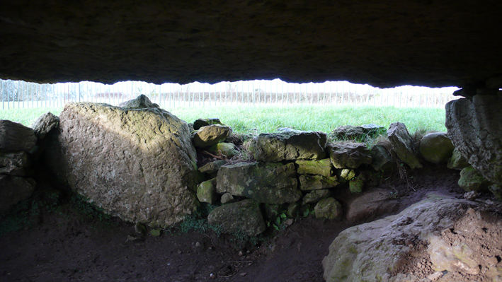
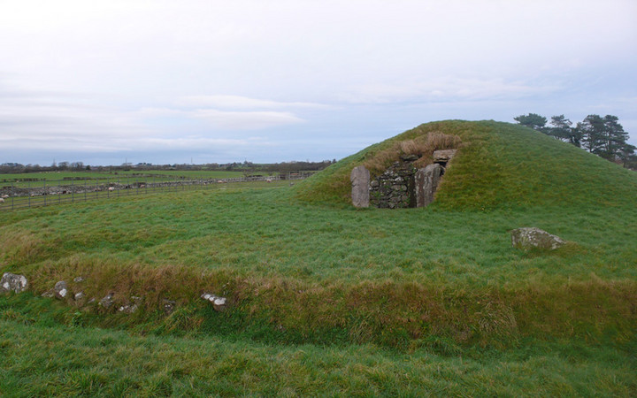
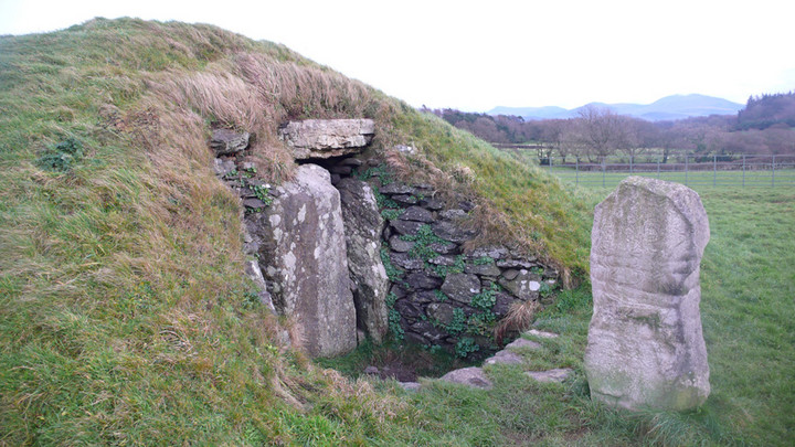
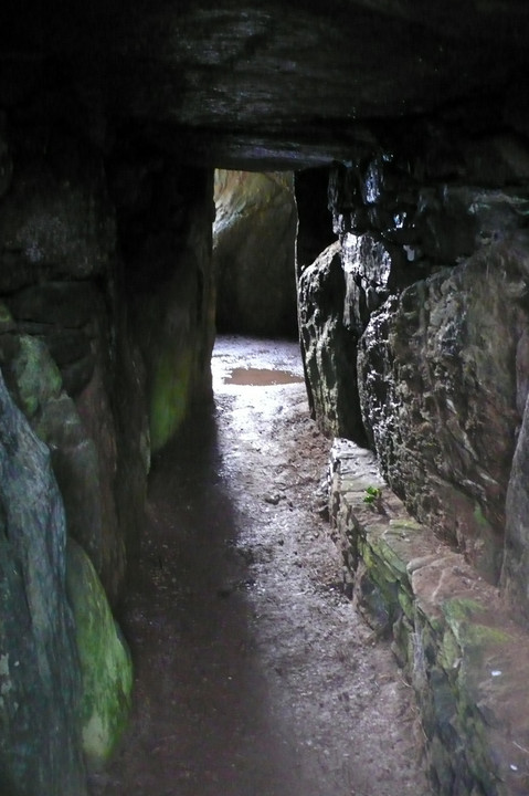
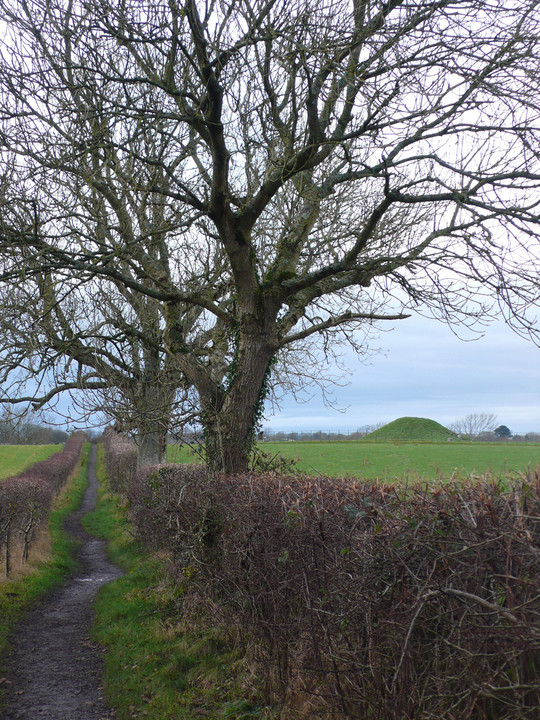
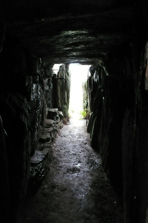
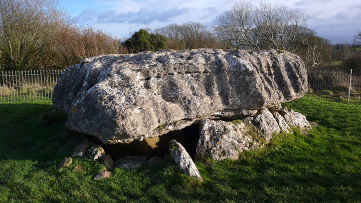
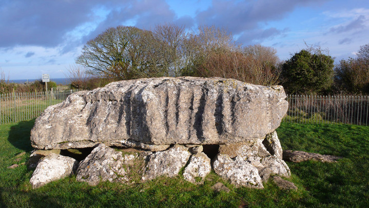
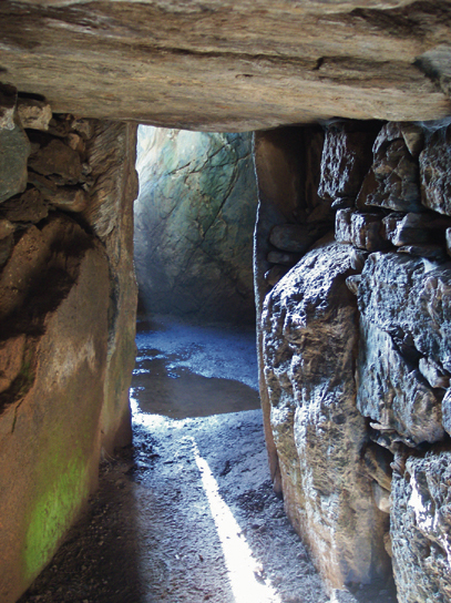
I remember going here when I was a child, on a rainy holiday, crossing muddy fields to the chamber. Now a path has been place beside the stream that borders the field, and a wooden bridge crosses it. Inside the center of the chamber there is a standing stone, it is a beautiful thing, and you can imagine the chamber being placed around it. The passage way into the chamber is really atmospheric, with markings on the entrance. When I last went there someone had left five pence pieces and flowers inside the chamber.
Outside there is a ditch around the chamber. The original incribed stone has been replaced by a copy, the original lies in a museum now, what a shame.
In the field to the side of the chamber a standing stone is on a small knoll, looking over the chamber. It's a great place to visit, even though the grassy mound has been restored.
|
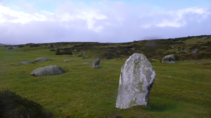
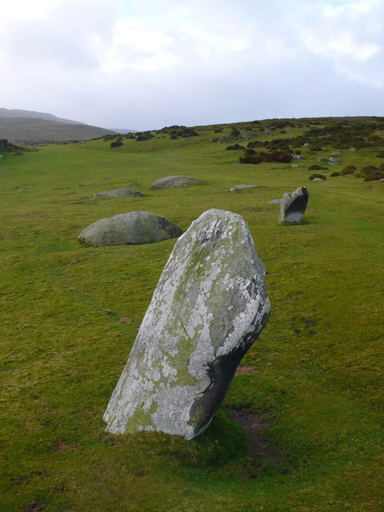
I visited the stones was when I was lost up on the moors to the south, coming from Drum, in thick mist, no visibility, I followed my compass north, across the moors, and from out of the mist came the stones, I was taken back at how they stood there, almost waiting for my arrival, and how I'd walked right into them, really atmospheric stuff.
Another time in strong rain and wind, I noticed, when I put my hand on the north westerly stone, (the one that's a bit square) I'm sure it was vibrating. Could it be the ground it stands on?
The cist was excavated I think in the sixties and I read they found the remains of two people, one a child, so the site may have been used for sacrificial purposes. Michael Seniors book on the stones of North wales covers this area quiet well.
It's a great area, rich in antiquities, and resonates the past perfectly, especially when you're lost!
|
Previous 50 | Showing 101-147 of 147 posts. Most recent first
|
|