|
An excellent essay by Sam Smiles from the Tate Research Journal.
|
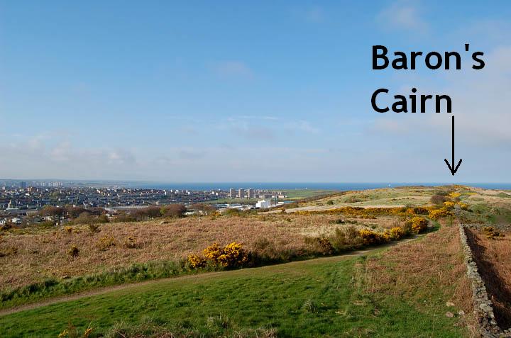
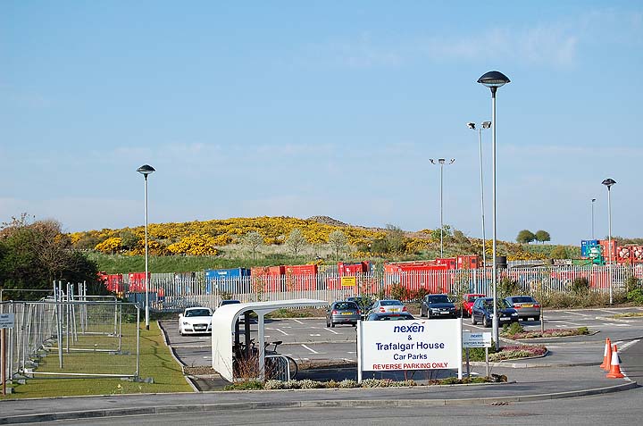
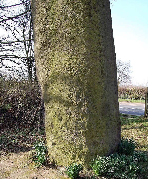
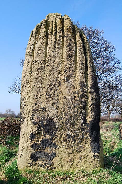
I have seen Cat Cairn many times on my visits to Aberdeen. The cairn sits on a high point on Tullos Hill overlooking the Altens industrial estate. I have often looked down Crawpeel Road and noticed the cairn sitting atop the furze-covered hill but have never taken time to visit it because whenever I'm in the area it's work related and all I want to do is leave and head for home. Anyway, I was staying in Altens for a few days and had time to kill so decided to walk up to the cairn.
The hill is part of the Loriston Country Park and can be accessed from the car park on Hareness Road. Unfortunately you can't park in the car park as the area was recently occupied by travellers. The travellers were evicted and then prevented from returning by blocking the entrance with huge boulders, however, parking alongside the road is not a problem unless you are driving a white transit van and towing a caravan.
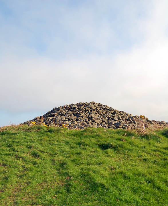
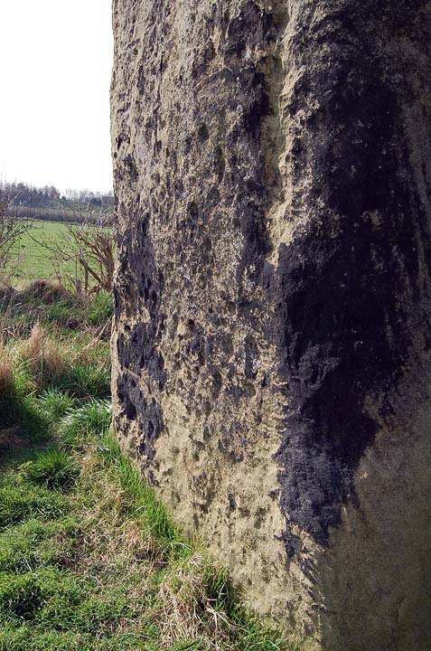
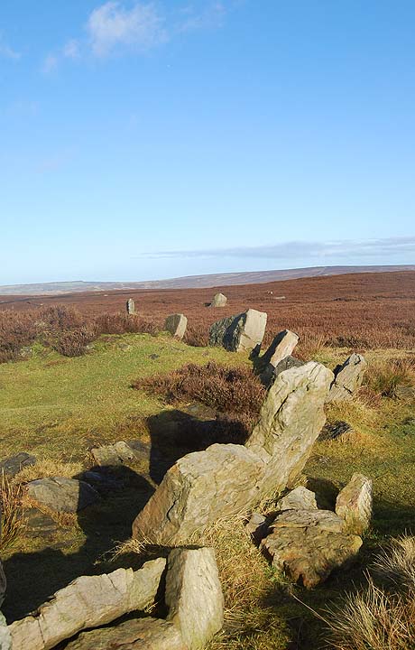
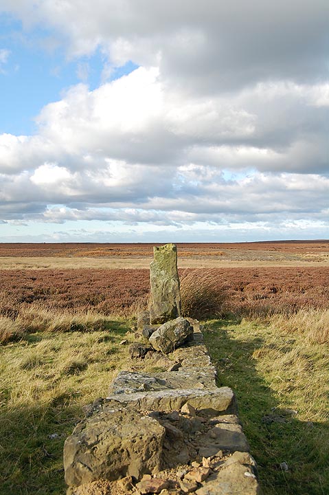
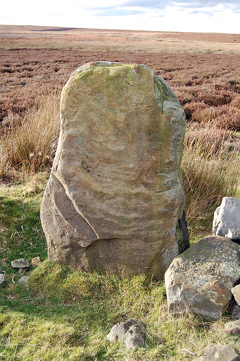
It takes five to ten minutes to walk from the road to the cairn. The cairn is pretty much what you'd expect, a large round cairn of stones, If you look at the amount of stones in the field walls that lead up to and from the cairn it's easy to imagine this cairn being two or three times as large, with stones being robbed for walling. Another thing about the walls is that they use this and the nearby Baron's Cairn as boundaries, whether this reflects prehistoric boundaries is a matter for debate. It could also be argued that the walls start and terminate at the cairns because they were a good source of materials for the walls. Who knows?
What I really want to say about the cairn concerns the views and it is something that you can't really appreciate unless you visit the site. The view here is spectacular, this small hilltop commands views across the sea, the coast, the Dee river mouth, the city of Aberdeen, the hills beyond the city and on a clear day I would imagine you could get a glimpse of the Cairngorms from this point. It is probably the perfect location for a monument and if you are in area I would definitely recommend a visit.
At this point I was going to wax lyrically about a Bronze Age monument overlooking the Oil Age city but that all sounded a bit cheesy so I won't bother.
|
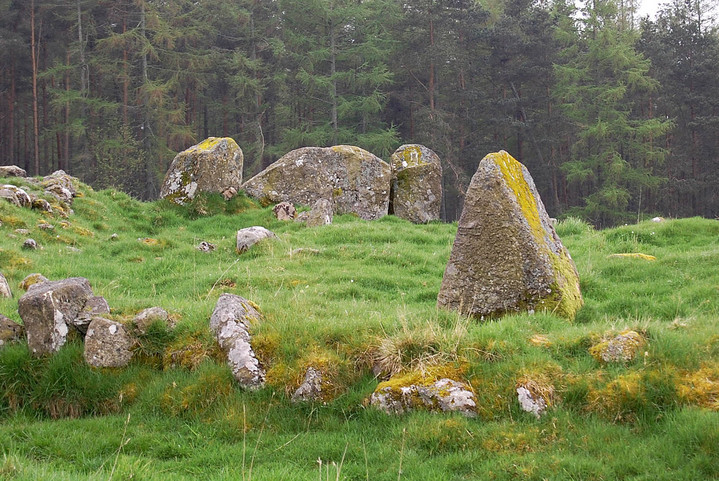
I visited the Nine Stanes after the two Esslie circles, parked-up at the forest car park and followed the short path to the stones.
This is a beautiful ruin of a circle, the forest, moss hung trees and lichen covered stones all blend together to produce a completely different sensory experience from the neighbouring Esslie rings. If it wasn't for the regimented lines of the forestry plantation you could easily daydream yourself back into prehistory at this lovely circle.
I noticed Hamish's outlier and its alignment with the recumbent stone and quite agree with him.
Nine Stanes is a lovely accessible site, one of the many jewels to be found in this part of the world.
|
I'd started off planning a visit to the circles around Old Bourtreebush but a wrong turn at Portlethen sent me heading forever westward along narrow lanes through the soft Aberdeenshire countryside. I revised my plan and decided to head towards the River Dee and the town of Banchory. After half an hour of being completely lost, not a completely new sensation, I found myself besides the river and heading the right way.
On the road to Esslie I passed a house called Standingstones, I parked up and took a look around but found nothing.
My next stop was at Esslie the Lesser. There were a few cows in the field so I decided content myself with the view from the verge. The stones of Esslie the Greater were just along the road and I could see that the field was clear so I headed off down the lane.
At Esslie the Greater the field gate was just tied with some band so entry wasn't a problem. The site is a fairly jumbled affair but the main components of the circle and ring cairn are present. The setting, in common with many other RSCs, is one of rich, rolling Aberdeenshire farmland and higher hills in the distance. Esslie the Lesser is visible from the circle across the shallow valley. It led me to wondering why create three circles, the two Esslies and Nine Stanes, within such a small geographical area? No answers came to mind apart from the fact that the locals must have really loved their stones to expend so much effort into building these beautiful rings.
All in all this is a lovely accessible site; it's a little damp underfoot but well worth a visit.
|

|
 
|

|
 
|

|
Odin's Glow
October 2009
Over 4 days the entire hill will be illuminated in a sensational display of lighting and pyrotechnics.
Open-air artworks will be positioned around the fields below the hill and perfomers, fellrunners and hillwalkers will add to the spectacle.
Watch this space
http://www.odinsglow.co.uk/
|
   
|

|
13th May 2006
The last time I was here the temples they were still being repaired after they were horrifically damaged by hunters at Easter 2001. The temples were fenced in locked up and no amount of pleading could get me through the gates. I had to satisfy myself with a mooch around the perimeter and a prolonged sit on the hillside behind the monuments.
As I walked up to the gated perimeter fence that separates the Hagar Qim temples from the path to Mnajdra I noticed some men working, as I got close to them I could see that they were putting razor wire onto the top of the already substantial fence. The temples have survived the ravages of time, environmental collapse and a couple of thousand years of conquest and invasion. It's extremely saddening that these unique structures, have to be protected against the all too real threat of vandalism by local people. I won't let this dishearten me, today is my temple day.
On the hillside between Hagar Qim and Mnajdra are a series of deep cavities that have been carved into the rock which are known as the Misqa Tanks It is thought that they were used as water cisterns for the prehistoric community in this area. It is possible to walk up to the tanks but today, despite having plenty of time, I declined not to do so. Today was not not a day for traipsing, I had to remain true to my purpose, Mnajdra is where I want to be.
Mnajdra is a difficult site to get your head around. It is actually three temples facing into a common oval forecourt. The smallest and oldest temple is to your right as you approach the site. It is described as a simple trefoil of the Ggantija phase. The second and third temples are of the four apse form and that's about as technical as I'll get.
I sat down and let the pure, deep joy of this place wash over me. The temples are nestled into a hollow in the hillside when you look uphill you see an endless blue sky, when you look downhill you see an expanse of deep blue sea. If you walk from the sea to the sky you will find the temples tucked into their niche somewhere in the middle.
Each temple is a different experience but it is all held together by the land and seascape. The temples, the hillside, the sea, it's just all too perfect. If you ever fortunate enough to visit Mnajdra, I would strongly urge you to go there as early in the morning as possible and try to experience the place without the distraction of strangers.
I'm afraid I'm not eloquent enough to elaborate on the feelings and emotions that this place provokes. Mnajdra is one of the few places on earth that really reaches down inside of me.
http://www.themodernantiquarian.com/post/46149/templehead_pt2_mnajdra.html
|

|
 
|
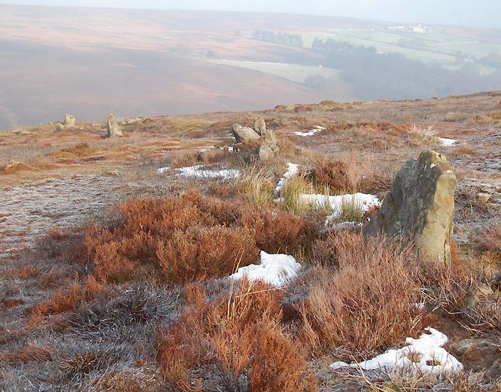
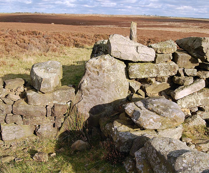
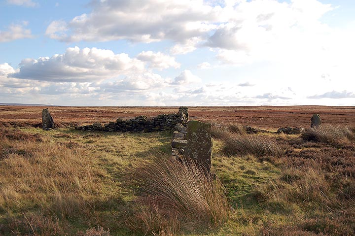
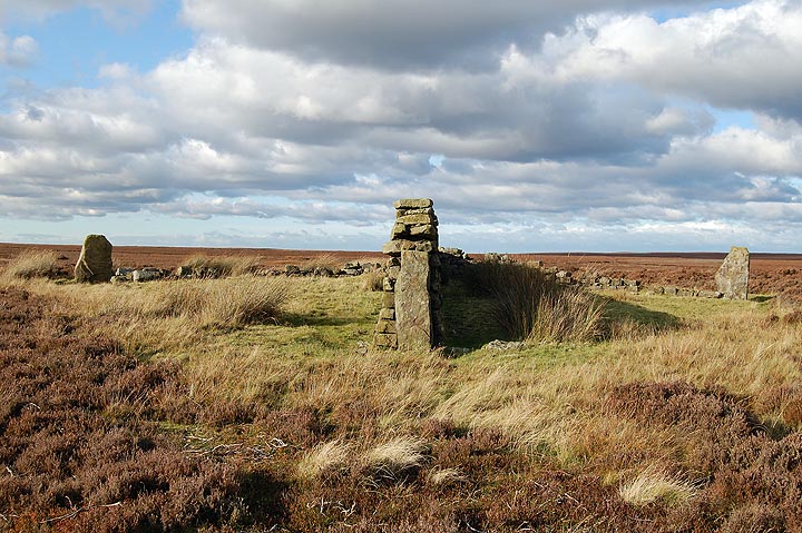
On a sunny, frosty winters morning and with half a day free I decided to have a mooch around a part of Westerdale Moor known as Crown End. If you look at a map of the North York moors you'll see that Westerdale Moor covers a fair swath, running from Farndale to the Esk valley. Crown End is only a small spur of the moor bounded by Baysdale and the Hob Hole Beck to the north and Westerdale and the infant River Esk to the south. The spur runs roughly west to east and is about a kilometre and a half long by about eight hundred metres wide.
The prehistoric remains on this section of the moor have been known about for the past couple of hundred years and were written about at some length by Frank Elgee. Essentially what you have is a cross ridge dyke running across the narrowest section of the spur, beyond that is a cairnfield and a possible enclosed settlement. The cross ridge dyke and cairnfield have been interpreted as Bronze Age and the settlement as Iron Age.
I parked up at Hob Hole, a local beauty spot popular with picnickers in the summer and generally deserted in the winter. It is also possible to access the moor by walking a mile or so from Castleton making this area accessible by bus or train.
If you use the Hob Hole car park you will need to cross over the beck using the ford, on my last visit there was a foot of water running over the ford so this wasn't an option and I parked at the south side of the ford.
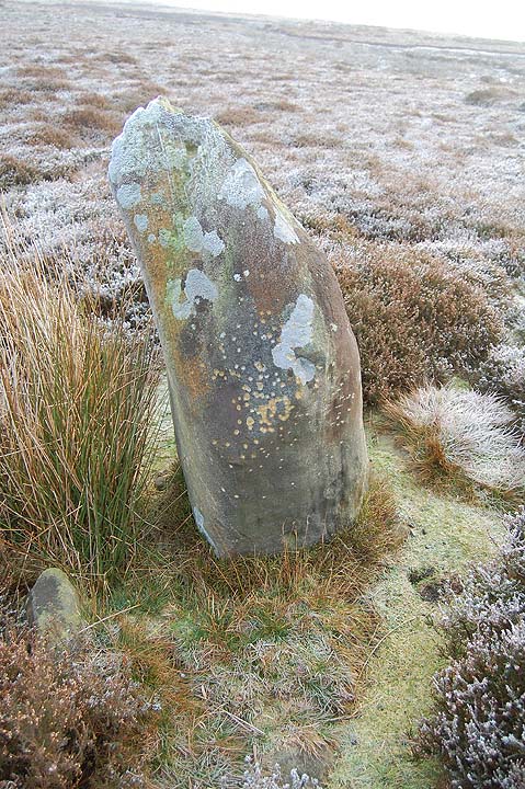
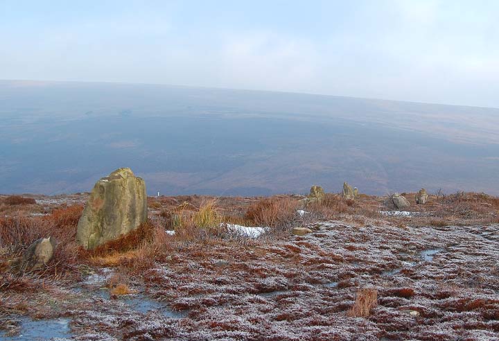
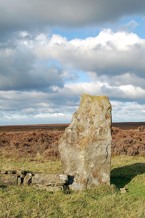
Once on the moor, the first monument you'll encounter is the cross ridge dyke. This is a line of standing stones built into an embankment running north to south across the narrowest section of the spur. The southern section only contains a couple of decent sized stones; the northern section is more complete with a dozen or more stones remaining. It's quite surprising that anything remains at all when you look at the grouse butts and other structures on the moor. It makes you wonder what this monument would have looked like prior to the introduction of grouse shooting.
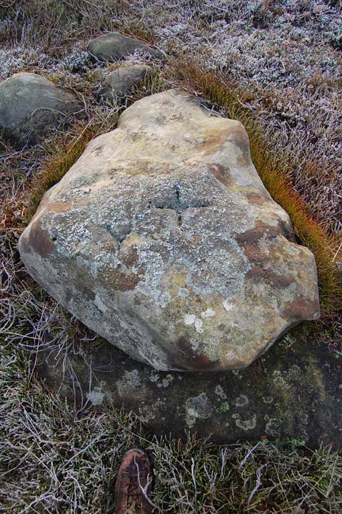
The northern section of the dyke terminates just before the land begins to drop off into the valley of the Hob Hole Beck, the final large stone has a cross carved into it. This cross may well indicate that this stone, or possibly the whole monument, was used as a boundary marker beyond the prehistoric period. Marked stones such as this one are often mentioned in the perambulations of the moorland estates. There is a cross marked stone in another, nearby cross ridge dyke, the Bridestones.
When I arrived at the stones the low winter sun was shining and everything was frosty and beautiful, however within half an hour the sun had disappeared and a dense fog enveloped the moor, you could almost hear the vegetation 'crisping up' in the freezing fog. The whole atmosphere of the moor was almost instantly transformed. Later, following a circular walk around the moor I returned to the dyke, as I approached I could see the stones emerging out of the fog like sentinels, perhaps this is how they were meant to be seen. It also made me think of nearby Hob Hole and its legendary inhabitants, perhaps these stones and the nearby ruined settlement gave rise to the lore of the Hobs or perhaps the legends started in prehistory when the Iron Age farmers founded their settlement Iron Age beside the Bronze Age remains.
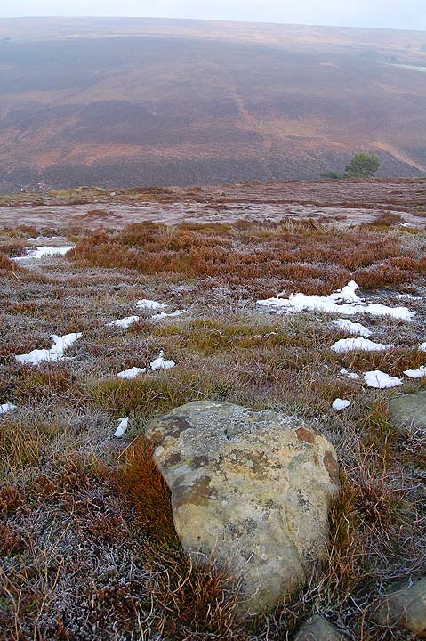
Once beyond the stones you'll notice a number of low cairns and once past these you'll encounter a number of low rubble walls running through the heather. These can be quite subtle features but once you 'get your eye in' you'll notice them everywhere.
There's not a great deal else to say about this part of the moors. Crown End is a good place to visit as it offers plenty to see in a small area, it is also very accessible if you are using public transport and don't mind a walk. Access on the moor itself may be difficult for anyone with restricted mobility as the paths are uneven, narrow and rocky in places, access from both Hob Hole and the Esk valley involves a short steep climb.
|
     
|
North Yorkshire historic environment day 2009
..Eight talks will cover the rich variety of research projects and fieldwork activity in the historic environment of the county over the past year. Speakers include Paula Ware on recent discoveries in Malton, Steve Moorhouse on the monastic landscape of Fountains Abbey, John Buglass on the coastal zone survey in North Yorkshire and Nicky Milner on recent excavations at Star Carr.
Visitors will also be able to browse archaeological book stalls and visit stands showcasing projects by local societies.
Pre-booking is essential. Tickets cost £6. To book, call 08458 727374,
Booking forms and info at
http://www.northyorks.gov.uk/index.aspx?articleid=3092
|
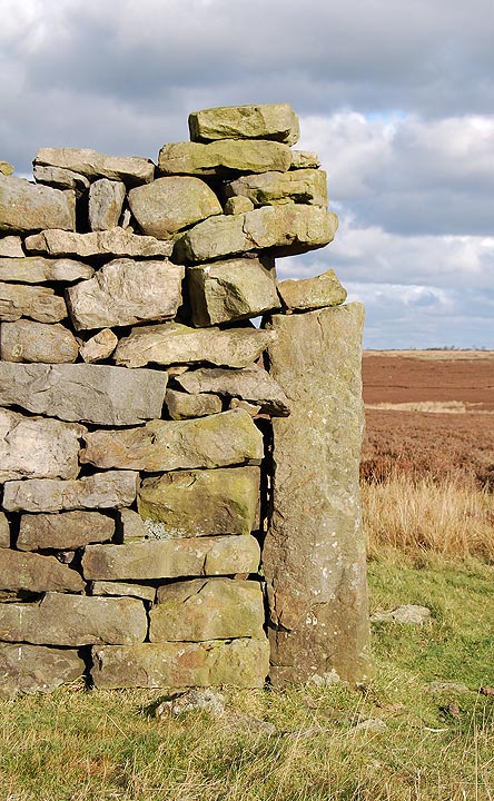
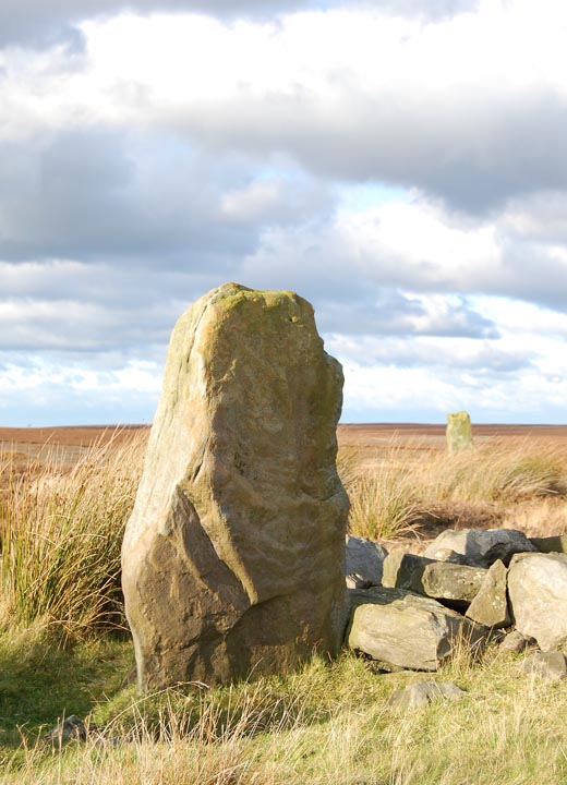
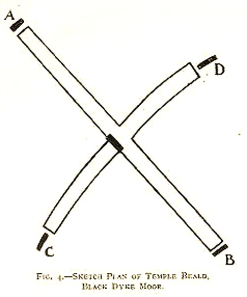
I was back up at the Beeld today and have a couple more observations to add to my original fieldnotes.
Temple Beeld Hill hardly lives up to its title however, it is slightly higher that the surrounding area and is surrounded by bogs to the west, north and east. The land to the south is very wet, the Beeld effectively forms an island, a dry refuge for the few hardy sheep that roam this part of the moor.
That said, the 'hill' is within a basin therefore the views, though extensive across the flat moors to the west and east, are limited as compared to the view from the nearby rising ground to the south of the Beeld.
Unusually for an area so rich in prehistoric remains, this site does not appear to share intervisibility with any of the nearby monuments. I was unable to spot any of the local barrows from the Beeld.
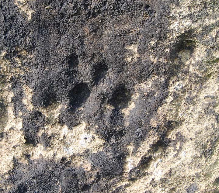
Regarding the possible cup marks on the central stone, I'd say almost definitely natural weathering processes at work here as opposed to the hand of man.
Orientation of the stones;
340-160 degrees.
60-240 degrees.
The GPS stuff is
NZ 75725 10141 (accuracy 5m)
Elevation 214m
|
        
|
Regarding Hob's photo
http://www.themodernantiquarian.com/post/31699/king_arthurs_round_table.html
In Mayburgh and King Arthurs Round Table by C.W. Dymond CWAAS 1890.
In the inn yard, serving as a water butt, is a circular tank of red sandstone, 38ins in diameter and about 36ins in depth, which has been called "King Arthur's Drinking-cup." About this object, as many another, a baseless story has been started which, unless checked, may in time, become, by repetition, a fixed tradition of the spot. I find that even some antiquarians have been misled by confiding too easily in statements made to them, to the effect that this tank was dug up on the site of the Round Table; nay, that it has been found in the very centre thereof. I myself was told this improbable tale, till on closely cross-questioning my informant,-the same who had set the story afloat, - he acknowleged that he knew nothing about it; and that he had stated as fact that which he only supposed to be so. The aforesaid man-the most ancient authority in the village, having lived there for more than 60 years-testified that it had been in the inn yard, (though not in the same position) as long as he could remember. of course, this tank has never really had any connection with the earthwork over the way.
|

|
The Megaliths
Heedless, unheeded of the years they stand;
The rain drips off their chins and lichens spread
A moist green skin along each stony hand
That gropes among the bones of the grey dead.
They did not see the forests flow and fall -
Junipers blue wave by the fellside shore -
Nor barley batten by the coddling wall,
Nor purple ploughland swipe across the moor.
They hold death in them. Skulls have moulded ears
That deaf remain to curlew, crow and dove.
The human winds blow past them; each one fears
The hoarded ache of malignant love.
Norman Nicholson
Selected Poems
Faber & Faber
1966
|
|