|
Visited: September 6, 2019
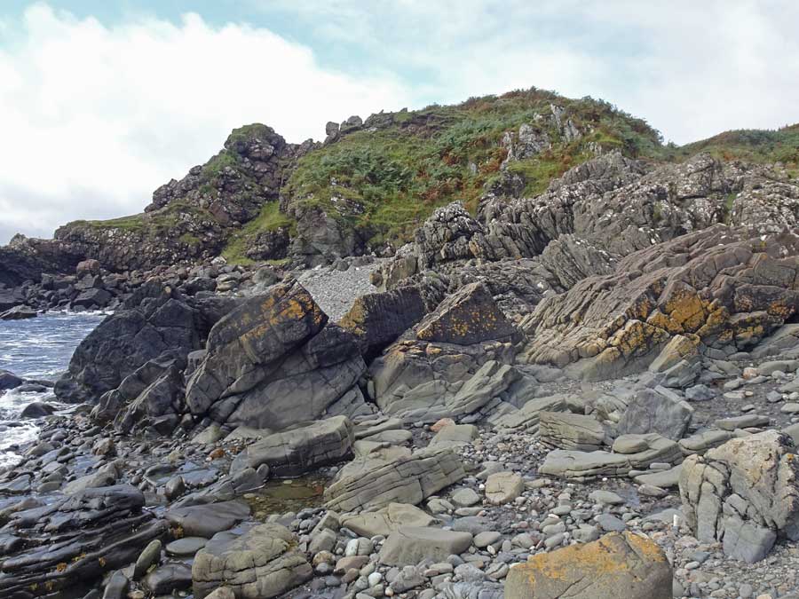
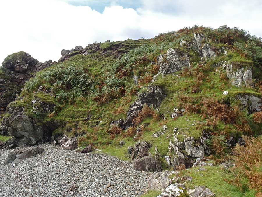
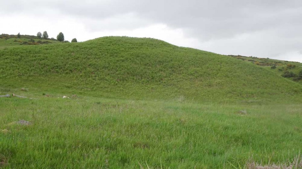
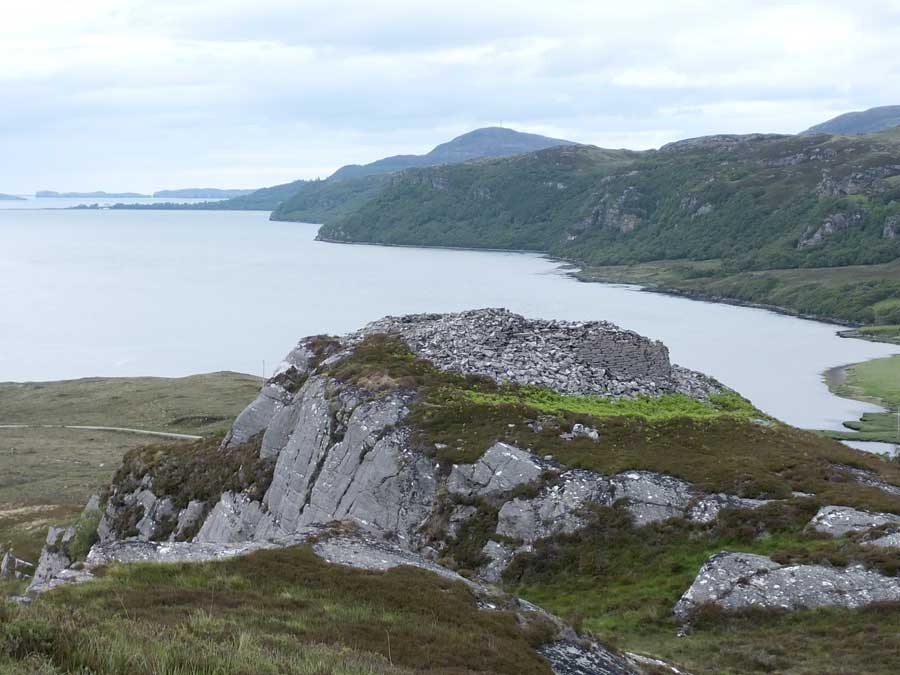
Dun a'Chleirich is a promontory fortification on the south coast of Sleat. Driving west, the starting point is at a small parking area on the left side of the road (white marker), just beside a dilapidated wooden hut, approximately 3.75 kilometres west of the community of Ardvasar, at NG 6029 0112.
Here, a convenient gate leads into a large grassy field. Enter the field and follow its boundary fence to the left (east) then down towards the coast to where a second gate leads left to the bracken-infested coastal strip. A walkers' path continues from here, bearing left, past Dun a'Chleirich (which is initially out of sight) to the shore. Though largely concealed by bracken, it was just possible to find a rough path up the northwestern side to the summit of the dun (blue marker).

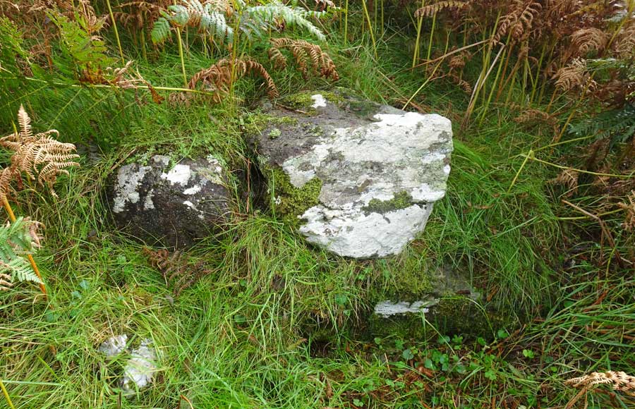
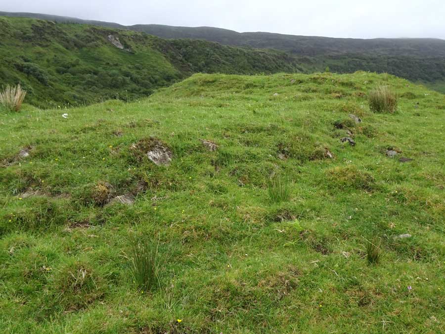
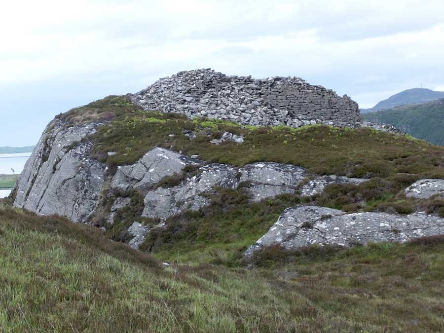
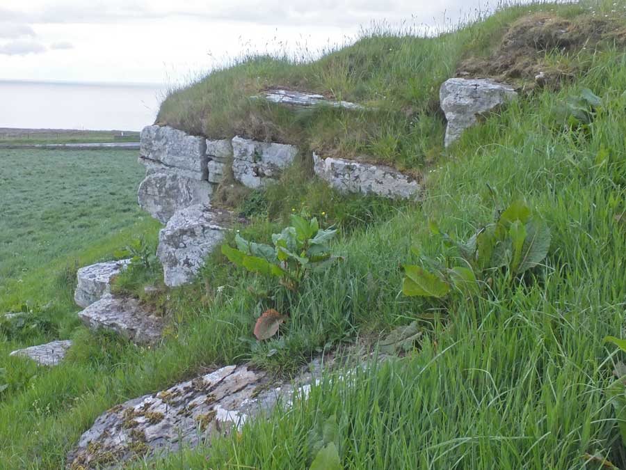
At this time of the year, Dun a'Chleirich is almost completely clothed by a rampant growth of bracken about a metre tall. Only on its western flank was the bedrock exposed, so any structural elements had to be searched for.
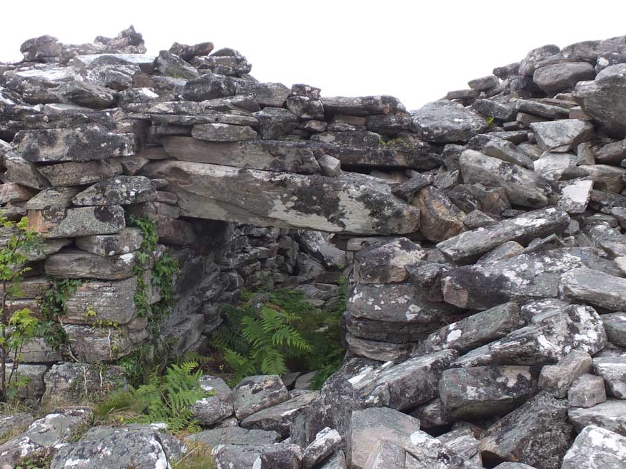
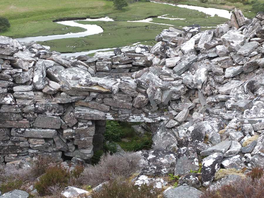
During the climb up on to the dun I had to step over some sizeable blocks that were presumably part of the dilapidated wall that still surrounds most of the structure, and a few metres father on, some blocks that I took to be of the inner wall facing. But the summit was devoid of features.
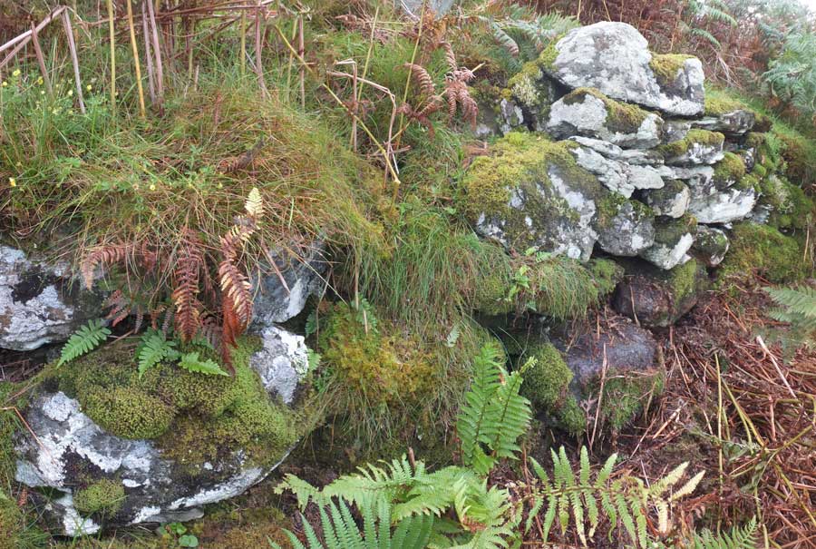
However, on the northeastern flank of the summit, after clearing some of the bracken, it was clear that there still remain significant remnants of a wall. At the point I investigated, the wall was chest high and up to six courses in height. I daresay that in spring, before the bracken has sprouted, significantly more structure would be apparent.
|
1,200-year-old Pictish cross-slab discovered near Dingwall
A stone carved by Picts 1,200 years ago has been discovered in the Highlands.
Archaeologists said the find is of national importance because it is one of only about 50 complete Pictish cross-slabs known to exist.
Decorated with a number of symbols, the stone was uncovered at an early Christian church site near Dingwall.
It was used as a grave marker in the 1790s and discovered hidden in vegetation by Anne MacInnes of North of Scotland Archaeological Society.
Read more about this find on the BBC website and in the Ross-shire Journal.
|
Visited: June 19, 2019
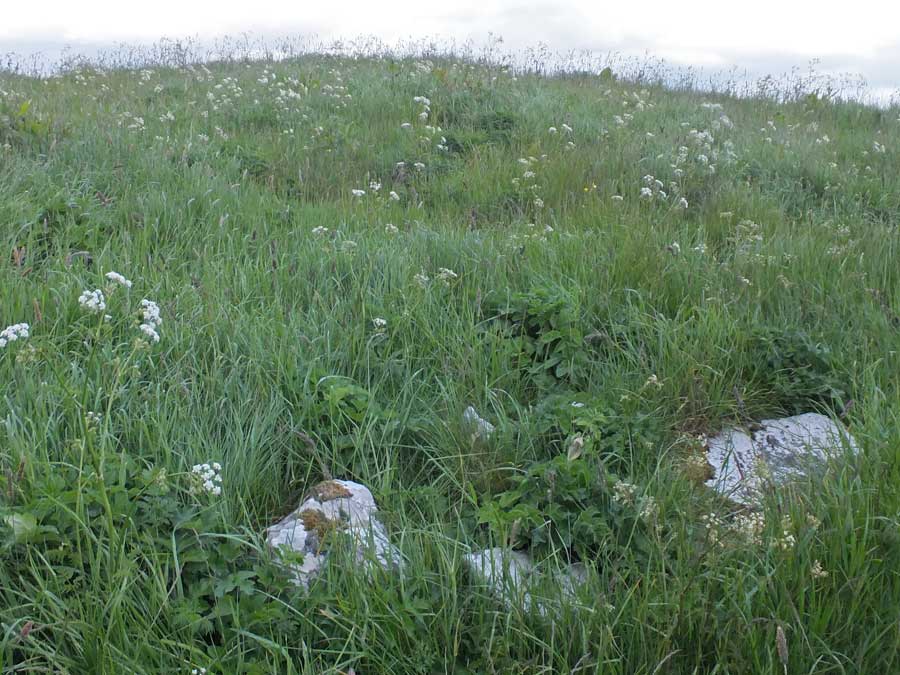
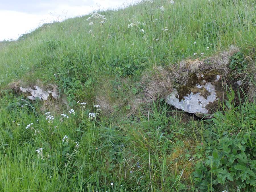
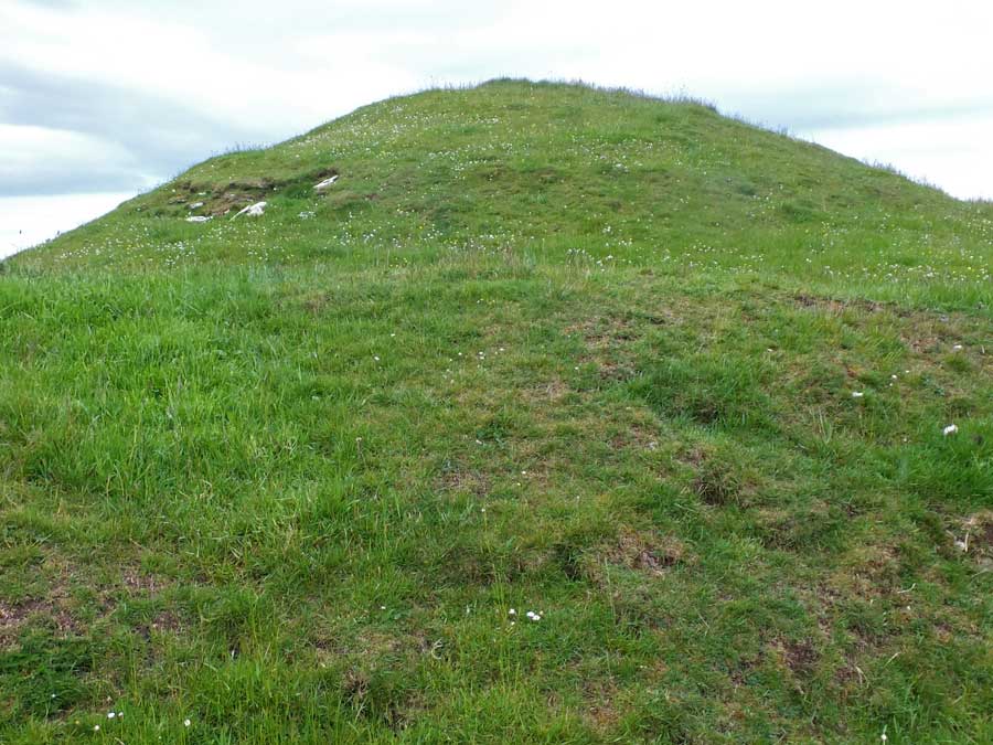
Situated in a field to the west of the Strathnaver road, and exactly a half kilometre north of the more famous Skail chambered cairn, stands a tall, elongated knoll which supports the remains of Skail broch.
Canmore refers to 'several stones in sufficient numbers to suggest an encircling wall which has been almost completely obliterated' round the periphery, although, perhaps because of the lush vegetation, these were not in evidence.
There is no tumble of masonry downhill, and it seems entirely likely that any stonework from the broch would have been robbed for the construction of the nearby farm and its outbuildings.
A small car-park is conveniently situated just 70 metres south of Skail Farm.
|
  
|
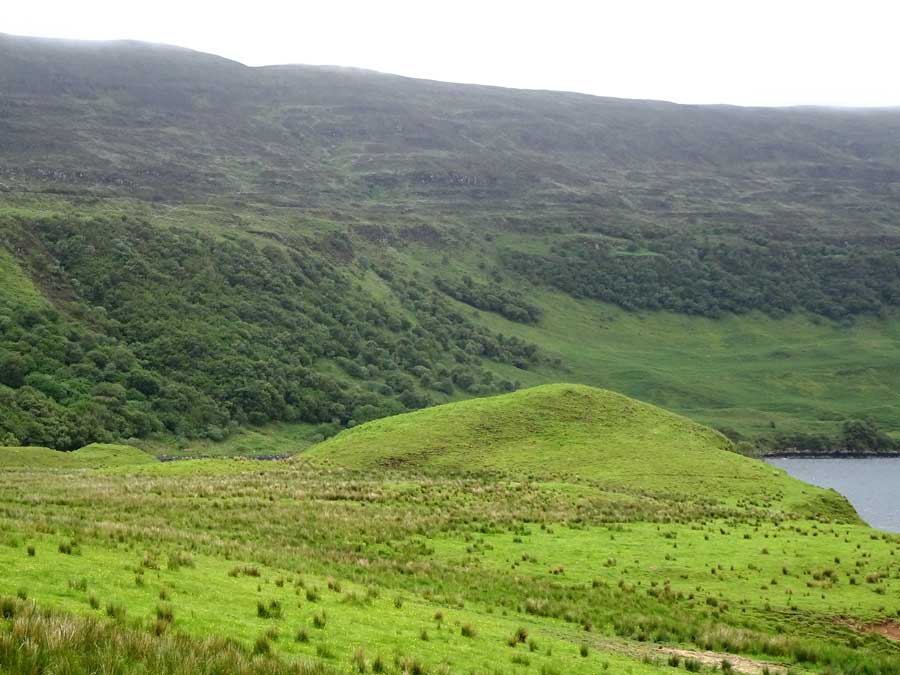
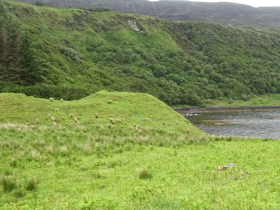
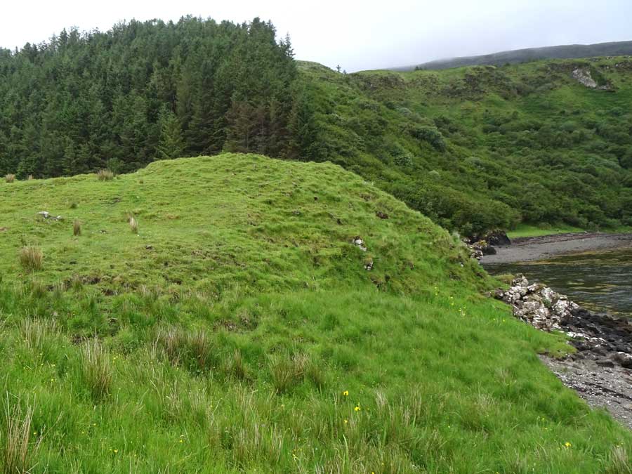
Visited: June 25, 2019
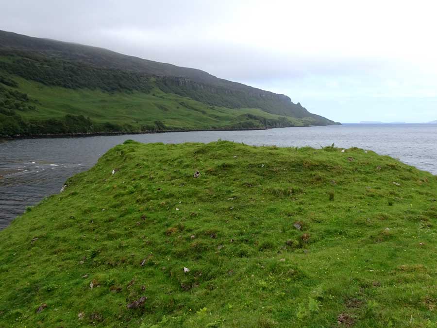
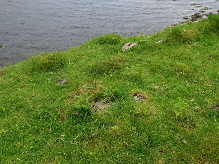
Rising steeply on the east bank of the Bay River, at the point where it debouches into Loch Bay, stand the remains of a small dun. Little in the way of structure remains: boulders just peeping from the turf on the seaward side hint at a possible defensive wall, as does a line of largely buried boulders curving round the eastern flank. Otherwise, this is just a grassy mound, falling steeply to the north and west, but down easy slopes elsewhere.
To access this site, head north from Fairy Bridge on the B886 for almost exactly 3 kilometres where, at NG272544, an unsugnposted, unclassified road leads off to the left towards the tiny community of Bay. Follow this road for about 600 metres to its end, where there is space to park. A gate leads to a path down to the coast. You can either follow the coastline, or head directly over easy grassy terrain towards Cnoc Na Cairidh.
|
      
|
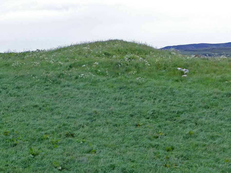
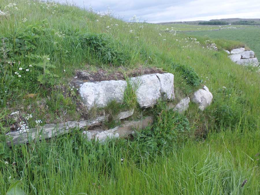
Visited: June 18, 2019
At Ballone, Mybster, just east of Westerdale, stands a huge grass-covered mound, almost four metres tall and measuring 37×41 metres in size. The mound sits in a field, immediately adjacent to the road to Westerdale, with a convenient gate giving access, and is believed to contain the remains of a platform bearing a broch.
In truth there is little to remark upon. The mound suffered quarrying on its northeast flank when the road was built, and this has revealed a significant stretch of drystone walling that could well be part of the broch's wall. On the southern flank, almost hidden by tall grass, a line of stones could be the footings of a wall.
|
   
|
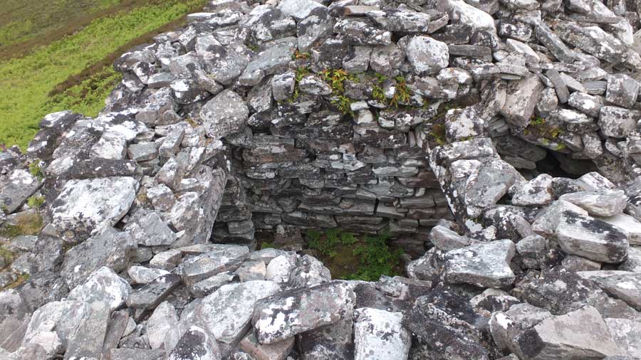
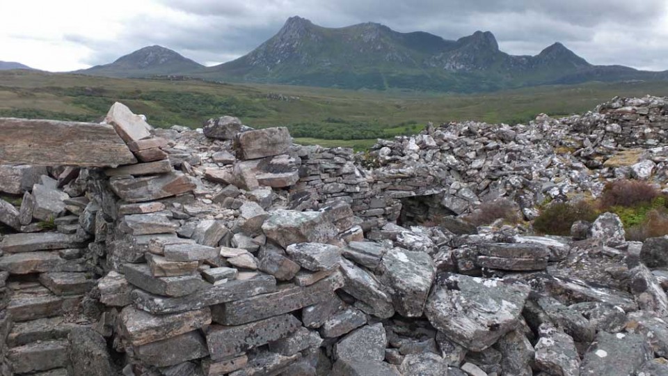
Visited: June 19, 2019
On heading west across the Far North of Scotland, the frequency of brochs—which pepper Caithness in their hundreds—dwindles to a mere handful west of Strathnaver. Probably the best known is the magnificent Dun Dornaigil in Strathmore, but for the intrepid enthusiast there's another that surpasses even this: Dun Mhaigh above the head of the Kyle of Tongue.
Despite the fact that Dun Mhaigh has seen much better days, the structure of this Iron Age broch still exhibits many features of interest. There is a well proportioned entrance passage in the east, five metres long, which, although missing some of its lintels, still boasts a fine lintelled doorway at each end and a guard cell. And round to the north is a neat intra-mural stair which would have accessed a second level. Though the interior of the broch is full of fallen masonry, the walls still stand a dozen and more courses tall round much of the structure.

To reach Dun Mhaigh, head west on the A838 into Tongue on the north Sutherland coast. At the point where this road hairpins right towards the causeway across Kyle of Tongue (signposted 'Durness'), head left along a good single track road for about five miles, round the head of the kyle until you bridge a river, then turn sharp right (heading back up the kyle). The only decent parking place (blue marker on the map above) is on the left left-hand verge just past this bridge, where there is space for two or three vehicles.
Note: Please do not park in a passing place as this hinders free movement of local traffic.
From here, Dun Mhaigh, which you might have spotted up on the ridge above the road during your drive in, is about 450 metres away, but you can't actually see it because of an intervening rise in the terrain. Best walk back along the road (to the yellow marker 'S' on the map) when all is revealed. The broch sits at an altitude of about 90 metres up a ridge, defended on its west by vertical 15 metre high cliffs, and you can now head across short heather directly to it. It is well worth continuing past the broch for a bit as the view down on it towards the Kyle of Tongue is a sight worth seeing.
There's lots of detailed information about Dun Mhaich on the Canmore website.
|
       
|
Visited: June 17, 2019
The first impression of Upper Latheron broch is of a ratherless featueless gassy mound. But look more closely and there is structure to be seen.
The broch sits atop a rock which is visible as an outcrop on the northeast of the site. On top of this, a neat course of large walling blocks heads west to a dip that presumably signals the location of the entrance. On the other side of the outcrop is another exposure of outer walling courses: Canmore says four courses deep though only two were visible due to the rank vegetation.
The broch stands in a field at Upper Latheron farm, just back from the A9, two miles north of Dunbeath. There is space to park at the junction with the farm access road (no signpost) from where the broch is but a short walk away.
|
    
|
Visited: June 17, 2019
There's not a lot to say abut Knockinnon broch. It's just a grassy mound, although there are small exposures of stonework around the structure, hinting that a broch still lurks within.
|
  
|
Visited: June 19, 2019
This broch at Thrumster Mains has endured a chequered past, principally in the late 19th century, when its court was cleared and the stones of its southern arc were excavated and used to build a rectangular 'Summer House'. Thankfully, the broch is well cared for nowadays and walling up to eight courses high in places now stands at least a metre tall around the remainder of the circumference, with both the inner and outer faces mainly intact.
The broch sits on a low grass-covered ridge in the gronds of Thrumster Mains, in which, at the time of my visit, wide paths had been carefully mowed to make access easier. The broch is now tastefully landscaped as part of an ornamental garden.
The broch was originally believed to be solid based, with its entrance at the location where the summer house now stands, but the most recent excavation (in 2011) discovered both an infilled entrance passage on the northwest, and infilled galleries. Steps leading down into a gallery have also come to light.
|
A keen hillwalker most of my life, my interest was restricted when the need arose to care for an ageing parent.
With limited opportunities to travel far from home, I 'discovered' the world of stone circles, mainly in my native Aberdeenshire.
This provided the ideal opportunity for short walks of just a few hours duration, and resulted in me visiting many places of interest that I had never considered previously.
Website:
Stone Circles of NE Scotland
Here you will find both Google and Bing maps displaying more than 100 sites of stone circles, the majority in my native Aberdeenshire. The markers on the maps are clickable, to reveal a photo of the stone circle and a link to their Canmore Site Record.
A menu at the side of the maps allows you to zoom in to any individual circle, viewing its environs as a zoomable aerial photograph (Google) or an OS Map (Bing).
Hunebedden
I've since extended my interest to the megalithic remains in The Netherlands, where there are some magnificent passage graves known as hunebedden (giant's beds). Despite the fact that The Netherlands is essentially flat and sandy, these 5000 year old monuments from the Funnel Beaker Culture are often found in exquisite woodland settings, nearly all of them in the province of Drenthe. There are almost limitless opportunities for delightful walks between small villages, taking in a diversion to a hunebed here and there.
|
|