The Modern Antiquarian
Log in
|
Register
Home
Latest Posts
Forums
Maps
Help
Browse Sites
News
Blog
Contributors
The Books
Select
-
Belgium
Denmark
Eire
France
Germany
Greece
Italy
The Netherlands
Norway
Portugal
Republic of Malta
Spain
Sweden
Switzerland
United Kingdom
England
Southern England
Gloucestershire
Bown Hill
Long Barrow
Bown Hill (Long Barrow) on The Modern Antiquarian, the UK & Ireland's most popular megalithic community website. 1 image, plus information on many more ancient sites nearby and across the UK & Ireland.
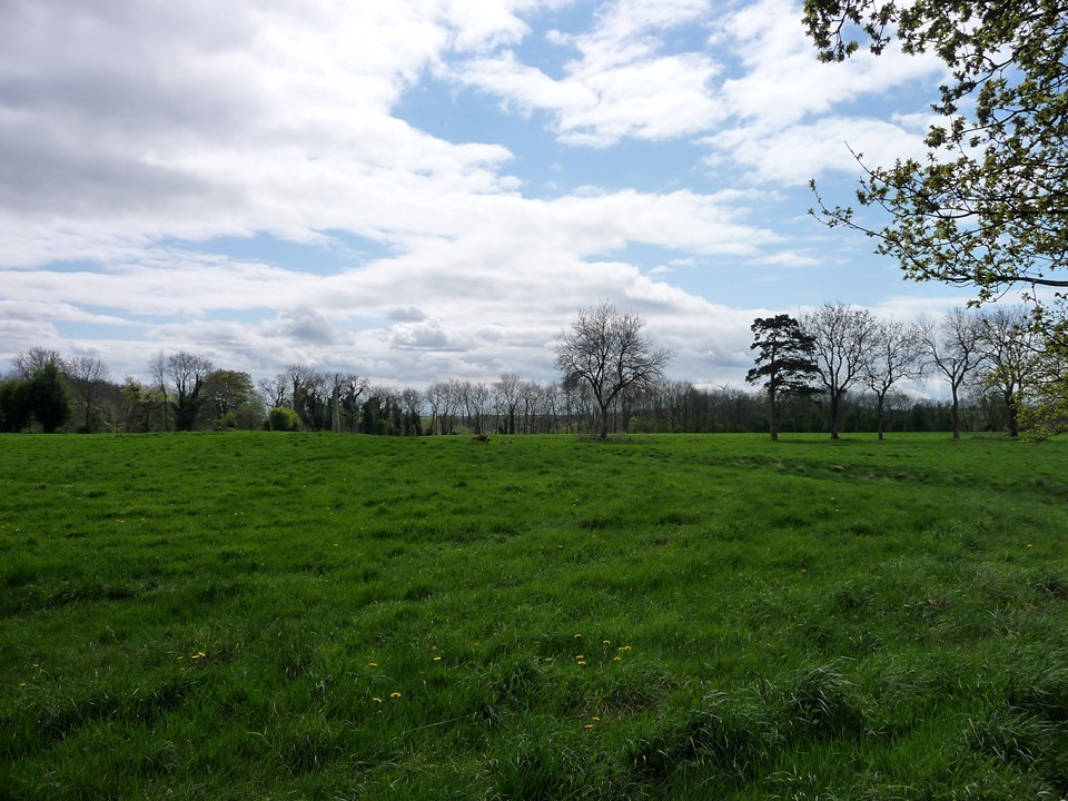
Image © A. Brookes (26.4.2009)
Nearest Town:
Stroud (4km NNE)
OS Ref (GB):
SO822017 /
Sheet: 162
Latitude:
51° 42' 47.65" N
Longitude:
2° 15' 27.6" W
Added by
Rhiannon
Images (1)
0 discussions
Start a topic
Show |
Hide
Web searches for Bown Hill
Flickr
Google
Google Images
MAGIC
The Megalithic Portal
Bing
Stone Pages
Streetmap.co.uk
Wikipedia
Show map
(inline Google Map)
- Sites within 20 km -
-
The Toots (1.45km NNE) (15 posts)
Buckholt Wood (2.3km WSW) (10 posts)
Nympsfield (2.71km WSW) (66 posts)
Soldier's Grave (2.8km WSW) (23 posts)
Whitfield's Tump (3.19km ENE) (17 posts)
The Horestone (Rodborough) (3.63km ENE) (5 posts)
Hetty Pegler's Tump (3.7km WSW) (113 posts)
The Bulwarks (Minchinhampton) (3.72km E) (13 posts)
Woodleaze (4.11km S) (5 posts)
Uley Bury Camp (4.71km SW) (36 posts)
Oldfield Wood (4.91km ESE) (6 posts)
Randwick Long Barrow (5.2km N) (27 posts)
Standish Wood (5.42km N) (8 posts)
Lechmore Long Barrow (5.43km ESE) (15 posts)
Lechmore Round Barrows (5.51km ESE) (9 posts)
The Lang Stone (5.57km E) (1 post)
The Oven (5.63km ESE) (5 posts)
Cobstone (5.77km E) (3 posts)
Symonds Hall Farm (6.25km SSW) (2 posts)
Gatcombe Lodge (6.4km E) (11 posts)
The Longstone of Minchinhampton (6.53km E) (68 posts)
The Tinglestone (6.56km E) (41 posts)
Avening Burial Chambers (6.62km E) (27 posts)
Shortwood mounds (6.73km N) (12 posts)
Upper Hyde Farm (6.78km E) (0 posts)
Beverston Stones (6.96km SE) (1 post)
Kingscote stones (7.1km S) (1 post)
Haresfield Camp (7.32km N) (37 posts)
Manor Farm (7.44km ESE) (1 post)
Norn's Tump (7.49km E) (7 posts)
Nash End Farm (Bisley) (7.96km ENE) (1 post)
Avenis (8.61km ENE) (4 posts)
Money Tump (8.65km ENE) (3 posts)
Tabitha's Well (9.17km NNE) (4 posts)
Boxwell stone (9.32km S) (1 post)
The Twizzle Stone (9.48km ENE) (1 post)
The Clump (9.67km SSW) (9 posts)
Twizzle Stone Long Barrow (9.78km ENE) (9 posts)
Bowldown Wood (9.92km SSE) (1 post)
Brackenbury Camp (10.24km SW) (38 posts)
West Barrow (10.4km S) (9 posts)
The Giant's Stone (10.53km ENE) (15 posts)
Througham (10.54km ENE) (3 posts)
Broadfield Farm (10.67km ESE) (2 posts)
Painswick Hill (11.31km NNE) (25 posts)
Inlands Plantation (11.42km E) (3 posts)
The Camp (11.64km NE) (25 posts)
Windmill Tump (11.9km E) (43 posts)
Westwood (11.92km ENE) (4 posts)
Tump Belt (11.97km ENE) (4 posts)
Park Wood Farm (12km S) (1 post)
Nan Tow's Tump (12.53km S) (4 posts)
Honeycombe Farm (12.95km NE) (3 posts)
Cranham Corner (13.01km NNE) (3 posts)
High Brotheridge Camp (13.59km NNE) (13 posts)
Haresdown Barn (13.92km E) (2 posts)
Starveall (14.07km S) (17 posts)
Buck's Head Barrow (14.17km NE) (5 posts)
Cooper's Hill (14.24km NNE) (11 posts)
College Plantation (14.37km ENE) (9 posts)
West Tump (14.66km NE) (42 posts)
The Hoar Stone (Duntisbourne Abbots) (15.07km ENE) (20 posts)
Hawkesbury Knoll (15.46km SSW) (15 posts)
Trewsbury (15.96km E) (7 posts)
Birdlip Camp (16.71km NE) (26 posts)
Bloody Acre Camp (16.72km SW) (6 posts)
Henley Bank (17.61km NNE) (6 posts)
Crickley Hill (17.85km NE) (70 posts)
Emma's Grove (18.05km NE) (25 posts)
Combend Farm (18.08km ENE) (9 posts)
Horton Camp (18.13km SSW) (28 posts)
Churchdown Hill (18.16km NNE) (21 posts)
Soudley Camp (18.28km W) (0 posts)
Cotswold Park (18.48km ENE) (7 posts)
Camp Hill (Thornbury) (18.74km WSW) (2 posts)
Giant's Cave (18.79km S) (20 posts)
North of Hebden Farm (18.89km S) (1 post)
The Grickstone (18.91km S) (2 posts)
Crippets Long Barrow (19.17km NE) (53 posts)
Coberley (19.27km NE) (38 posts)
Grickstone (19.41km S) (2 posts)
Bagendon Earthworks (19.87km ENE) (14 posts)
Welshbury (19.97km WNW) (12 posts)
Woodmancote (19.98km ENE) (6 posts)
- Facilities within 20 km -
-
Winstones Cotswold Ice... (Cafe: 3.8 km ENE)
- Add -
-
Add news
Add an image
Add fieldnotes
Add folklore
Add miscellaneous
Add a link
-
Add a site
Add a nearby facility
Add an alternative name/spelling
Images
(click to view fullsize)
Add an image
 Image © A. Brookes (26.4.2009)