Ysgyryd Fawr from Bryn Arw to the northwest.
Image credit: A. Brookes (18.4.2022)
Ysgyryd Fawr from Bryn Arw to the northwest.

On the summit ridge.

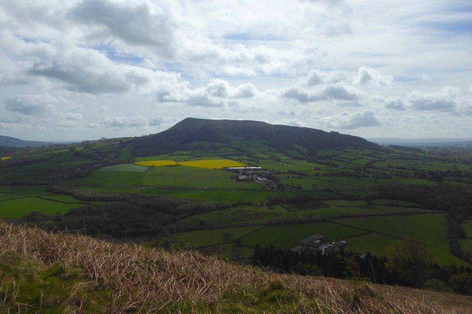
Ysgyryd Fawr seen across Abergavenny from the lower slopes of Blorenge.

Ysgyryd Fawr seen over Abergavenny from Pen-y-Graig below Blorenge, a few days after a snowfall.

Lower limb, sunrise, May 17th. “As seen from the site”

Semi diameter, sunrise May 17th, “As seen from the site”

First flash, sunrise on May 17th, “As seen from the site”

The view East from “the site”(not my garden)
There is a very good formula forAlt/Az calculations in the appendix of this book. Highly recommended reading.

Looking westwards towards the seriously ‘be-cairned’ Black Mountains from near the summit....

Side profile of Ysgyryd Fawr, seen from the neighbouring Sugarloaf/Y Fal.

Ysgyryd Fawr takes centre-stage on the descent from Hatterrall Hill. Pen-Twyn hillfort is over on the near-left.

The small (well, relatively so) but incredibly shapely hillfort-cum-sacred hill viewed from Blorenge.... Abergavenny is the border town.

Ysgyryd Fawr seen from its little sibling, Ysgyryd Fach to the south. Hatterrall Hill at the southeastern tip of the Black Mountains rises on the left.

Some very nice light to end a lovely day in the snow.

Looking toward The Black Mountains from this wondrous place.... some additional sites are (very) approximately indicated. Suffice to know they are there.

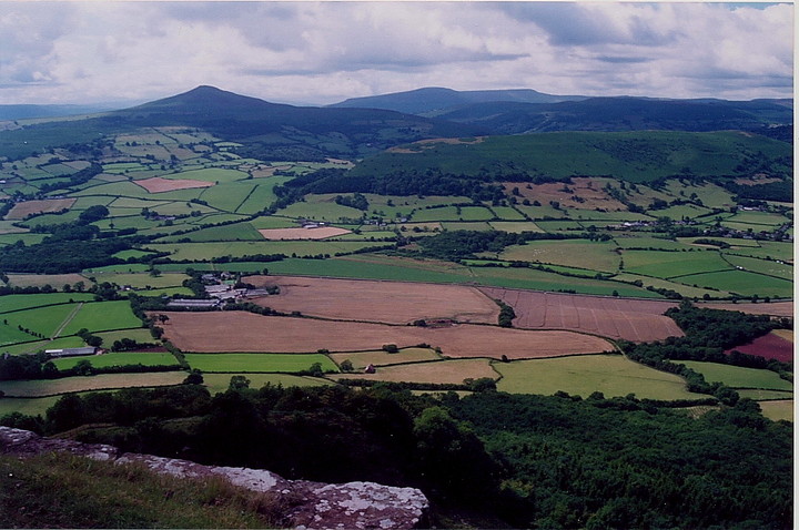
Ysgyryd Fawr, with the conical Sugarloaf behind. Seen from The Kymin above Monmouth, the best part of 20 miles distant.

Viewed from the east, near White Castle.

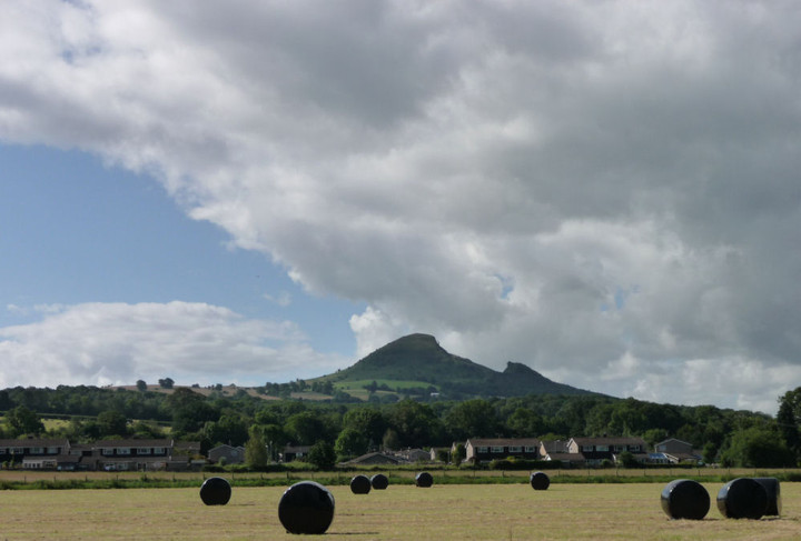
Ysgyryd Fawr rises above fertile Monmouthshire farmland. From Llangattock Lingoed to the NE.
Ysgyryd Fawr, seen from Pandy to the north.

Ysgyryd Fawr seen from the slopes of Hatterrall Hill to the north.

Ysgyryd Fawr from Credenhill Park Woods in Herefordshire.

Frost + mist, = magic.
Looking approx north-west from this hillfort-cum-sacred hill. Mynydd Pen-y-fal is left of image, with The Black Mountains beyond, all crowned by Bronze Age funerary cairns.

Towards the nearby English border from the hillfort-cum-sacred-hill...........

On the summit ridge, looking south.

Seen from Edmund’s Tump to the east.

Viewed looking beyond the summit of the ‘Sugar Loaf’......

Some sort of earthworks.. perhaps the 2 stones indicate the entrance to the enclosure?

Taken from a moving micra...
Visited 7 March 2010.
A visit to the “Three Castles” of Skenfrith, Grosmont and White Castle with some friends includes a walk up Edmund’s Tump (Graig Syfyrddin), a prominent hill in eastern Monmouthshire. A lovely spring day, a bit of a chill lingering from a cold morning, the mud still firmly frosted. From the hill, an impressive view stretches west across the Monnow valley to the Black Mountains, but the real draw for me lies nearer at hand in the form of the wedge-shaped Ysgyryd Fawr, an outlier of the bigger hills, sharp-crested and solitary in its elevation above the valley. It looks close enough to touch.
After leaving White Castle, a hasty plan is made to climb Ysgyrd Fawr before the light fades. We park to the south and make our way through woods to the steeply rising ridge. The sky is a deep blue, the ranks of hills, ridges and mountains themselves hazy in powder and periwinkle, ice and Delft.
It’s cold on the top, the summit is exposed to winds that didn’t register down below. The views are wonderful though, I watch a couple of planes leave their high altitude vapour trails, the only mark on the otherwise flawless sky. There’s little to see of any hillfort, although scant remains of the later chapel are discernable. But coming here isn’t really about the archaeology, it’s a matter of location and landscape.
It’s not long since I climbed the neighbouring Blorenge, a first foray to these South Wales peaks. By now my appetite is properly whetted and I long to visit the hills I can see spread before me. I won’t be waiting long.
If in the area I can highly recommend a visit to the Skirrid Fawr Inn. This very old pub is supposed to be the most haunted in Wales and has lots of information boards inside (they used to hang people here!). The Inn also gives good views over the hill.
Hmm...I must admit I was initially a little confused to find Ysgyryd Fawr defined as a ‘Sacred Hill’ within TMA since the long, elongated summit ridge is enclosed by what appear to be defensive earthworks – a hillfort, no less. OK, these aren’t exactly powerful, but then again they don’t need to be since the only feasible direction of attack is from the south. Case closed, m’lud.
However the presence of the (very) scant remains of St Michael’s Chapel at the summit got me thinking (Uh oh, not that again!) and doing a bit of reading .... why build it here? I can’t escape the tentative conclusion that it may well have been for the same reason the earlier enclosure was laid out – to absorb or appropriate some of the otherwordly ‘sacred power’ this hill was clearly thought to possess, if the local folklore is anything to go by, that is. Handy to utilise for your Christian congregation’s spiritual needs (if somewhat hypocritical, it has to be said) and handy to call upon a bit of divine assistance when your Iron Age neighbours want to do your knapper in as well.
Let’s face it, there are numerous precedents for Christian sites trying this scam (Knowlton Henges, Ysbyty Cynfyn etc). The Iron Age thing is less clear cut, but many a hillfort incorporates seemingly revered Neolithic and Bronze Age monuments within their ramparts. Was a touch of supernatural help the finishing touch to assuring your safety? Not that it always worked, of course.
On a more prosaic level a visit to this wonderful ‘mini mountain’ is, well, wonderful, either by the easy ‘tourist’ route from the south, or the steeper approach from Pen-y-parc to the NE, right on the English Border. The views are superb, particularly across to the Sugar Loaf and The Black Mountains. And then there’s the legends............
Ysgyryd means “shivered” or “shattered”. This is due to the hill’s jagged western side, caused by landslips in the ice age.
It’s easy to get to, you can walk to the summit from the car park on the side of the B4521 road from Abergavenny to Ross-on-Wye.
Description and folklore, from vol 11 of ‘The Beauties of England and Wales, Or, Delineations, Topographical, Historical, and Descriptive’ by John Britton and others (1810).
[The Skirrid] is isolated, arising abruptly from the plain: the north-eastern side is a ridge, of a barren russet hue; towards the south the declivity is less; and towards the botom terminates in a gentle cultivated slope. The base is ornamented with wood, and enriched with luxuriant corn-fields and pasture; which form a gratifying contrast to the brown and dark aspect of its summit, covered with heath and ling.
Seen in different directions, it assumes a variety of forms: from one point it seems like a large long barrow; from another it appears globular; from others like a truncated cone..
..[on the NE summit] formerly stood a small chapel, the site of which is traceable in a circular hollow; but no vestiges of the building remains. The chapel was dedicated to St. Michael, whence the hill is denominated St. Michael’s Mount. It is at times the scene of superstitious folly. The catholic, and ignorant persons among the lower classes, annually repair, on Michaelmas Eve, to pay their devoirs to the saint, and still consider the soil as sacred; quantities of which they carry away to strew over the coffins and graves of their deceased friends. Formerly it was considered as endued with miraculous efficacy for the curing of certain diseases; but the age of such gross blindness, it is hoped, for ever is past...
.. [on the rent in the mountain] Various have been the conjectures respecting the cause of this horrid yawning chasm. Ignorance, ever ready to cut the knot it is unable to untie; and credulity, as ready to credit the surmises of superstition, have trumped up the legendary story, that the mountain was rent asunder by the earthquake which happened at the crucifixion of the Saviour: hence it has obtained the appellation of Holy Mount, a name under which it is best known among the inhabitants of the county.
The Skyrrid, or Holy Mountain, is so called because it was divided at the Crucifixion. One part of it is in America. There has been no snail upon it ever since, or worm either: that is because it is sacred; they cannot go there. (Collected at Bromyard, 1909)
ELLA M. LEATHER.
Any religion that refuses entry to worms and snails is of no use to me. From p110 in
Welsh Folklore Items, I
E. J. Dunnill; Ella M. Leather
Folklore, Vol. 24, No. 1. (Mar., 1913), pp. 106-110.
Ysgyryd Fawr – the Skirrid – is the easternmost of the Black Mountains. It has a distinctive shape – the great cleft in its side was allegedly split open in an earthquake at the moment of Christ’s death.
This is an extract from Mary Trevelyan’s 1909 ‘Folk-lore and folk-stories of Wales’:
It was formerly the custom of Welsh farmers and peasants to obtain earth from certain important places, for the purpose of sprinkling through their stables, pigsties, gardens and even their house, to avert evil. Portions of this earth were also strewn over the coffins and graves of their relatives and friends.
Earth from the fissure of the Skyrrid Fawr, in the parish of Llantheweg Skyrrid, Monmouthshire, was used [in this way]..
A Kentchurch woman told this story in 1903 about Jack O’Kent, giving a non-Christian explanation for the Skirrid’s scar:
“Jack did some wonderful things in his time. Why, one day he jumped off the Sugar Loaf Mountain onto the Skirrid, and there’s his heel mark in the Skirrid to this day. An’ when he got there he began playing quoits; he pecked [threw] three stones as far as Trelleck (and there they stand to this day)..”
(from B A Wherry’s ‘Wizardry on the Welsh Border’ in Folklore 15).
Entry about the undated defended enclosure