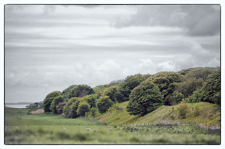
Danes Dyke is a fantastic structure. Whether it had anything to do with the people that built the centre around the Gypsey Race I have no idea but I do know that this is a great place. The Dyke literally cuts off Flamborough head from the rest of the mainland and even now the size of it leaves you in awe just thinking of how someone could have constructed such a thing.
We are lucky that these days, parts of the Dyke are protected as a park and you can walk along it to its end. We parked up and did just that, the Dyke is huge when you walk along side it and then when you reach its end the view of the coastline is so fantastic. A worthy trip in anyones book and had we not had only one day left to explore as much of this area as possible I would have loved to have walked its length.
I’d visited the southern part of Dane’s Dyke in the past on the way north either to the seaside or to Rudston but had never given it the examination it deserved. This day I planned to visit the various sections of the bank and ditch after having a look at Starr Carr. In the end I didn’t get to the Mesolithic settlement site and it had gone 4pm by the time I reached the carpark at the RSPB nature reserve of Bempton Cliffs which is fairly well signposted and makes an excellent start for a visit to the earthwork which is about a mile further east along the coast. After spending about half an hour watching the thousands of puffins, guillemots and gannets the weather took a turn for the worse and huge black clouds charged in from the west. There was no way I would make it to the dyke before it started raining so while watching everybody else dashing back to their cars I set up my camera and happily snapped away at clouds speeding over the cliffs and out to sea. Then it started raining – and I mean *raining*. I packed the camera away and started what seemed a very long walk along the cliffs in the pouring rain. Everything got soaked, the rain went right through my coat, the long wet grass left my trousers with water running down the inside and I had my own personal lake inside my boots. Strangely though it hardly bothered me, the cliff edge was deserted, just me, the birds and the elements, which is what it must have been like here for thousands of years – I have to say I really enjoyed that walk.
Eventually I got to the northern terminal of the earthwork which is best described with words like ‘huge’ and ‘looming’. There was still some evidence of the ditch on the western side but both bank and ditch finished just short of the cliffs, I’m not sure if it was designed that way to allow a narrow easily defended entrance to the enclosed area or whether the gap had been created in more recent times. Trying to get some photographs was a nightmare in the rain but I a snapped a few pictures showing the bank disappearing into the distance then made my way back to the car along the field edge this time, scouring the soil for flints but as usual found nothing.
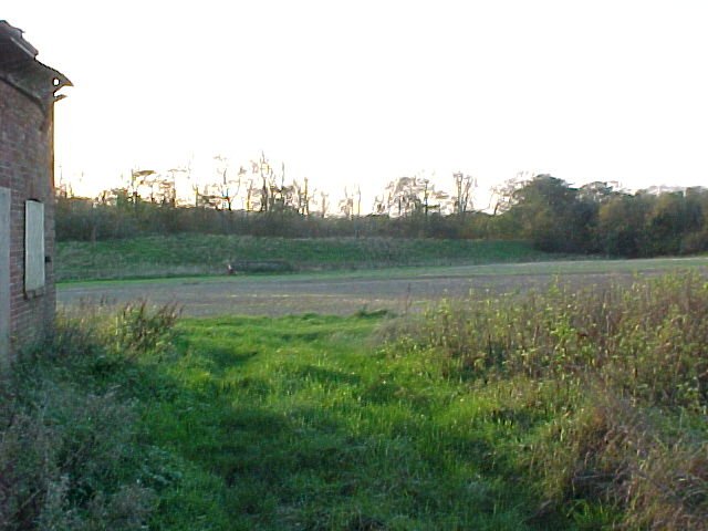
Next stop was the central section of the earthwork where it is cut through by the B1229. Parking was only possible on the grass verge and the view to the north was limited by the trees that partially cover the bank – the view to the south was much better.
Following the road it takes a turn south at Flamborough village and doubles back west as the B1255 where there is a sharp left signposted turn as the road dips through a small wood. As you drive down the track the bank is just to your left all the way down to a carpark where the dyke ends and a gully runs down to the sea.
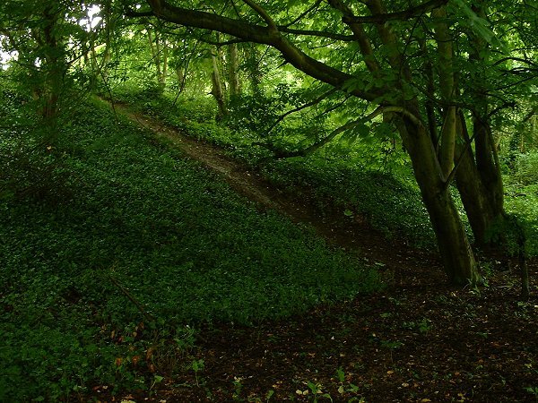
As it was getting late I only had time for a quick look round and as the area was covered with trees it was difficult to figure out just were the earthwork ended and the natural features began, I’m guessing they were extended and built up by the original builders anyway. At least it had stopped raining and I managed to get some photos of the bank under the gloom of the trees before setting off home. The next day I went to work in wet footwear - my coat took about three days to dry out...
The 'Readers Digest Folklore Myths and Legends of Britain' suggests that the dyke is haunted by a spectral 'White Lady'. I can't find any more on her, but did notice on the map that there is a spring called the Gell/Gel-Spring at the southern end of the dyke - and white ladies are often associated with springs and water. Can 'gell' mean girl? Or is the fact it is an old word for 'leech' more significant? Or perhaps it's just like the word 'gill' for a narrow stream.
The name of this huge earthwork is misleading, in the past it was believed to have been built by Danish invaders, then more recently Hawkes and Dyer recorded it as Iron Age. Current opinion is that it was constructed in the middle to late Bronze Age as were many of the defensive/boundary banks and ditches that cover large areas further west on the Yorkshire Wolds, although it is entirely probable that it was later used and modified during the Iron Age and even as late as the 9-10th century AD.
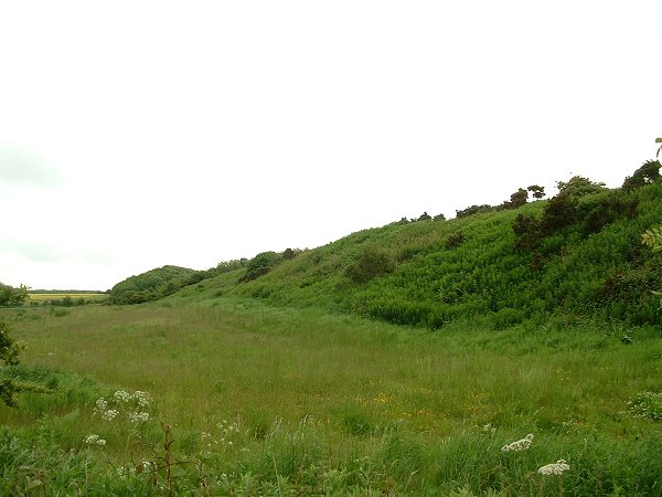
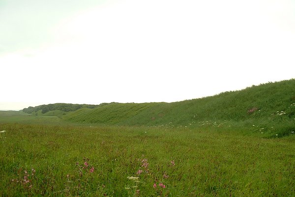
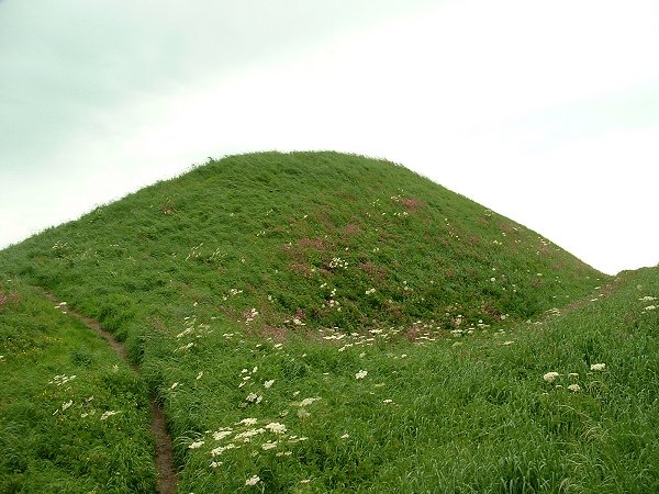
The bank’s construction started with a layer of compacted stones which were overlaid with chalk blocks, rubble and earth and covered over with a layer of turf to a height of between 4-5 metres and a width at the base of about 20 metres. To the west of the bank the ditch, which has become partly infilled over time, is estimated to have been around 3-4 metres deep and up to 12 metres wide. In places the existing single ditch/bank is joined by another smaller bank on the western side, and occasionally a pair of banks.
It is interesting that the southern end of Danes Dyke starts (or ends) at a natural deep gully that leads down to the sea and it could be that this natural defensive feature was the inspiration for the earthwork which runs north for two and a half miles to the northern edge of the Flamborough peninsular. The enclosed area measures about 5 square miles and is naturally defended to the north, east and south by cliffs making it an ideal fortified settlement site although there seems to be no obvious signs of occupation except for a single barrow and I have yet to find any archaeological information for the area. The bank and ditch are cut in half by the B1229 and are further bisected by the B1255 a little further south – there is a car-park and paths down to the sea at it’s southern end and access through the RSPB reserve to the north - the map ref is for this northern end.

 Posted by Chris Collyer
 Posted by Rhiannon