|
|

|
|
Barningham MoorCup and Ring Marks / Rock Art
|
|
|
|
News |
|
Prehistoric rock art secrets of the Dales uncoveredBy Martin Slack MORE than a century ago a South Yorkshire clergyman and archaeologist spent several days excavating a burial mound on moorland near Richmond... continues... |
 Posted by moss
3rd September 2008ce Edited 4th September 2008ce |
Images (click to view fullsize) |
|
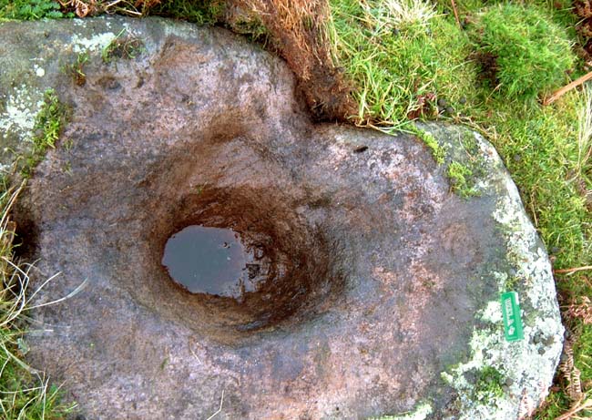
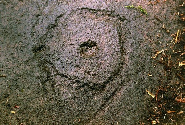
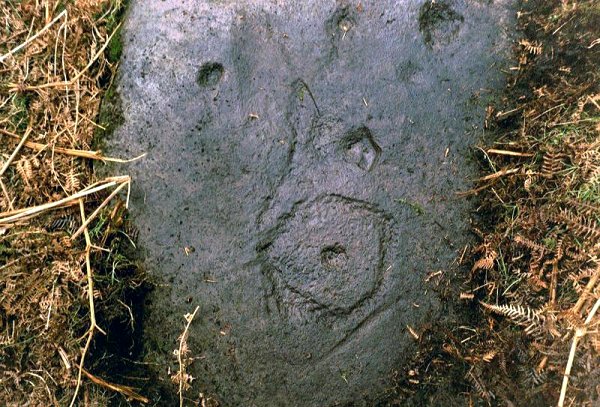
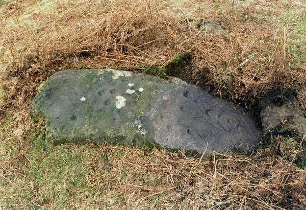
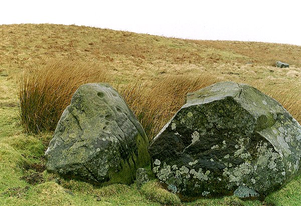
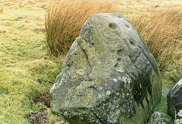
Photographs: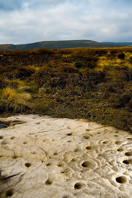
 Artistic / Interpretive:
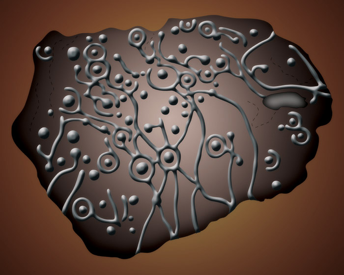
|
Fieldnotes |
|
|
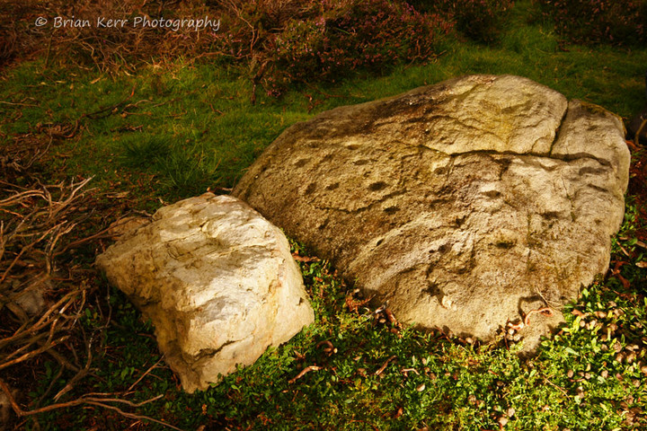
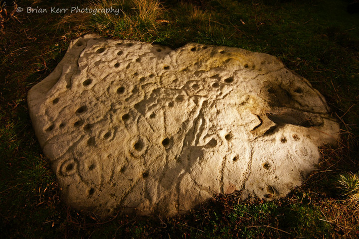
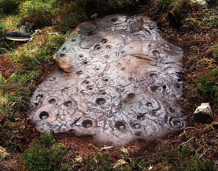
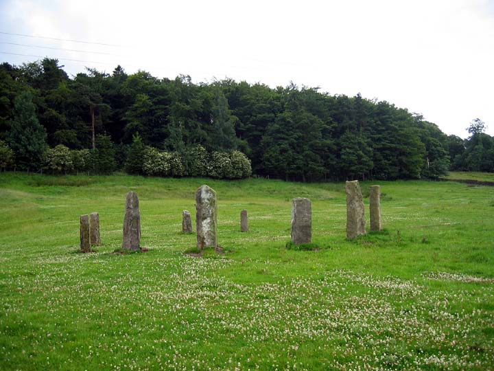
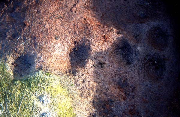
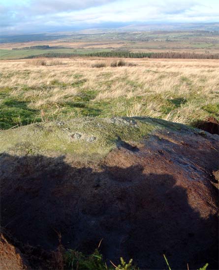
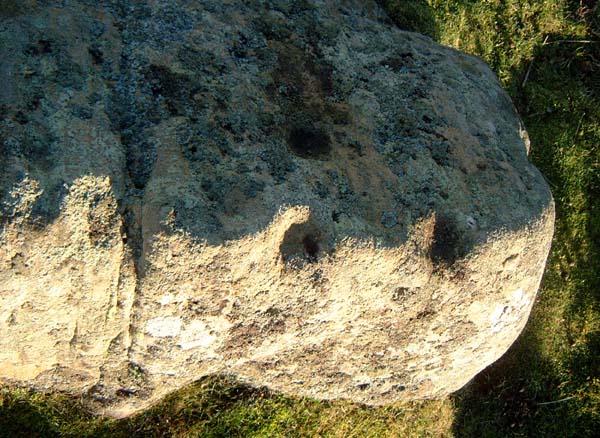
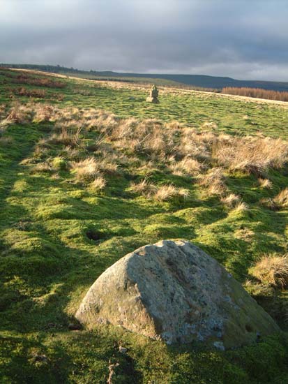
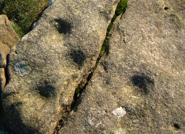
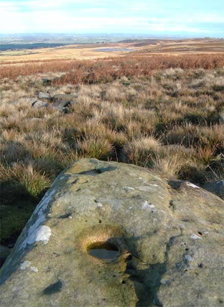
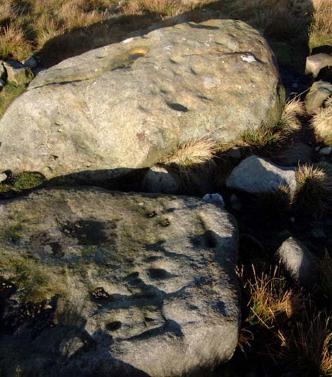
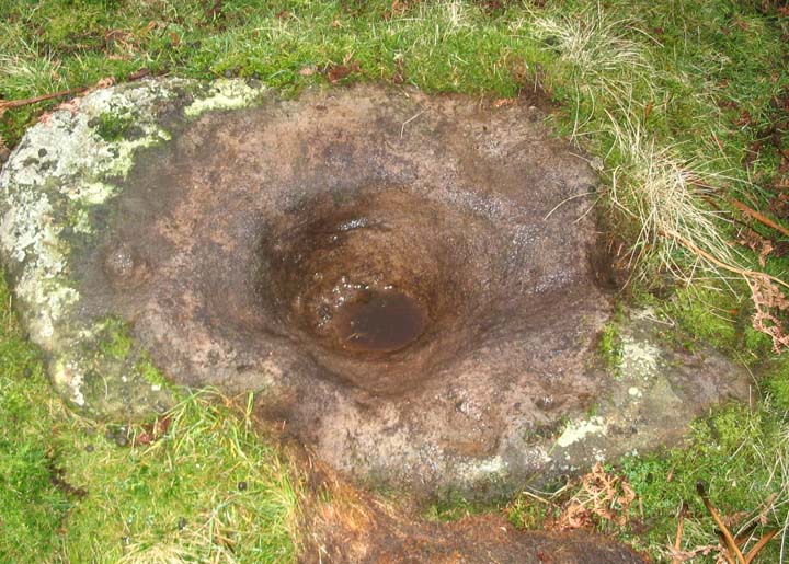
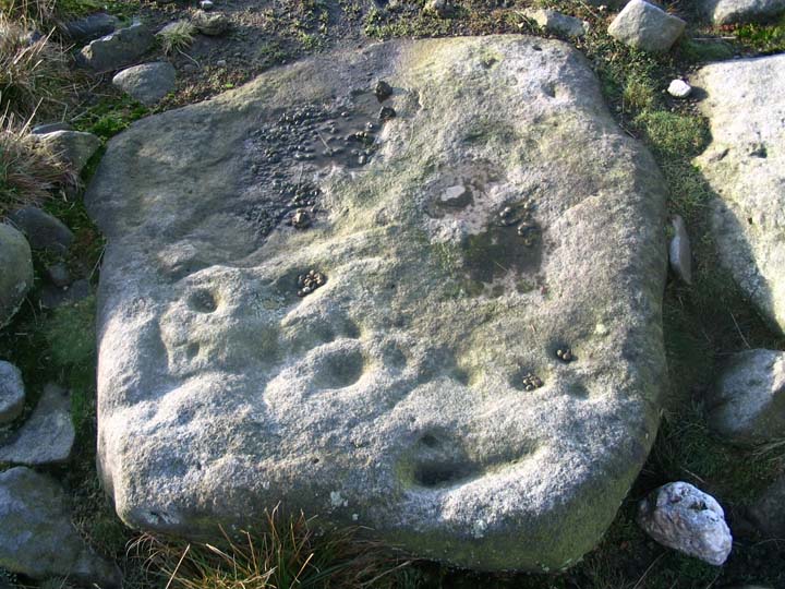
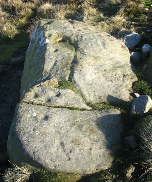
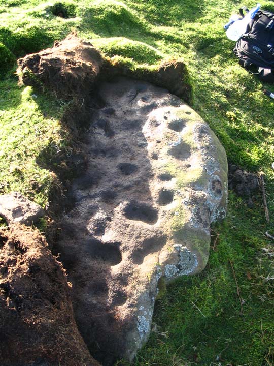
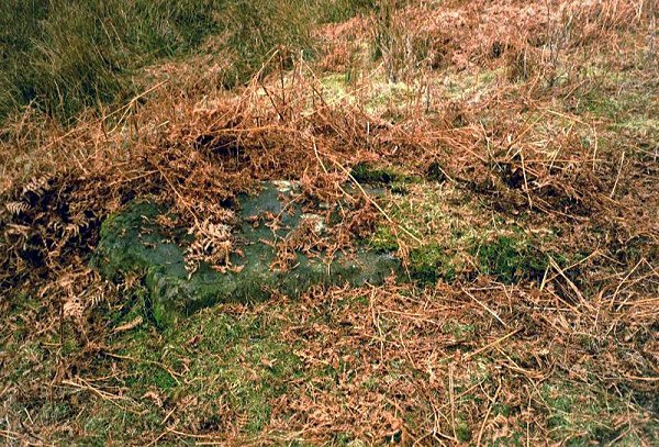
Yesterday Hob and I decided to have a run up to Barningham to see what we could see. We parked up at Haythwaite Farm and followed the footpath onto the moor. The rocks that we looked at are basically split into two groups, one on either side of Osmonds Gill (marked Osmiril Gill on the OS map). We initially had trouble locating any cup marked stones as were unsure which contour we were walking on. I would advise that you follow the footpath to the area marked Black Hill Gate and then backtrack east along the terrace. The first group of stones are just below the craggy outcrop and scattered around a bizarre 'cairn' - you'll know what I mean when you see it. Many of the rocks are covered in vegetation so it's a case of peel to reveal. After checking out the westerly group I would advise that you have a mooch up the hill and seek out the wonderful Eel Hill stone. From here you can cross Osmonds Gill and check out the How Tallon circle. After the circle you can walk through the gill and head east along the 420m contour, this is roughly on the same level as the boulder laden slope on the east side of the gill. There are a number of cup marked rocks here along with a decent hut circle and some confusing linear features ?walls. The burnt mount that Hob mentions is a bugger to see. We only really knew it was there because Hob found a burnt cobble. This is a beautiful North Pennine landscape. The scarp edge of the moor has many features that imply that this was a pretty special place to our ancestors. The rock art may look pretty but you really have to experience the place to get any idea of it's power. Djang by the bucketload! |
 Posted by fitzcoraldo
27th November 2004ce |
|
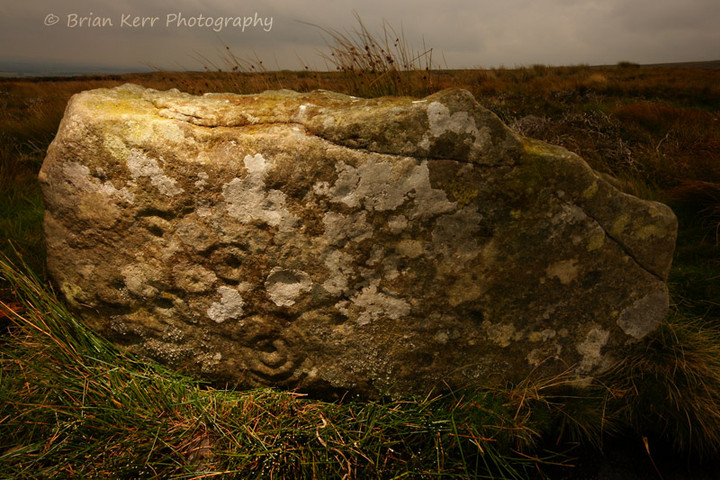
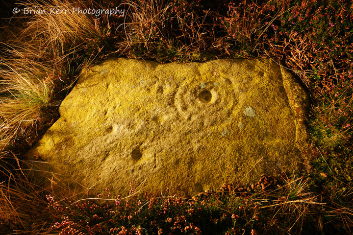
What an absolutely grand spot! Cup-marked stones all over the place. My eternal thanks go to Fitzcoraldo for showing me this place. A copy of Beckensall and Laurie's 'Prehistoric Rock Art of County Durham, Swaledale and Wensleydale' is very helpful. The sketched map, cross referenced with the diagrams, means that if you find one, you can find loads. It does appear that there's a map amiss in the book though. Stones 3-13 are represented on the 'West and South west' map, as are stones 19-32. 33-81 are shown on the 'Barningham- South' map, but 14-18 aren't shown. Which is a shame, as from the diagrams in the book, they are some of the more complex in the area, with multiple rings, arcs and pennanulars. After a nip up to Eel Hill to find the big cup, then to Osmond's gill and the circle near Howe Tallon, the marked stones of the South side were in shadow, and harder to spot, but the whopping cup of stone 48 decided to reveal itself. The hut circles in this area are quite clear, more so than the enigmatic burnt mounds further down the slope. It would be a right pain in the neck if the bracken were in full flush, but in the winter, with some nice direct sunlight, the stones are easy to spot at a distance. There are many, many more unmarked than marked though. The shelves with the marked stones, sited as they are either side of the wonderfully atmospheric Osmonds Gill, are extensive markers for what was, and still is a very special place. |
 Posted by Hob
27th November 2004ce |
Miscellaneous |
|
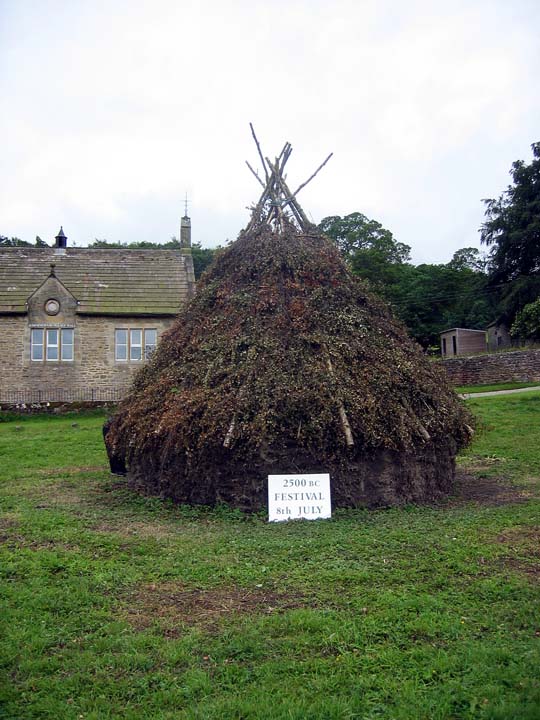
| Where is the best place to park the car as I am very unfamilar with the site. Went about July as had nothing planned and the day was nice. Think I found some hut circles, but I do not remember any forests. Otherwise I was dissapointed. I was wondering what that huge mound was at the bottom was. |
 Posted by bobpc
4th December 2006ce |
Links |
|
Barningham Moor on BRAC UpdatedBarningham Moor on BRAC Updated |
Posted by markj99 30th March 2021ce |
The Smell of Water - Barningham Moor |
Posted by fitzcoraldo 25th December 2018ce |