Our next point of call was to see if anything remained of the Little Argham Henge. The OS map showed the henge as being in a supposedly easy to find spot at the corner of two roads on the Maidens Grave hill. Also the Gypsey Race runs straight past it. According to local sources burials had been discovered here within a triangular structure at least four trackways led to it over the wolds. Given its proximity to Rudston and it being in direct alignment with the monolith, one suspects that the place was once of great importance.
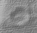
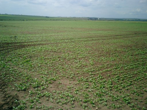
Alas, farmers and father time care not one jot for former influence. The Henge was a massive disappointment. It has indeed been totally ploughed out and there are no signs of it that I could see from the ground. Add to this the added disappointment of seeing the Race for the first time – totally bone dry and rather anti-climactic! Ah well I understood that the race could be free flowing in some parts and dry in others such is the nature of the Gypsey.
This must once have been an important part of the Gypsey Race landscape, but plough damage means there is now nothing to be seen at ground level - just how do you plough out an entire henge?
Anyway, while you are at Rudston, take a look for yourself. Follow the road north out of Rudston village towards Burton Fleming, the field where the henge stood is on the right, a short distance after the second right turn.
A henge located north of Rudston, circa 160 metres from the Gypsey Race stream and the cursus which runs north-south parallel with the stream. The henge was discovered as a cropmark on an aerial photograph in the early 1960s, although subsequent field investigation showed it to survive as an earthwork, albeit badly plough-damaged. The monument comprises a sub-circular enclosure of around 98 metres maximum external diameter, featuring a ditch with external bank. Two broadly opposing entrances, to the south east and the north west, are visible. A later small square barrow is visible as a cropmark within the henge, while another square barrow is visible to the north, and a ring ditch abuts the external southwestern side of the henge bank. Trial excavation in 1964 showed that little of the bank material remained unaffected by ploughing, with just 2 inches of compacted chalk rubble lying over the original ground surface. The bank was measured at circa 37 feet wide. The internal ditch was 38 feet wide, V-shaped in profile and very steep-sided, up to 13 feet 3 inches deep. No berm was observed in the excavations, although a narrow berm appears on aerial photographs. The primary ditch silts contained no finds. Beaker and Grooved Ware sherds were present in the secondary fill, while a single Roman sherd was found in the uppermost layers. Near the centre of the henge a small trench uncovered four post holes in a line, 2 of them containing Beaker sherds. A trench across the south-eastern entrance uncovered a causeway circa 50 feet wide, with the ditch terminals "somewhat" squared at the ends and steeply sloped. Further excavations were planned but do not appear to have taken place. It has been suggested that the name "Stodefald" (horse inclosure), recorded in 1299, refers to the henge. Maiden's Grave may also have served as the wapentake meeting place, during the Early Medieval period.
Also known as Maidensgrave Henge, it was excavated in 1964 and found to consist of an oval bank with 2 entrances with a line of 4 post holes at the centre.

 Maps / Plans / Diagrams:
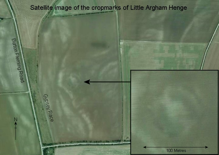
 Posted by Chris Collyer
 Posted by Chance